
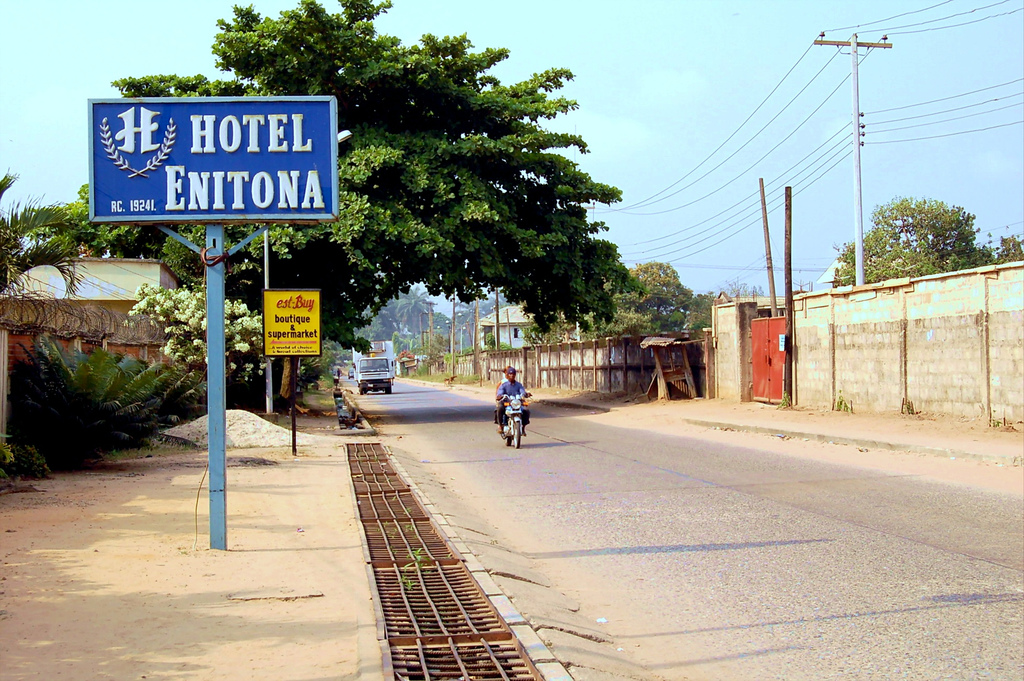


Why visit Aba
Townapedia lists 1 museum or landmark, 1 park or trail, 1 place to eat, 1 place to stay and 2 attractions in and around town.
Highlights include Abia State Polytechnic, Rhema University, National Museum of Colonial History, Aba and Enyimba International Stadium.
Weather in Aba
Forecast from MET Norway (CC BY 4.0). Full forecast
About Aba
Aba is a city in southeastern Nigeria. It lies along the west bank of the Aba River and is at the intersection of roads leading to cities such as Port Harcourt, Owerri, Umuahia, Ikot Ekpene, and Ikot-Abasi.
From the Wikipedia article Aba, Nigeria (this version), under CC BY-SA 4.0.
Travel tips from other travellers: Aba on Wikivoyage (CC BY-SA 4.0).
Things to do2

Rhema University
School · 5.0 km
A university in Aba, Abia State , Nigeria
Museums and landmarks1

National Museum of Colonial History, Aba
Museum · 4.5 km
Nigerian Museum on colonial era to independence
Parks, trails and playgrounds1
Restaurants and cafes1

History
The city was initially a trade centre, which eventually became an administrative centre of Britain's colonial government. Aba has been a major commercial centre ever since it became part of British Nigeria.
The Aro Expedition, which was part of a larger military plan to quell anti-colonial sentiment in the region, took place in the area of Aba between 1901 and 1902. During this military action, the British defeated the native Aro people with a presumably large number of casualties. In 1901, the British founded a military post in Aba and in 1915, a railroad was constructed to link it to Port Harcourt, which transported agricultural goods such as palm oil and palm kernels.
From the History section of Aba, Nigeria on Wikipedia, under CC BY-SA 4.0.
Where to stay1
Churches and places of worship13
Christian Penticostal Mission CPM
Church · Protestant · 2.5 km
Furo street Obuda -Aba, Aba
The Lord's Chosen Charismatic Revival Movement
Church · 2.3 km
Port Harcourt Road, Aba
Gas and EV charging2
Schools, colleges and libraries3
Healthcare1
Seventh-day Adventist Hospital and Motherless Babies' Home, ABA
Hospital · 2.7 km
Map of Aba
25 places. The map loads OpenStreetMap tiles when you open it.
Getting there and nearby towns
Sam Mbakwe International Airport (QOW) is the nearest airport with scheduled flights listed in OpenStreetMap, 40 km away.
- Ikot Ekpene 39 km east, about 39 min by car
- Umuahia 49 km north, about 49 min by car
- Bori 48 km south, about 48 min by car
- Abak 49 km east, about 49 min by car
- Okrika 51 km southwest, about 51 min by car
- Port Harcourt 54 km southwest, about 54 min by car
- Owerri 56 km northwest, about 56 min by car
- Bende 58 km northeast, about 58 min by car
- Elele 61 km west, about 1 h by car
- Uyo 63 km east, about 1 h by car
Drive times are estimates from straight-line distance, not routes.
Local news
Headlines from INDB.
Reviews, tips and questions
Loading what members have shared...
Sources and licences
- GeoNames (CC BY 4.0): population, coordinates, regions and time zone
- OpenStreetMap contributors (ODbL 1.0): places, airports, map data
- Wikidata (CC0 1.0): elevation, founding date, time zone, website, landmarks and historic places
- Wikimedia Commons (see each image): photos
- Wikipedia (CC BY-SA 4.0): overview and history text
Photo credits
- Aba Nigeria hotel, pjotter05, CC BY 2.0
- Rainy day at Ndoki road market, Aba, Soulmender (Chinomso Nzenwa), CC BY-SA 4.0
- Crunchies Fried Chicken, Factory Road, Aba, Xlencie, CC BY 4.0
- Enyimba International Stadium, Unknown author Unknown author, CC BY 4.0
- Enyimba, Aba, Nyerougo, CC0
- Rainy day at Ndoki road market, Soulmender (Chinomso Nzenwa), CC BY-SA 4.0
- Rainy day at Ndoki road apparel market, Soulmender (Chinomso Nzenwa), CC BY-SA 4.0
- Rainfal at Ndoki road market, Soulmender (Chinomso Nzenwa), CC BY-SA 4.0
- Africa Dress by Victor 1, Victoreke, CC BY-SA 4.0
- Africa Dress by Victor, Victoreke, CC BY-SA 4.0
- Nduka small, Ihanako, CC BY-SA 4.0
- Mbash College1, Bashcollege, CC BY-SA 4.0
- Cloudy sky at Obiwali road Rivers State, Soulmender (Chinomso Nzenwa), CC BY-SA 4.0
- Crunchies fried chicken, Godwin233, CC0


Page built November 3, 2026. Spotted a mistake? Tell us or suggest a place.