




Damaturu, Nigeria
Damaturu is a regional capital of 46,000 people in Yobe State, Nigeria.
Why visit Damaturu
Townapedia lists 2 attractions in and around town.
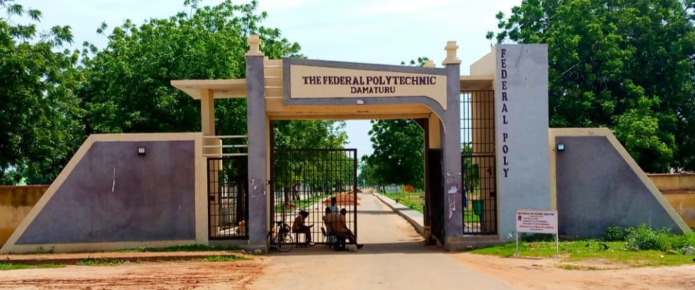
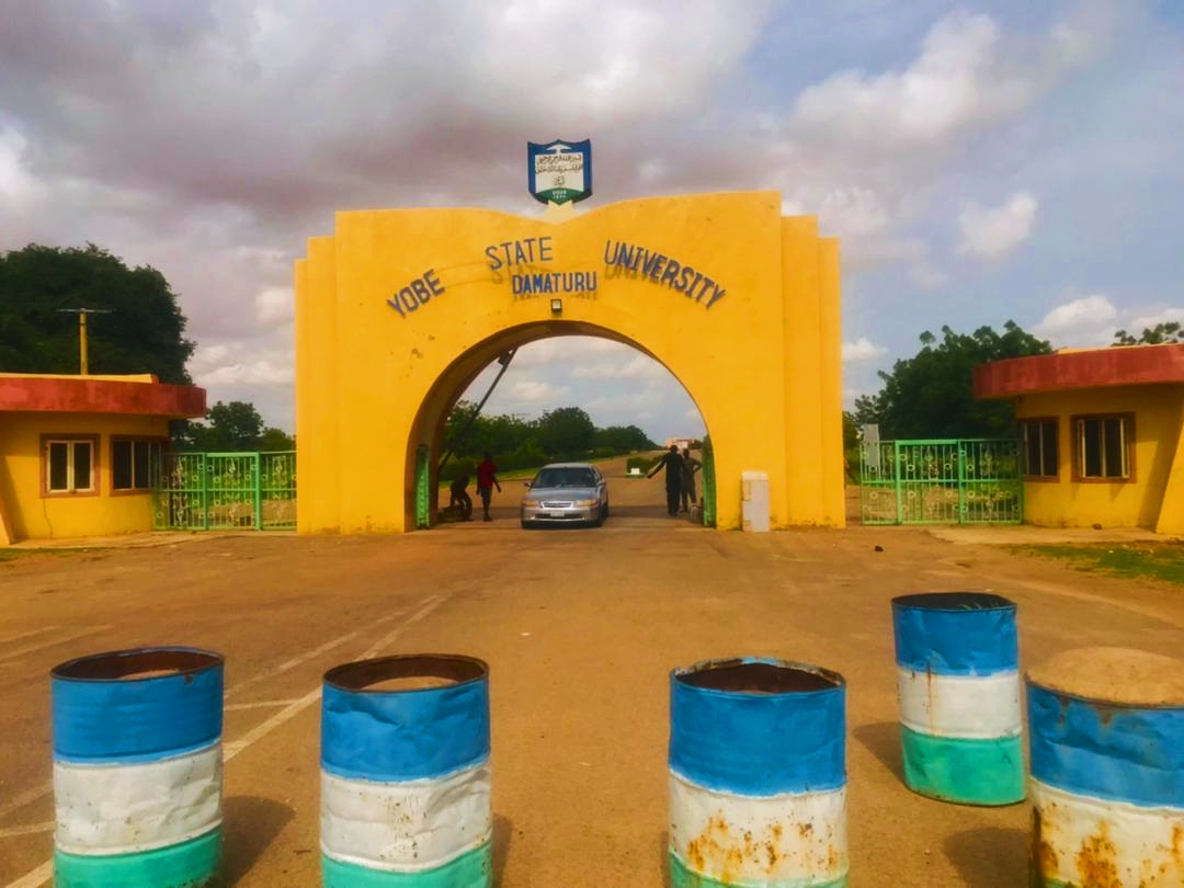
Highlights include Federal Polytechnic Damaturu and Yobe State University.
Weather in Damaturu
Forecast from MET Norway (CC BY 4.0). Full forecast
About Damaturu
Damaturu () is a city in northeastern Nigeria and the capital of Yobe State in northern Nigeria. It is the headquarters of the Damaturu Emirate.
From the Wikipedia article Damaturu (this version), under CC BY-SA 4.0.
Travel tips from other travellers: Damaturu on Wikivoyage (CC BY-SA 4.0).
Things to do2
Federal Polytechnic Damaturu
School · 2.5 km
Polytechnic in Nigeria, Yobe State
Yobe State University
School · 7.8 km
State university in Yobe, Nigeria
Churches and places of worship2

Masallacin yan Nguru (Masjid Abibakar Siddeeq)
Place of worship · 1.6 km
Brainpower Street, Damaturu
Schools, colleges and libraries2

Healthcare4

History
Damaturu came into existence as a colony when it was carved out of the Alagarno district by the British. The British action resulted in the conquest of the Bornu Empire in 1902 by colonial forces under the command of Colonel Thomas Morland.
From the History section of Damaturu on Wikipedia, under CC BY-SA 4.0.
Map of Damaturu
10 places. The map loads OpenStreetMap tiles when you open it.
Getting there and nearby towns
- Dankalwa 24 km east, about 24 min by car
- Gujba 28 km south, about 28 min by car
- Goniri 48 km southeast, about 48 min by car
- Benisheikh 58 km east, about 58 min by car
- Lajere 62 km northwest, about 1 h by car
- Daura 64 km west, about 1 h by car
- Bornu Yassu 88 km northeast, about 1 h 30 min by car
Drive times are estimates from straight-line distance, not routes.
Local news
Headlines from INDB.
Reviews, tips and questions
Loading what members have shared...
Sources and licences
- GeoNames (CC BY 4.0): population, coordinates, regions and time zone
- OpenStreetMap contributors (ODbL 1.0): places, airports, map data
- Wikidata (CC0 1.0): elevation, founding date, time zone, website, landmarks and historic places
- Wikimedia Commons (see each image): photos
- Wikipedia (CC BY-SA 4.0): overview and history text
Photo credits
- Round about jpg, Murja Khalid, CC0
- August 27th Stadium Football Pitch, Damaturu, Yobe State, Escanor247, CC BY-SA 4.0
- View of August 27th Stadium Football Pitch, Damaturu, Yobe State, Escanor247, CC BY-SA 4.0
- Sunset View from August 27th Stadium, Damaturu, Yobe State, Escanor247, CC BY-SA 4.0
- Federal Polytechnic Damaturu Entry Gate, Musaddam Idriss, CC BY-SA 4.0
- Yobe State University, Musaddam Idriss, CC BY-SA 4.0
- A Street Grain Hawker selling his wares on a Truck, Mamauch, CC BY-SA 4.0
- A herd of cattle, Nigeria, Mamauch, CC BY-SA 4.0
- A Mechanical Road, Mamauch, CC BY-SA 4.0
- A Water Supply Truck, Mamauch, CC BY-SA 4.0
- Two Keke Napeps (a.k.a Tricycles ) plying the same route, Mamauch, CC BY-SA 4.0
- A Man pushing a water truck, Mamauch, CC BY-SA 4.0
- 8 Ball Snooker Game, Escanor247, CC BY-SA 4.0
- August 27th Stadium Main Entrance, Escanor247, CC BY-SA 4.0
- Main Entrance Of Yobe State University Teaching Hospital, Escanor247, CC BY-SA 4.0
- Yobe State University Teaching Hospital Main Building, Escanor247, CC BY-SA 4.0
- Department Of Community Medicine, Yobe State University Teaching Hospital, Escanor247, CC BY 4.0
- Rear view Department of Community Medicine, Mhizabdoul, CC BY-SA 4.0
- Front Entrance of Yobe State University Medical College, Escanor247, CC BY 4.0
- ISS053-E-214243 - View of Earth, Earth Science and Remote Sensing Unit , Lyndon B. Johnson Space Center, Public domain
- ISS053-E-217548 - View of Earth, Earth Science and Remote Sensing Unit , Lyndon B. Johnson Space Center, Public domain
- ISS053-E-217547 - View of Earth, Earth Science and Remote Sensing Unit , Lyndon B. Johnson Space Center, Public domain
- ISS053-E-214242 - View of Earth, Earth Science and Remote Sensing Unit , Lyndon B. Johnson Space Center, Public domain


Page built November 3, 2026. Spotted a mistake? Tell us or suggest a place.