


Ibadan, Nigeria
Ibadan is a regional capital of 3,649,000 people in Oyo State, Nigeria, founded in 1829.
Why visit Ibadan
Townapedia lists 9 museums and landmarks, 18 parks and trails, 27 places to eat, 24 places to stay and 8 attractions in and around town.
Highlights include Dominican University, Lead City University, National Museum of Unity, Ibadan and New Culture Studios.
Weather in Ibadan
Forecast from MET Norway (CC BY 4.0). Full forecast
About Ibadan
Ibadan ( UK: , US: ; Yoruba: Ìbàdàn [ì.bà.dã̀]) is the capital and most populous city of Oyo State, in Nigeria. It is one of the largest cities by population in Nigeria with a population of 4.3 million within its metropolitan area. At 3,080 square kilometres (1,190 mi2) it is the country's largest city by land area. At the time of Nigeria's independence in 1960, Ibadan was the largest and most populous city in the country, and the second-most populous in Africa behind Cairo.
From the Wikipedia article Ibadan (this version), under CC BY-SA 4.0.
Travel tips from other travellers: Ibadan on Wikivoyage (CC BY-SA 4.0).
Things to do8
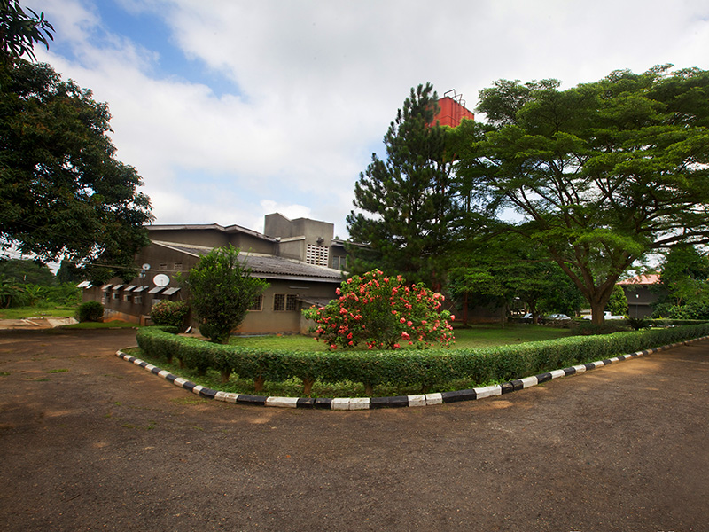

Lead City University
School · 6.4 km
Private university in Oyo State, Nigeria

Precious Cornerstone University
School · 4.5 km
Nigerian private university

The Polytechnic, Ibadan
School · 10.6 km
Educational institute in Ibadan, Oyo State, Nigeria

Trans Wonderland
Monument and historic site · 4.5 km
Amusement park in Ibadan, Nigeria

University of Ibadan
School · 7.3 km
Public university in Ibadan, Nigeria

Museums and landmarks9

National Museum of Unity, Ibadan
Museum · 4.2 km
Museum in Ibadan, Nigeria



Parks, trails and playgrounds18

Centre for Space Life Sciences (NASRDA), University of Ibadan
Park · 10.3 km
Centre for Space Life Sciences, Oluyole Road, Ajibode Road, Ibadan
Mo-Fr 09:00-17:00




6 more on the map.
Restaurants and cafes27

Stone Café Bar & Grill
Restaurant · Fish And Chips, International · 1.9 km
6 MKO Abiola Way, Ibadan
24/7
Chicken Republic, Akobo
Restaurant · Chicken, Ice Cream, Donut · 7.5 km
Iyana-Olopa, Akobo, Ibadan
Mo-Su 09:00-22:00
LADE'S CUISINE
Restaurant · Pizza, French, Regional · 2.9 km
Queen Elizabeth II Road, Ibadan
Mo-Su 09:00-21:00

15 more on the map.
History
Ibadan, coined from the phrase "Eba-Odan", which literally means 'by the edge of the meadow', came into existence in 1829, during a period of turmoil that characterized Yorubaland at the time. It was in this period that many old Yoruba cities such as Old Oyo (Oyo-ile), Ijaye and Owu disappeared, and newer ones such as Abeokuta, New Oyo (Oyo Atiba) and Ibadan sprang up to replace them. According to local historians, Lagelu founded the city, and was initially intended to be a war camp for warriors coming from Oyo, Ifẹ and Ijebu. As a forest site containing several ranges of hills, varying in elevation from 160 to 275 meters, the location of the camp offered strategic defense opportunities. Its location at the fringe of the forest (the origin of the city's name) promoted its emergence as a trade center for traders and goods from both the forest and grassland areas.
Ibadan thus had initially begun as a military state and retained its martial character until the last decade of the 19th century. Between the 1860s and 1890s, the city-state became the center of an empire extending over much of northern and eastern Yorubaland. It was appropriately nicknamed idi-Ibon or "gun base", because of its unique military character.
From the History section of Ibadan on Wikipedia, under CC BY-SA 4.0.
Where to stay24
Churches and places of worship82
Shopping15
Gas and EV charging34
Schools, colleges and libraries50
Healthcare138
Danax Pharmacy, Adamasingba Junction, Ibadan
Clinic and pharmacy · 2.9 km
Suite 28 Fajuyi Road, Ibadan
Baba David Clinic (Faithbased Clinic) Oke Alasepe Abaeja
Clinic and pharmacy · 11.0 km
Bolajoko Hospital(Badejoko Hospital) Mokola road, after GTBank
Hospital · 4.1 km
Map of Ibadan
250 places. The map loads OpenStreetMap tiles when you open it.
Getting there and nearby towns
Ibadan Airport (IBA) is the nearest airport with scheduled flights listed in OpenStreetMap, 8 km away.
- Lalupon 20 km northeast, about 20 min by car
- Ikire 31 km east, about 31 min by car
- Apomu 31 km east, about 31 min by car
- Fiditi 37 km north, about 37 min by car
- Modakeke 39 km east, about 39 min by car
- Olupona 40 km northeast, about 40 min by car
- Iwo 42 km northeast, about 42 min by car
- Ijebu-Igbo 46 km south, about 46 min by car
- Gbongan 51 km east, about 51 min by car
- Oyo 53 km north, about 53 min by car
Drive times are estimates from straight-line distance, not routes.
Local news
Headlines from INDB.
Reviews, tips and questions
Loading what members have shared...
Sources and licences
- GeoNames (CC BY 4.0): population, coordinates, regions and time zone
- OpenStreetMap contributors (ODbL 1.0): places, airports, map data
- Wikidata (CC0 1.0): elevation, founding date, time zone, website, landmarks and historic places
- Wikimedia Commons (see each image): photos
- Wikipedia (CC BY-SA 4.0): overview and history text
Photo credits
- Aerial view of Ibadan from the top of Mapo Hall 1, Lafemo 123, CC BY-SA 4.0
- Oja Oba Central Mosque -Oja Oba, Ibadan, Nigeria. 03, ExploreWithTunde, CC BY-SA 4.0
- Ibadan skyline roof top, Supashegs Olusegun Aderinto, CC BY-SA 4.0
- Oja Oba Central Mosque -Oja Oba, Ibadan, Nigeria. 04, ExploreWithTunde, CC BY-SA 4.0
- Oja Oba Central Mosque -Oja Oba, Ibadan, Nigeria. 02, ExploreWithTunde, CC BY-SA 4.0
- Oja Oba Central Mosque -Oja Oba, Ibadan, Nigeria. 01, ExploreWithTunde, CC BY-SA 4.0
- The Kenneth Dike Library at University of Ibadan (5600395592), Michael Sean Gallagher from London, United Kingdom, CC BY-SA 2.0
- 2011 Kenneth Dike Library at University of Ibadan in Oyo Nigeria 5600394968, Michael Sean Gallagher from London, United Kingdom, CC BY-SA 2.0
- 2011 Kenneth Dike Library at University of Ibadan in Oyo Nigeria 5599813317, Michael Sean Gallagher from London, United Kingdom, CC BY-SA 2.0
- 2011 Kenneth Dike Library at University of Ibadan in Oyo Nigeria 5599812743, Michael Sean Gallagher from London, United Kingdom, CC BY-SA 2.0
- The main thoroughfare at the University of Ibadan (5600395848), Michael Sean Gallagher from London, United Kingdom, CC BY-SA 2.0
- 2011 Kenneth Dike Library at University of Ibadan in Oyo Nigeria 5599813197, Michael Sean Gallagher from London, United Kingdom, CC BY-SA 2.0
- The Iconic Bowers Tower Monument - Layipo, Ibadan, Nigeria. 03, ExploreWithTunde, CC BY-SA 4.0
- Bower Tower, Ibadan, Oyo State, NaNa Cre8, CC BY-SA 4.0
- Aerial view of Ibadan 03, Ogundele1, CC BY-SA 4.0
- Aerial view of Ibadan 02, Ogundele1, CC BY-SA 4.0
- Aerial view of Ibadan 01, Ogundele1, CC BY-SA 4.0
- The Iconic Bowers Tower Monument - Layipo, Ibadan, Nigeria. 02, ExploreWithTunde, CC BY-SA 4.0
- The Iconic Bowers Tower Monument - Layipo, Ibadan, Nigeria. 01, ExploreWithTunde, CC BY-SA 4.0
- Ibadan Tour Documentary, Omoimole, CC BY-SA 4.0
- Broking House, Dugbe, Ibadan, Tea angelleo, CC BY-SA 4.0
- Yoruba Wikimedians User Group Training at Mufutau Lanihun College of Education, Ibadan, Macdanpets, CC0
- Yoruba Wikimedians User Group Training at Mufutau Lanihun College of Education, Ibadan 9, Macdanpets, CC0
- Dominican University Ibadan Lecture area, HannahWikiEditor, CC BY 4.0
- Lead City university, Ibadan, Abiolakintrunde, CC BY-SA 4.0
- The Polytechnic Ibadan Central library, Abiolakintrunde, CC BY-SA 4.0
- University of Ibadan gate, Ibadan4, Eukoha, CC BY-SA 4.0
- Nat Museum, Ibadan (4), DipoTayo, CC BY-SA 4.0
- Lekan Salami Stadium Ibadan1, Hizick27, CC BY-SA 4.0
- UNIVERSITY COLLEDGE HOSPITAL, Ibadan 3, Lightshot1, CC BY-SA 4.0
- A Statue at Mapo's hall, Iffy kay, CC BY-SA 4.0
- Lekan Salami Stadium (Night), Oyo State Archives, CC0
- University College Hospital Ibadan(First teaching hospital in Nigeria)4, Hizick27, CC BY-SA 4.0
- Aerial view of Mapo Hall, Ayorinde Ogundele, CC BY-SA 4.0
- Bus from a bus, Rubann7, CC BY-SA 4.0
- Captain Bower's Tower-4, JTSait, CC BY-SA 4.0
- Captain Bower's Tower-2, JTSait, CC BY-SA 4.0
- Captain Bower's Tower-3, JTSait, CC BY-SA 4.0
- Captain Bower's Tower-1, JTSait, CC BY-SA 4.0
- Space in Bower Tower side, NaNa Cre8, CC BY-SA 4.0
- Aerial view of Mapo Hall in ibadan city, Ayorinde Ogundele, CC BY-SA 4.0


Page built November 3, 2026. Spotted a mistake? Tell us or suggest a place.