


Why visit Lagos
Townapedia lists 22 museums and landmarks, 26 parks and trails, 153 places to eat, 74 places to stay and 21 attractions in and around town.
Highlights include Silverbird Cinemas Galleria, Ozone Cinema, Nike Art Gallery and African Artists' Foundation.
Weather in Lagos
Forecast from MET Norway (CC BY 4.0). Full forecast
About Lagos
Lagos (; LAY-goss; Yoruba: Èkó [èkó]), or Lagos City, is a large metropolitan port city in southwestern Nigeria. As of November 2025, the size of the city's population has been estimated to be between 17 and 21 million residents, making Lagos the largest city in Nigeria, the most populous urban area on the African continent, and one of the fastest-growing megacities in the world.
From the Wikipedia article Lagos (this version), under CC BY-SA 4.0.
Travel tips from other travellers: Lagos on Wikivoyage (CC BY-SA 4.0).
Things to do21




Delta State University, Abraka
School · 7.0 km
Public state-owned university in Abraka town, in Ethiope-East Local Government Area, Delta State, Nigeria



Lagos Business School
School · 0.7 km
School for intending business professionals established in Lagos State

Lebanese Community School
School · 6.5 km
An academic institution in Nigeria

9 more on the map.
Museums and landmarks22



National Arts Theatre
Monument and historic site · 3.7 km
Theater in Lagos, Nigeria

Tinubu Square
Monument and historic site · 0.6 km
Landmark in Lagos, Nigeria
Centre For Black And African Arts And Civilization
Museum
CBAAC is a parastatal under the Federal Ministry of Culture and Information which is statutorily charged with the responsibility of...

Ilojo Bar
Monument and historic site · 14.4 km
National monument of Nigeria in Lagos Island

National Gallery of Modern Art
Museum · 3.7 km
National gallery in Nigeria
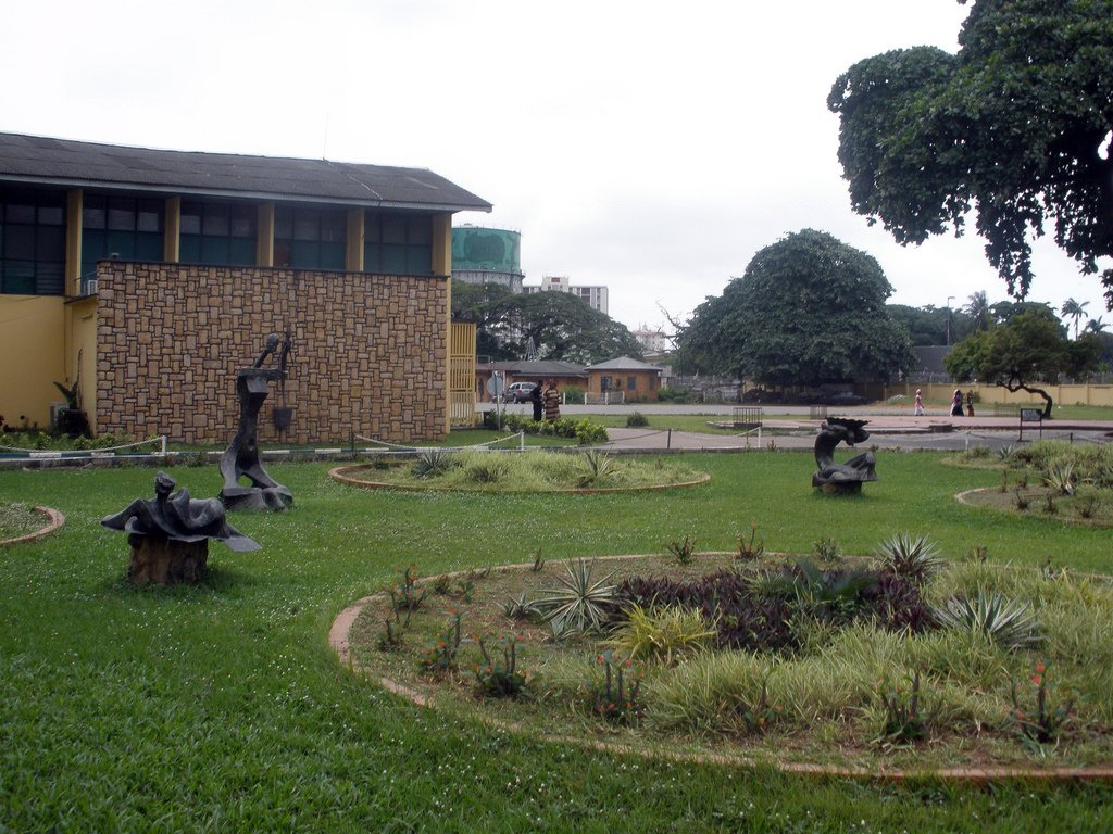
Nigerian National Museum, Lagos
Museum · 1.5 km
National museum in Nigeria


Rio de la plata
Monument and historic site · 1.4 km
Official residence of Oba of Lagos, Lagos Nigeria

Tafawa Balewa Square
Monument and historic site · 1.1 km
Ceremonial ground in Lagos, Nigeria

10 more on the map.
Parks, trails and playgrounds26

Apapa Amusement Park
Sports field and stadium · Arab, African · 3.4 km
Theme park in Lagos, Nigeria
11 Randle Avenue, Lagos
Mo-Su 09:00-20:00

Freedom Park
Park · 0.6 km
Park in Nigeria
1 Hospital Road, Broad Street, Lagos


Lekki Conservation Centre
Park · 15.7 km
Biodiversity conservation centre in Lagos, Nigeria

Garden Top Hotel, Festac, Nigeria
Park · 9.7 km
2014 New Festac Bridge Road, Amuwo Odofin
24/7



Lagos Jet Ski Riders Club
Marina and boat launch · 2.4 km
12 Ademola Street, Lagos
14 more on the map.
Restaurants and cafes153

Circa NonPareil
Restaurant · Italian, Pizza, Chinese, Burger, Regional, Sandwich · 7.7 km
12e Admiralty Way, Lagos
Tu-Su 10:00-21:00
Indigo Bar Restaurant and Suites
Restaurant · Chinese, Indian, International, Regional · 5.1 km
242B Muri Okunola Street, Lagos
Mo-Su 10:00-02:00
Leila Restaurant
Restaurant · Lebanese · 4.6 km
864B Bishop Aboyade Cole Street, Eti-Osa
Mo-Su 09:00-23:00
Mercury Lagos
Restaurant · African, Continental · 5.4 km
99 Ajose Adeogun Street, Victoria Island
Tu-Su 19:00-03:00
The Greenhouse Lagos
Restaurant · Burger, Pizza, Coffee Shop, American, Italian, Ice Cream, Sandwich, Seafood, Fish And Chips · 3.7 km
15 Oba Adeyinka Oyekan Avenue, Lagos
Mo-Su 10:00-23:00
desector pub & restaurant
Restaurant · Pizza, Burger, Sandwich, Chicken, Fish, Seafood, Juice, French, Pasta, Salad, Dessert, Steak House, Regional · 9.5 km
7 Plot 7 QMB Builders road off elf bustop Ikate Elegushi Lekki 105102, Lekki, Lagos
Mo-Su 12:00-03:00

141 more on the map.
History
The Island of Lagos (Yoruba: Ìsàlẹ̀ Èkó) emerged as a home to the Awori people, a subgroup of the Yoruba of West Africa in the 15th century. Before then, the Awori lived in the areas centred around the present-day littoral Local Government Areas of Lagos Mainland, Eti-Osa, Amuwo-Odofin, Apapa and other parts of Lagos metropolis behind the coast, such as Agege, Shomolu, Ikeja, Oshodi-Isolo and Kosofe. Lagos Island itself was a farmstead close to the Lagoon (Ọ̀sà), where they cultivated the land and lived. "Farmstead" or "hamlet" translates to Ereko in Yoruba, from which comes the indigenous name of Lagos; Eko, which it was named by the natives from its earliest days as a farm before it was eventually permanently settled by the Aworis of nearby Iddo Island.
From the History section of Lagos on Wikipedia, under CC BY-SA 4.0.
Where to stay74
Clear essence california spa & wellness resort
Motel and hotel · 6.0 km
13 Alexander Avenue, Ikoyi Lagos
Churches and places of worship40
St Joseph Catholic Parish kirikiri
Church · Catholic · 9.2 km
Dillion Street, Lagos
Holy Cross Cathedral
Church · Catholic
19 Catholic Mission Street, Lagos
Shopping32
Gas and EV charging37
Schools, colleges and libraries61
American International School Lagos
School · 4.8 km
1004 Federal Housing Complex Road, Lagos
Lycée Français Louis Pasteur
School · 5.5 km
16 Younis Bashorun Street, Lagos
National Open University of Nigeria
School · 2.8 km
14/16 Ahmadu Bello Way, Lagos
Healthcare126
Medison Specialist Women's Hospital
Hospital · 8.2 km
18 Olatunji Moore Street, lagos
Map of Lagos
250 places. The map loads OpenStreetMap tiles when you open it.
Getting there and nearby towns
Murtala Mohammed International Airport (LOS) is the nearest airport with scheduled flights listed in OpenStreetMap, 16 km away.
- Obalende 2 km east, about 2 min by car
- Surulere 7 km northwest, about 7 min by car
- Ajegunle 7 km west, about 7 min by car
- Aliayabiagba 7 km west, about 7 min by car
- Aiyetoro 6 km west, about 6 min by car
- Lekki 9 km east, about 9 min by car
- Mushin 9 km northwest, about 9 min by car
- Shomolu 10 km north, about 10 min by car
- Oshodi 13 km northwest, about 13 min by car
- Ikeja 17 km north, about 17 min by car
Drive times are estimates from straight-line distance, not routes.
Local news
Headlines from INDB.
Reviews, tips and questions
Loading what members have shared...
Sources and licences
- GeoNames (CC BY 4.0): population, coordinates, regions and time zone
- OpenStreetMap contributors (ODbL 1.0): places, airports, map data
- Wikidata (CC0 1.0): elevation, founding date, time zone, website, landmarks and historic places
- Wikimedia Commons (see each image): photos
- Wikipedia (CC BY-SA 4.0): overview and history text
Photo credits
- Skywater, Ernestblinqz, CC BY-SA 4.0
- 2013 Bar Beach Lagos Nigeria 12997530443, T. Obi, CC BY 2.0
- Carter Brdge 001, Solasly, CC BY-SA 4.0
- Main gate, Douglas Oraka, CC BY-SA 3.0
- Eko cater bridge in Lagos State-Nigeria, Omoeko Media, CC BY-SA 4.0
- 2013 Suya on Elegushi Beach Lekki Lagos Nigeria 12997714615, T. Obi, CC BY 2.0
- Lekki Ikoyi Link Bridge, Chippla, CC BY-SA 3.0
- Outside Nike Art Gallery (4202980259), Jeremy Weate, CC BY 2.0
- Garden front of National Theater, Iganmu, Lagos, Omoeko Media, CC BY-SA 4.0
- 2014 Tinubu Square Lagos Nigeria 14640600637, Jeremy Weate from Abuja, Nigeria, CC BY 2.0
- Ilojo bar, Epicy, CC BY-SA 4.0
- National arts theatre (19799909141), dotun55, CC BY-SA 2.0
- Garden in front of museum (6349971557), crashdburnd, CC BY-SA 2.0
- Exhibition 2015, Tundehundeyin, CC BY-SA 4.0
- Iga iduganran, Yeniajayiii, CC BY-SA 4.0
- Tafawa Balewa Square Image, Sidhant Bendre, CC BY-SA 4.0
- Super Star, Freak Out and KMG Booster, night, Unknown author, CC BY-SA 2.0
- Muri Okunola Park Lagos 2026-08 view-from-South, FrankvEck, CC BY-SA 4.0
- Gani Fawehinmi Park 36, ReoMartins, CC BY-SA 4.0
- Koi Pond at LEKKI CONSERVATION CENTRE LAGOS, NIGERIA (LCC) 15, Ashinze, CC BY-SA 4.0
- Frontview of the Synagogue Church of all Nations (cropped), Hallo503, CC BY-SA 4.0
- Holy Cross Cathedral Lagos, Kelechinaba, CC BY-SA 4.0
- Onikan Stadium, Comradeayobami, CC BY-SA 4.0
- Main-bowl-national-stadium-surulere-lagos, S.aderogba, CC BY-SA 4.0
- View of NOUN Media centre, Fawaz.tairou, CC BY-SA 4.0
- Mechanical workshop, Yabatech, Abiolakintrunde, CC BY-SA 4.0
- Cross segment of igbobi college front view, Bamidele Olaoluwa Emmanuel, CC BY-SA 4.0
- Cathedral Church of Christ, CMS, Lagos, Sho photography, CC BY-SA 4.0
- Nurse checking triplets, Mike Blyth, CC BY-SA 3.0
- St. Nicholas Hospital, Lagos, User:Kaizenify, Public domain
- Terra Kulture, Anjie o, CC BY-SA 4.0
- National Orthopedic Hospital, Igbobi, Kaizenify, CC BY-SA 4.0
- MORNING MARKET, Koyejoadejoye, CC BY-SA 4.0
- (Photo-walk Nigeria),front view of the Federal College of Education (Tech), Yemi festus, CC BY-SA 4.0
- Lagos Central Mosque, Chukwuka Tolulope Obu, CC BY-SA 4.0
- Silverbird cinema building, Lagos, Kaizenify, CC BY-SA 4.0
- Lago Oriental Hotel, Ernestblinqz, CC BY-SA 4.0
- Federal palace hotel,Victoria island,Lagos, Godmyhelper, CC BY-SA 4.0
- National Stadium Surulere, Juganutt, CC BY-SA 4.0
- Yaba Tech second gate, Official alade, CC BY-SA 4.0
- Federal college of fisheries and marine technology (cropped), Ebubechukwu1, CC BY-SA 4.0
- Picture News, CMS Grammar School, Oct 2012, Grammar78, CC0
- Lagos Island General Hospital with it's red roofs, Juganutt, CC BY-SA 4.0
- KFC Nigeria in Lagos 01, Qasamaan, CC BY 3.0
- MKO Abiola park 74, Kojoclicks, CC BY-SA 4.0
- Sunset at Landmark Beach, Kwadoskii, CC BY-SA 4.0


Page built November 3, 2026. Spotted a mistake? Tell us or suggest a place.