
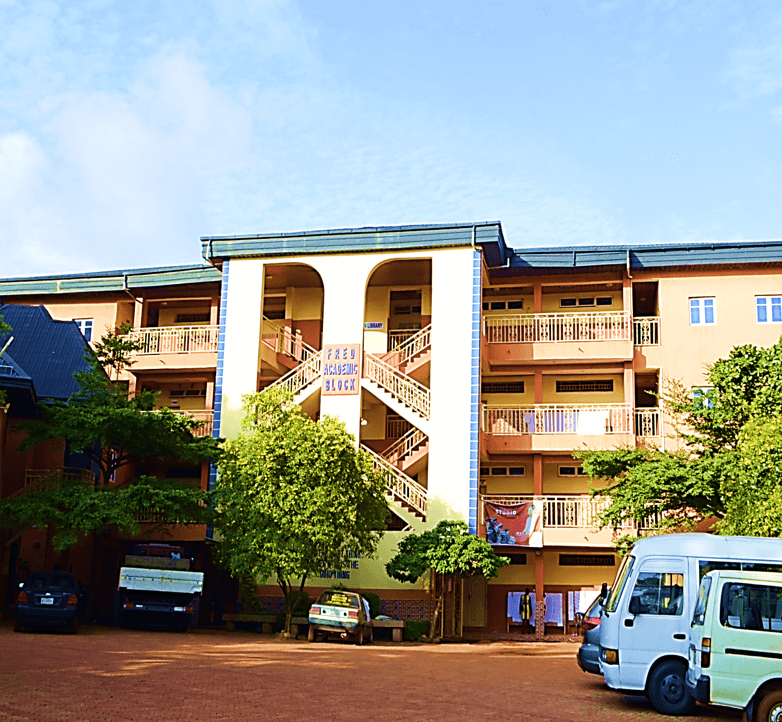


Why visit Udi
Townapedia lists 2 museums and landmarks, 4 parks and trails, 4 places to eat, 16 places to stay and 6 attractions in and around town.
Highlights include Bigard Memorial Seminary and Enugu State University of Science and Technology.
Weather in Udi
Forecast from MET Norway (CC BY 4.0). Full forecast
About Udi
Udi is a town and Local Government Area in Enugu State, Nigeria. Its headquarters is there. The current local government chairman is Hon Hyginus Ogbonnia Agu.
From the Wikipedia article Udi, Enugu State (this version), under CC BY-SA 4.0.
Things to do6

Bigard Memorial Seminary
School · 14.7 km
Catholic seminary in Enugu, Nigeria
Enugu State University of Science and Technology
School · 11.6 km
University in Enugu, Nigeria
Institute of Management Technology, Enugu
School · 17.1 km
State polytechnic in Enugu, Nigeria
Our Saviour Institute of Science and Technology
School · 18.0 km
College of Education in Nigeria
Renaissance University
School · 15.1 km
Private university in Nigeria
Museums and landmarks2

Aguagwa
Monument and historic site · 12.9 km
6 Aguagwa Street Ologo Quaters Enugu
Parks, trails and playgrounds4


Restaurants and cafes4




Kilimanjaro
Fast food · Nigerian · 13.7 km
159 Agbani Road, Enugu
Mo-Su 07:30-22:00
Where to stay16
Rossy Valley International Hotels Limited
Motel and hotel · 13.8 km
37.0 Calabar Street
Churches and places of worship12
SCRIPTURE UNION ENUGU REGIONAL HOUSE
Church · Nondenominational · 13.6 km
28 Ozalla Street, ENUGU
Gas and EV charging2
Schools, colleges and libraries18
International Institute For Entrepreneurship & Development
School · 14.3 km
Zik Avenue
Healthcare8
First Holistic Health Physiotherapy Clinic
Clinic and pharmacy · 14.7 km
10.0 Boardman Street
Map of Udi
72 places. The map loads OpenStreetMap tiles when you open it.
Getting there and nearby towns
Akanu Ibiam International Airport (ENU) is the nearest airport with scheduled flights listed in OpenStreetMap, 23 km away.
- Enugu 16 km northeast, about 16 min by car
- Amagunze 26 km east, about 26 min by car
- Awgu 28 km south, about 28 min by car
- Mberubu 28 km southeast, about 28 min by car
- Awka 40 km west, about 40 min by car
- Aku 45 km north, about 45 min by car
- Agulu 46 km southwest, about 46 min by car
- Enugu-Ukwu 49 km west, about 49 min by car
- Eha Amufu 53 km northeast, about 53 min by car
- Okigwe 55 km south, about 55 min by car
Drive times are estimates from straight-line distance, not routes.
Local news
Headlines from INDB.
Reviews, tips and questions
Loading what members have shared...
Sources and licences
- GeoNames (CC BY 4.0): population, coordinates, regions and time zone
- OpenStreetMap contributors (ODbL 1.0): places, airports, map data
- Wikidata (CC0 1.0): elevation, founding date, time zone, website, landmarks and historic places
- Wikimedia Commons (see each image): photos
- Wikipedia (CC BY-SA 4.0): overview and history text
Photo credits
- Peaceland University building, Marvinno47, CC BY 4.0
- Akwuke Beach Site 8, Ugo K. Chime, CC BY-SA 4.0
- Akwuke Beach Site 5, Ugo K. Chime, CC BY-SA 4.0
- Akwuke Beach Site 2, Ugo K. Chime, CC BY-SA 4.0
- Akwuke Beach Site 7, Ugo K. Chime, CC BY-SA 4.0
- Akwuke Beach Site 10, Ugo K. Chime, CC BY-SA 4.0
- Akwuke Beach Site 3, Ugo K. Chime, CC BY-SA 4.0
- Akwuke Beach Site 6, Ugo K. Chime, CC BY-SA 4.0
- Akwuke Beach Site 9, Ugo K. Chime, CC BY-SA 4.0
- Akwuke Beach Site 4, Ugo K. Chime, CC BY-SA 4.0
- Akwuke Beach Site 01, Ugo K. Chime, CC BY-SA 4.0
- ISS042-E-249092 - View of Earth, Earth Science and Remote Sensing Unit , Lyndon B. Johnson Space Center, Public domain
- ISS042-E-249095 - View of Earth, Earth Science and Remote Sensing Unit , Lyndon B. Johnson Space Center, Public domain
- ISS042-E-249094 - View of Earth, Earth Science and Remote Sensing Unit , Lyndon B. Johnson Space Center, Public domain
- ISS042-E-249093 - View of Earth, Earth Science and Remote Sensing Unit , Lyndon B. Johnson Space Center, Public domain
- ISS042-E-78681 - View of Earth, Earth Science and Remote Sensing Unit , Lyndon B. Johnson Space Center, Public domain


Page built November 3, 2026. Spotted a mistake? Tell us or suggest a place.