
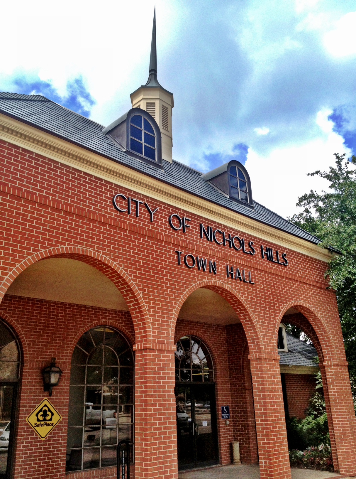


Nichols Hills, Oklahoma
Nichols Hills is a city of 3,843 people in Oklahoma County, Oklahoma, founded in 1929.
Why visit Nichols Hills
Townapedia lists 6 museums and landmarks, 14 parks and trails, 77 places to eat, 4 places to stay and 2 attractions in and around town.
Highlights include AMC Penn Square 10, Wedgewood Village Amusement Park, Donald Pollock House and Founders Tower.
July is the warmest month, with average highs of 95°F; January lows average 28°F.
Weather in Nichols Hills
Forecast from the National Weather Service. Full forecast
About Nichols Hills
Nichols Hills is a city in Oklahoma County, Oklahoma, United States, and a part of the Oklahoma City metropolitan area. The population was 3,870 as of the 2020 census, a 4.3% increase from 2010.
From the Wikipedia article Nichols Hills, Oklahoma (this version), under CC BY-SA 4.0.
Things to do2


Wedgewood Village Amusement Park
Monument and historic site · 2.9 mi
Former amusement park in Oklahoma City, Oklahoma, United States
Museums and landmarks6

Donald Pollock House
Monument and historic site · National Register of Historic Places · 1.0 mi
Historic house in Oklahoma, United States
Founders Tower
Monument and historic site · National Register of Historic Places · 1.9 mi
Residential in Oklahoma City, Oklahoma

Harding Charter Preparatory High School
Monument and historic site · National Register of Historic Places · 3.1 mi
Charter school in Oklahoma City, Oklahoma, United States

Paseo Arts District
Monument and historic site · National Register of Historic Places · 3.5 mi
Human settlement in Oklahoma City, Oklahoma, United States of America


Will Rogers Gardens
Monument and historic site · National Register of Historic Places · 3.4 mi
Oklahoma City, Oklahoma

National Cowboy & Western Heritage Museum
Museum · 3.5 mi
Museum in Oklahoma City, Oklahoma, USA
Parks, trails and playgrounds14


Mayview Park
Park · 1.6 mi
3135 Northwest 73rd Street, Oklahoma City
Mo-Su 05:00-23:00
2 more on the map.
Restaurants and cafes77

Baskin-Robbins
Ice cream · Ice Cream · 1.2 mi
7502 North May Avenue, Oklahoma City
Mo-Th 10:30-21:30; Fr-Sa 10:30-22:00; Su 11:00-21:30

Burger Punk
Restaurant · Burger · 1.5 mi
915 West Britton Road, Oklahoma City
Mo-We 11:00-22:00; Th-Sa 11:00-23:00; Su 11:00-21:00

Dutch Bros. Coffee
Cafe · Coffee Shop · 1.6 mi
5900 North May Avenue, Oklahoma City
Su-Th 05:00-22:00; Fr-Sa 05:00-23:00
JINYA Ramen Bar
Restaurant · Ramen · 0.9 mi
6800 North Western Avenue, Oklahoma City
Su-Th 11:00-22:00; Fr-Sa 11:00-22:30
La Baguette Bistro
Restaurant · French · 1.2 mi
7408 North May Avenue, Oklahoma City
Su 09:00-14:30; Mo 08:00-15:00; Tu-Th 09:00-21:00; Fr-Sa 08:00-22:00
Ocean81 Sushi Bar
Restaurant · Sushi · 1.2 mi
7508 North May Avenue, Oklahoma City
Mo-Fr 11:00-14:00,17:00-21:00; Sa 17:00-21:00
Pho' Kim Vietnamese Noodle House
Restaurant · Vietnamese · 1.2 mi
7504 North May Avenue, Oklahoma City
Mo-Sa 11:00-21:00
Piatto Italian Kitchen
Restaurant · Italian · 1.5 mi
2920 Northwest 63rd Street, Oklahoma City
Mo-Th 16:30-21:00; Fr-Sa 16:30-21:30
S&B Burger Joint
Restaurant · Burger · 1.6 mi
5929 North May Avenue, Oklahoma City
Su 11:00-20:00; Mo-Sa 11:00-21:00
65 more on the map.
History
The 1,280 acres now known as Nichols Hills were developed as an exclusive residential area by Dr. G.A. Nichols in 1929. Between 1907 and 1929, Dr. Nichols, an Oklahoma City real estate pioneer, developed the University, Paseo Arts District, Military Park, Central Park, Winans, University Place, Gatewood, Harndale, Nichols University Place and Lincoln Terrace neighborhoods of Oklahoma City and designed the city of Nicoma Park, Oklahoma.
From the History section of Nichols Hills, Oklahoma on Wikipedia, under CC BY-SA 4.0.
Where to stay4
Churches and places of worship19
Highland Missionary Baptist Church
Church · Baptist · 1.5 mi
2600 Northwest 57th Street, Oklahoma City
Nichols Hills United Methodist Church
Church · Methodist · 0.6 mi
1212 Bedford Drive, Nichols Hills
North Highland Community Seventh Day Adventist Church
Church · Seventh Day Adventist · 1.4 mi
8721 North Walker Avenue, Oklahoma City
Saint Jude Missionary Baptist Church
Church · Baptist · 1.5 mi
1001 Northwest 92nd Street, Oklahoma City
All Souls' Episcopal Church
Church · Episcopal · 0.7 mi
6400 North Pennsylvania Avenue, Oklahoma City
Shopping26
Gas and EV charging4
Schools, colleges and libraries49
Casady School
School · Episcopal · 1.6 mi
9500 North Pennsylvania Avenue, Oklahoma City
Healthcare7
Advanced Relief Chiropractice and Acupuncture
Clinic and pharmacy · 1.4 mi
8020 North May Avenue, Oklahoma City
Nichols Hills Drugs
Clinic and pharmacy · 0.8 mi
7600 North Western Avenue, Nichols Hills
MidFirst Bank - Employee Health Center
Clinic and pharmacy · 1.6 mi
717 Northwest 56th Street, Oklahoma City
Map of Nichols Hills
208 places. The map loads OpenStreetMap tiles when you open it.
Climate by month
Monthly table
| Month | High | Low | Rain |
|---|---|---|---|
| Jan | 50°F | 28°F | 0.8 in |
| Feb | 55°F | 31°F | 1.0 in |
| Mar | 64°F | 40°F | 2.0 in |
| Apr | 72°F | 49°F | 3.0 in |
| May | 80°F | 59°F | 4.3 in |
| Jun | 89°F | 68°F | 4.8 in |
| Jul | 95°F | 73°F | 2.9 in |
| Aug | 94°F | 71°F | 3.5 in |
| Sep | 85°F | 63°F | 3.0 in |
| Oct | 74°F | 51°F | 2.7 in |
| Nov | 62°F | 39°F | 1.5 in |
| Dec | 51°F | 30°F | 1.3 in |
U.S. Climate Normals 1991-2020 for Oklahoma City Post Ap (6 mi away), NOAA NCEI.
People and cost of living
American Community Survey 5-year estimates, 2020-2024, U.S. Census Bureau. Estimates have margins of error, larger for small towns.
Disaster history
Oklahoma County has had 43 federal disaster declarations since 2000, most often for fires.
- 2026-08-13: Train Trestle Fire (Fire)
- 2025-05-21: Wildfires And Straight-Line Winds (Fire)
- 2025-03-18: Severe Storms, Straight-Line Winds, Tornadoes, And Flooding (Severe Storm)
- 2025-03-14: Luther Fire (Fire)
- 2023-03-31: Hefner Fire, Oklahoma Fmag (Fire)
- 2021-02-24: Severe Winter Storms (Severe Ice Storm)
OpenFEMA disaster declarations summaries.
Getting there and nearby towns
Wiley Post Airport (PWA) is the nearest airport with scheduled flights listed in OpenStreetMap, 6 miles away.
- Warr Acres 4 mi west, about 7 min by car
- Oklahoma City 6 mi south, about 9 min by car
- Bethany 6 mi southwest, about 10 min by car
- Del City 9 mi southeast, about 14 min by car
- Edmond 11 mi northeast, about 18 min by car
- Midwest City 11 mi southeast, about 18 min by car
- Yukon 13 mi west, about 20 min by car
- Nicoma Park 13 mi east, about 21 min by car
- Mustang 15 mi southwest, about 24 min by car
- Moore 16 mi south, about 25 min by car
Drive times are estimates from straight-line distance, not routes.
Local news
Headlines from INDB, the NEMICO news database.
Reviews, tips and questions
Loading what members have shared...
Sources and licences
- NCES EDGE (Public domain): public schools
- NOAA NCEI U.S. Climate Normals 1991-2020 (Public domain): climate by month
- OpenFEMA (Public domain): disaster declarations
- OpenStreetMap contributors (ODbL 1.0): places, airports, map data
- U.S. Census Bureau (Public domain): population, income, housing, education, commute
- Wikidata (CC0 1.0): elevation, founding date, time zone, website, landmarks and historic places
- Wikimedia Commons (see each image): photos
- Wikipedia (CC BY-SA 4.0): overview and history text
Photo credits
- Nichols Hills Town Hall, Popsiclecrawfish, CC BY-SA 3.0
- Harding Junior High School, Cburga1964, CC BY-SA 3.0
- Paseo Arts District - Oklahoma City, OK USA, PASEO ART SPACE - panoramio, MARELBU, CC BY 3.0
- DonaldPollockHouseOKC, Melodibit, CC BY-SA 3.0
- Oklahoma City, OK - USA - Will Rogers Park - panoramio (8), MARELBU, CC BY 3.0
- Unitedfounders 10 29 07 c, Doug Loudenback, http://www.dougloudenback.com/ http://s8.photobucket.com/albums/a49/DougLoudenback/ http://www.dougdawg.blogspot.com/, CC BY-SA 3.0
Page built October 30, 2026. Spotted a mistake? Tell us or suggest a place.