


Niles, Michigan
Niles is a city of 11,803 people in Berrien County, Michigan, founded in 1827.
Why visit Niles
Townapedia lists 12 museums and landmarks, 24 parks and trails, 17 places to eat, 3 places to stay and 2 attractions in and around town.
Highlights include Wonderland Cinema, Ferry Street Historic District, Fort St. Joseph and French Field.
July is the warmest month, with average highs of 83°F; January lows average 19°F, and about 62 inches of snow fall in a normal year.
Weather in Niles
Forecast from the National Weather Service. Full forecast
About Niles
Niles is a city in Berrien and Cass counties in the U.S. state of Michigan, near the Indiana state line city of South Bend. The population was 11,988 according to the 2020 census. It is the larger, by population, of the two principal cities in the Niles-Benton Harbor metropolitan area, an area with 153,797 people.
From the Wikipedia article Niles, Michigan (this version), under CC BY-SA 4.0.
Things to do2

Museums and landmarks12

Ferry Street Historic District
Monument and historic site · National Register of Historic Places
Historic district in Niles, Michigan, United States
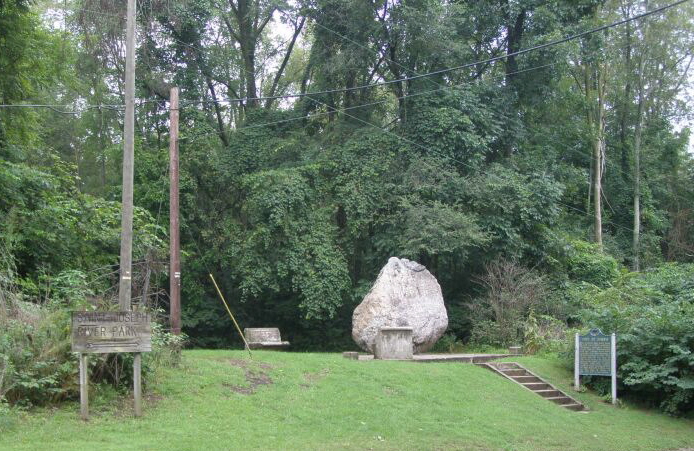
Fort St. Joseph
Monument and historic site · National Register of Historic Places · 1.6 mi
Fort and mission in Michigan

Henry A. Chapin House
Museum · National Register of Historic Places · 0.5 mi
Niles, Michigan
Niles Downtown Historic District
Monument and historic site · National Register of Historic Places · 0.5 mi
Historic district in Niles, Michigan

Niles station
Monument and historic site · National Register of Historic Places
Railway station in Niles, Michigan

Old U.S. Post Office
Monument and historic site · National Register of Historic Places · 1.1 mi
Post office in Michigan, United States of America
Paine Bank
Monument and historic site · National Register of Historic Places · 0.5 mi
Historic bank building in Niles, Michigan, United States
Ring Lardner House
Monument and historic site · National Register of Historic Places · 0.9 mi
Historic house in Michigan, United States
Parks, trails and playgrounds24





12 more on the map.
Restaurants and cafes17

Taqueria Don Chepe
Restaurant · Mexican · 1.3 mi
Taqueria Don Chepe in Niles, MI is your destination for authentic Mexican food and creative catering in Niles and surrounding areas. In...
1668 East Main Street, Niles
Mo 11:00-20:00; Tu, Th-Sa 10:00-20:00; Su 10:00-16:30

Nuggett Downtown Grill
Bar and pub · 0.6 mi
202 East Main Street, Niles
Mo-Th 10:00-22:00; Fr 11:00-01:30
Curly Q's BBQ
Restaurant · Barbecue
1125 Wayne Street, Niles
We 12:00-18:00; Th 12:00-21:00; Fr-Sa 12:00-22:00

Burger King
Fast food · Burger · 1.4 mi
1250 South 11th Street, Niles
Mo-Sa 06:00-22:00; Su 07:00-22:00
Taco Bell
Fast food · Tex-Mex · 1.5 mi
1298 South 11th Street, Niles
Mo-Th 07:00-02:00; Fr-Sa 07:00-03:00; Su 07:00-02:00
5 more on the map.
History
Niles lies on the banks of the St. Joseph River, at the site of the French Fort St. Joseph, which was built in 1697 to protect the Jesuit Mission established in 1691. After 1761, it was held by the British and was captured on May 25, 1763, by Native Americans during Pontiac's Rebellion. The British retook the fort but it was not re-garrisoned and served as a trading post. During the American Revolutionary War, the fort was held for a short time by a Spanish force. The occupation of the fort by the four nations of France, Britain, Spain, and the United States has earned Niles the nickname City of Four Flags.
The town was named after Hezekiah Niles, editor of the Niles Register, a Baltimore newspaper. The town of Niles as it exists today was settled in 1827. Between 1820 and 1865, Niles was an integral part of the Underground Railroad, helping slaves escape from as far south as New Orleans through the Heartland, and eventually into Canada.
From the History section of Niles, Michigan on Wikipedia, under CC BY-SA 4.0.
Where to stay3
Quality Inn & Suites Niles
Motel and hotel · 1.4 mi
1265 South 11th Street, Niles
Churches and places of worship31
Niles Philadelphia Seventh-day Adventist Church
Church · Seventh Day Adventist · 0.5 mi
1327 Broadway Street, Niles
Westside Seventh-day Adventist Church
Church · Seventh Day Adventist · 1.3 mi
1105 Grant Street, Niles
Franklin A.M.E. Chruch
Church · African Methodist Episcopal
811 Sycamore Street, Niles
Shopping3
Gas and EV charging8
Schools, colleges and libraries31
Healthcare4
Corewell Health Lakeland Hospitals Niles Hospital
Hospital · 0.8 mi
31 North Saint Joseph Avenue, Niles
Map of Niles
135 places. The map loads OpenStreetMap tiles when you open it.
Climate by month
Monthly table
| Month | High | Low | Rain | Snow |
|---|---|---|---|---|
| Jan | 33°F | 19°F | 3.0 in | 22.6 in |
| Feb | 36°F | 21°F | 2.3 in | 13.6 in |
| Mar | 47°F | 29°F | 2.5 in | 6.3 in |
| Apr | 60°F | 38°F | 3.7 in | 0.8 in |
| May | 71°F | 48°F | 4.2 in | 0.0 in |
| Jun | 80°F | 58°F | 4.0 in | 0.0 in |
| Jul | 83°F | 61°F | 3.7 in | 0.0 in |
| Aug | 81°F | 61°F | 4.4 in | 0.0 in |
| Sep | 76°F | 53°F | 3.5 in | 0.0 in |
| Oct | 63°F | 43°F | 4.4 in | 0.1 in |
| Nov | 49°F | 33°F | 3.0 in | 4.6 in |
| Dec | 38°F | 25°F | 2.7 in | 14.5 in |
U.S. Climate Normals 1991-2020 for Niles (1 mi away), NOAA NCEI.
People and cost of living
American Community Survey 5-year estimates, 2020-2024, U.S. Census Bureau. Estimates have margins of error, larger for small towns.
Disaster history
Berrien County has had 5 federal disaster declarations since 2000, most often for biologicals.
- 2020-03-27: Covid-19 Pandemic (Biological)
- 2020-03-13: Covid-19 (Biological)
- 2005-09-07: Hurricane Katrina Evacuation (Hurricane)
- 2004-06-30: Severe Storms, Tornadoes, And Flooding (Severe Storm)
- 2001-01-10: Snow (Snowstorm)
OpenFEMA disaster declarations summaries.
Getting there and nearby towns
Jerry Tyler Memorial Airport (NLE) is the nearest airport with scheduled flights listed in OpenStreetMap, 1 miles away.
- Granger 9 mi southeast, about 14 min by car
- South Bend 11 mi south, about 18 min by car
- Mishawaka 12 mi south, about 19 min by car
- Elkhart 18 mi southeast, about 29 min by car
- Goshen 28 mi southeast, about 45 min by car
- La Porte 29 mi southwest, about 46 min by car
- Michigan City 33 mi west, about 53 min by car
- Plymouth 34 mi south, about 54 min by car
- Chesterton 45 mi west, about 1 h 15 min by car
- Kalamazoo 46 mi northeast, about 1 h 15 min by car
Drive times are estimates from straight-line distance, not routes.
Local news
Headlines from INDB, the NEMICO news database.
Reviews, tips and questions
Loading what members have shared...
Sources and licences
- NCES EDGE (Public domain): public schools
- NOAA NCEI U.S. Climate Normals 1991-2020 (Public domain): climate by month
- OpenFEMA (Public domain): disaster declarations
- OpenStreetMap contributors (ODbL 1.0): places, airports, map data
- U.S. Census Bureau (Public domain): population, income, housing, education, commute
- Wikidata (CC0 1.0): elevation, founding date, time zone, website, landmarks and historic places
- Wikimedia Commons (see each image): photos
- Wikipedia (CC BY-SA 4.0): overview and history text
Photo credits
- Main Street Niles Michigan 0024, Chris Light ( talk ), CC BY-SA 3.0
- Henry A. Chapin House Niles Michigan 2021-2802, Paul R. Burley, CC BY-SA 4.0
- Henry A. Chapin House Niles Michigan 2021-2796, Paul R. Burley, CC BY-SA 4.0
- Henry A. Chapin House Niles Michigan 2021-2803, Paul R. Burley, CC BY-SA 4.0
- Henry A. Chapin House Niles Michigan 2021-2795, Paul R. Burley, CC BY-SA 4.0
- Henry A. Chapin House Niles Michigan 2021-2797, Paul R. Burley, CC BY-SA 4.0
- Henry A. Chapin House Niles Michigan Brick Detail 2021-2798, Paul R. Burley, CC BY-SA 4.0
- Henry A. Chapin House Niles Michigan 2021-2799, Paul R. Burley, CC BY-SA 4.0
- Henry A. Chapin House Niles Michigan 2021-2800, Paul R. Burley, CC BY-SA 4.0
- Carnegie Library Niles Michigan 2021-2810, Paul R. Burley, CC BY-SA 4.0
- Carnegie Library Niles Michigan 2021-2809, Paul R. Burley, CC BY-SA 4.0
- Niles bridge (5532847740), Kevin Dooley from Chandler, AZ, USA, CC BY 2.0
- Carnegie Library Niles Michigan 2021-2817, Paul R. Burley, CC BY-SA 4.0
- Carnegie Library Niles Michigan 2021-2816, Paul R. Burley, CC BY-SA 4.0
- Carnegie Library Niles Michigan 2021-2812, Paul R. Burley, CC BY-SA 4.0
- Carnegie Library Niles Michigan 2021-2808, Paul R. Burley, CC BY-SA 4.0
- Carnegie Library Niles Michigan Column 2021-2815, Paul R. Burley, CC BY-SA 4.0
- Carnegie Library Niles Michigan Globe Lamp 2021-2813, Paul R. Burley, CC BY-SA 4.0
- Carnegie Library Niles Michigan 2021-2814, Paul R. Burley, CC BY-SA 4.0
- Carnegie Library Niles Michigan 2021-2804, Paul R. Burley, CC BY-SA 4.0
- Carnegie Library Niles Michigan 2021-2806, Paul R. Burley, CC BY-SA 4.0
- Carnegie Library Niles Michigan 2021-2805, Paul R. Burley, CC BY-SA 4.0
- Fort St. Joseph Site Niles Michigan 068, Chris Light ( talk ), CC BY-SA 3.0
- Post Office Niles Michigan, upnorthmemories, Public domain
- 20020119 01 Amtrak station Niles, MI, David Wilson, CC BY 2.0
- Henry A. Chapin House 04, JDNorry, CC BY-SA 3.0
- Henry A. Chapin House 01, JDNorry, CC BY-SA 3.0
- Henry A. Chapin House 03, JDNorry, CC BY-SA 3.0
- Henry A. Chapin House 06, JDNorry, CC BY-SA 3.0
- Henry A. Chapin House 05, JDNorry, CC BY-SA 3.0
- Henry A. Chapin House 02, JDNorry, CC BY-SA 3.0
- Barrien Springs Courthouse (5532243361), Kevin Dooley from Chandler, AZ, USA, CC BY 2.0
- Pine Lake Pizzeria (4785510136), Kevin Dooley from Chandler, AZ, USA, CC BY 2.0
- Paine Bank, JDNorry, CC BY-SA 3.0
- Ring Lardner House 02, JDNorry, CC BY-SA 3.0
- Ring Lardner House 01, JDNorry, CC BY-SA 3.0
- Ring Lardner House 03, JDNorry, CC BY-SA 3.0
- Percina caprodes 29027393, moxostoma, CC BY 4.0
- Blue Star Mem 19-09-20 071, Chris Light, CC BY-SA 4.0
- Allouez Memorial, Chris Light, CC BY-SA 4.0


Page built October 30, 2026. Spotted a mistake? Tell us or suggest a place.