




North East, Pennsylvania
North East is a borough of 4,054 people in Erie County, Pennsylvania, founded in 1800.
Why visit North East
Townapedia lists 5 museums and landmarks, 10 parks and trails and 17 places to eat in and around town.
Highlights include North East Historic District, Short's Hotel and Gibson Park.
July is the warmest month, with average highs of 83°F; January lows average 21°F.
Weather in North East
Forecast from the National Weather Service. Full forecast
About North East
North East is a borough in North East Township, Erie County, Pennsylvania, United States, 14 miles (23 km) northeast of Erie. Its name comes from its position in the northeastern corner of Erie County, despite being near the extreme northwest of Pennsylvania. The population was 4,114 at the 2020 census, down from 4,294 in 2010. Fruit growing was an early economic endeavor, and is still to this day, as this is a popular area especially for cherries and grapes.
From the Wikipedia article North East, Pennsylvania (this version), under CC BY-SA 4.0.
Museums and landmarks5

North East Historic District
Monument and historic site · National Register of Historic Places
Historic district in Pennsylvania, United States
Short's Hotel
Monument and historic site · National Register of Historic Places
Hotel in North East, United States of America

Parks, trails and playgrounds10



The Clubhouse Indoor Golf
Golf course · 0.8 mi
10722 West Main Street, North East
Restaurants and cafes17

The Skunk & Goat Tavern
Diner · American
Vibrant menu offerings include irresistible starters, hearty American entrees, imaginative seasonal cuisine, ice-cold beer, notable...
17 West Main Street, North East
Mo-Th 08:00-21:00; Fr, Sa 08:00-22:00; Su 08:00-20:00

La Casa De Pizza
Restaurant · Pizza
13 East Main Street, North East
Mo 11:00-19:15; Tu 11:30-19:15; We 11:00-19:15; Th 11:00-19:15; Fr...

South Shore Wine Company
Brewery and winery · 1.1 mi
1120 Freeport Road, North East


5 more on the map.
Churches and places of worship11

Episcopal Church of Holy Cross
Church · Episcopal
51 West Main Street, North East
Immanuel United Methodist Church
Church · United Methodist · 0.4 mi
22 East Division Street, North East
Park United Methodist Church
Church · United Methodist
30 North Lake Street, North East
Praise Cathedral Church of God
Church · Church Of God · 1.5 mi
5335 Station Road, North East
Saint Gregory Catholic Church
Church · Catholic
50 South Pearl Street, North East
Saint Peter's Lutheran Church
Church · Lutheran · 0.9 mi
1500 Freeport Road, North East
History
Before 1650, the area was settled by the Eriez, a relatively peaceful tribe; however, they were destroyed by the Seneca.
As part of the Erie Triangle, it was only in 1792 that the locale became part of Pennsylvania. However, North East did not receive its first settlers until 1794, still, several years before the county (Erie) and township (North East) was organized. Originally the North East Township was called "Lower Greenfield" being downstream from Greenfield Township. The first road was built in 1797 from present-day Freeport at the mouth of Sixteenmile Creek to present-day Colt Station now in Greenfield Township. That road was extended in 1798 to where French Creek forks (present-day Wattsburg). In 1800 a road from the village of North East to Wattsburg was opened, it paralleled, but ran east of, the first one from Freeport.
From the History section of North East, Pennsylvania on Wikipedia, under CC BY-SA 4.0.
Shopping4
Gas and EV charging3
Schools, colleges and libraries9
North East Intermediate Elementary
School · 0.5 mi
50 E Division Street, North East
Earle C. Davis Primary School
School · 0.5 mi
50 East Division Street, North East
Intermediate Elementary School
School · 0.6 mi
50 East Division Street, North East
Healthcare3
North East Family Practice
Clinic and pharmacy · 0.4 mi
115 East Main Street, North East
UPMC Outpatient Center
Clinic and pharmacy · 0.6 mi
2060 North Pearl Street, North East
Map of North East
62 places. The map loads OpenStreetMap tiles when you open it.
Climate by month
Monthly table
| Month | High | Low | Rain |
|---|---|---|---|
| Jan | 34°F | 21°F | 2.6 in |
| Feb | 36°F | 21°F | 2.4 in |
| Mar | 44°F | 28°F | 2.9 in |
| Apr | 57°F | 38°F | 3.5 in |
| May | 69°F | 50°F | 3.8 in |
| Jun | 78°F | 60°F | 3.6 in |
| Jul | 83°F | 64°F | 4.4 in |
| Aug | 80°F | 62°F | 3.8 in |
| Sep | 73°F | 57°F | 4.6 in |
| Oct | 61°F | 47°F | 4.9 in |
| Nov | 49°F | 36°F | 3.8 in |
| Dec | 39°F | 28°F | 3.2 in |
U.S. Climate Normals 1991-2020 for Westfield 2 Sse (14 mi away), NOAA NCEI.
People and cost of living
American Community Survey 5-year estimates, 2020-2024, U.S. Census Bureau. Estimates have margins of error, larger for small towns.
Disaster history
Erie County has had 6 federal disaster declarations since 2000, most often for hurricanes.
- 2020-03-30: Covid-19 Pandemic (Biological)
- 2020-03-13: Covid-19 (Biological)
- 2012-10-29: Hurricane Sandy (Hurricane)
- 2005-09-10: Hurricane Katrina (Hurricane)
- 2004-09-19: Tropical Depression Ivan (Hurricane)
- 2004-09-19: Severe Storms And Flooding Associated With Tropical Depression Frances (Severe Storm)
OpenFEMA disaster declarations summaries.
Getting there and nearby towns
Erie International Airport (ERI) is the nearest airport with scheduled flights listed in OpenStreetMap, 19 miles away.
- Penn State Erie (Behrend) 10 mi southwest, about 16 min by car
- Lawrence Park 11 mi southwest, about 17 min by car
- Erie 14 mi southwest, about 23 min by car
- Westfield 15 mi northeast, about 24 min by car
- Mayville 17 mi east, about 28 min by car
- Waterford 20 mi southwest, about 32 min by car
- Corry 22 mi southeast, about 36 min by car
- Brocton 23 mi northeast, about 38 min by car
- Fairview 25 mi southwest, about 41 min by car
- Avonia 26 mi southwest, about 41 min by car
Drive times are estimates from straight-line distance, not routes.
Local news
Headlines from INDB, the NEMICO news database.
Reviews, tips and questions
Loading what members have shared...
Sources and licences
- NCES EDGE (Public domain): public schools
- NOAA NCEI U.S. Climate Normals 1991-2020 (Public domain): climate by month
- OpenFEMA (Public domain): disaster declarations
- OpenStreetMap contributors (ODbL 1.0): places, airports, map data
- U.S. Census Bureau (Public domain): population, income, housing, education, commute
- Wikidata (CC0 1.0): elevation, founding date, time zone, website, landmarks and historic places
- Wikimedia Commons (see each image): photos
- Wikipedia (CC BY-SA 4.0): overview and history text
Photo credits
- North East, Pennsylvania, Publichall, CC BY-SA 3.0
- 20150827 31 North East, Pennsylvania, David Wilson, CC BY 2.0
- Borough of North East Pennsylvania Business District, Canadian2006, CC BY-SA 3.0
- 2022-06-05 08 28 30 View west along U.S. Route 20 (Main Street) at Pennsylvania State Route 89 (Lake Street) in North East, Erie County, Pennsylvania, Famartin, CC BY-SA 4.0
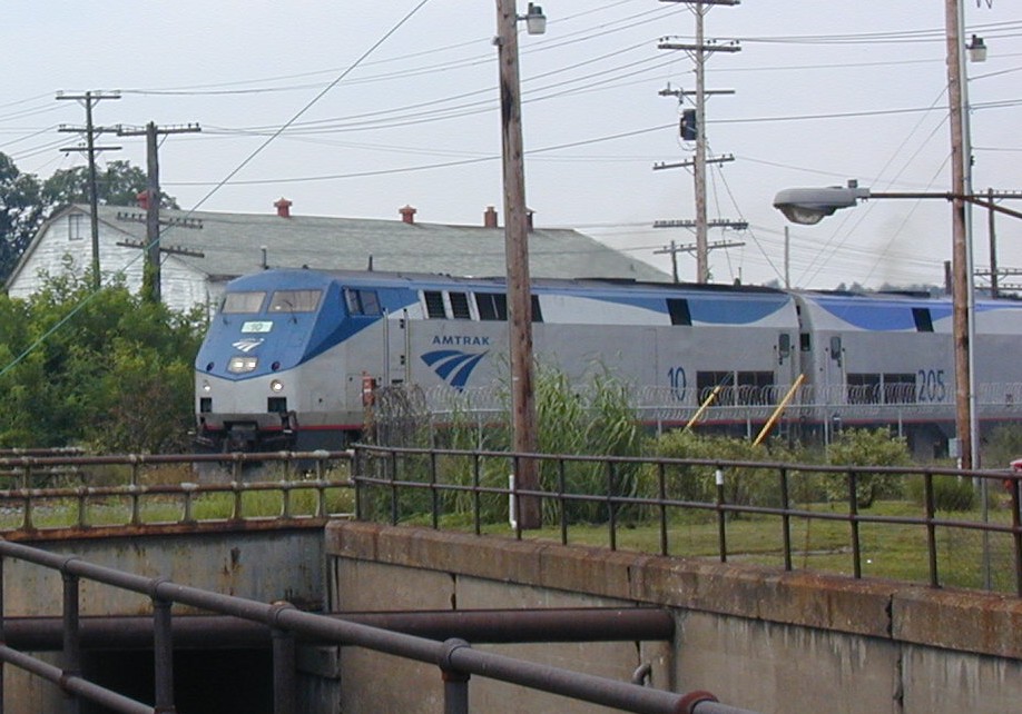
- Amtrak in North East, Niagara, CC BY-SA 3.0
- Shorts Hotel North East Pennsylvania, Canadian2006, CC BY-SA 3.0
- Wall Street, North East PA, Cards84664, CC BY-SA 4.0
- North East PA station, Cards84664, CC BY-SA 4.0
- North East PA station (3), Cards84664, CC BY-SA 4.0
- North East PA station (2), Cards84664, CC BY-SA 4.0
- Lake Shore Railway Historical Society Hqrs. - August 2013, NOYB #1, CC BY 2.0
- SSL 802, Lake Shore Railway Museum 2022, Cards84664, CC BY-SA 4.0
- Conrail 18374, Lake Shore Railway Museum 2022, Cards84664, CC BY-SA 4.0
- Lake Shore Railway Museum Pennsylvania, Canadian2006, CC BY-SA 3.0
- GE 6002, Lake Shore Railway Museum 2022, Cards84664, CC BY-SA 4.0
- Chessie 8272, Lake Shore Railway Museum 2022, Cards84664, CC BY-SA 4.0
- NS 3563, Lake Shore Railway Museum 2022, Cards84664, CC BY-SA 4.0
- NYC 2500, Lake Shore Railway Museum 2022, Cards84664, CC BY-SA 4.0
- CSX 7764, Cards84664, CC BY-SA 4.0
- Pullman Car, Lake Shore Railway Museum 2022, Cards84664, CC BY-SA 4.0
- Freight depot, Lake Shore Railway Museum 2022, Cards84664, CC BY-SA 4.0


Page built October 30, 2026. Spotted a mistake? Tell us or suggest a place.