


North Sarasota, Florida
North Sarasota is a community of 2,824 people in Sarasota County, Florida.
Why visit North Sarasota
Townapedia lists 57 museums and landmarks, 8 parks and trails, 14 places to eat and 3 attractions in and around town.
Highlights include John Ringling Causeway, Regal Hollywood 11, Sarasota High School and American National Bank Building.
August is the warmest month, with average highs of 92°F; January lows average 52°F.
Weather in North Sarasota
Forecast from the National Weather Service. Full forecast
About North Sarasota
North Sarasota is a census-designated place (CDP) in Sarasota County, Florida, United States. The population was 2,418 at the 2020 census, down from 6,982 at the 2010 census. It is part of the North Port–Bradenton–Sarasota, Florida Metropolitan Statistical Area.
From the Wikipedia article North Sarasota, Florida (this version), under CC BY-SA 4.0.
Things to do3

John Ringling Causeway
Bridge · 3.3 mi
Bridge in United States of America

Van Wezel Performing Arts Hall
Cinema and theater · 2.0 mi
Performing arts venue in Sarasota Florida
Museums and landmarks57

Sarasota High School
Monument and historic site · National Register of Historic Places · 2.2 mi
High school in Sarasota, Florida
2155 Bahia Vista St, Sarasota

American National Bank Building
Monument and historic site · National Register of Historic Places · 2.0 mi
Bank building in Sarasota, Florida

Appleby Building
Monument and historic site · National Register of Historic Places · 1.6 mi
Commercial building in Sarasota, Florida

Atlantic Coast Line Passenger Depot
Monument and historic site · National Register of Historic Places · 1.4 mi
Railway station in Sarasota, the United States of America

Bacheller-Brewer Model Home Estate
Monument and historic site · National Register of Historic Places · 2.2 mi
Sarasota, Florida, NRHP-listed
Bacon and Tomlin Building
Monument and historic site · National Register of Historic Places · 2.0 mi
Former building in Sarasota, Florida, USA

Bay Haven School
Monument and historic site · National Register of Historic Places · 1.8 mi
School building in Sarasota, Florida, United States

Bryson-Crane House
Monument and historic site · National Register of Historic Places · 2.7 mi
Historic house in Florida, United States
Burns Court Historic District
Monument and historic site · National Register of Historic Places · 1.9 mi
Mixed-use area, predominately commercial, in Sarasota, Florida

Burns Realty Company–Karl Bickel House
Monument and historic site · National Register of Historic Places · 2.0 mi
Historic house in Florida, United States
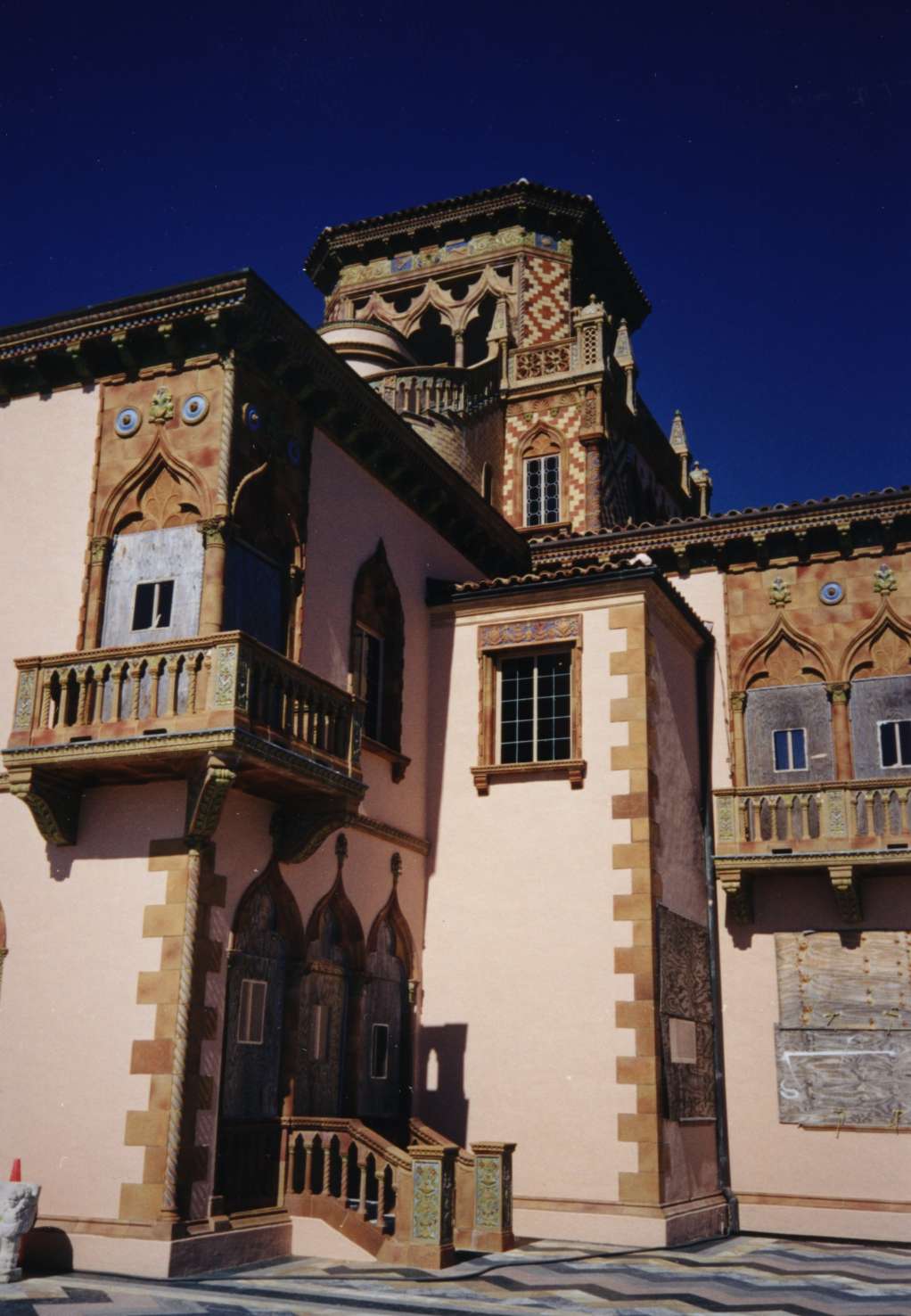
Caples'-Ringlings' Estates Historic District
Monument and historic site · National Register of Historic Places · 3.0 mi
Historic district in Florida, United States


Capt. W. F. Purdy House
Monument and historic site · National Register of Historic Places · 2.2 mi
Historic house in Florida, United States
45 more on the map.
Parks, trails and playgrounds8

Circus Hammock
Park · 2.6 mi
Nature preserve in Florida, United States

Restaurants and cafes14

La Brisa Tacos y Mariscos
Restaurant · Mexican · 0.8 mi
1156 N Washington Blvd, Sarasota
Tu - Th 10:00-21:00; Fr, Sa 10:00-22:00; Su 11:00-20:00
MADE Restaurant
Restaurant · 1.5 mi
Main Street, Sarasota
Mo closed; Tu-Fr 11:30-14:30+,17:00-22:00; Sa 17:00-22:00; Su 10:00-14:30

Bavaro's Pizza Napoletana & Pastaria
Restaurant · 1.4 mi
27 Fletcher Avenue, Sarasota
Paramo Café & Restaurant
Restaurant · 1.3 mi
3700 North Lockwood Ridge Road, Sarasota



Papa John's
Fast food · Pizza · 1.0 mi
3080 17th Street, Sarasota
Mo-Th 10:00-01:00; Fr-Sa 10:00-02:00; Su 10:00-24:00
2 more on the map.
Churches and places of worship21
Islamic Society of Sarasota and Bradenton
Place of worship · 1.5 mi
4350 North Lockwood Ridge Road, Sarasota
Greater Hurst Chapel AME Church
Church · African Methodist Episcopal · 0.7 mi
2730 North Links Avenue, Sarasota
Shiloh Primitive Baptist Church
Church · Baptist · 0.9 mi
3099 North Osprey Avenue, Sarasota
Truevine Missionary Baptist Church
Church · Baptist · 0.7 mi
1947 31st Street, Sarasota
Ecclessia Family Worship Center International
Church · 0.8 mi
1760 24th Street, Sarasota
Shopping4
Gas and EV charging7
Schools, colleges and libraries43
Emma E. Booker Elementary School
School
2350 Dr Martin Luther King Way, Sarasota
Healthcare4
Passport Health Sarasota Travel Clinic
Clinic and pharmacy · 1.5 mi
2189 Ringling Boulevard, Sarasota
Map of North Sarasota
161 places. The map loads OpenStreetMap tiles when you open it.
Climate by month
Monthly table
| Month | High | Low | Rain |
|---|---|---|---|
| Jan | 72°F | 52°F | 2.8 in |
| Feb | 75°F | 55°F | 1.9 in |
| Mar | 78°F | 58°F | 2.9 in |
| Apr | 82°F | 63°F | 2.5 in |
| May | 88°F | 68°F | 2.6 in |
| Jun | 90°F | 74°F | 7.0 in |
| Jul | 91°F | 75°F | 7.4 in |
| Aug | 92°F | 75°F | 9.1 in |
| Sep | 90°F | 74°F | 6.0 in |
| Oct | 86°F | 68°F | 2.8 in |
| Nov | 80°F | 60°F | 1.8 in |
| Dec | 75°F | 55°F | 2.3 in |
U.S. Climate Normals 1991-2020 for Sarasota Bradenton Ap (4 mi away), NOAA NCEI.
People and cost of living
American Community Survey 5-year estimates, 2020-2024, U.S. Census Bureau. Estimates have margins of error, larger for small towns.
Disaster history
Sarasota County has had 34 federal disaster declarations since 2000, most often for hurricanes.
- 2024-10-11: Hurricane Milton (Hurricane)
- 2024-10-07: Hurricane Milton (Hurricane)
- 2024-09-28: Hurricane Helene (Hurricane)
- 2024-09-24: Tropical Storm Helene (Tropical Storm)
- 2024-08-10: Hurricane Debby (Tropical Storm)
- 2024-08-03: Tropical Storm Debby (Tropical Storm)
OpenFEMA disaster declarations summaries.
Getting there and nearby towns
Sarasota-Bradenton International Airport (SRQ) is the nearest airport with scheduled flights listed in OpenStreetMap, 3 miles away.
- Sarasota 2 mi southwest, about 3 min by car
- Kensington Park 2 mi east, about 3 min by car
- Desoto Lakes 2 mi northeast, about 4 min by car
- Fruitville 4 mi southeast, about 7 min by car
- Sarasota Springs 4 mi southeast, about 7 min by car
- Bee Ridge 6 mi southeast, about 9 min by car
- Bayshore Gardens 6 mi northwest, about 10 min by car
- Gulf Gate 7 mi south, about 11 min by car
- Lake Sarasota 7 mi southeast, about 11 min by car
- South Bradenton 8 mi northwest, about 13 min by car
Drive times are estimates from straight-line distance, not routes.
Local news
Headlines from INDB, the NEMICO news database.
Reviews, tips and questions
Loading what members have shared...
Sources and licences
- NCES EDGE (Public domain): public schools
- NOAA NCEI U.S. Climate Normals 1991-2020 (Public domain): climate by month
- OpenFEMA (Public domain): disaster declarations
- OpenStreetMap contributors (ODbL 1.0): places, airports, map data
- U.S. Census Bureau (Public domain): population, income, housing, education, commute
- Wikidata (CC0 1.0): elevation, founding date, time zone, website, landmarks and historic places
- Wikimedia Commons (see each image): photos
- Wikipedia (CC BY-SA 4.0): overview and history text
Photo credits
- Sarasota FL old high school pano01, Ebyabe, CC BY-SA 3.0
- Sarasota FL Binz House01, Ebyabe, CC BY-SA 3.0
- Sarasota FL Downtown HD Roth Cigar Factory01, Ebyabe, CC BY-SA 3.0
- Sarasota FL Downtown HD Kress Bldg03, Ebyabe, CC BY-SA 3.0
- Sarasota FL Downtown HD Warren Bldg01, Ebyabe, CC BY-SA 3.0
- Sarasota FL County crths06, Ebyabe, CC BY-SA 3.0
- Sarasota FL Downtown HD DeCanizares House02, Ebyabe, CC BY-SA 3.0
- Sarasota FL Purdy House outside01, Ebyabe, CC BY-SA 3.0
- Sarasota Opera House-March 2008, Viva-Verdi, Public domain
- Sarasota FL Downtown HD Reagin House01, Ebyabe, CC BY-SA 3.0
- Sarasota FL Rigbys La Plaza HD 1 Alta Vista01, Ebyabe, CC BY-SA 3.0
- Sarasota Ringling estate, Unknown author, CC BY-SA 3.0
- Sarasota FL Whitfield Estate03, Ebyabe, CC BY-SA 3.0
- Sarasota FL Thoms House01, Ebyabe, CC BY-SA 3.0
- Sarasota FL Earle House01, Ebyabe, CC BY-SA 3.0
- Sarasota FL Halton House01, Ebyabe, CC BY-SA 3.0
- Sarasota FL Bay Haven School01, Ebyabe, CC BY-SA 3.0
- Sarasota FL Bacheller-Brewer Estate01, Ebyabe, CC BY-SA 3.0
- Sarasota FL Southwick-Harmon House01, Ebyabe, CC BY-SA 3.0
- Sarasota FL Downtown HD DeMarcay Hotel02, Ebyabe, CC BY-SA 3.0
- Sarasota FL Downtown HD Worths Block01, Ebyabe, CC BY-SA 3.0
- Sarasota FL Downtown HD American Natl Bank01, Ebyabe, CC BY-SA 3.0
- Sarasota FL Downtown HD Frances-Carlton Apts01, Ebyabe, CC BY-SA 3.0
- Sarasota FL Central-Cocoanut HD02, Ebyabe, CC BY-SA 3.0
- Sarasota FL Corrigan House01, Ebyabe, CC BY-SA 3.0
- Sarasota FL Armistead House gate01, Ebyabe, CC BY-SA 3.0
- El Vernona Hotel-John Ringling Hotel, Michael Everson, Public domain
- Sarasota FL Chidsey Library03, Ebyabe, CC BY-SA 3.0
- Sarasota FL Bickel House Verona Hotel site02, Ebyabe, CC BY-SA 3.0
- Sarasota FL Bryson-Crane House01, Ebyabe, CC BY-SA 3.0
- Sarasota FL Selby Gardens Payne Mansion02, Ebyabe, CC BY-SA 3.0
- Sarasota FL old ACL depot site01, Ebyabe, CC BY-SA 3.0
- Sarasota FL Laurel Park HD Kennedy House01, Ebyabe, CC BY-SA 3.0
- Sarasota FL Rosemary Cem01, Ebyabe, CC BY-SA 3.0
- Sarasota FL Laurel Park HD02b, Ebyabe, CC BY-SA 3.0
- Sarasota FL Municipal Aud03, Ebyabe, CC BY-SA 3.0
- Sarasota FL Downtown HD Times Bldg01, Ebyabe, CC BY-SA 3.0
- Sarasota FL Herald Bldg01, Ebyabe, CC BY-SA 3.0
- Sarasota FL William House01, Ebyabe, CC BY-SA 3.0
- Sarasota FL Leech House and School01, Ebyabe, CC BY-SA 3.0


Page built October 30, 2026. Spotted a mistake? Tell us or suggest a place.