


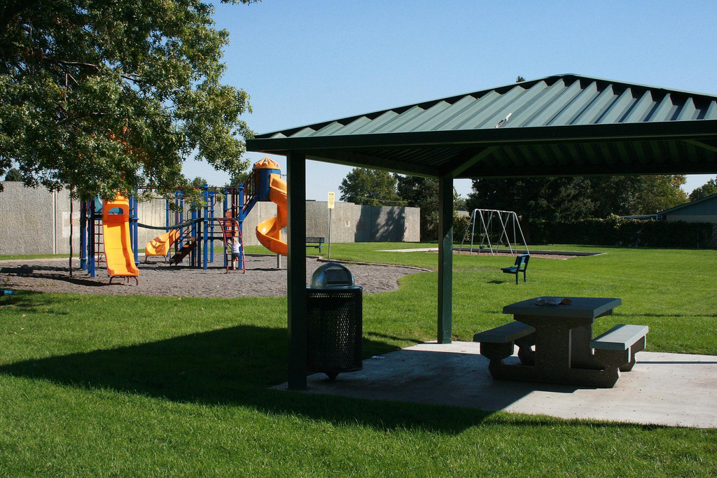
Pasco, Washington
Pasco is a city of 79,575 people in Franklin County, Washington, founded in 1891.
Why visit Pasco
Townapedia lists 14 museums and landmarks, 69 parks and trails, 224 places to eat, 18 places to stay and 5 attractions in and around town.
Highlights include Cable Bridge, Clover Island Light, REACH Museum and Blue Bridge.
July is the warmest month, with average highs of 92°F; December lows average 27°F.
Weather in Pasco
Forecast from the National Weather Service. Full forecast
About Pasco
Pasco is a city in and the county seat of Franklin County, Washington, United States. The population was 77,108 at the 2020 census, and estimated at 81,724 in 2024.
From the Wikipedia article Pasco, Washington (this version), under CC BY-SA 4.0.
Things to do5


Clover Island Light
Lighthouse · 3.4 mi
Lighthouse in Washington, United States
Interstate 182 Bridge
Bridge · 6.0 mi
Bridge in United States of America

Museums and landmarks14


Blue Bridge
Bridge · National Register of Historic Places · 2.9 mi
Four-lane arch-truss bridge

Franklin County Courthouse
Monument and historic site · National Register of Historic Places · 2.3 mi
County courthouse in Pasco, Washington

Pasco–Kennewick Bridge
Monument and historic site · National Register of Historic Places · 3.4 mi
Bridge in Washington, U.S


Sacajawea State Park
Monument and historic site · National Register of Historic Places · 6.0 mi
State park of Washington State, USA
Hanford Reach Interpretive Center
Museum · 5.0 mi
Museum in Richland, Washington, US

Esvelt Gallery
Museum · 1.0 mi
Mo-Th 08:00-20:30; Fr 08:00-12:00; Sa-Su off; PH off
2 more on the map.
Parks, trails and playgrounds69

Columbia Park
Park · 3.3 mi
Recreational park in Tri-Cities, Washington comprising two public city parks—one in Richland, and the other in Kennewick

Gesa Stadium
Sports field and stadium · 2.4 mi
6200 Burden Boulevard, Pasco

57 more on the map.
Restaurants and cafes224

Round Table Pizza
Restaurant · Pizza · 1.8 mi
3201 Court Street, Pasco
Mo-Th,Su 11:00-21:00; Fr,Sa 11:00-22:00
Andy's North
Restaurant · Breakfast, Diner, Lounge · 1.8 mi
3321 Court Street, Pasco
Su-Th 07:00-20:00; Fr,Sa 06:00-20:00


Baskin-Robbins
Ice cream · Ice Cream · 4.3 mi
2617 West Kennewick Avenue, Kennewick
Mo-Fr 10:00-23:00; Sa 10:00-24:00; Su 10:00-23:00
Poutine, Eh?
Restaurant · Poutine · 4.4 mi
3902 West Clearwater Avenue, Kennewick
We-Th 10:45-18:45; Fr 10:45-17:45; Sa 10:45-16:45
Rice and Noodles
Restaurant · Asian, Korean · 1.7 mi
3315 West Court Street, Pasco
Tu-Su 10:30-21:00; Mo off

Sharetea
Cafe · Bubble Tea · 4.4 mi
128 South Ely Street, Kennewick
Mo-Th, Su 11:00-21:30; Fr-Sa 11:00-22:30
Starbucks
Cafe · Coffee Shop · 4.2 mi
2801 West Clearwater Avenue, Kennewick
Mo-Sa 04:30-22:30, Su 04:30-22:00
Tacos y Más
Restaurant · Mexican · 3.3 mi
7425 Sandifur Parkway, Pasco
Mo-Sa 11:00-21:00; Su 11:00-20:00
The Chicken Shack
Restaurant · Chicken · 4.2 mi
8921 Sandifur Parkway, Pasco
Mo-Sa 11:00-21:00; Su 11:00-20:00
212 more on the map.
History
On October 16, 1805, the Lewis and Clark Expedition camped in the Pasco area, at a site now commemorated by Sacajawea State Park. The area was frequented by fur trappers and gold traders. In the 1880s, the Northern Pacific Railway was built near the Columbia River, bringing many settlers to the area. Pasco was officially incorporated on September 3, 1891. It was named by Virgil Bogue, a construction engineer for the Northern Pacific Railway after Cerro de Pasco, a city in the Peruvian Andes, where he had helped build a railroad. In its early years Pasco was a small railroad town, but the completion of the Grand Coulee Dam in 1941 brought irrigation and agriculture to the area.
Due largely to the presence of the Hanford Site (which made the plutonium for the "Fat Man" nuclear bomb used on Nagasaki in 1945), the entire Tri-Cities area grew rapidly from the 1940s through 1950s. However, most of the population influx resided in Richland and Kennewick, as Pasco remained primarily driven by the agricultural industry, and to a lesser degree the NP Pasco rail yards. After the end of World War II, the entire region went through several "boom" and "bust" periods, cycling approximately every 10 years and heavily based on available government funding for Hanford-related work. Farming continues to be the economic driver for most of the city's industrial tax base.
From the History section of Pasco, Washington on Wikipedia, under CC BY-SA 4.0.
Where to stay18
Kennewick Inn & Suites
Motel and hotel · 4.2 mi
321 North Johnson Street, Kennewick
Churches and places of worship69
The Church of Jesus Christ of Latter-day Saints
Church · Mormon · 1.4 mi
2004 24th Avenue, Pasco
New Hope Missionary Baptist Church
Church · Baptist · 3.7 mi
630 South Waldemar Avenue, Pasco
Shopping44
Gas and EV charging57
Schools, colleges and libraries86
Healthcare23
Benton Franklin Orthopedic Associates (BFOA)
Clinic and pharmacy · 4.5 mi
711 South Auburn Street, Kennewick
Map of Pasco
250 places. The map loads OpenStreetMap tiles when you open it.
Climate by month
Monthly table
| Month | High | Low | Rain |
|---|---|---|---|
| Jan | 41°F | 28°F | 1.0 in |
| Feb | 49°F | 28°F | 0.6 in |
| Mar | 59°F | 33°F | 0.7 in |
| Apr | 67°F | 38°F | 0.7 in |
| May | 76°F | 46°F | 0.7 in |
| Jun | 83°F | 53°F | 0.6 in |
| Jul | 92°F | 57°F | 0.1 in |
| Aug | 91°F | 56°F | 0.3 in |
| Sep | 81°F | 48°F | 0.3 in |
| Oct | 66°F | 38°F | 0.7 in |
| Nov | 50°F | 32°F | 0.9 in |
| Dec | 41°F | 27°F | 1.0 in |
U.S. Climate Normals 1991-2020 for Pasco Tri Cities Ap (0 mi away), NOAA NCEI.
People and cost of living
American Community Survey 5-year estimates, 2020-2024, U.S. Census Bureau. Estimates have margins of error, larger for small towns.
Disaster history
Franklin County has had 7 federal disaster declarations since 2000, most often for floods.
- 2022-03-29: Severe Winter Storms, Snowstorms, Straight-Line Winds, Flooding (Flood)
- 2021-02-04: Wildfires And Straight-Line Winds (Fire)
- 2020-03-22: Covid-19 Pandemic (Biological)
- 2020-03-13: Covid-19 (Biological)
- 2017-04-21: Severe Winter Storms, Flooding, Landslides, Mudslides (Flood)
- 2009-03-02: Severe Winter Storm And Record And Near Record Snow (Severe Storm)
OpenFEMA disaster declarations summaries.
Getting there and nearby towns
Tri-Cities Airport (PSC) is the nearest airport with scheduled flights listed in OpenStreetMap, 0 miles away.
- West Pasco 3 mi west, about 5 min by car
- Kennewick 5 mi southwest, about 9 min by car
- Richland 8 mi west, about 13 min by car
- Finley 8 mi southeast, about 12 min by car
- Burbank 8 mi southeast, about 13 min by car
- West Richland 13 mi west, about 21 min by car
- Benton City 17 mi west, about 27 min by car
- Hermiston 31 mi south, about 50 min by car
- Grandview 38 mi west, about 1 h by car
- Pendleton 43 mi south, about 1 h 15 min by car
Drive times are estimates from straight-line distance, not routes.
Local news
Headlines from INDB, the NEMICO news database.
Reviews, tips and questions
Loading what members have shared...
Sources and licences
- NCES EDGE (Public domain): public schools
- NOAA NCEI U.S. Climate Normals 1991-2020 (Public domain): climate by month
- OpenFEMA (Public domain): disaster declarations
- OpenStreetMap contributors (ODbL 1.0): places, airports, map data
- U.S. Census Bureau (Public domain): population, income, housing, education, commute
- Wikidata (CC0 1.0): elevation, founding date, time zone, website, landmarks and historic places
- Wikimedia Commons (see each image): photos
- Wikipedia (CC BY-SA 4.0): overview and history text
Photo credits
- City Hall in Pasco, Washington (panorama), Allen4names, CC BY-SA 3.0
- McGee Playfield, 2009 Pasco Washington - panoramio, Kirk Bagley, CC BY 3.0
- Richardson Park, 2009 Pasco Washington - panoramio (1), Kirk Bagley, CC BY 3.0
- Lucus Park, 2009 Pasco Washington - panoramio, Kirk Bagley, CC BY 3.0
- Richardson Park, 2009 Pasco Washington - panoramio (2), Kirk Bagley, CC BY 3.0
- Lucus Park, 2009 Pasco Washington - panoramio (1), Kirk Bagley, CC BY 3.0
- Richardson Park, 2009 Pasco Washington - panoramio, Kirk Bagley, CC BY 3.0
- Desert Dunes Park, 2009 Pasco Washington - panoramio, Kirk Bagley, CC BY 3.0
- Casa Del Sol Park, 2009 Pasco Washington - panoramio, Kirk Bagley, CC BY 3.0
- Speedway gas station at Court Street Plaza in Pasco, Washington - 2022-10-11, Allen4names, CC BY-SA 4.0
- Centennial Park, 2009 Pasco Washington - panoramio, Kirk Bagley, CC BY 3.0
- Centennial Park, 2009 Pasco Washington - panoramio (1), Kirk Bagley, CC BY 3.0
- A mantis in Pasco, Washington, Allen4names, CC BY-SA 3.0
- Isaac Stevens Middle School in Pasco, Washington - 2022-10-08 image 1, Allen4names, CC BY-SA 4.0
- Isaac Stevens Middle School in Pasco, Washington - 2022-10-08 image 2, Allen4names, CC BY-SA 4.0
- Lewis and Clark Highway near Henry Street in Pasco, Washington, Allen4names, CC BY-SA 3.0
- Lincoln Park, 2009 Pasco Washington - panoramio, Kirk Bagley, CC BY 3.0
- Lincoln Park, 2009 Pasco Washington - panoramio (1), Kirk Bagley, CC BY 3.0
- Grapeline bus in Pasco, Washington, Allen4names, CC BY-SA 3.0
- Pasco-Kennewick Bridge from Ed Hendler Bridge, Not recorded, Public domain
- Blue Bridge over the Columbia River, Allen4names, CC BY-SA 3.0
- Franklin County Courthouse in Pasco, Washington, Allen4names, CC BY-SA 3.0
- Sacajawea Museum - Pasco, WA, Allen4names, CC BY-SA 3.0
- PSC Tri-Cities Airport tower at night 2015-10-20, Junkyardsparkle, CC0
- Voodoo Petros, Adam.austin.und, CC BY-SA 4.0
- This happened... - Flickr - eilonwy77, Katie Walker from Pasco, Washington, USA, CC BY-SA 2.0
- Beauty in asphalt, a weed grows in a post office parking lot, Brendaekeller, CC BY 4.0
- Leap (Unsplash), Gabriel Sanchez gabrielsanchez, CC0
- BFT 223, Ziggzagzac, CC BY-SA 3.0
- Radcon Cosplayers Alaire Bowen Victoria Suebsanh and Dani February 2012, Alaire Bowen, CC BY-SA 3.0
- Ben Franklin Transit 283, Allen4names, CC BY-SA 3.0
- Ben Franklin Transit 250, Allen4names, CC BY-SA 3.0
- Ben Franklin Transit 248, Allen4names, CC BY-SA 3.0
- Ben Franklin Transit 252, Allen4names, CC BY-SA 3.0
- Ben Franklin Transit 240, Allen4names, CC BY-SA 3.0
- Ben Franklin Transit 262, Allen4names, CC BY-SA 3.0
- Ben Franklin Transit 280, Allen4names, CC BY-SA 3.0
- Ben Franklin Transit 242, Allen4names, CC BY-SA 3.0
- Ben Franklin Transit 272, Allen4names, CC BY-SA 3.0
- Ben Franklin Transit 277, Allen4names, CC BY-SA 3.0


Page built October 30, 2026. Spotted a mistake? Tell us or suggest a place.