
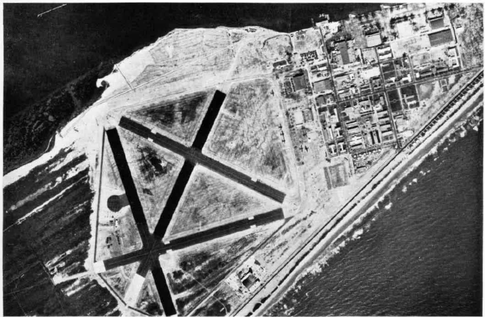


Patrick AFB, Florida
Patrick AFB is a community of 1,644 people in Brevard County, Florida, founded in October 1, 1940.
Why visit Patrick AFB
Townapedia lists 1 museum or landmark, 3 parks and trails, 5 places to eat, 4 places to stay and 1 attraction in and around town.
Highlights include Manatee Cove Golf Club.
July is the warmest month, with average highs of 91°F; January lows average 50°F.
Weather in Patrick AFB
Forecast from the National Weather Service. Full forecast
About Patrick AFB
Patrick Space Force Base (IATA: COF, ICAO: KCOF, FAA LID: COF) is a United States Space Force installation located between Satellite Beach and Cocoa Beach, in Brevard County, Florida, United States. It is named in honor of Major General Mason Patrick, USAAC. It is home to Space Launch Delta 45 (SLD 45), known as the 45th Space Wing (45 SW) when it was part of the Air Force. In addition to its "host wing" responsibilities at Patrick SFB, the 45 SW controls and operates Cape Canaveral Space Force Station (CCSFS) and the Eastern Range.
From the Wikipedia article Patrick Space Force Base (this version), under CC BY-SA 4.0.
Things to do1

Museums and landmarks1

Parks, trails and playgrounds3





Restaurants and cafes5

Chez Quan’s - Beachside
Restaurant · Thai, Latin American · 1.9 mi
228 Highway A1A, Satellite Beach
Mo-Sa 07:00-19:00

Burger King
Fast food · Burger · 1.0 mi
1221 South Patrick Drive, Patrick Air Force Base
Mo-Fr 06:00-18:00; Sa 10:30-16:00
Domino's
Fast food · Pizza · 1.9 mi
254 Highway A1A, Satellite Bch
Mo-Fr 10:30-24:00; Sa-Su 00:00-01:00,10:30-24:00
Where to stay4
Churches and places of worship1
Shopping2
Gas and EV charging2
Schools, colleges and libraries14
Freedom 7 Elementary School of International Studies
School · 5.4 mi
400 S 4Th St, Cocoa Beach
Ocean Breeze Elementary School
School · 5.8 mi
1101 Cheyenne Dr, Indian Harbour Beach
Spessard L. Holland Elementary School
School · 3.2 mi
50 Holland Ct, Satellite Beach
Map of Patrick AFB
33 places. The map loads OpenStreetMap tiles when you open it.
Climate by month
Monthly table
| Month | High | Low | Rain | Snow |
|---|---|---|---|---|
| Jan | 72°F | 50°F | 2.8 in | 0.0 in |
| Feb | 75°F | 53°F | 2.3 in | 0.0 in |
| Mar | 78°F | 56°F | 2.9 in | 0.0 in |
| Apr | 82°F | 61°F | 2.5 in | 0.0 in |
| May | 86°F | 67°F | 3.8 in | 0.0 in |
| Jun | 89°F | 72°F | 7.5 in | 0.0 in |
| Jul | 91°F | 73°F | 6.8 in | 0.0 in |
| Aug | 91°F | 73°F | 7.5 in | 0.0 in |
| Sep | 89°F | 73°F | 8.6 in | 0.0 in |
| Oct | 84°F | 68°F | 5.3 in | 0.0 in |
| Nov | 78°F | 60°F | 2.6 in | 0.0 in |
| Dec | 74°F | 54°F | 2.7 in | 0.0 in |
U.S. Climate Normals 1991-2020 for Melbourne Wfo (9 mi away), NOAA NCEI.
People and cost of living
American Community Survey 5-year estimates, 2020-2024, U.S. Census Bureau. Estimates have margins of error, larger for small towns.
Disaster history
Brevard County has had 31 federal disaster declarations since 2000, most often for hurricanes.
- 2024-10-11: Hurricane Milton (Hurricane)
- 2024-10-07: Hurricane Milton (Hurricane)
- 2024-08-10: Hurricane Debby (Tropical Storm)
- 2024-08-03: Tropical Storm Debby (Tropical Storm)
- 2023-08-31: Hurricane Idalia (Hurricane)
- 2023-08-28: Tropical Storm Idalia (Tropical Storm)
OpenFEMA disaster declarations summaries.
Getting there and nearby towns
Patrick Space Force Base (COF) is the nearest airport with scheduled flights listed in OpenStreetMap, 1 miles away.
- Satellite Beach 4 mi south, about 6 min by car
- Merritt Island 7 mi northwest, about 11 min by car
- Viera East 7 mi west, about 11 min by car
- Cocoa Beach 7 mi north, about 11 min by car
- Viera West 8 mi west, about 13 min by car
- Melbourne 9 mi south, about 14 min by car
- Rockledge 10 mi northwest, about 16 min by car
- Cape Canaveral 11 mi north, about 18 min by car
- West Melbourne 13 mi south, about 21 min by car
- Cocoa 14 mi northwest, about 22 min by car
Drive times are estimates from straight-line distance, not routes.
Local news
Headlines from INDB, the NEMICO news database.
Reviews, tips and questions
Loading what members have shared...
Sources and licences
- NCES EDGE (Public domain): public schools
- NOAA NCEI U.S. Climate Normals 1991-2020 (Public domain): climate by month
- OpenFEMA (Public domain): disaster declarations
- OpenStreetMap contributors (ODbL 1.0): places, airports, map data
- U.S. Census Bureau (Public domain): population, income, housing, education, commute
- Wikidata (CC0 1.0): elevation, founding date, time zone, website, landmarks and historic places
- Wikimedia Commons (see each image): photos
- Wikipedia (CC BY-SA 4.0): overview and history text
Photo credits
- NAS Banana River NAN4 47, U.S. Navy, Public domain
- CannoliAtGate, Nsartor, CC BY-SA 4.0
- Cryptocaryan irritans, Jbinfla1963, CC BY-SA 3.0
- Cocoa Beach - panoramio (9), Jayesh Naithani, CC BY-SA 3.0
Page built October 30, 2026. Spotted a mistake? Tell us or suggest a place.