


Why visit Aplaya
Townapedia lists 8 museums and landmarks, 5 parks and trails, 85 places to eat, 8 places to stay and 4 attractions in and around town.
Highlights include Enchanted Kingdom and School of Dr. Jose P. Rizal Site and Museum.
Weather in Aplaya
Forecast from MET Norway (CC BY 4.0). Full forecast
Things to do4

Enchanted Kingdom
Monument and historic site · 4.8 km
Theme park in the Philippines

Museums and landmarks8

School of Dr. Jose P. Rizal Site and Museum
Museum · 3.7 km
Museum in the Philippines


Parks, trails and playgrounds5



Restaurants and cafes85




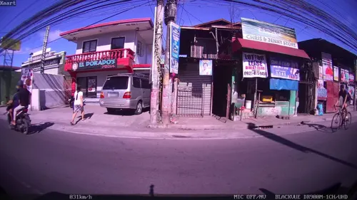


73 more on the map.
Where to stay8
Churches and places of worship15
Santa Rosa de Lima Parish Church
Church · 0.8 km
F. Gomez, Santa Rosa
Nuestra Señora delos Angeles Church
Church · 1.0 km
Sinalhan Road, Santa Rosa City
Shopping31
SM City Santa Rosa
Shopping center · 1.9 km
National Highway 1, Santa Rosa
Robinsons Santa Rosa Market
Shopping center · 1.9 km
National Highway, Santa Rosa
Gas and EV charging14
Schools, colleges and libraries28
Polytechnic University of the Philippines, Santa Rosa
School · 1.1 km
Arcillas Boulevard, Santa Rosa
Jose Zavalla Memorial Elementary School
School · 2.1 km
Rizal Boulevard, Santa Rosa
Healthcare19
Map of Aplaya
217 places. The map loads OpenStreetMap tiles when you open it.
Getting there and nearby towns
Ninoy Aquino International Airport (MNL) is the nearest airport with scheduled flights listed in OpenStreetMap, 24 km away.
- Santa Rosa 1 km south, about 1 min by car
- Biñan 4 km northwest, about 4 min by car
- Cabuyao 6 km south, about 6 min by car
- Carmona 6 km west, about 6 min by car
- San Pedro 8 km northwest, about 8 min by car
- Tunasan 9 km northwest, about 9 min by car
- Muntinlupa 10 km northwest, about 10 min by car
- Calamba 13 km southeast, about 13 min by car
- Binangonan 18 km northeast, about 18 min by car
- Dasmariñas 19 km west, about 19 min by car
Drive times are estimates from straight-line distance, not routes.
Local news
Headlines from INDB.
Reviews, tips and questions
Loading what members have shared...
Sources and licences
- GeoNames (CC BY 4.0): population, coordinates, regions and time zone
- Mapillary (see each image): photos
- OpenStreetMap contributors (ODbL 1.0): places, airports, map data
- Wikidata (CC0 1.0): elevation, founding date, time zone, website, landmarks and historic places
- Wikimedia Commons (see each image): photos
Photo credits
- Enchanted Kingdom (01-03-2015), Martin Lewison, CC BY-SA 2.0
- 9562Biñan, Laguna Landmarks Houses Roads 07, Judgefloro, CC0
- Sta. Rosa de Lima Church, Laguna, Elmer B. Domingo, CC BY-SA 3.0
- Santa Rosa Arch, Laguna, Jul 2024 (2), Ralff Nestor Nacor, CC BY-SA 4.0
- Santa rosa delima parish, Benedict Esber, CC BY-SA 4.0
- 9546Santa Rosa, Laguna Landmarks Attractions Roads 25, Judgefloro, CC0
- 9546Santa Rosa, Laguna Landmarks Attractions Roads 40, Judgefloro, CC0
- 9697Santa Rosa, Laguna Landmarks Attractions Roads 16, Judgefloro, CC0
- 9546Santa Rosa, Laguna Landmarks Attractions Roads 04, Judgefloro, CC0
- 9546Santa Rosa, Laguna Landmarks Attractions Roads 17, Judgefloro, CC0
- 9697Santa Rosa, Laguna Landmarks Attractions Roads 20, Judgefloro, CC0
- 9546Santa Rosa, Laguna Landmarks Attractions Roads 19, Judgefloro, CC0
- 9697Santa Rosa, Laguna Landmarks Attractions Roads 03, Judgefloro, CC0
- 9546Santa Rosa, Laguna Landmarks Attractions Roads 35, Judgefloro, CC0
- 9546Santa Rosa, Laguna Landmarks Attractions Roads 16, Judgefloro, CC0
- 9546Santa Rosa, Laguna Landmarks Attractions Roads 01, Judgefloro, CC0
- 9546Santa Rosa, Laguna Landmarks Attractions Roads 14, Judgefloro, CC0
- 9697Santa Rosa, Laguna Landmarks Attractions Roads 05, Judgefloro, CC0
- 9546Santa Rosa, Laguna Landmarks Attractions Roads 41, Judgefloro, CC0
- 9546Santa Rosa, Laguna Landmarks Attractions Roads 33, Judgefloro, CC0
- 9546Santa Rosa, Laguna Landmarks Attractions Roads 15, Judgefloro, CC0
- 9546Santa Rosa, Laguna Landmarks Attractions Roads 27, Judgefloro, CC0
- 9546Santa Rosa, Laguna Landmarks Attractions Roads 09, Judgefloro, CC0
- 9546Santa Rosa, Laguna Landmarks Attractions Roads 32, Judgefloro, CC0
- 9546Santa Rosa, Laguna Landmarks Attractions Roads 02, Judgefloro, CC0
- 9546Santa Rosa, Laguna Landmarks Attractions Roads 13, Judgefloro, CC0
- 9546Santa Rosa, Laguna Landmarks Attractions Roads 20, Judgefloro, CC0
- 9546Santa Rosa, Laguna Landmarks Attractions Roads 21, Judgefloro, CC0
- 9546Santa Rosa, Laguna Landmarks Attractions Roads 22, Judgefloro, CC0
- 9546Santa Rosa, Laguna Landmarks Attractions Roads 11, Judgefloro, CC0
- 9546Santa Rosa, Laguna Landmarks Attractions Roads 44, Judgefloro, CC0
- 9546Santa Rosa, Laguna Landmarks Attractions Roads 23, Judgefloro, CC0
- 9546Santa Rosa, Laguna Landmarks Attractions Roads 08, Judgefloro, CC0
- 9546Santa Rosa, Laguna Landmarks Attractions Roads 36, Judgefloro, CC0
- 9546Santa Rosa, Laguna Landmarks Attractions Roads 37, Judgefloro, CC0
- 9546Santa Rosa, Laguna Landmarks Attractions Roads 47, Judgefloro, CC0
- 9697Santa Rosa, Laguna Landmarks Attractions Roads 19, Judgefloro, CC0
- 9697Santa Rosa, Laguna Landmarks Attractions Roads 13, Judgefloro, CC0
- 9697Santa Rosa, Laguna Landmarks Attractions Roads 14, Judgefloro, CC0
- 9546Santa Rosa, Laguna Landmarks Attractions Roads 03, Judgefloro, CC0
- Street-level photo, kaart_1, CC BY-SA 4.0
- Street-level photo, kaart_1, CC BY-SA 4.0
- Street-level photo, kaart_1, CC BY-SA 4.0
- Street-level photo, kaart_1, CC BY-SA 4.0
- Street-level photo, kaart_1, CC BY-SA 4.0
- Street-level photo, kaart_1, CC BY-SA 4.0
- Street-level photo, kaart_1, CC BY-SA 4.0


Page built November 8, 2026. Spotted a mistake? Tell us or suggest a place.