
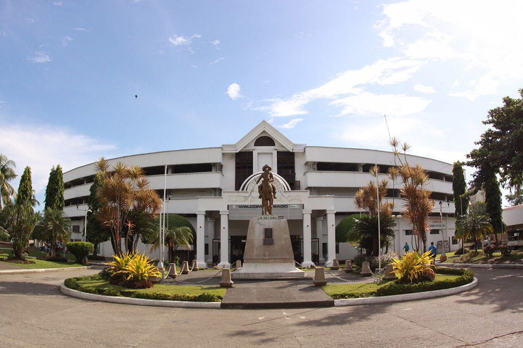


Bago City, Philippines
Bago
Bago City is a city of 192,993 people in Western Visayas, Philippines.
Why visit Bago City
Townapedia lists 8 museums and landmarks, 13 parks and trails, 20 places to eat, 5 places to stay and 1 attraction in and around town.
Highlights include Republic of Negros.
Weather in Bago City
Forecast from MET Norway (CC BY 4.0). Full forecast
About Bago City
Bago, officially the City of Bago (Hiligaynon: Dakbanwa/Syudad sang Bago; Filipino: Lungsod ng Bago), is a component city in the province of Negros Occidental, Philippines. According to the 2024 census, it has a population of 192,993 people.
From the Wikipedia article Bago, Negros Occidental (this version), under CC BY-SA 4.0.
Travel tips from other travellers: Bago City on Wikivoyage (CC BY-SA 4.0).
Things to do1

Museums and landmarks8

House of Mugs
Museum · 1.3 km
Started as a personal collection of Poinsettia Dormido, but has grown quickly thanks to gifts from family and friends

Parks, trails and playgrounds13


1 more on the map.
Restaurants and cafes20

Ur Story Cafe
Cafe · Pizza, Coffee Shop, Bubble Tea, Burger, Korean, Noodles, Ice Cream, Sandwich, Asian · 3.9 km
Patic, Pulupandan
Mo-Su 10:00-19:00

Chino's Wok 6100
Restaurant · Thai · 14.9 km
Angel P. Villasor Avenue, Bacolod
Tu-Sa 10:00-18:00




8 more on the map.
Where to stay5
Churches and places of worship25
Lokal ng Bago City, Iglesia ni Cristo
Church · Iglesia Ni Cristo · 0.7 km
Dela Rama Street, Bago City
Cathedral of Saint John the Baptist
Church · Iglesia Filipina Independiente
Gonzaga Street, Bagoi
Lokal ng La Carlota, Iglesia ni Cristo
Church · Iglesia Ni Cristo · 14.8 km
Ginete Street, La Carlota
Saint John the Baptist Parish Church
Church · Roman Catholic
Bonifacio Street, Bago
St. John Nepomuceno Parish
Church · Roman Catholic · 12.1 km
Araneta Street, Bacolod
The Church of Jesus Christ of Latter-day Saints
Church · Mormon · 1.0 km
Araneta Avenue, Bago
Shopping8
Gas and EV charging20
Schools, colleges and libraries93
Central Philippines State University - Valladolid Extension Class
School · 10.5 km
Bacolod South Road, Valladolid
Maranatha Christian Academy, Bago City Chapter
School · Pentecostal · 0.9 km
Araneta Street, Bago
Ayungon Elementary School
School · 13.5 km
Ma-ao – La Carlota Highway, La Carlota
Don Vicente Lopez Elementary School
School · 14.7 km
Sibucao- San Enrique-Pontevedra Road
Enriqueta Montilla de Esteban Memorial High School
School · 3.0 km
Riego Street, Pulupandan
Healthcare7
Map of Bago City
200 places. The map loads OpenStreetMap tiles when you open it.
Getting there and nearby towns
Bacolod-Silay Airport (BCD) is the nearest airport with scheduled flights listed in OpenStreetMap, 34 km away.
- La Carlota 15 km southeast, about 15 min by car
- Pontevedra 18 km south, about 18 min by car
- Bacolod City 20 km northeast, about 20 min by car
- Murcia 24 km east, about 24 min by car
- Talisay 27 km northeast, about 27 min by car
- Hinigaran 29 km south, about 29 min by car
- Iloilo 35 km northwest, about 35 min by car
- Dumangas 35 km north, about 35 min by car
- Binalbagan 38 km south, about 38 min by car
- Enrique B. Magalona 41 km north, about 41 min by car
Drive times are estimates from straight-line distance, not routes.
Local news
Headlines from INDB.
Reviews, tips and questions
Loading what members have shared...
Sources and licences
- GeoNames (CC BY 4.0): population, coordinates, regions and time zone
- OpenStreetMap contributors (ODbL 1.0): places, airports, map data
- Wikidata (CC0 1.0): elevation, founding date, time zone, website, landmarks and historic places
- Wikimedia Commons (see each image): photos
- Wikipedia (CC BY-SA 4.0): overview and history text
Photo credits
- Public Plaza in Bago City, Hptina24, CC BY-SA 4.0
- Republic of Negros historical marker, Paolobon140, CC BY-SA 4.0
Page built November 8, 2026. Spotted a mistake? Tell us or suggest a place.