


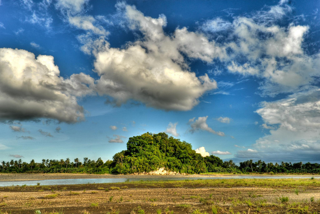
Bañga, Philippines
Banga
Bañga is a town of 2,136 people in Western Visayas, Philippines, founded in January 1, 1912.
Why visit Bañga
Townapedia lists 10 museums and landmarks, 8 parks and trails, 11 places to eat, 6 places to stay and 4 attractions in and around town.
Highlights include Kalibo Bridge III, Manduyog Hill, Aklan Freedom Shrine and Bakhawan Eco-Park.
Weather in Bañga
Forecast from MET Norway (CC BY 4.0). Full forecast
About Bañga
Banga, officially the Municipality of Banga (Aklanon: Banwa it Banga; Hiligaynon: Banwa sang Banga; Tagalog: Bayan ng Banga), is a municipality in the province of Aklan, Philippines. According to the 2024 census, it has a population of 41,188 people.
From the Wikipedia article Banga, Aklan (this version), under CC BY-SA 4.0.
Things to do4

Kalibo Bridge III
Bridge · 4.5 km
Two-lane highway bridge in Philippines

Museums and landmarks10

Aklan Freedom Shrine
Monument and historic site · 8.1 km
National shrine in Aklan

Parks, trails and playgrounds8


Bakhawan Eco-Park
Park · 10.5 km
Mangrove forest located in Kalibo, Aklan, Philippines


Restaurants and cafes11

Banga County Bakeshop and Grocery
Bakery
191 J.P. Rizal Street
Mo-Su 05:30-18:30

History
The history of Banga dates back to the 15th century upon arrival in Panay Island of the ten datus from Borneo. While some skeptics considered this information a legend, still, Banganhons believed that Datu Manduyog ruled over the place with his seat of government located in Bakan, the ancient name of Banga. The site was at the foot of the Manduyog Hill that was named after Datu Manduyog. Being a legitimate successor to Datu Dangandanan who ruled what was called Akean in the late 1390s, Datu Manduyog became the ruler of Akean in 1437 and made Bakan the capital of Akean.
Another account of Banga’s history, as cited in *Panublion*, states that the town’s original site was located in what is now the Municipality of Malinao. In 1792, the town center was relocated across the Aklan River to the foot of Manduyog Hill. However, several prominent families chose to remain in the former settlement, which later became a barrio and was named Malinao, after a calm tributary of the Aklan River.
The families of Bernabe Teodosio, Diego Eulalio Teodosio, Esteban Masigon and the Muntuyas established a settlement in 1676 in what is now Sitio Opong-opong of Barrio Cupang. However, these families moved to a higher ground due to its closeness to the Aklan River that overflowed annually. In 1781 they settled in sitio Agbueakan in Barrio Tabayon.
From the History section of Banga, Aklan on Wikipedia, under CC BY-SA 4.0.
Where to stay6
Churches and places of worship21
Lokal ng Tigayon, Iglesia ni Cristo
Church · Iglesia Ni Cristo · 4.2 km
Aklan East Road
San Isidro Labrador Church
Church · Catholic · 3.0 km
Father Pedro Laserna Street
Saint Joseph, Spouse of the Blessed Virgin Mary, Parish Church
Church
Santan Street
Shopping4
Gas and EV charging9
Schools, colleges and libraries87
Healthcare1
Map of Bañga
161 places. The map loads OpenStreetMap tiles when you open it.
Getting there and nearby towns
Kalibo International Airport (KLO) is the nearest airport with scheduled flights listed in OpenStreetMap, 6 km away.
- Kalibo 8 km northeast, about 8 min by car
- Makato 9 km northwest, about 9 min by car
- New Washington 11 km east, about 11 min by car
- Ibajay 28 km northwest, about 28 min by car
- Culasi 38 km southwest, about 38 min by car
- Roxas City 46 km east, about 46 min by car
- Tapas 47 km southeast, about 47 min by car
- Panay 51 km east, about 51 min by car
- Dumarao 57 km southeast, about 57 min by car
- Passi 68 km southeast, about 1 h 15 min by car
Drive times are estimates from straight-line distance, not routes.
Local news
Headlines from INDB.
Reviews, tips and questions
Loading what members have shared...
Sources and licences
- GeoNames (CC BY 4.0): population, coordinates, regions and time zone
- OpenStreetMap contributors (ODbL 1.0): places, airports, map data
- Wikidata (CC0 1.0): elevation, founding date, time zone, website, landmarks and historic places
- Wikimedia Commons (see each image): photos
- Wikipedia (CC BY-SA 4.0): overview and history text
Photo credits
- Banga Town Rotunda, Sevreil Lao, CC BY-SA 3.0
- Phils Kalibo City 19 Martyrs of Aklan Freedom Shrine Kalibo, Ryme26, CC BY-SA 3.0
- Bamboo bridge and Mangroves at Bakhawan Eco-park and Research Centre, Paolobon140, CC BY-SA 3.0
- Kalibo Cathedral, Aklan, Benedict Esber, CC BY 3.0
- Feathers, Ree Dexter, CC BY 3.0
- Tigayon Hills, Ree Dexter, CC BY 2.0
- Lezo Aklan, Ree Dexter, CC BY 2.0
- ISS065-E-475124 - View of Earth, Earth Science and Remote Sensing Unit , Lyndon B. Johnson Space Center, Public domain
- ISS048-E-22833 - View of Earth, Earth Science and Remote Sensing Unit , Lyndon B. Johnson Space Center, Public domain
- ISS043-E-254398 - View of Earth, Earth Science and Remote Sensing Unit , Lyndon B. Johnson Space Center, Public domain
- ISS043-E-254397 - View of Earth, Earth Science and Remote Sensing Unit , Lyndon B. Johnson Space Center, Public domain
- Ati Atihan, EnzoBontia, CC BY-SA 4.0
- Pinoy Balut, Anne Molina, CC BY-SA 4.0
- Kalibo International Airport - panoramio - Tuderna, Tuderna, CC BY 3.0
- Sunset of Boracay, Alex C. Henon, CC BY-SA 4.0
- Kalibo International Airport - panoramio, Tuderna, CC BY 3.0
- Horn Coral from the Philippines, Bots22940, CC BY 4.0
- Horn coral from the Philippines2, Bots22940, CC BY 4.0
- Philippine Airlines Hawker Siddeley HS-748 Srs2-209 RP-C1023 (29721944592), Kambui, CC BY 2.0
- Feral cats in Kalibo, Philippines, March, 2016, Alexey Komarov, CC BY-SA 4.0


Page built November 7, 2026. Spotted a mistake? Tell us or suggest a place.