


Coron, Philippines
Coron is a town of 8,723 people in Mimaropa, Philippines, founded in 1902.
Why visit Coron
Townapedia lists 28 museums and landmarks, 18 parks and trails, 117 places to eat, 157 places to stay and 20 attractions in and around town.
Highlights include Teru Kaze.
Weather in Coron
Forecast from MET Norway (CC BY 4.0). Full forecast
About Coron
Coron, officially the Municipality of Coron (Tagalog: Bayan ng Coron), is a municipality in the province of Palawan, Philippines. According to the 2024 census, it has a population of 69,439 people.
From the Wikipedia article Coron, Palawan (this version), under CC BY-SA 4.0.
Travel tips from other travellers: Coron on Wikivoyage (CC BY-SA 4.0).
Things to do20



8 more on the map.
Museums and landmarks28

16 more on the map.
Parks, trails and playgrounds18



6 more on the map.
Restaurants and cafes117


Ala-e
Bar and pub · Burger, Local, Filipino
5 Nueva Street
Mo-Su 09:00-23:00
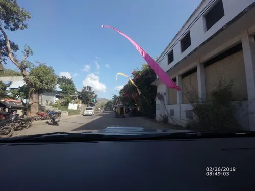
Cafe Koko
Cafe · Sandwich, Cake · 1.1 km
Homemade specialities
Busuanga Loop
Mo-Su 06:30-22:30
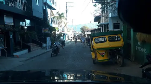
Gran' Italia
Restaurant · Italian
10 San Agustin Street
Mo-Su 11:00-22:30
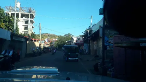
Summer Restaurant
Restaurant · Chinese, Filipino
R2R Building Busuanga Loop, Coron
Mo-Su 10:00-22:00

Gigi's Soft Ice Cream, Belgian Waffles & HK Style Noodles
Ice cream
Coron-Busuanga Road
Mo-Su 12:00-21:00
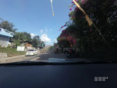
KokosNuss Garden Restaurant
Restaurant · International, Philippine, German · 1.1 km
Busuanga Loop
06:30-22:30



105 more on the map.
Where to stay157
Churches and places of worship12
Shopping12
Gas and EV charging6
Schools, colleges and libraries23
Healthcare8
Map of Coron
250 places. The map loads OpenStreetMap tiles when you open it.
Getting there and nearby towns
Francisco B. Reyes Airport (USU) is the nearest airport with scheduled flights listed in OpenStreetMap, 18 km away.
- Culion 23 km southwest, about 23 min by car
- Bulalacao 29 km south, about 29 min by car
- Salvacion 33 km northwest, about 33 min by car
- Panlaitan 41 km west, about 41 min by car
- Buluang 44 km northwest, about 44 min by car
- San Miguel 67 km southwest, about 1 h by car
Drive times are estimates from straight-line distance, not routes.
Local news
Headlines from INDB.
Reviews, tips and questions
Loading what members have shared...
Sources and licences
- GeoNames (CC BY 4.0): population, coordinates, regions and time zone
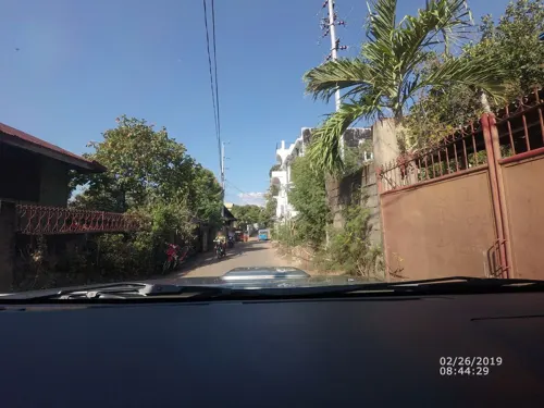
- Mapillary (see each image): photos
- OpenStreetMap contributors (ODbL 1.0): places, airports, map data
- Wikidata (CC0 1.0): elevation, founding date, time zone, website
- Wikimedia Commons (see each image): photos
- Wikipedia (CC BY-SA 4.0): overview and history text
Photo credits
- Coron from Mount Tapyas, Matikas 0805, CC BY-SA 3.0
- Coron Town Lolo Nonoy's Food Station - panoramio, 우한길(HK Woo), CC BY 3.0
- Coron and Calamian Islands - Coron1734, lumoplank, CC0
- Coron and Calamian Islands - Coron1729, lumoplank, CC0
- Coron and Calamian Islands - Coron1713, lumoplank, CC0
- Coron and Calamian Islands - Coron1715, lumoplank, CC0
- Coron Harbour Center - panoramio, Tuderna, CC BY 3.0
- Princess of Coron - panoramio, 우한길(HK Woo), CC BY 3.0
- Mababang Paaralan ng Claudio Sandoval - Claudio Sandoval Elementary School - Coron, Palawan, Philippines, Paul Christian B. Yang-ed, CC0
- Princess of Coron(프린세스 오브 코론) - panoramio, 우한길(HK Woo), CC BY 3.0
- Coron church(코론 시내의 교회) - panoramio, 우한길(HK Woo), CC BY 3.0
- Coron Village Lodge - panoramio, Ronx Ronquillo, CC BY-SA 3.0
- Coron Town Seaport(코론 신항구) - panoramio, 우한길(HK Woo), CC BY 3.0
- Sea dive in Coron - panoramio, 우한길(HK Woo), CC BY 3.0
- Seadive Resort, Coron, Palawan, Philippines - panoramio, André Héroux, CC BY 3.0
- Seadive Resort, Coron, Palawan, Philippines - panoramio (1), André Héroux, CC BY 3.0
- Coron Hotel(코론 재래 시장옆 신축 호텔) - panoramio, 우한길(HK Woo), CC BY 3.0
- Coron Public Market, Coron, Palawan - panoramio, André Héroux, CC BY 3.0
- La Serenatta Restaurant-Bar, Coron City, Palawan, Philippines - panoramio, André Héroux, CC BY 3.0
- Coron Town - panoramio, Tuderna, CC BY 3.0
- The Pier of Coron, Palawan, Philippines - panoramio, André Héroux, CC BY 3.0
- The Boulevard by the Coronians - panoramio, Tuderna, CC BY 3.0
- Coron port(코론 항구) - panoramio, 우한길(HK Woo), CC BY 3.0
- Coron Bay sunset - panoramio, Tuderna, CC BY 3.0
- The Island of Coron and Uson, Average-Joe, CC BY-SA 4.0
- The Island of Coron and Uson and the Mt. Tapias Viewdeck, Average-Joe, CC BY-SA 4.0
- Approaching Coron Town by boat - panoramio, Tuderna, CC BY 3.0
- Coron School of Fisheries - panoramio, Tuderna, CC BY 3.0
- Tarangkahan ng Mababang Paaralan ng Tagumpay, Coron, Palawan - Tagumpay Elementary School, Paul Christian B. Yang-ed, CC0
- Nepenthes sp. (pitcher plant) sa Mt. Tapyas, Coron, Palawan, Paul Christian B. Yang-ed, CC BY-SA 4.0
- Coron 전망대에서 바라본 풍경 - panoramio, 우한길(HK Woo), CC BY 3.0
- Coron Banca Boat, Palawan - panoramio, André Héroux, CC BY 3.0
- The Bar of Dive Link, Coron, Palawan - panoramio, André Héroux, CC BY 3.0
- At Dive Link, Uson Island, Coron - panoramio, André Héroux, CC BY 3.0
- Road to Lualhati Park - panoramio, Tuderna, CC BY 3.0
- Busuanga airstrip, Moody 75 from Phoenix, AZ (currently), CC BY-SA 2.0
- Bopha Dec 5 2012 0520Z, National Aeronautics and Space Administration, LANCE/EOSDIS Rapid Response, captured on Aqua satellite, Public domain
- Sunset overlooking Uson Island, Average-Joe, CC BY-SA 4.0
- Two Seasons Bay View, Mmichaels01, CC BY-SA 4.0
- Lobby ViewT wo Seasons Bayside, Mmichaels01, CC BY-SA 4.0
- Mount Tapyas - Tapyas1700, lumoplank, CC0
- Street-level photo, banito, CC BY-SA 4.0
- Street-level photo, banito, CC BY-SA 4.0
- Street-level photo, banito, CC BY-SA 4.0
- Street-level photo, banito, CC BY-SA 4.0
- Street-level photo, banito, CC BY-SA 4.0
- Street-level photo, banito, CC BY-SA 4.0
- Street-level photo, banito, CC BY-SA 4.0
- Street-level photo, banito, CC BY-SA 4.0
- Street-level photo, fullwatts76, CC BY-SA 4.0
- Street-level photo, banito, CC BY-SA 4.0
- Street-level photo, banito, CC BY-SA 4.0
- Street-level photo, banito, CC BY-SA 4.0
- Street-level photo, banito, CC BY-SA 4.0
- Street-level photo, banito, CC BY-SA 4.0
- Street-level photo, banito, CC BY-SA 4.0
- Street-level photo, banito, CC BY-SA 4.0
- Street-level photo, banito, CC BY-SA 4.0
- Street-level photo, banito, CC BY-SA 4.0
- Street-level photo, banito, CC BY-SA 4.0
- Street-level photo, banito, CC BY-SA 4.0
- Street-level photo, banito, CC BY-SA 4.0


Page built November 8, 2026. Spotted a mistake? Tell us or suggest a place.