


Why visit Dauin
Townapedia lists 7 museums and landmarks, 3 parks and trails, 27 places to eat, 20 places to stay and 2 attractions in and around town.
Highlights include Church of Dauin.
Weather in Dauin
Forecast from MET Norway (CC BY 4.0). Full forecast
About Dauin
Dauin, officially the Municipality of Dauin (Cebuano: Lungsod sa Dauin; Tagalog: Bayan ng Dauin) is a municipality in the province of Negros Oriental, Philippines. According to the 2024 census, it has a population of 30,921 people.
From the Wikipedia article Dauin (this version), under CC BY-SA 4.0.
Travel tips from other travellers: Dauin on Wikivoyage (CC BY-SA 4.0).
Things to do2


Museums and landmarks7


Parks, trails and playgrounds3


Restaurants and cafes27

Kingaroo's Seaview Resto Bar
Restaurant · 7.1 km
2 Larena St
Mo-Su 09:00-21:00
Green Dining
Restaurant · Burger, International, Grill, Diner, Mexican · 8.7 km
Tu-Su 15:00-23:00





15 more on the map.
History
The municipality was created on January 13, 1908, through Executive Order No. 37.
From the History section of Dauin on Wikipedia, under CC BY-SA 4.0.
Where to stay20
Churches and places of worship7
Shopping3
Gas and EV charging10
Schools, colleges and libraries40
Adventist Academy of Negros Oriental-Siquijor, Inc.
School · 6.0 km
Dumaguete South Road, Dauin
DLHOH Institute Learning Center Corporation
School · 7.3 km
Dumaguete South Road, Bacong
Healthcare7
Map of Dauin
126 places. The map loads OpenStreetMap tiles when you open it.
Getting there and nearby towns
Dumaguete-Sibulan Airport (DGT) is the nearest airport with scheduled flights listed in OpenStreetMap, 16 km away.
- Dumaguete 14 km north, about 14 min by car
- Sibulan 19 km north, about 19 min by car
- Siquijor 28 km east, about 28 min by car
- Pamplona 35 km northwest, about 35 min by car
- Tanjay 38 km north, about 38 min by car
- Oslob 41 km northeast, about 41 min by car
- Lazi 41 km east, about 41 min by car
- Bais 47 km north, about 47 min by car
- Santa Catalina 47 km west, about 47 min by car
- Bayawan 54 km west, about 54 min by car
Drive times are estimates from straight-line distance, not routes.
Local news
Headlines from INDB.
Reviews, tips and questions
Loading what members have shared...
Sources and licences
- GeoNames (CC BY 4.0): population, coordinates, regions and time zone
- Mapillary (see each image): photos
- OpenStreetMap contributors (ODbL 1.0): places, airports, map data
- Wikidata (CC0 1.0): elevation, founding date, time zone, website
- Wikimedia Commons (see each image): photos
- Wikipedia (CC BY-SA 4.0): overview and history text
Photo credits
- Dauin Municipality Hall, DumagueteInfo Net Service Email: [email protected], CC BY-SA 4.0
- Bacong Church facade - 3, Eugene Alvin Villar ( seav ), CC BY-SA 4.0
- Rizal monument at Bacong Town Plaza, Eugene Alvin Villar ( seav ), CC BY-SA 4.0
- Siphopteron makisig 43288423, Dan Schofield, CC BY 4.0
- Siphopteron makisig 43288343, Dan Schofield, CC BY 4.0
- Siphopteron makisig 43288259, Dan Schofield, CC BY 4.0
- Antennarius commerson 43488262, Dan Schofield, CC BY 4.0
- Antennarius commerson 43488280, Dan Schofield, CC BY 4.0
- Odontodactylus scyllarus 42405292, Dan Schofield, CC BY 4.0
- Bohadschia argus 42214534, Dan Schofield, CC BY 4.0
- Gymnothorax fimbriatus 43203398, Dan Schofield, CC BY 4.0
- Astropyga radiata 42456494, Dan Schofield, CC BY 4.0
- Miamira sinuata 42894863, Dan Schofield, CC BY 4.0
- Miamira sinuata 42895148, Dan Schofield, CC BY 4.0
- Miamira sinuata 42895098, Dan Schofield, CC BY 4.0
- Astropyga radiata 43290104, Dan Schofield, CC BY 4.0
- Arothron mappa 43772569, Dan Schofield, CC BY 4.0
- Arothron mappa 43772505, Dan Schofield, CC BY 4.0
- Odontodactylus scyllarus 42892676, Dan Schofield, CC BY 4.0
- Odontodactylus scyllarus 42892528, Dan Schofield, CC BY 4.0
- Antennarius commerson 43076859, Dan Schofield, CC BY 4.0
- Goniobranchus kuniei 43663403, Dan Schofield, CC BY 4.0
- Siphopteron makisig 43289473, Dan Schofield, CC BY 4.0
- Antennarius maculatus (Desjardins, 1840) 2283129219, iNaturalist.org (Dan Schofield) (Dan Schofield), CC BY 4.0
- Iniistius pavo Philippines, djscho, CC BY 4.0
- Odontodactylus latirostris 43165103, Dan Schofield, CC BY 4.0
- Clavelina moluccensis 60641896, Kai Squires, CC BY 4.0
- Arothron mappa 45635326, Dan Schofield, CC BY 4.0
- Cheilinus fasciatus 45489191, Dan Schofield, CC BY 4.0
- Parapercis pacifica 47536736, Dan Schofield, CC BY 4.0
- Gymnothorax thyrsoideus 44884326, Dan Schofield, CC BY 4.0
- Gymnothorax fimbriatus 44194338, Dan Schofield, CC BY 4.0
- Blackstripe Dottyback, Elias Levy, CC BY 2.0
- Siganus guttatus Golden Rabbitfish, Elias Levy, CC BY 2.0
- Semicircle angelfish (Pomacanthus semicirculatus), Elias Levy, CC BY 2.0
- Latticed Sandperch (6997551029), Elias Levy, CC BY 2.0
- Maybe Ambanoro Shrimpgoby (6851426390), Elias Levy, CC BY 2.0
- Clark's Anemonefish (6997549061), Elias Levy, CC BY 2.0
- Dwarf Hawkfish (6851428172), Elias Levy, CC BY 2.0
- Nudibranch (6997549525), Elias Levy, CC BY 2.0
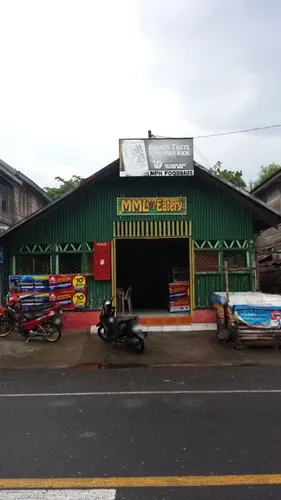
- Street-level photo, GOwin, CC BY-SA 4.0
- Street-level photo, GOwin, CC BY-SA 4.0


Page built November 7, 2026. Spotted a mistake? Tell us or suggest a place.