


Why visit Guagua
Townapedia lists 31 museums and landmarks, 7 parks and trails, 68 places to eat and 13 places to stay in and around town.
Highlights include Aurelio Tolentino, Juan Crisostomo Soto (Crissot), Jose B. Lingad Park and Museum and The Risen Christ.
Weather in Guagua
Forecast from MET Norway (CC BY 4.0). Full forecast
About Guagua
Guagua, officially the Municipality of Guagua (Kapampangan: Balen ning Guagua; Tagalog: Bayan ng Guagua), is a municipality in the province of Pampanga, Philippines. According to the 2024 census, it has a population of 137,948 people.
From the Wikipedia article Guagua (this version), under CC BY-SA 4.0.
Travel tips from other travellers: Guagua on Wikivoyage (CC BY-SA 4.0).
Museums and landmarks31


Don Honorio Ventura Technological State University historical marker
Monument and historic site · 4.2 km



19 more on the map.
Parks, trails and playgrounds7

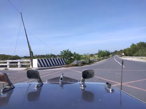


Needs Resort and Amusement Park
Sports field and stadium · 4.1 km
Jose Abad Santos Avenue, Lubao

Restaurants and cafes68

Apag Marangle
Restaurant · Filipino · 2.7 km
Dalan Betis, Guagua
Mo-Su 08:00-22:00

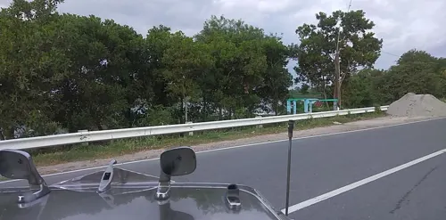


Patrio"s Grill
Restaurant · Regional, Coffee Shop, Chicken · 2.6 km
Megadike West Road, Guagua
Mo-Fr 08:00-17:00
Luring's Restaurant
Restaurant · Barbecue · 0.8 km
Guagua - Santa Rita Provincial Road, Guagua


56 more on the map.
Where to stay13

Cattleya Garden Villas
Motel and hotel · 0.7 km
Hotel, Function Hall, Catering
Guagua Old National Highway
1 more on the map.
Churches and places of worship123
San Guillermo Parish Church
Church · Roman Catholic · 4.2 km
McKinley Drive
Saint James The Apostle Parish
Church · Roman Catholic · 1.6 km
Guagua Old National Highway, Guagua
Immaculate Conception Chapel
Church · Roman Catholic
Eligio G. Lagman Street, Guagua
United Church of Christ in the Philippines
Church · Evangelical · 0.9 km
Guagua-Sasmuan Road, Guagua
Archdiocesan Shrine of Lady of Lourdes Church
Church · Roman Catholic · 3.4 km
MacArthur Highway
Church of God International
Church · Evangelical · 4.6 km
Guagua-Floridablanca Road
First United Methodist Church
Church · Methodist · 1.1 km
Guagua-Sasmuan Road, Guagua
Iglesia ni Cristo
Church · Iglesia Ni Cristo · 1.6 km
Guagua-Floridablanca Road, Guagua
Iglesia Ni Cristo
Church · Iglesia Ni Cristo · 2.8 km
Guagua Old National Highway, Guagua
Shopping28
Gas and EV charging46
AJ27 Fuel Refilling Station
Gas station · 3.4 km
Guagua-Floridablanca Road, Guagua
Schools, colleges and libraries76
Don Honorio Ventura State University
School · 4.4 km
MacArthur Highway
President Diosdado P. Macapagal Library and Museum
Library · 4.5 km
National Highway
Eastwood International Institute of Science and Technology
School
Calle Rizal, Guagua
First United Methodist Church Ecumenical School
School · 1.1 km
Guagua-Sasmuan Road, Guagua
Healthcare128
Pampanga Medical Specialist Hospital
Hospital · 2.9 km
Jose Abad Santos Avenue, Guagua
Alfonso Medical Clinic
Clinic and pharmacy · 0.8 km
Guagua Old National Road, Guagua
C.D. Sison Medical Clinic
Clinic and pharmacy · 1.9 km
San Juan - San Matias Road, Guagua
Map of Guagua
250 places. The map loads OpenStreetMap tiles when you open it.
Getting there and nearby towns
Clark International Airport (CRK) is the nearest airport with scheduled flights listed in OpenStreetMap, 26 km away.
- Sasmuan 3 km southwest, about 3 min by car
- Lubao 4 km southwest, about 4 min by car
- Santa Rita 4 km northwest, about 4 min by car
- Minalin 5 km east, about 5 min by car
- San Fernando 9 km northeast, about 9 min by car
- Masantol 11 km southeast, about 11 min by car
- Apalit 15 km east, about 15 min by car
- Porac 15 km northwest, about 15 min by car
- Calumpit 15 km east, about 15 min by car
- San Simon 16 km east, about 16 min by car
Drive times are estimates from straight-line distance, not routes.
Local news
Headlines from INDB.
Reviews, tips and questions
Loading what members have shared...
Sources and licences
- GeoNames (CC BY 4.0): population, coordinates, regions and time zone
- Mapillary (see each image): photos
- OpenStreetMap contributors (ODbL 1.0): places, airports, map data
- Wikidata (CC0 1.0): elevation, founding date, time zone, website, landmarks and historic places
- Wikimedia Commons (see each image): photos
- Wikipedia (CC BY-SA 4.0): overview and history text
Photo credits
- GuaguaPampangajf332, Ramon FVelasquez, CC BY-SA 3.0
- 8176Guagua National Colleges 26, Judgefloro, CC0
- 8225Town Proper of Plaza Burgos Guagua Pampanga 27, Judgefloro, CC0
- 7940Town Proper of Plaza Burgos Guagua Pampanga 39, Judgefloro, CC0
- 9466Pampanga Tilapia Festival Guagua 35, Judgefloro, CC0
- 8274Town Proper of Plaza Burgos Guagua Pampanga 08, Judgefloro, CC0
- 8140Town Proper of Plaza Burgos Guagua Pampanga 21, Judgefloro, CC0
- 8274Town Proper of Plaza Burgos Guagua Pampanga 11, Judgefloro, CC0
- 8324Town Proper of Plaza Burgos Guagua Pampanga 19, Judgefloro, CC0
- 9533Pampanga Tilapia Festival Guagua 19, Judgefloro, CC0
- 8225Town Proper of Plaza Burgos Guagua Pampanga 14, Judgefloro, CC0
- 8274Town Proper of Plaza Burgos Guagua Pampanga 01, Judgefloro, CC0
- 8424Town Proper of Plaza Burgos Guagua Pampanga 23, Judgefloro, CC0
- 7890Town Proper of Plaza Burgos Guagua Pampanga 10, Judgefloro, CC0
- 7990Town Proper of Plaza Burgos Guagua Pampanga 47, Judgefloro, CC0
- 7990Town Proper of Plaza Burgos Guagua Pampanga 35, Judgefloro, CC0
- 9533Pampanga Tilapia Festival Guagua 18, Judgefloro, CC0
- 8040Town Proper of Plaza Burgos Guagua Pampanga 16, Judgefloro, CC0
- 8090Town Proper of Plaza Burgos Guagua Pampanga 26, Judgefloro, CC0
- 8040Town Proper of Plaza Burgos Guagua Pampanga 25, Judgefloro, CC0
- 7890Town Proper of Plaza Burgos Guagua Pampanga 24, Judgefloro, CC0
- 7890Town Proper of Plaza Burgos Guagua Pampanga 42, Judgefloro, CC0
- 7940Town Proper of Plaza Burgos Guagua Pampanga 41, Judgefloro, CC0
- 8176Guagua National Colleges 22, Judgefloro, CC0
- 8424Town Proper of Plaza Burgos Guagua Pampanga 43, Judgefloro, CC0
- 9533Pampanga Tilapia Festival Guagua 44, Judgefloro, CC0
- 9533Pampanga Tilapia Festival Guagua 48, Judgefloro, CC0
- 9745Immaculate Conception Parish Church Guagua 48, Judgefloro, CC0
- 9795Immaculate Conception Parish Church Guagua 12, Judgefloro, CC0
- 9816Immaculate Conception Parish Church Guagua 20, Judgefloro, CC0
- 8176Guagua National Colleges 16, Judgefloro, CC0
- 7940Town Proper of Plaza Burgos Guagua Pampanga 35, Judgefloro, CC0
- 9745Immaculate Conception Parish Church Guagua 27, Judgefloro, CC0
- 9816Immaculate Conception Parish Church Guagua 18, Judgefloro, CC0
- 9745Immaculate Conception Parish Church Guagua 26, Judgefloro, CC0
- 9582Pampanga Tilapia Festival Guagua 04, Judgefloro, CC0
- 9582Pampanga Tilapia Festival Guagua 31, Judgefloro, CC0
- 8140Town Proper of Plaza Burgos Guagua Pampanga 14, Judgefloro, CC0
- 8274Town Proper of Plaza Burgos Guagua Pampanga 41, Judgefloro, CC0
- 8274Town Proper of Plaza Burgos Guagua Pampanga 02, Judgefloro, CC0
- Sunken Cabetican Shrine low entryway2, Bagoto, CC BY-SA 4.0
- 2717Bacolor Pampanga Roads Town Landmarks 30, Judgefloro, CC0
- Jf4760Guagua National Collegesfvf 01, Judgefloro, CC BY-SA 4.0
- Bacolor Church, Joefran4, CC BY-SA 3.0
- Betischurch2sjfccc, Ramon FVelasquez, CC BY-SA 3.0
- Aurelio Tolentino Historical Marker, Guagua, Pampanga, Ralff Nestor Nacor, CC BY-SA 4.0
- Felix Galura NHCP marker, Photo: Roel Balingit ; perspective correction: Eugene Alvin Villar ( seav ), CC BY-SA 4.0
- Juan Crisostomo Soto (Crissot) historical marker, Photo: Judgefloro ; perspective correction: Eugene Alvin Villar ( seav ), Public domain
- Jose B. Lingad historical marker - NHCP, National Historical Commission of the Philippines, Public domain
- Jose B. Lingad Park and Museum, National Historical Commission of the Philippines, Public domain
- Don Honorio Ventura Technological State University NHCP marker, Photo: Roel Balingit ; perspective correction: Eugene Alvin Villar ( seav ), CC BY-SA 4.0
- Street-level photo, mdgabriel, CC BY-SA 4.0
- Street-level photo, mdgabriel, CC BY-SA 4.0
- Street-level photo, mdgabriel, CC BY-SA 4.0
- Street-level photo, mdgabriel, CC BY-SA 4.0
- Street-level photo, mdgabriel, CC BY-SA 4.0
- Street-level photo, mdgabriel, CC BY-SA 4.0
- Street-level photo, mdgabriel, CC BY-SA 4.0
- Street-level photo, mdgabriel, CC BY-SA 4.0
- Street-level photo, mdgabriel, CC BY-SA 4.0
- Street-level photo, mdgabriel, CC BY-SA 4.0
- Street-level photo, mdgabriel, CC BY-SA 4.0
- Street-level photo, mdgabriel, CC BY-SA 4.0


Page built November 7, 2026. Spotted a mistake? Tell us or suggest a place.