


Hagonoy, Philippines
Hagonoy is a town of 7,409 people in Davao Region, Philippines, founded in March 8, 1959.
Why visit Hagonoy
Townapedia lists 1 museum or landmark, 7 parks and trails, 265 places to eat, 17 places to stay and 7 attractions in and around town.
Weather in Hagonoy
Forecast from MET Norway (CC BY 4.0). Full forecast
About Hagonoy
Hagonoy, officially the Municipality of Hagonoy (Cebuano: Lungsod sa Hagonoy; Tagalog: Bayan ng Hagonoy), is a municipality in the province of Davao del Sur, Philippines. According to the 2024 census, it has a population of 58,689 people.
From the Wikipedia article Hagonoy, Davao del Sur (this version), under CC BY-SA 4.0.
Things to do7


Museums and landmarks1

Parks, trails and playgrounds7


Restaurants and cafes265

Kookel's Digos
Restaurant · Filipino, Lechon Manok, Crispy Liempo, Pancit Canton, Lomi, Lumpia Shanghai · 7.3 km
Canteen Rizal Avenue, Digos City
Mo-Su 10:00-22:00
Jekoy's Inn and Resto Bar
Bar and pub · 5.8 km
Rizal Avenue, Digos City
17:00-01:00



253 more on the map.
History
Before its creation into a municipality, Hagonoy was a sitio of barrio Digos, municipality of Santa Cruz. Then, when the municipality of Padada was created on July 1, 1949, Hagonoy was annexed as one of its barrios. On May 28, 1953, by virtue of Executive Order No. 596 issued by President Elpidio V. Quirino, Hagonoy was separated from Padada and became a regular municipality. Then in the early 1970s, a batch of Cebuanos came from Danao City, particularly from Caputatan, among them Nathaniel Capuyan and Loselo Capuno Sr., who worked in the sugarcane plantations and settled in barangay Maliit Digos. From then on, plenty of others from Caputatan, Danao City followed, and eventually found a place in a land owned by Alejandro Almendras.
Republic Act No. 2094, which defined the boundaries of Hagonoy, was ratified in 1959. It referred to Hagonoy's territory as comprising the barrios of Kibuaya, Upper Sacub, Lower Sacub, Maliit-Digos, La Union, Malabang, Tulogan, Malinao, Guihing, Pawa, Hagonoy, Balutakay, Leling, and Sinayawan, and the sitios of Quezon and Polopolo.
From the History section of Hagonoy, Davao del Sur on Wikipedia, under CC BY-SA 4.0.
Where to stay17
Churches and places of worship34
The Jesus is Lord Ministries International
Place of worship · 5.3 km
Rizal Street
Digos City Southern Baptist Church
Church · Baptist · 7.5 km
General Lim Street, Digos City
Panon sa 12 ka Banay
Church · Panon Sa 12 Ka Banay · 6.6 km
Mabini Extension, Digos City
Shopping59
Gas and EV charging33
Schools, colleges and libraries91
Isaac Abalayan Elementary School
School · 6.6 km
Isaac Abalayan Street, Digos City
Malinao National High School of Arts and Trade
School · 4.0 km
Bohol Street, Padada
Healthcare46
Tongcos-Riveral Medical & Surgical Clinic
Clinic and pharmacy · 7.3 km
Rizal Avenue, Digos City
Map of Hagonoy
250 places. The map loads OpenStreetMap tiles when you open it.
Getting there and nearby towns
Francisco Bangoy International Airport (DVO) is the nearest airport with scheduled flights listed in OpenStreetMap, 60 km away.
- Padada 5 km southeast, about 5 min by car
- Digos 8 km northeast, about 8 min by car
- Matanao 8 km west, about 8 min by car
- Sulop 10 km south, about 10 min by car
- Malalag 13 km southeast, about 13 min by car
- Bansalan 17 km northwest, about 17 min by car
- Magsaysay 18 km northwest, about 18 min by car
- Makilala 39 km northwest, about 39 min by car
- Malita 43 km southeast, about 43 min by car
- Kidapawan 45 km northwest, about 45 min by car
Drive times are estimates from straight-line distance, not routes.
Local news
Headlines from INDB.
Reviews, tips and questions
Loading what members have shared...
Sources and licences
- GeoNames (CC BY 4.0): population, coordinates, regions and time zone
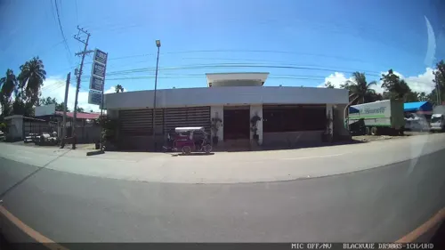
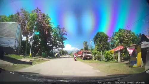
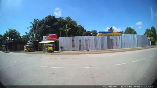
- Mapillary (see each image): photos
- OpenStreetMap contributors (ODbL 1.0): places, airports, map data
- Wikidata (CC0 1.0): elevation, founding date, time zone, website, landmarks and historic places
- Wikimedia Commons (see each image): photos
- Wikipedia (CC BY-SA 4.0): overview and history text
Photo credits
- Digos Poblacion, Roxas Street-Lim NB drone (Digos, Davao Del Sur; 03-24-2026), Patrickroque01, CC BY-SA 4.0
- St, Michael's School of Padada, QuecyKeith, CC BY-SA 3.0
- Street-level photo, Kaart---LEFT, CC BY-SA 4.0
- Street-level photo, Kaart---LEFT, CC BY-SA 4.0
- Street-level photo, Kaart---LEFT, CC BY-SA 4.0
- Street-level photo, Kaart---FRONT, CC BY-SA 4.0
- Street-level photo, Kaart---RIGHT, CC BY-SA 4.0
- Street-level photo, Kaart---FRONT, CC BY-SA 4.0
- Street-level photo, Kaart---RIGHT, CC BY-SA 4.0
- Street-level photo, Kaart---RIGHT, CC BY-SA 4.0
- Street-level photo, Kaart---LEFT, CC BY-SA 4.0
- Street-level photo, Kaart---LEFT, CC BY-SA 4.0
- Street-level photo, Kaart---RIGHT, CC BY-SA 4.0
- Street-level photo, Kaart---LEFT, CC BY-SA 4.0
- Street-level photo, Kaart---RIGHT, CC BY-SA 4.0
- Street-level photo, Kaart---LEFT, CC BY-SA 4.0
- Street-level photo, Kaart---RIGHT, CC BY-SA 4.0
- Street-level photo, Kaart---FRONT, CC BY-SA 4.0
- Street-level photo, Kaart---LEFT, CC BY-SA 4.0
- Street-level photo, Kaart---LEFT, CC BY-SA 4.0
- Street-level photo, Kaart---FRONT, CC BY-SA 4.0
Page built November 7, 2026. Spotted a mistake? Tell us or suggest a place.