


Iguig, Philippines
Iguig is a town of 3,274 people in Cagayan Valley, Philippines, founded in December 28, 1607.
Why visit Iguig
Townapedia lists 3 museums and landmarks, 1 park or trail, 1 place to stay and 2 attractions in and around town.
Highlights include Callao Cave and Peñablanca Protected Landscape and Seascape.
Weather in Iguig
Forecast from MET Norway (CC BY 4.0). Full forecast
About Iguig
Iguig, officially the Municipality of Iguig (Ibanag: Ili nat Iguig; Ilocano: Ili ti Iguig; Tagalog: Bayan ng Iguig), is a municipality in the province of Cagayan, Philippines. According to the 2024 census, it has a population of 31,342 people.
From the Wikipedia article Iguig (this version), under CC BY-SA 4.0.
Travel tips from other travellers: Iguig on Wikivoyage (CC BY-SA 4.0).
Things to do2

Callao Cave
Monument and historic site · 10.6 km
Cave and archaeological site in the Philippines

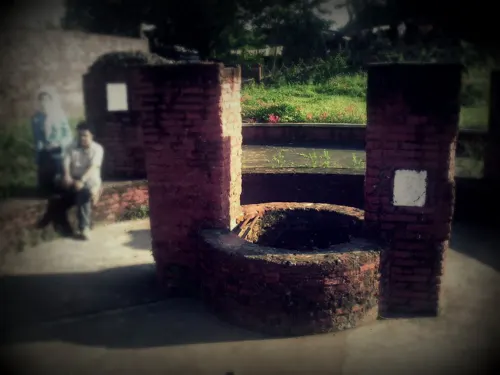
Museums and landmarks3

Parks, trails and playgrounds1
Peñablanca Protected Landscape and Seascape
Park · 10.6 km
Nature reserve in Philippines
Where to stay1


History
Iguig was officially established as a Spanish mission on 16 April 1608. The name of the town is said to mean "the place of Ig", referring to a native chieftain and warrior who lived in the area.
From the History section of Iguig on Wikipedia, under CC BY-SA 4.0.
Churches and places of worship2
Shopping3
Gas and EV charging5
Schools, colleges and libraries42
Map of Iguig
59 places. The map loads OpenStreetMap tiles when you open it.
Getting there and nearby towns
Tuguegarao Airport (TUG) is the nearest airport with scheduled flights listed in OpenStreetMap, 12 km away.
- Minanga Norte 1 km northwest, about 1 min by car
- Dassun 3 km west, about 3 min by car
- Gammad 5 km south, about 5 min by car
- Estefania 6 km north, about 6 min by car
- Solana 12 km southwest, about 12 min by car
- Tuguegarao 15 km south, about 15 min by car
- Cabagan 36 km south, about 36 min by car
- Tabuk 49 km southwest, about 49 min by car
- Ilagan 69 km south, about 1 h 15 min by car
- Roxas 71 km south, about 1 h 15 min by car
Drive times are estimates from straight-line distance, not routes.
Local news
Headlines from INDB.
Reviews, tips and questions
Loading what members have shared...
Sources and licences
- GeoNames (CC BY 4.0): population, coordinates, regions and time zone
- Mapillary (see each image): photos
- OpenStreetMap contributors (ODbL 1.0): places, airports, map data
- Openverse (see each image): photos
- Wikidata (CC0 1.0): elevation, founding date, time zone, website, landmarks and historic places
- Wikimedia Commons (see each image): photos
- Wikipedia (CC BY-SA 4.0): overview and history text
Photo credits
- IGUIG Church, Markadan, CC BY-SA 3.0
- Old Well (Iguig Church) - Flickr, Shubert Ciencia from Nueva Ecija, Philippines, CC BY 2.0
- Iguig Church - Flickr, Shubert Ciencia from Nueva Ecija, Philippines, CC BY 2.0
- Callao Cave, Ervin Malicdem, CC BY-SA 4.0
- Pinacanauan River (Penablanca, Cagayan), Shubert Ciencia, CC BY 2.0
- Iguig Church, Cagayan, Elmer Domingo, CC BY-SA 4.0
- ISS029-E-27912 - View of Earth, Earth Science and Remote Sensing Unit , Lyndon B. Johnson Space Center, Public domain
- ISS064-E-52672 - View of Earth, Earth Science and Remote Sensing Unit , Lyndon B. Johnson Space Center, Public domain
- Old Well (Iguig, Cagayan), ~MVI~ (warped), CC BY 2.0
- Street-level photo, asdfasdf0986, CC BY-SA 4.0
- Street-level photo, asdfasdf0986, CC BY-SA 4.0
- Street-level photo, asdfasdf0986, CC BY-SA 4.0
- Street-level photo, asdfasdf0986, CC BY-SA 4.0
- Street-level photo, asdfasdf0986, CC BY-SA 4.0
- Street-level photo, asdfasdf0986, CC BY-SA 4.0
- Street-level photo, asdfasdf0986, CC BY-SA 4.0
- Street-level photo, asdfasdf0986, CC BY-SA 4.0
- Street-level photo, asdfasdf0986, CC BY-SA 4.0


Page built November 7, 2026. Spotted a mistake? Tell us or suggest a place.