


Namayan, Philippines
Namayan is a town of 7,670 people in National Capital Region, Philippines.
Why visit Namayan
Townapedia lists 46 museums and landmarks, 20 parks and trails, 236 places to eat, 25 places to stay and 9 attractions in and around town.
Highlights include Jones Bridge, Manila Baywalk Dolomite Beach, Church of Santa Ana and M. P. Lichauco Heritage House.
Weather in Namayan
Forecast from MET Norway (CC BY 4.0). Full forecast
About Namayan
Namayan is a barangay in the city of Mandaluyong, Philippines. It is located in the western part of the city near the border with Santa Ana, Manila and Kasilawan and Carmona, Makati, separated from them by the Pasig River. The barangay covers an area of 38.55 hectares (95.3 acres), and is bordered by the barangays of Mabini–J.Rizal and Old Zañiga on the northside, and Vergara on the eastside. According to the 2020 census, it has a population of 7,670 people.
From the Wikipedia article Namayan, Mandaluyong (this version), under CC BY-SA 4.0.
Things to do9

Jones Bridge
Bridge · 5.2 km
Bridge that spans the Pasig River in the Philippines connecting Binondo and the center of Manila

Manila Baywalk Dolomite Beach
Beach · 4.7 km
Artificial beach in Manila

Manila Grand Opera House
Cinema and theater · 5.4 km
Former opera house in Manila, Philippines

Manila Metropolitan Theatre
Cinema and theater · 4.9 km
Theater in Manila, Philippines

Star City, Manila
Monument and historic site · 4.7 km
Amusement park in the Philippines

Tanghalang Francisco Balagtas
Cinema and theater · 5.1 km
Arts center in Metro Manila, Philippines
Tanghalang Pambansa
Cinema and theater · 4.6 km
Theatre in Pasay, Metro Manila, Philippines, part of Cultural Center of the Phliippines

Museums and landmarks46


M. P. Lichauco Heritage House
Monument and historic site · 1.3 km
2315 Pedro Gil Street, Manila

Ayala Museum
Museum · 2.7 km
Art and history museum in, Ayala Museum Building


GSIS Museo ng Sining
Museum · 5.4 km
Art museum in Metro Manila, Philippines


Lopez Museum
Museum · 4.3 km
Art museum and library in Metro Manila, Philippines

Metropolitan Museum of Manila
Museum · 4.3 km
Art and history museum in Manila, Philippines

People Power Monument
Monument and historic site · 4.7 km
Monument commemorating the 1986 People Power Revolution in the Philippines


The Mind Museum
Museum · 3.8 km
Science museum in Metro Manila, Philippines
34 more on the map.
Parks, trails and playgrounds20

APEC Sculpture Garden
Park · 5.1 km
Sculpture park in Pasay, Philippines

Legazpi Active Park
Park · 2.8 km
Public space and pocket park in Makati Central Business District


Manila Zoological and Botanical Garden
Park · 4.0 km
Zoo in the Philippines



8 more on the map.
Restaurants and cafes236


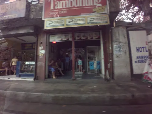


Mang Inasal
Restaurant · Barbecue, Chicken, Filipino · 1.1 km
Pedro Gil Street, Santa Ana
Mo-Sa 08:00-20:00

Roundabout Bistro
Cafe · Bistro · 1.3 km
Maysilo Circle
11:00-24:00

Caffera Photo + Café
Cafe · 0.8 km
480 Boni Avenue
Mo-Su 12:00-24:00
Hi Sports Resto
Restaurant · Filipino, Grill · 1.1 km
6F Coronado Street, Mandaluyong
08:00-21:00
224 more on the map.
Where to stay25
Churches and places of worship59
Shopping45
Gas and EV charging15
Schools, colleges and libraries93
Healthcare60
BloomMD Wellness & Beauty
Clinic and pharmacy · 1.4 km
1922 Centuria Medical Makati Kalayaan Avenue, Makati City
Santa Ana Hospital
Hospital · 0.9 km
2692 New Panaderos Street, Manila
Map of Namayan
250 places. The map loads OpenStreetMap tiles when you open it.
Getting there and nearby towns
Ninoy Aquino International Airport (MNL) is the nearest airport with scheduled flights listed in OpenStreetMap, 7 km away.
- Mandaluyong City 2 km east, about 2 min by car
- Bel Air 2 km south, about 2 min by car
- San Juan 3 km northeast, about 3 min by car
- Makati City 3 km south, about 3 min by car
- Pasig City 4 km east, about 4 min by car
- Manila 5 km northwest, about 5 min by car
- Pasay 5 km southwest, about 5 min by car
- Baclaran 6 km southwest, about 6 min by car
- Pateros 7 km southeast, about 7 min by car
- Quezon City 8 km north, about 8 min by car
Drive times are estimates from straight-line distance, not routes.
Local news
Headlines from INDB.
Reviews, tips and questions
Loading what members have shared...
Sources and licences
- GeoNames (CC BY 4.0): population, coordinates, regions and time zone
- Mapillary (see each image): photos
- OpenStreetMap contributors (ODbL 1.0): places, airports, map data
- Wikidata (CC0 1.0): elevation, founding date, time zone, website, landmarks and historic places
- Wikimedia Commons (see each image): photos
- Wikipedia (CC BY-SA 4.0): overview and history text
Photo credits
- Jones Bridge December 2019, PH 0447, CC BY 4.0
- Manila Bay beach (Roxas Boulevard, Manila; 09-19-2020) wiki, patrickroque01, CC BY-SA 4.0
- Manila Metropolitan Theaterjwilz, JWilz12345, CC0
- Star City at night2jwilz, JWilz12345, CC0
- Cultural Center Philippines TP, The original uploader was Nixenzo at English Wikipedia ., CC BY-SA 3.0
- Casa Manila, Manila, Filipinas, 2023-08-27, DD 72, Diego Delso, CC BY-SA 4.0
- Lopezmuseumfacade2, Lopez Museum, CC BY-SA 3.0
- WTMP Team RMD A7, Richard Espiritu, Mei Tanchico, DK Solis (Wikipedia Takes Manila participant), CC BY-SA 3.0
- PICCjf0135 36, Ramon FVelasquez, CC BY-SA 3.0
- Legazpi Active Park Makati CBD, RioHondo, CC BY-SA 4.0
- Oceania Manila Ocean Park, Foxyreign, CC BY 3.0
- MZandBGjf9906 02, Ramon FVelasquez, CC BY-SA 3.0
- Rizal Monument at Rizal Park, Maynard Rabanal ( Greedyplus ), CC BY-SA 3.0
- Washington SyCip Park Zen Garden, Hariboneagle927, CC BY-SA 4.0
- Iglesia ni Cristo Museum facade Punta Sta. Ana Manila, Urbanroamer, CC BY-SA 4.0
- Manilajf7875 21, Ramon FVelasquez, CC BY-SA 3.0
- Chapel of the Most Blessed Sacrament at De La Salle University, Manila, Mithril_Cloud, CC BY 2.5
- Cosmopolitan Church 02, Hannachiever07, CC BY-SA 3.0
- Ermita de San Nicolas de Tolentino3, Ronaldbunag, CC BY-SA 3.0
- Iglesia ni Cristo Lokal ng San Juan, Arius1998, CC BY-SA 4.0
- Iglesia ni Cristo chapel, Makati, Arius1998, CC BY-SA 4.0
- WTMP Redscale C-16 IMG 7178, Redscale (Wikipedia Takes Manila participant), CC BY-SA 3.0
- Immaculate concepcion church (cubao, quezon city; 2014), Patrick Roque, CC BY 4.0
- WTMP po-kus 0162, po-kus (Wikipedia Takes Manila participant), CC0
- Asian Social Institute, Hannachiever07, CC BY-SA 3.0
- PasayHallSchoolMarketjf9840 26, Ramon FVelasquez, CC BY-SA 3.0
- A Dunkin' Donuts restaurant in Hiawassee, Georgia, United States 01, Harrison Keely, CC BY 4.0
- Yankee Candle Coppergate Walk York, Malcolmxl5, CC BY-SA 4.0
- Church of Santa Ana facade, Roel Balingit, CC BY-SA 4.0
- Lichauco House 3, Ngiping kidlat, CC BY-SA 3.0
- Lichauco Heritage House marker (cropped), Zernan2014, CC BY-SA 4.0
- Felipe G. Calderon PHC historical marker (Manila), Photo: Judgefloro ; perspective correction: Eugene Alvin Villar ( seav ), CC0
- Facade of the Church of Our Lady of the Forsaken (Desamparados) in Santa Ana, Manila, Sharlyne Ang and Karla Redor (Wikipedia Takes Manila participant), CC BY-SA 3.0
- Plaza Calderon, Sta Ana Manila 3, Zernan2014, CC BY-SA 4.0
- 04247jfAsia Pacific College Magallanes Village Makati Cityfvf 10, Judgefloro, CC0
- National Shrine of Our Lady of the Abandoned 2026-02-15, LMP 2001, CC BY-SA 4.0
- GSIS Museum 20230428, Dcalviar2, CC BY-SA 4.0
- Episcopalian Cathedral of Saint Mary & Saint John, Nasugbu batangas ( talk ); Jayzl Nebre-Villafania, CC BY 3.0
- Morning smog on Makati and Manila, Philippines - panoramio, André Héroux, CC BY 3.0
- Circuit Makati Blue Pitch, Hariboneagle927, CC BY-SA 4.0
- The Manila Grand Opera House Historical Marker, Santa Cruz, Manila, Ralff Nestor Nacor, CC BY-SA 4.0
- Ayala Museum, Makati, Feb 2025 (9), Ralff Nestor Nacor, CC BY-SA 4.0
- Street-level photo, kaart_4, CC BY-SA 4.0
- Street-level photo, kaart_4, CC BY-SA 4.0
- Street-level photo, GOwin, CC BY-SA 4.0
- Street-level photo, kaart_4, CC BY-SA 4.0
- Street-level photo, kaart_4, CC BY-SA 4.0
- Street-level photo, GOwin, CC BY-SA 4.0
- Street-level photo, kaart_4, CC BY-SA 4.0
- Street-level photo, kaart_4, CC BY-SA 4.0
- Street-level photo, kaart_4, CC BY-SA 4.0
- Street-level photo, kaart_4, CC BY-SA 4.0
- Street-level photo, kaart_4, CC BY-SA 4.0
- Street-level photo, kaart_4, CC BY-SA 4.0
- Street-level photo, kaart_4, CC BY-SA 4.0


Page built November 8, 2026. Spotted a mistake? Tell us or suggest a place.