
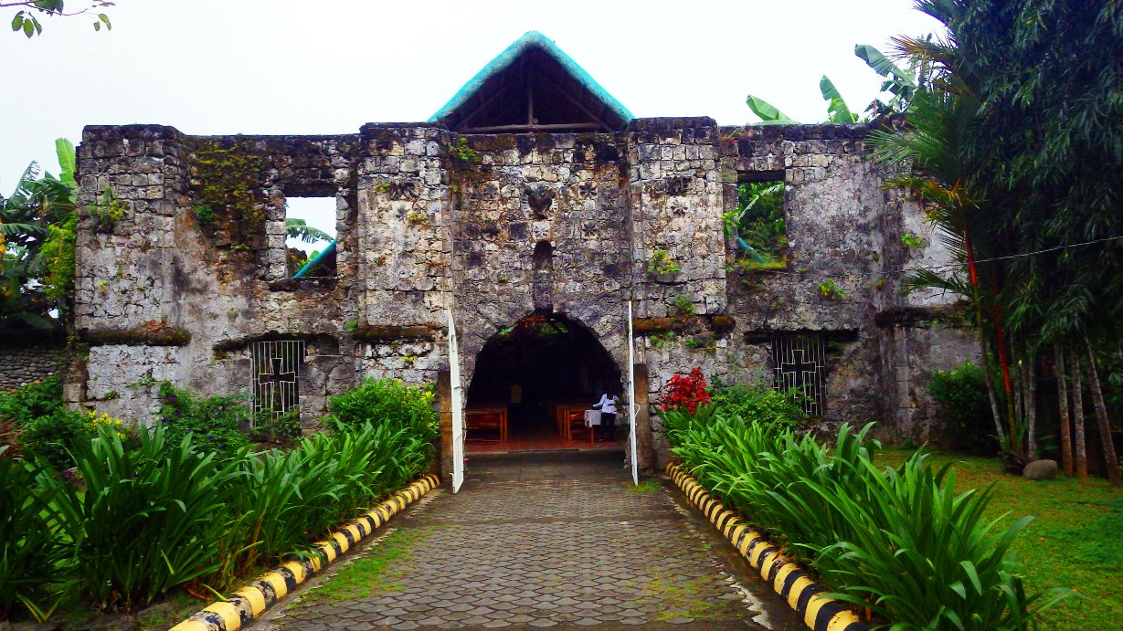


Naujan, Philippines
Naujan is a town of 2,792 people in Mimaropa, Philippines, founded in 1693.
Why visit Naujan
Townapedia lists 1 museum or landmark, 2 parks and trails, 1 place to eat and 2 attractions in and around town.
Weather in Naujan
Forecast from MET Norway (CC BY 4.0). Full forecast
About Naujan
Naujan (Filipino pronunciation: [naʔuˈhan]), officially the Municipality of Naujan (Tagalog: Bayan ng Naujan), is a municipality in the province of Oriental Mindoro, Philippines. According to the 2024 census, it has a population of 109,122 people.
From the Wikipedia article Naujan (this version), under CC BY-SA 4.0.
Things to do2


Museums and landmarks1

Parks, trails and playgrounds2

Restaurants and cafes1


Arsenia's
Restaurant · Peruvian · 14.2 km
Western Nautical Highway, Calapan
Mo-Su 09:00-21:00
History
The town of Naujan was established in 1639 under a Royal decree issued by King Phillip of Spain. Prior to the arrival of the Spaniards, traces of an earlier civilization existed, as evidenced by the unearthed artifacts of Chinese origin dating from the Sung, Yuan, and the Ming dynasties in barangays of Dao and San Jose. This reinforces the theory that the natives of Naujan have trade relations with the Chinese during those early years. Its name according to legend, came from the word, “nauhaw”, or “went thirsty”.
Still, the Mangyans that are of malayan descent are known to be the first inhabitants and were just pushed to the interior mountanous area due to the arrival of Christian settlers. They currently reside in the reservation areas of Barangays Metolza, Caburo, Balite, Paitan, Magtibay and Banuton.
In the 17th century, a Recollect priest built a church in Barrio Bancuro with walls made of stone. This served as the house of worship and at the same time as a fort and a place of refuge against the Moro invaders. However in 1824, the Moros were able to conquer them and burned the fort. The 1800s census showed that Naujan had 924 native families and 6 Spanish-Filipino families.
From the History section of Naujan on Wikipedia, under CC BY-SA 4.0.
Churches and places of worship11
Seventh Adventist Church
Church · Seventh Day Adventist · 14.3 km
Bgy. Mabini, Victoria
Members Church of God International
Place of worship · 14.6 km
Calapan South Road
Gas and EV charging2
Schools, colleges and libraries83
Healthcare1
Map of Naujan
103 places. The map loads OpenStreetMap tiles when you open it.
Getting there and nearby towns
Marinduque Airport (MRQ) is the nearest airport with scheduled flights listed in OpenStreetMap, 57 km away.
- Calapan 17 km northwest, about 17 min by car
- Victoria 16 km south, about 16 min by car
- Socorro 30 km south, about 30 min by car
- Pinamalayan 35 km southeast, about 35 min by car
- Puerto Galera 43 km northwest, about 43 min by car
- Bansud 54 km south, about 54 min by car
- Ibaan 58 km north, about 58 min by car
- Bauan 61 km northwest, about 1 h by car
- San Pascual 62 km northwest, about 1 h by car
- Lipa City 70 km north, about 1 h 15 min by car
Drive times are estimates from straight-line distance, not routes.
Local news
Headlines from INDB.
Reviews, tips and questions
Loading what members have shared...
Sources and licences
- GeoNames (CC BY 4.0): population, coordinates, regions and time zone
- Mapillary (see each image): photos
- OpenStreetMap contributors (ODbL 1.0): places, airports, map data
- Wikidata (CC0 1.0): elevation, founding date, time zone, website, landmarks and historic places
- Wikimedia Commons (see each image): photos
- Wikipedia (CC BY-SA 4.0): overview and history text
Photo credits
- Simbahang Bato, Naujan, Oriental Mindoro 003, KisekiLacroix, CC BY-SA 4.0
- Sto Nino Church Calapan, Elmer B. Domingo, CC BY-SA 4.0
- Simbahang Bato, Naujan, Oriental Mindoro 002, KisekiLacroix, CC BY-SA 4.0
- Fishers Village, Orlan Rovira Frane, CC BY-SA 4.0
- Stairway to Nature, Odelon90, CC BY-SA 4.0
- A church within a church, Orlan Rovira Frane, CC BY-SA 4.0
- Street-level photo, ben_supermen, CC BY-SA 4.0
- Street-level photo, ben_supermen, CC BY-SA 4.0
- Street-level photo, ben_supermen, CC BY-SA 4.0
- Street-level photo, ben_supermen, CC BY-SA 4.0
- Street-level photo, ben_supermen, CC BY-SA 4.0
- Street-level photo, ben_supermen, CC BY-SA 4.0
Page built November 8, 2026. Spotted a mistake? Tell us or suggest a place.