
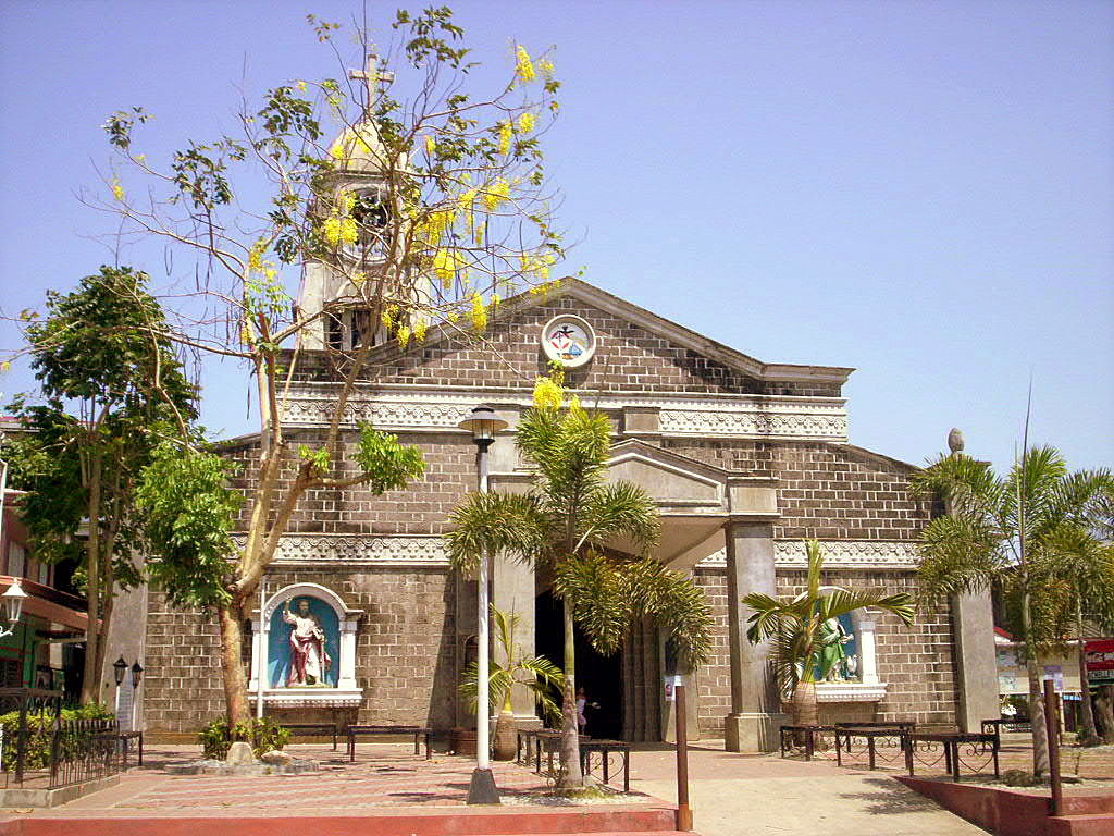


Pandi, Philippines
Pandi is a city of 162,725 people in Central Luzon, Philippines, founded in April 17, 1946.
Why visit Pandi
Townapedia lists 7 museums and landmarks, 3 parks and trails, 49 places to eat, 7 places to stay and 3 attractions in and around town.
Highlights include Francisco Santiago (1889–1947): Ama ng Kundiman.
Weather in Pandi
Forecast from MET Norway (CC BY 4.0). Full forecast
About Pandi
Pandi [pɐnˈde], officially the Municipality of Pandi (Tagalog: Bayan ng Pandi), is a municipality in the province of Bulacan, Philippines. According to the 2024 census, it has a population of 162,725 people.
From the Wikipedia article Pandi, Bulacan (this version), under CC BY-SA 4.0.
Travel tips from other travellers: Pandi on Wikivoyage (CC BY-SA 4.0).
Things to do3

Museums and landmarks7


Francisco Santiago (1889–1947): Ama ng Kundiman
Monument and historic site · 5.0 km
F. Santiago Street, Santa Maria

Parks, trails and playgrounds3


Restaurants and cafes49


Rhona’S Boodle House
Restaurant · Grill, Local · 5.1 km
25 Ricardo Nicolas Street
Mo-Su 10:00-21:00
JQ Food House
Restaurant · Filipino · 5.1 km
Jose Corazon de Jesus Street, Santa Maria

37 more on the map.
Where to stay7
Churches and places of worship30
Blessed Sacrament Parish
Church · Roman Catholic · 2.8 km
Caypombo-Mag-asawang Sapa Road
Iglesia ni Cristo - Lokal ng Guyong
Church · Iglesia Ni Cristo · 3.9 km
Norzagaray-Santa Maria Road
Iglesia ni Cristo- Lokal ng Caypombo
Church · Iglesia Ni Cristo · 2.9 km
Caypombo-Mag-asawang Sapa Road
Kingdom Hall of Jehovah's Witnesses
Church · Jehovahs Witness · 4.9 km
E. Rodriguez Street
Lokal ng Pandi, Iglesia ni Cristo
Church · Iglesia Ni Cristo · 0.9 km
J. P. Rizal Street
Our Lady of Mount Carmel Parish
Church · Roman Catholic · 4.3 km
Norzagaray-Santa Maria Road
Sta. Cruz Proper Sub-Parish Pastorial Council
Church · Roman Catholic · 3.2 km
Santa Maria - Pandi Road, Santa Maria
Shopping26
Gas and EV charging42
Schools, colleges and libraries65
Polytechnic University of the Philippines, Santa Maria
School · 4.5 km
Sacred Heart Academy
School · Roman Catholic · 4.6 km
J. Mendoza Street, Santa Maria
Santa Maria Ecumenical School
School · Methodist · 4.9 km
Doctor T. Santiago Street, Santa Maria
Healthcare24
De Jesus Multi-Specialty Clinic and Diagnostic Center
Clinic and pharmacy · 3.2 km
Caypombo, Sta. Maria
Get Well Pharmacy
Clinic and pharmacy · 3.0 km
Caypombo-Mag-asawang Sapa Road, Santa Maria
Map of Pandi
250 places. The map loads OpenStreetMap tiles when you open it.
Getting there and nearby towns
Ninoy Aquino International Airport (MNL) is the nearest airport with scheduled flights listed in OpenStreetMap, 40 km away.
- Bocaue 8 km southwest, about 8 min by car
- Guiguinto 9 km southwest, about 9 min by car
- San Jose del Monte 11 km southeast, about 11 min by car
- Angat 11 km northeast, about 11 min by car
- Plaridel 11 km west, about 11 min by car
- Norzagaray 11 km northeast, about 11 min by car
- Bustos 11 km north, about 11 min by car
- Balagtas 11 km southwest, about 11 min by car
- Baliuag 12 km northwest, about 12 min by car
- Bulacan 12 km southwest, about 12 min by car
Drive times are estimates from straight-line distance, not routes.
Local news
Headlines from INDB.
Reviews, tips and questions
Loading what members have shared...
Sources and licences
- GeoNames (CC BY 4.0): population, coordinates, regions and time zone
- OpenStreetMap contributors (ODbL 1.0): places, airports, map data
- Wikidata (CC0 1.0): elevation, founding date, time zone, website, landmarks and historic places
- Wikimedia Commons (see each image): photos
- Wikipedia (CC BY-SA 4.0): overview and history text
Photo credits
- Pandi Church, Angeles624 at English Wikipedia, Public domain
- Pandi Municipal Hall, Bulacan, Nov 2025 (1), Ralff Nestor Nacor, CC BY-SA 4.0
- Pandi Municipal Hall, Bulacan, Nov 2025 (2), Ralff Nestor Nacor, CC BY-SA 4.0
- S. Osmeña St., Pandi, Bulacan, Nov 2025 (2), Ralff Nestor Nacor, CC BY-SA 4.0
- Pandi Municipal Hall Stage, Bulacan, Nov 2025, Ralff Nestor Nacor, CC BY-SA 4.0
- S. Osmeña St., Pandi, Bulacan, Nov 2025 (1), Ralff Nestor Nacor, CC BY-SA 4.0
- F. Balagtas Bust in Pandi, Bulacan, Nov 2025, Ralff Nestor Nacor, CC BY-SA 4.0
- Pandi Municipal Hall Welcome Arch, Bulacan, Nov 2025, Ralff Nestor Nacor, CC BY-SA 4.0
- Pandi Municipal Hall, Bulacan, Nov 2025 (3), Ralff Nestor Nacor, CC BY-SA 4.0
- E. Rodriguez St. x S. Osmeña St., Pandi, Bulacan, Nov 2025, Ralff Nestor Nacor, CC BY-SA 4.0
- Pandi, Bunsuran - panoramio (34), schlawginski, CC BY-SA 3.0
- Pandi, Barangays, Bulacan - panoramio (129), schlawginski, CC BY-SA 3.0
- M.G. Santos St., Pandi, Bulacan, Nov 2025 (1), Ralff Nestor Nacor, CC BY-SA 4.0
- Pandi, Barangays, Bulacan - panoramio (128), schlawginski, CC BY-SA 3.0
- Pandi, Barangays, Bulacan - panoramio (127), schlawginski, CC BY-SA 3.0
- Municipality Pandi bulacan - panoramio (4), schlawginski, CC BY-SA 3.0
- Pandi, Barangays, Bulacan - panoramio (192), schlawginski, CC BY-SA 3.0
- Municipality Pandi bulacan - panoramio (3), schlawginski, CC BY-SA 3.0
- Municipality Pandi bulacan - panoramio (2), schlawginski, CC BY-SA 3.0
- Pandi, Barangays, Bulacan - panoramio (126), schlawginski, CC BY-SA 3.0
- Municipality Pandi bulacan - panoramio, schlawginski, CC BY-SA 3.0
- Pandi Bulacan - panoramio (13), schlawginski, CC BY-SA 3.0
- Pandi, Bunsuran - panoramio (35), schlawginski, CC BY-SA 3.0
- Pandi Bulacan - panoramio (23), schlawginski, CC BY-SA 3.0
- Pandi, Bunsuran - panoramio (38), schlawginski, CC BY-SA 3.0
- Pandi Bulacan - panoramio (27), schlawginski, CC BY-SA 3.0
- Municipality Pandi bulacan - panoramio (1), schlawginski, CC BY-SA 3.0
- Pandi, Barangays, Bulacan - panoramio (194), schlawginski, CC BY-SA 3.0
- Pandi, Bunsuran - panoramio (36), schlawginski, CC BY-SA 3.0
- Pandi Bulacan - panoramio (14), schlawginski, CC BY-SA 3.0
- Barangays of Pandi Bulacan - panoramio, schlawginski, CC BY-SA 3.0
- Pandi, Barangays, Bulacan - panoramio, schlawginski, CC BY-SA 3.0
- Pandi - panoramio, schlawginski, CC BY-SA 3.0
- Pandi, Barangays, Bulacan - panoramio (131), schlawginski, CC BY-SA 3.0
- Pandi, 3014 Bulacan, Philippines - panoramio (39), schlawginski, CC BY-SA 3.0
- Barangays of Pandi Bulacan - panoramio (1), schlawginski, CC BY-SA 3.0
- Pandi Bulacan - panoramio (15), schlawginski, CC BY-SA 3.0
- Pandi, Barangays, Bulacan - panoramio (190), schlawginski, CC BY-SA 3.0
- Pandi, Barangays, Bulacan - panoramio (5), schlawginski, CC BY-SA 3.0
- M.G. Santos St., Pandi, Bulacan, Nov 2025 (2), Ralff Nestor Nacor, CC BY-SA 4.0
- 3431Our Lady of Mount Carmel Church in Santa Maria, Bulacan 24, Judgefloro, CC0
- Francisco Santiago PHC historical marker, Eugene Alvin Villar ( seav ), CC0
- 3318St. Joseph College of Bulacan 21, Judgefloro, CC0


Page built November 8, 2026. Spotted a mistake? Tell us or suggest a place.