
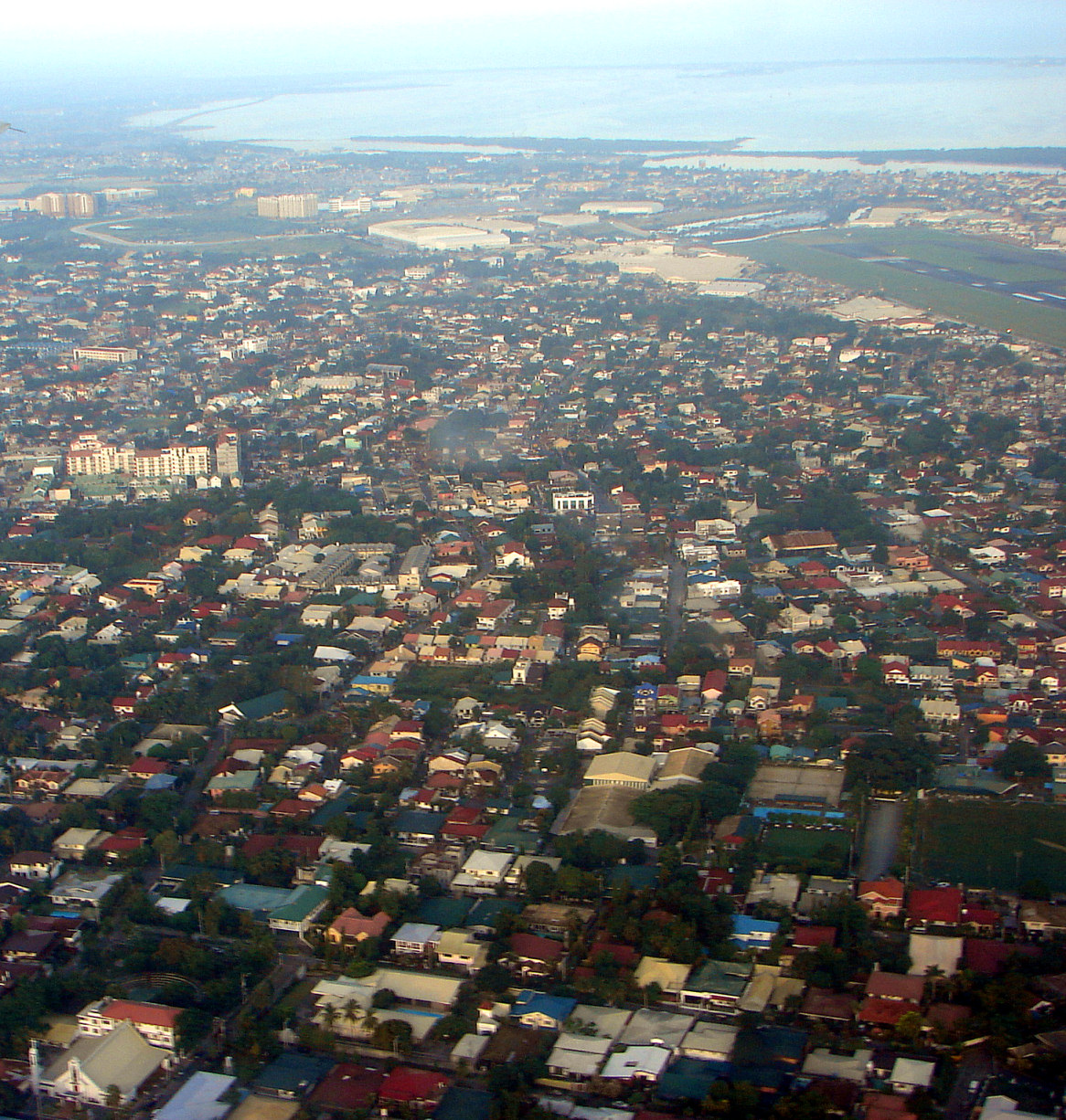


Paranaque City, Philippines
Paranaque City is a city of 703,245 people in National Capital Region, Philippines, founded in 1572.
Why visit Paranaque City
Townapedia lists 7 museums and landmarks, 33 parks and trails, 262 places to eat, 15 places to stay and 8 attractions in and around town.
Highlights include Felix Y. Manalo National Historical Landmark, KidZania Manila, Ayala Museum and Dessert Museum.
Weather in Paranaque City
Forecast from MET Norway (CC BY 4.0). Full forecast
About Paranaque City
Parañaque, officially the City of Parañaque (Filipino: Lungsod ng Parañaque, Tagalog pronunciation: [paɾaˈɲäke̞]), is a highly urbanized city in the National Capital Region of the Philippines. According to the 2024 census, it has a population of 703,245 people.
From the Wikipedia article Parañaque (this version), under CC BY-SA 4.0.
Travel tips from other travellers: Paranaque City on Wikivoyage (CC BY-SA 4.0).
Things to do8

Felix Y. Manalo National Historical Landmark
Monument and historic site · 8.8 km
National Historical Landmark for the birthplace of Felix Y. Manalo

KidZania Manila
Monument and historic site · 8.9 km
Family entertainment center in Taguig, Philippines
Star City, Manila
Monument and historic site · 8.9 km
Amusement park in the Philippines

Wawa Bridge
Bridge · 5.1 km
Bridge in Bacoor and Las Piñas, Philippines
Zapote Bridge
Bridge · 5.8 km
Historic stone arch bridge between Bacoor and Las Piñas in the Philippines

Airplane Observation Deck
Scenic view · 2.4 km
Upper floor in Shell Select has viewing deck

Museums and landmarks7

Ayala Museum
Museum · 8.0 km
Art and history museum in, Ayala Museum Building


GSIS Museo ng Sining
Museum · 8.1 km
Art museum in Metro Manila, Philippines

Museo del Galeón
Museum · 7.4 km
Maritime history museum in the Philippines

The Mind Museum
Museum · 8.4 km
Science museum in Metro Manila, Philippines
Meditation Tower
Monument and historic site · 2.9 km
Supposed to be two hands clasped together in prayer.
Parks, trails and playgrounds33

Ayala Triangle Gardens
Park · 8.4 km
Urban park in Makati, Philippines

Las Piñas–Parañaque Critical Habitat and Ecotourism Area
Park · 4.1 km
Protected coastal area in Metro Manila, Philippines

Legazpi Active Park
Park · 8.1 km
Public space and pocket park in Makati Central Business District



Greenheights Circon Park
Park · 1.3 km
Park with Basketball Court, playground, wishing well, mango tree.

The Azure Beach Club
Sports field and stadium · 2.8 km
West Service Road, Parañaque
21 more on the map.
Restaurants and cafes262


Dolora's Hauz of Pancit Malabon
Restaurant · Pancit Malabon · 1.0 km
004 Doña Soledad Avenue, Paranaque
Mo-Su 08:00-20:00
Open in Google Maps · +6328734-9775;+6327728-4462;+639098202567
Dolora's Hauz of Pancit Malabon (Sucat Branch)
Restaurant · Pancit Malabon · 1.5 km
99 San Antonio Avenue, Parañaque
Mo-Su 08:00-20:00
Open in Google Maps · (02) 8833-2398 / (02)7746-3238 / 0909-954-1142
Starbucks
Cafe · Coffee Shop · 2.7 km
Doña Soledad Avenue
Mo-Th 08:00-21:00; Fr-Su 08:00-22:00

4th's Burgers
Restaurant · Burger · 2.1 km
64 Doña Soledad Avenue, Parañaque
Mo-Su 12:00-22:00
Alpha's Original Lapaz Batchoy
Restaurant · Soup, Snacks · 2.6 km
Alfa Romeo Street, Paranaque
Mo-Su 09:00-21:00
Dixies
Restaurant · 1.9 km
117 Multinational Avenue
07:00-21:00
250 more on the map.
Where to stay15
Kinetsu Worlwide Express (T.I. Baguio)
Motel and hotel · 2.9 km
Ninoy Aquino Avenue, Parañaque
Lion's Den Backpackers Hostel
Motel and hotel · 2.1 km
22 President Roxas Street, Parañaque
Churches and places of worship54
Church of Jesus Christ of Latter-day Saints Parañaque 4th Ward Chapel
Church · Latter Day Saints · 1.0 km
Doña Soledad Avenue, Parañaque
Lord's Lighthouse International Ministries
Church · Born Again · 1.3 km
2/f 164 Doña Soledad Avenue, Parañaque
Shopping47
Duty Free Philippines Fiesta Mall
Shopping center · 2.9 km
Ninoy Aquino Avenue, Parañaque
Gas and EV charging44
Schools, colleges and libraries88
Immaculate Heart of Mary College-Parañaque
School · 0.8 km
Saint Dominic Savio Street, Parañaque
Parañaque National High School
School · 2.0 km
Kay Talise Street, Parañaque
Healthcare49
Mercury Drug
Clinic and pharmacy · 1.7 km
Jaka Plaza Dr. A. Santos Avenue, Parañaque
Paranaque Social Hygiene Clinic
Clinic and pharmacy · 1.3 km
San Antonio Avenue, Parañaque
Unihealth-Parañaque Hospital and Medical Center
Hospital · 1.9 km
Dr. A. Santos Avenue, Parañaque
Map of Paranaque City
250 places. The map loads OpenStreetMap tiles when you open it.
Getting there and nearby towns
Ninoy Aquino International Airport (MNL) is the nearest airport with scheduled flights listed in OpenStreetMap, 3 km away.
- Upper Bicutan 4 km northeast, about 4 min by car
- Las Piñas 5 km southwest, about 5 min by car
- Pasay 6 km north, about 6 min by car
- Baclaran 6 km northwest, about 6 min by car
- Taguig 8 km northeast, about 8 min by car
- Makati City 8 km north, about 8 min by car
- Pateros 9 km northeast, about 9 min by car
- Bel Air 9 km north, about 9 min by car
- Bacoor 9 km west, about 9 min by car
- Imus 10 km southwest, about 10 min by car
Drive times are estimates from straight-line distance, not routes.
Local news
Headlines from INDB.
Reviews, tips and questions
Loading what members have shared...
Sources and licences
- GeoNames (CC BY 4.0): population, coordinates, regions and time zone
- OpenStreetMap contributors (ODbL 1.0): places, airports, map data
- Wikidata (CC0 1.0): elevation, founding date, time zone, website, landmarks and historic places
- Wikimedia Commons (see each image): photos
- Wikipedia (CC BY-SA 4.0): overview and history text
Photo credits
- Paranaque City, P199, CC BY-SA 3.0
- PasayHallSchoolMarketjf9840 26, Ramon FVelasquez, CC BY-SA 3.0
- FelixManalojf0056 06, Ramon FVelasquez, CC BY-SA 3.0
- Dessert Museum Entrance, LittleT889, CC BY-SA 4.0
- The Galeon dome construction (June 2016), Hariboneagle927, CC BY-SA 4.0
- Ayala Triangle Gardens, RioHondo ( talk ) ( Uploads ), CC BY 3.0
- LPPCHEA, Klienneeco, CC BY-SA 4.0
- Legazpi Active Park Makati CBD, RioHondo, CC BY-SA 4.0
- Salcedo Park 01, RioHondo ( talk ) ( Uploads ), CC BY-SA 4.0
- 6081Sucat Muntinlupa Park Covered Court Laguna de Bay 12, Judgefloro, CC0
- Washington SyCip Park Zen Garden, Hariboneagle927, CC BY-SA 4.0
- Archdiocesan Shrine of Jesus the Way, the Truth, and the Life - Reclamation Area, Pasay City August 2022, Ralff Nestor Nacor, CC BY-SA 4.0
- Iglesia ni Cristo chapel, Makati, Arius1998, CC BY-SA 4.0
- 9146Mary Help of Christians Parañaque, Judgefloro, CC0
- Saint Andrew Cathedral, Parañaque City, Elmer B. Domingo, CC BY-SA 4.0
- ShrineofSt.Therese,DoctoroftheChurchjf9743 11, Ramon FVelasquez, CC BY-SA 3.0
- Simborio, Taguig Cemetery (2020), Ralff Nestor Nacor, CC BY-SA 4.0
- SVNHSFacade, Svnhs2008, CC BY-SA 4.0
- 04247jfAsia Pacific College Magallanes Village Makati Cityfvf 10, Judgefloro, CC0
- Parañaque Cathedral, Nov 2023, Ralff Nestor Nacor, CC BY-SA 4.0
- ArchdiocesanShrineofSaint Annejf0083 05, Ramon FVelasquez, CC BY-SA 3.0
- PNHS Quadrangle V.2., Mark Lance Olaguera, CC BY-SA 4.0
- GSIS Museum 20230428, Dcalviar2, CC BY-SA 4.0
- Mercado del Lago, Lakeshore Taguig, JParis, CC BY-SA 4.0
- Hidden pride socks, Creativekai, CC BY-SA 4.0
- 9306Mary Help of Christians in the Philippines 33, Judgefloro, CC0
- 9396Don Bosco, Parañaque 13, Judgefloro, CC0
- 9306Mary Help of Christians in the Philippines 41, Judgefloro, CC0
- 9306Mary Help of Christians in the Philippines 02, Judgefloro, CC0
- 9306Mary Help of Christians in the Philippines 23, Judgefloro, CC0
- 9160Mary Help of Christians Parish 03, Judgefloro, CC0
- 9306Mary Help of Christians in the Philippines 45, Judgefloro, CC0
- 9306Mary Help of Christians in the Philippines 04, Judgefloro, CC0
- 9114Mary Help of Christians Parish 19, Judgefloro, CC0
- 9251Mary Help of Christians Parish 43, Judgefloro, CC0
- 9251Mary Help of Christians Parish 47, Judgefloro, CC0
- 9251Mary Help of Christians Parish 33, Judgefloro, CC0
- 9251Mary Help of Christians Parish 49, Judgefloro, CC0
- 9114Mary Help of Christians Parish 48, Judgefloro, CC0
- 9114Mary Help of Christians Parish 18, Judgefloro, CC0
- Ayala Museum, Makati, Feb 2025 (9), Ralff Nestor Nacor, CC BY-SA 4.0


Page built November 8, 2026. Spotted a mistake? Tell us or suggest a place.