


Parang, Philippines
Parang is a town of 44,930 people in Autonomous Region in Muslim Mindanao, Philippines, founded in August 18, 1947.
Why visit Parang
Townapedia lists 1 museum or landmark, 5 parks and trails, 17 places to eat and 5 attractions in and around town.
Highlights include Mado Hot Spring National Park and Tantawan Park.
Weather in Parang
Forecast from MET Norway (CC BY 4.0). Full forecast
About Parang
Parang, officially the Municipality of Parang (Maguindanaon: Inged nu Parang, Jawi: ايڠايد نو ڤارڠ; Iranun: Inged a Parang, ايڠايد ا ڤارڠ; Tagalog: Bayan ng Parang), is a municipality in the province of Maguindanao del Norte, Philippines. According to the 2024 census, it had a population of 123,209.
From the Wikipedia article Parang, Maguindanao del Norte (this version), under CC BY-SA 4.0.
Things to do5


Museums and landmarks1

Parks, trails and playgrounds5

Mado Hot Spring National Park
Park · 14.5 km
National park in the Philippines



Restaurants and cafes17


5 more on the map.
History
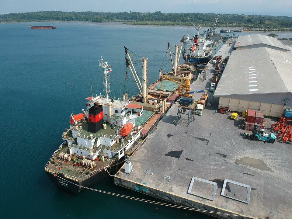
The history of Parang traces back to the era when it used to be an integral part of the Maguindanao Sultanate. In June 1851, the Spanish military government based in Zamboanga sent forces to Polloc, presently a barangay of Parang, and seized it. Having a natural deep water harbor, the Spanish then set up a fortress and a naval base at Polloc, from which they would launch military operations against the Moros of the Pulangui Valley.
Polloc eventually grew into a small town that by 1860 it was home to 600 Christians and 50-60 Chinese traders along with people from other walks of life. In 1884, a road was built between Polloc and the other town of Cotabato, which was founded ten years later than Polloc in 1861 and now served as the capital of the 5th Military District of Cotabato in which Polloc was part of.
From the History section of Parang, Maguindanao del Norte on Wikipedia, under CC BY-SA 4.0.
Churches and places of worship9
Gas and EV charging7
Schools, colleges and libraries30
Amir Bara Lidasan National High School
School · 4.2 km
Simuay-Landasan-Parang Road, Parang
ARMM Regional Science High School
School · 4.3 km
Simuay-Landasan-Parang Road, Parang
Sultan Mastura National High School
School · 7.4 km
Simuay-Landasan-Parang Road, Sultan Mastura
Tapayan Central Elementary School
School · 7.4 km
Simuay-Landasan-Parang Road, Sultan Mastura
Healthcare3
Map of Parang
77 places. The map loads OpenStreetMap tiles when you open it.
Getting there and nearby towns
Cotabato Airport (CBO) is the nearest airport with scheduled flights listed in OpenStreetMap, 24 km away.
- Sultan Kudarat 16 km south, about 16 min by car
- Dinaig 23 km south, about 23 min by car
- Midsayap 35 km southeast, about 35 min by car
- Wao 56 km northeast, about 56 min by car
- Pikit 57 km southeast, about 57 min by car
- Kabacan 68 km southeast, about 1 h 15 min by car
- Kalilangan 67 km northeast, about 1 h by car
- Marawi City 70 km north, about 1 h 15 min by car
- Tacurong 88 km southeast, about 1 h 30 min by car
- Don Carlos 88 km northeast, about 1 h 30 min by car
Drive times are estimates from straight-line distance, not routes.
Local news
Headlines from INDB.
Reviews, tips and questions
Loading what members have shared...
Sources and licences
- GeoNames (CC BY 4.0): population, coordinates, regions and time zone
- OpenStreetMap contributors (ODbL 1.0): places, airports, map data
- Wikidata (CC0 1.0): elevation, founding date, time zone, website, landmarks and historic places
- Wikimedia Commons (see each image): photos
- Wikipedia (CC BY-SA 4.0): overview and history text
Photo credits
- Polloc Port, MarkoDalisay, CC BY-SA 4.0
- Tantawan Park Cotabato City, MarkoDalisay, CC BY-SA 4.0
- PT boats speed through Polloc Harbor, Mindanao, while supporting landings there, boat in background appears to be PT-150 April 17th 1945. (50250595783), tormentor4555, PDM-owner
- ISS059-E-66629 - View of Earth, Earth Science and Remote Sensing Unit, NASA Johnson Space Center, Public domain
- ISS059-E-66628 - View of Earth, Earth Science and Remote Sensing Unit, NASA Johnson Space Center, Public domain
- ISS053-E-203617 - View of Earth, Earth Science and Remote Sensing Unit , Lyndon B. Johnson Space Center, Public domain
- ISS059-E-66627 - View of Earth, Earth Science and Remote Sensing Unit, NASA Johnson Space Center, Public domain
- ISS053-E-205356 - View of Earth, Earth Science and Remote Sensing Unit , Lyndon B. Johnson Space Center, Public domain


Page built November 7, 2026. Spotted a mistake? Tell us or suggest a place.