


Pinambaran, Philippines
Pinambaran is a town of 3,378 people in Central Luzon, Philippines.
Loading the weather...
Population3,378
GeoNames
RegionCentral Luzon
Elevation24 m
79 ft
Time zoneAsia/Manila
Nearest airportClark International Airport (CRK)
45 km
Weather in Pinambaran
Forecast from MET Norway (CC BY 4.0). Full forecast
Churches and places of worship1

Gas and EV charging2



Schools, colleges and libraries6

Advertisement
Map of Pinambaran
9 places. The map loads OpenStreetMap tiles when you open it.
Getting there and nearby towns
Clark International Airport (CRK) is the nearest airport with scheduled flights listed in OpenStreetMap, 45 km away.
- San Miguel 7 km south, about 7 min by car
- Gapan 12 km north, about 12 min by car
- San Ildefonso 14 km south, about 14 min by car
- Cabiao 14 km west, about 14 min by car
- Jaen 15 km northwest, about 15 min by car
- San Leonardo 18 km north, about 18 min by car
- San Antonio 17 km northwest, about 17 min by car
- Candaba 20 km southwest, about 20 min by car
- Papaya 20 km northwest, about 20 min by car
- Arayat 23 km west, about 23 min by car
Drive times are estimates from straight-line distance, not routes.
Local news
Headlines from INDB.
Reviews, tips and questions
Loading what members have shared...
Sources and licences
- GeoNames (CC BY 4.0): population, coordinates, regions and time zone
- Mapillary (see each image): photos
- OpenStreetMap contributors (ODbL 1.0): places, airports, map data
- Wikidata (CC0 1.0): elevation, founding date, time zone, website
- Wikimedia Commons (see each image): photos
Photo credits
- Gerrys Toyota Hiace rear, GianSAN, CC BY-SA 4.0
- 0004Maharlika Highway San Miguel 08, Judgefloro, CC0
- 9905Maharlika Highway San Miguel public transport in the Philippines during the pandemic 71, Judgefloro, CC0
- 9905Maharlika Highway San Miguel public transport in the Philippines during the pandemic 73, Judgefloro, CC0
- 9905Maharlika Highway San Miguel public transport in the Philippines during the pandemic 47, Judgefloro, CC0
- 9905Maharlika Highway San Miguel public transport in the Philippines during the pandemic 58, Judgefloro, CC0
- 9905Maharlika Highway San Miguel public transport in the Philippines during the pandemic 75, Judgefloro, CC0
- 9905Maharlika Highway San Miguel public transport in the Philippines during the pandemic 34, Judgefloro, CC0
- 9905Maharlika Highway San Miguel public transport in the Philippines during the pandemic 07, Judgefloro, CC0
- 9905Maharlika Highway San Miguel public transport in the Philippines during the pandemic 43, Judgefloro, CC0
- 0004Maharlika Highway San Miguel 10, Judgefloro, CC0
- 9905Maharlika Highway San Miguel public transport in the Philippines during the pandemic 51, Judgefloro, CC0
- 9905Maharlika Highway San Miguel public transport in the Philippines during the pandemic 59, Judgefloro, CC0
- 9905Maharlika Highway San Miguel public transport in the Philippines during the pandemic 57, Judgefloro, CC0
- 9905Maharlika Highway San Miguel public transport in the Philippines during the pandemic 64, Judgefloro, CC0
- 9905Maharlika Highway San Miguel public transport in the Philippines during the pandemic 50, Judgefloro, CC0
- 9905Maharlika Highway San Miguel public transport in the Philippines during the pandemic 54, Judgefloro, CC0
- 9905Maharlika Highway San Miguel public transport in the Philippines during the pandemic 29, Judgefloro, CC0
- 0004Maharlika Highway San Miguel 04, Judgefloro, CC0
- 9905Maharlika Highway San Miguel public transport in the Philippines during the pandemic 33, Judgefloro, CC0
- 9905Maharlika Highway San Miguel public transport in the Philippines during the pandemic 76, Judgefloro, CC0
- 9905Maharlika Highway San Miguel public transport in the Philippines during the pandemic 01, Judgefloro, CC0
- 9905Maharlika Highway San Miguel public transport in the Philippines during the pandemic 18, Judgefloro, CC0
- 9905Maharlika Highway San Miguel public transport in the Philippines during the pandemic 62, Judgefloro, CC0
- 9905Maharlika Highway San Miguel public transport in the Philippines during the pandemic 74, Judgefloro, CC0
- 0004Maharlika Highway San Miguel 09, Judgefloro, CC0
- 9905Maharlika Highway San Miguel public transport in the Philippines during the pandemic 27, Judgefloro, CC0
- 9905Maharlika Highway San Miguel public transport in the Philippines during the pandemic 10, Judgefloro, CC0
- 9905Maharlika Highway San Miguel public transport in the Philippines during the pandemic 32, Judgefloro, CC0
- 9905Maharlika Highway San Miguel public transport in the Philippines during the pandemic 12, Judgefloro, CC0
- 0004Maharlika Highway San Miguel 01, Judgefloro, CC0
- 9905Maharlika Highway San Miguel public transport in the Philippines during the pandemic 22, Judgefloro, CC0
- 0004Maharlika Highway San Miguel 06, Judgefloro, CC0
- 9905Maharlika Highway San Miguel public transport in the Philippines during the pandemic 56, Judgefloro, CC0
- 9905Maharlika Highway San Miguel public transport in the Philippines during the pandemic 41, Judgefloro, CC0
- 9905Maharlika Highway San Miguel public transport in the Philippines during the pandemic 48, Judgefloro, CC0
- 9905Maharlika Highway San Miguel public transport in the Philippines during the pandemic 40, Judgefloro, CC0
- 9905Maharlika Highway San Miguel public transport in the Philippines during the pandemic 61, Judgefloro, CC0
- 9905Maharlika Highway San Miguel public transport in the Philippines during the pandemic 70, Judgefloro, CC0
- 9905Maharlika Highway San Miguel public transport in the Philippines during the pandemic 14, Judgefloro, CC0
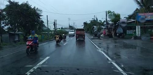
- Street-level photo, mdgabriel, CC BY-SA 4.0
- Street-level photo, mdgabriel, CC BY-SA 4.0
- Street-level photo, mdgabriel, CC BY-SA 4.0


Page built November 7, 2026. Spotted a mistake? Tell us or suggest a place.