
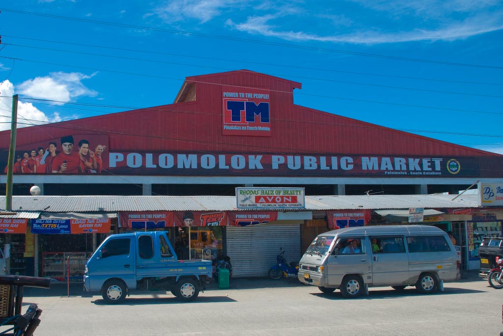


Polomolok, Philippines
Polomolok is a town of 63,987 people in Soccsksargen, Philippines, founded in August 21, 1957.
Why visit Polomolok
Townapedia lists 2 museums and landmarks, 11 parks and trails, 36 places to eat, 16 places to stay and 4 attractions in and around town.
Weather in Polomolok
Forecast from MET Norway (CC BY 4.0). Full forecast
About Polomolok
Polomolok, officially the Municipality of Polomolok, is a municipality in the province of South Cotabato, Philippines. In the 2024 census, it has a population of 176,671 people making it both the most populated municipality in Mindanao and the most populated municipality outside Luzon.
From the Wikipedia article Polomolok (this version), under CC BY-SA 4.0.
Travel tips from other travellers: Polomolok on Wikivoyage (CC BY-SA 4.0).
Things to do4


Museums and landmarks2

Parks, trails and playgrounds11

Dr. Jorge Calderon Park
Park · 3.3 km
Cannery Housing, Brgy. Cannery Site Cannery Road, Polomolok



Restaurants and cafes36


Nadies Chicken House
Restaurant · Chicken · 0.6 km
General Santos-Koronadal Highway, South Cotabato
North Deck Sinawal
Cafe · Dessert, Hot Chocolate · 11.4 km
Albert Morrow Boulevard, General Santos City
Hotfilter Fastfood and Restaurant
Restaurant · 14.2 km
Nuñez Street, General Santos
24 more on the map.
History
The name Polomolok is derived from the Blaan term flomlok, meaning "hunting ground." In its early years, the area where the present-day Poblacion stands was known for its abundance of wild life. With no established roads, lowland settlers relied on the Blaan highlanders as guides. In addition to its rich hunting grounds, Polomolok was characterized by numerous creeks with clear, free-flowing water from the surrounding hills, which attracted settlers. Among the early inhabitants was a Japanese trader, Zenjiro Takahashi, and his Blaan wife. He began clearing the land and cultivating agricultural crops. Over time, Christian settlers also arrived, further developing the area.
From the History section of Polomolok on Wikipedia, under CC BY-SA 4.0.
Where to stay16
Emily T. Pension House
Motel and hotel · 0.6 km
General Santos-Koronadal Highway, Polomolok
Dolores Farm Resort
Motel and hotel · 1.8 km
General Santos-Koronadal Highway, Polomolok
Southwinds Park Inn Hotel
Motel and hotel · 11.7 km
Albert Morrow Boulevard, General Santos City
Venue 88
Motel and hotel · 14.4 km
Leopoldo Dacera Sr. Avenue, General Santos City
Churches and places of worship42
Apostolic Ministries for Christ Inc church
Church · Pentecostal · 12.8 km
Mabuhay Road
Kingdom Hall of Jehovah's Witnesses
Church · Jehovahs Witness · 10.6 km
Mabuhay Road, General Santos
Lokal ng Glamang, Iglesia ni Cristo
Church · Iglesia Ni Cristo · 7.4 km
Glamang Road
Our Lady of Manaoag
Church · Roman Catholic · 13.7 km
Nuñez Extension, General Santos City
The Church Of Jesus Christ of Latter Day Saints
Place of worship · Mormon · 0.6 km
Uranus, Polomolok
Vestige Christian Alliance Church
Church · Evangelical · 13.1 km
M. Rufilla Avenue, General Santos City
Apostolic Ministries for Christ
Place of worship · 12.8 km
Leopoldo D. Dacera Avenue
Shopping26
AI Everlasting Enterprises
Hardware store · 12.4 km
Leopoldo D. Dacera Avenue, General Santos City
AL- EQWA Coco Lumber & Construction Spplies
Hardware store · 12.1 km
Rizal Avenue
Alde Hardware and Construction Supply
Hardware store · 12.9 km
Leopoldo D. Dacera Avenue
BIM Diam's Marketing
Hardware store · 12.4 km
Leopoldo D. Dacera Avenue, General Santos City
CDSaver Engineering Works & Integrated Supply
Hardware store · 11.8 km
Makar-Marbel Road
Gaisano Grand Polomolok
Shopping center · 0.7 km
General Santos-Koronadal Highway
JCML Hardware & Construction Supply
Hardware store · 12.9 km
Leopoldo D. Dacera Avenue
Kean Nel Marketing
Hardware store · 12.5 km
Leopoldo D. Dacera Avenue, General Santos City
Gas and EV charging17
Schools, colleges and libraries108
Notre Dame - Siena College of General Santos City
School · 13.7 km
NLSA Road, General Santos
JL Valencia Academy, Inc. Campus
School · 2.0 km
Cannery Road, Polomolok, South Cotabato
New Society National High School
School · 12.1 km
Marcos Avenue, General Santos City
Poblacion Polomolok National High School
School · 1.9 km
B. Bayan Sr. Street, Polomolok
Healthcare9
Map of Polomolok
250 places. The map loads OpenStreetMap tiles when you open it.
Getting there and nearby towns
General Santos International Airport (GES) is the nearest airport with scheduled flights listed in OpenStreetMap, 18 km away.
- General Santos 17 km southeast, about 17 min by car
- Alabel 28 km southeast, about 28 min by car
- Koronadal 39 km northwest, about 39 min by car
- Banga 39 km northwest, about 39 min by car
- Surallah 39 km northwest, about 39 min by car
- Lake Sebu 39 km west, about 39 min by car
- Padada 56 km northeast, about 56 min by car
- Magsaysay 62 km north, about 1 h by car
- Buluan 63 km northwest, about 1 h by car
- Malita 64 km east, about 1 h by car
Drive times are estimates from straight-line distance, not routes.
Local news
Headlines from INDB.
Reviews, tips and questions
Loading what members have shared...
Sources and licences
- GeoNames (CC BY 4.0): population, coordinates, regions and time zone
- OpenStreetMap contributors (ODbL 1.0): places, airports, map data
- Wikidata (CC0 1.0): elevation, founding date, time zone, website, landmarks and historic places
- Wikimedia Commons (see each image): photos
- Wikipedia (CC BY-SA 4.0): overview and history text
Photo credits
- Polomolok Public Market, Engr. Mervin Martinez Gonzales, CC BY-SA 3.0
- Dolores Farm Resort sunset Polomolok - Flickr, Thomas Galvez from Ho Chi Minh City, Vietnam, CC BY 2.0
- Dole Philippines pineapple plantation in Polomolok - Flickr, Thomas Galvez from Ho Chi Minh City, Vietnam, CC BY 2.0
- ISS022-E-65660 - View of Earth, Earth Science and Remote Sensing Unit , Lyndon B. Johnson Space Center, Public domain
- Mt. Matutum, Precipitated, CC BY-SA 4.0
Page built November 7, 2026. Spotted a mistake? Tell us or suggest a place.