



San Agustin, Philippines
San Agustin is a town of 4,258 people in Mimaropa, Philippines, founded in 1631.
Why visit San Agustin
Townapedia lists 1 museum or landmark, 2 parks and trails, 2 places to eat, 8 places to stay and 6 attractions in and around town.
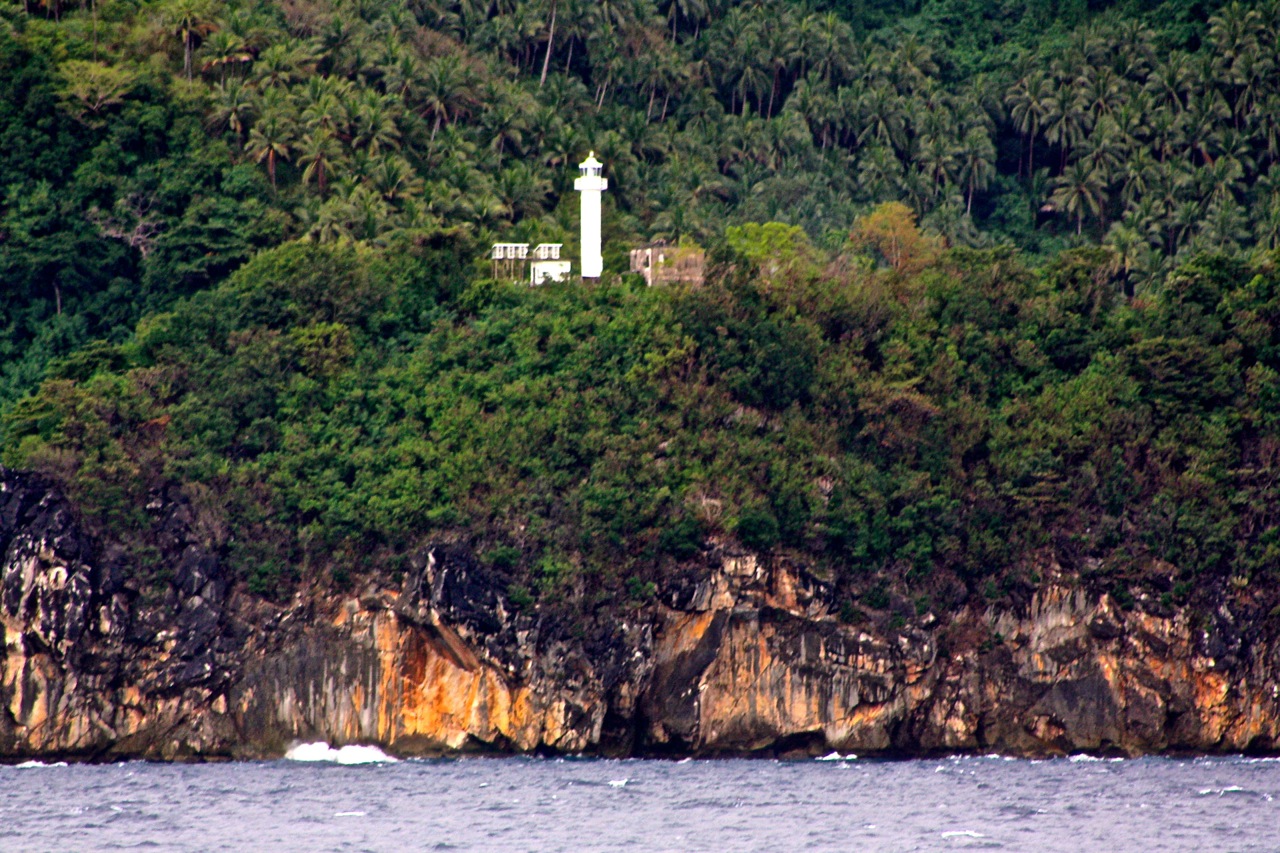
Highlights include Gorda Point Lighthouse.
Weather in San Agustin
Forecast from MET Norway (CC BY 4.0). Full forecast
About San Agustin
San Agustin, officially the Municipality of San Agustin, (formerly Guintigui-an and Badajoz), is a municipality in the province of Romblon, Philippines. According to the 2024 census, it has a population of 23,698 people.
From the Wikipedia article San Agustin, Romblon (this version), under CC BY-SA 4.0.
Things to do6
Gorda Point Lighthouse
Lighthouse · 10.4 km
Lighthouse in the Philippines


Museums and landmarks1

Parks, trails and playgrounds2

Restaurants and cafes2

History
San Agustín was known during Spanish times as Guintigui-an because of the abundance of a fish called "tigue" in the area. Negrito and Mangyan tribes from Panay and Mindoro were the first inhabitants, as well as migrants from island of Romblon, and southern Tablas.
In the early part of Spanish conquest, the first settlement was at barangay Cabolutan. The early settlers found it very tiring at times to cross the channel to Romblon town to attend to civil and religious duties. To solve this problem, Cabolutan leaders discussed the matter such as building a visita in their settlement of around 250 souls. Finally in 1635, the first church building made of coral stone and lime was started.
From the History section of San Agustin, Romblon on Wikipedia, under CC BY-SA 4.0.
Where to stay8
Churches and places of worship9
Shopping2
Schools, colleges and libraries26
Map of San Agustin
56 places. The map loads OpenStreetMap tiles when you open it.
Getting there and nearby towns
Tablas Airport (TBH) is the nearest airport with scheduled flights listed in OpenStreetMap, 29 km away.
- Dobdoban 2 km west, about 2 min by car
- Carmen 5 km north, about 5 min by car
- Calatrava 9 km northwest, about 9 min by car
- Romblon 15 km east, about 15 min by car
- Alad 14 km northeast, about 14 min by car
- Cajimos 16 km east, about 16 min by car
- Panique 16 km southwest, about 16 min by car
- Bansud 80 km northwest, about 1 h 15 min by car
- Ibajay 83 km south, about 1 h 30 min by car
- Pinamalayan 90 km northwest, about 1 h 30 min by car
Drive times are estimates from straight-line distance, not routes.
Local news
Headlines from INDB.
Reviews, tips and questions
Loading what members have shared...
Sources and licences
- GeoNames (CC BY 4.0): population, coordinates, regions and time zone
- OpenStreetMap contributors (ODbL 1.0): places, airports, map data
- Wikidata (CC0 1.0): elevation, founding date, time zone, website, landmarks and historic places
- Wikimedia Commons (see each image): photos
- Wikipedia (CC BY-SA 4.0): overview and history text
Photo credits
- Mount Payaopao, Makahilo, CC BY-SA 3.0
- Boats to romblon from san agustin pier - panoramio, Martyn Savident, CC BY-SA 3.0
- San agustin tablas romblon - panoramio, Martyn Savident, CC BY-SA 3.0
- San Agustin, Romblon, Philippines - panoramio, Martyn Savident, CC BY-SA 3.0
- San agustin harbour - panoramio, Martyn Savident, CC BY-SA 3.0
- Gorda Point Lighthouse, Alexcooper1, CC BY-SA 4.0
- ISS067-E-159434 - View of Earth, Earth Science and Remote Sensing Unit , Lyndon B. Johnson Space Center, Public domain
- ISS056-E-199683 - View of Earth, Earth Science and Remote Sensing Unit, NASA Johnson Space Center, Public domain
- STS126-E-5076 - View of Earth, NASA, Public domain
- ISS056-E-199682 - View of Earth, Earth Science and Remote Sensing Unit, NASA Johnson Space Center, Public domain


Page built November 8, 2026. Spotted a mistake? Tell us or suggest a place.