
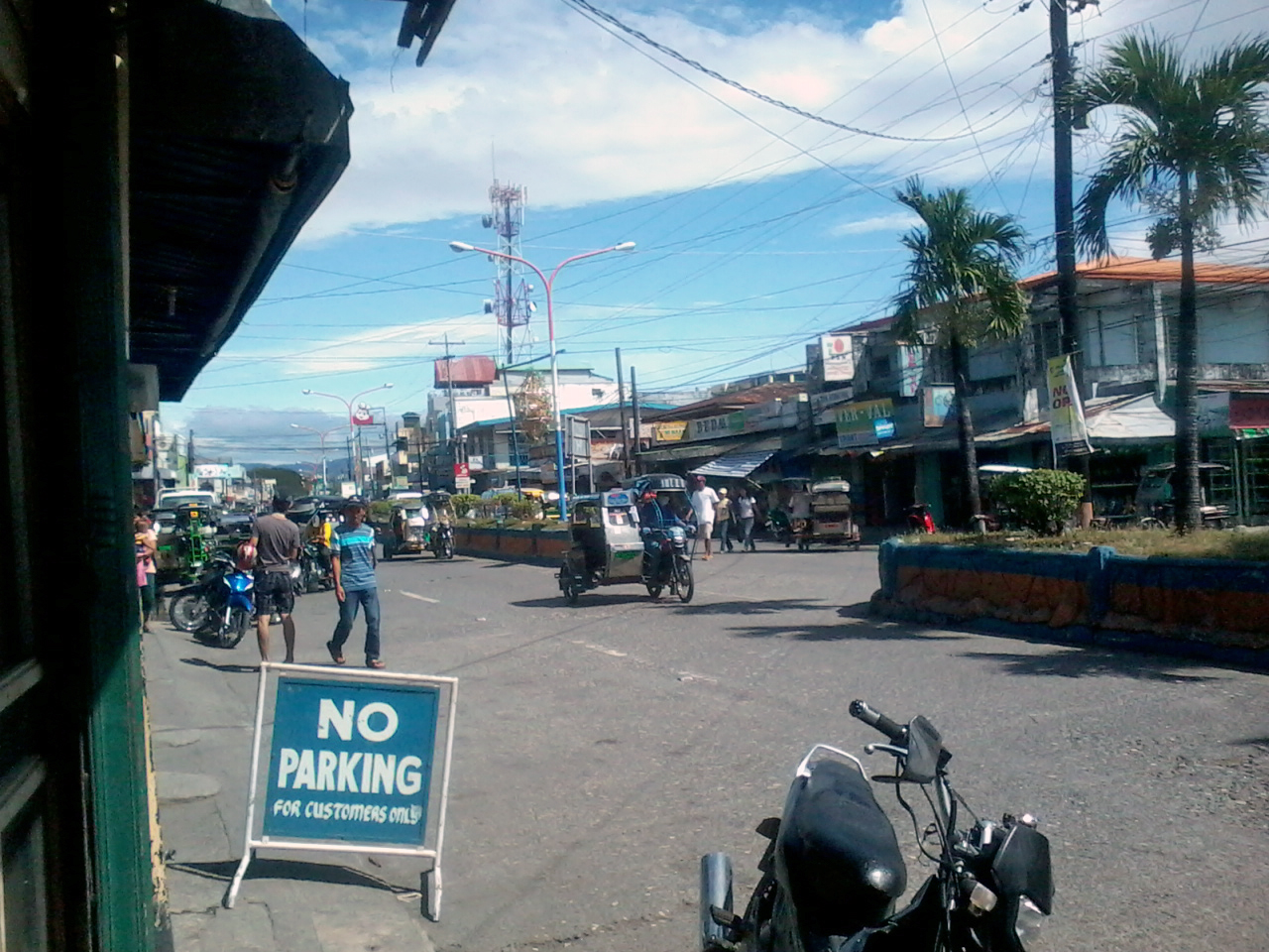


San Jose, Philippines
San Jose is a city of 143,495 people in Mimaropa, Philippines, founded in May 1, 1910.
Why visit San Jose
Townapedia lists 4 museums and landmarks, 5 parks and trails, 22 places to eat, 18 places to stay and 6 attractions in and around town.
Highlights include Landing at Mindoro and Occidental Mindoro Sports Complex.
Weather in San Jose
Forecast from MET Norway (CC BY 4.0). Full forecast
About San Jose
San Jose, officially the Municipality of San Jose (Tagalog: Bayan ng San Jose), is a municipality in the province of Occidental Mindoro, Philippines. According to the 2024 census, it has a population of 143,495 people.
From the Wikipedia article San Jose, Occidental Mindoro (this version), under CC BY-SA 4.0.
Travel tips from other travellers: San Jose on Wikivoyage (CC BY-SA 4.0).
Things to do6

Museums and landmarks4

Parks, trails and playgrounds5





Restaurants and cafes22




10 more on the map.
History
Historical records show that in the 14th century, Chinese traders anchored to trade at the shores of Mangarin, the oldest settlement in the southern portion of Occidental Mindoro. Its name was derived from the word “Mandarin”, an official Chinese Palace, the remains of which can still be found in the old barrio of Mangarin. The area was once a Sinified Buddhist state called Ma-i before the Sultanate of Brunei invaded. When the Spanish took possession of the Island in the 18th century, the first site of the Presidencia was built in sitio of Sinaoga, on the western side of Barrio Santa Teresa, now part of the municipality of Magsaysay. A year later, it was again transferred to Caminawit.
Archaeological evidence from caves and rockshelter sites in the island of Ilin indicate human habitation dating back thousands of years (Middle Holocene period, about 6,000 years ago).
From the History section of San Jose, Occidental Mindoro on Wikipedia, under CC BY-SA 4.0.
Where to stay18
Churches and places of worship26
Pentecostal Missionary Church of Christ (4th Watch)
Church · Pentecostal · 2.7 km
Labangan, San Jose
Caminawit Foursquare Gospel Church
Church · 2.2 km
Felix Y. Manalo Avenue, San Jose
Iglesia ni Cristo Lokal ng San Jose (Pag-asa)
Church · Iglesia Ni Cristo · 0.9 km
Shopping28
Robinsons Supermarket (Labangan Poblacion)
Shopping center · 1.4 km
Labangan Road, San Jose
Gas and EV charging17
EcoOil Gas Station - Pag-asa
Gas station · 1.4 km
Felix Y. Manalo Avenue, San Jose
Petron Gasoline Station (Caminawit)
Gas station · 1.8 km
Felix Y. Manalo Avenue, San Jose
Schools, colleges and libraries86
Healthcare8
Zapanta Maternity And General Hospital ZMGH
Hospital · 0.8 km
Felix Y. Manalo Avenue, San Jose
Map of San Jose
220 places. The map loads OpenStreetMap tiles when you open it.
Getting there and nearby towns
San Jose Airport (SJI) is the nearest airport with scheduled flights listed in OpenStreetMap, 2 km away.
- Bagong Sikat 2 km north, about 2 min by car
- Caminauit 3 km southeast, about 3 min by car
- Mangarine 3 km east, about 3 min by car
- Babug 4 km northwest, about 4 min by car
- Magsaysay 9 km east, about 9 min by car
- Sablayan 63 km northwest, about 1 h by car
- Bansud 71 km northeast, about 1 h 15 min by car
- Gloria 82 km northeast, about 1 h 15 min by car
- Socorro 87 km northeast, about 1 h 30 min by car
- Pinamalayan 88 km northeast, about 1 h 30 min by car
Drive times are estimates from straight-line distance, not routes.
Local news
Headlines from INDB.
Reviews, tips and questions
Loading what members have shared...
Sources and licences
- GeoNames (CC BY 4.0): population, coordinates, regions and time zone
- OpenStreetMap contributors (ODbL 1.0): places, airports, map data
- Wikidata (CC0 1.0): elevation, founding date, time zone, website, landmarks and historic places
- Wikimedia Commons (see each image): photos
- Wikipedia (CC BY-SA 4.0): overview and history text
Photo credits
- San Jose, Occidental Mindoro, Zuanzuanfuwa, CC BY-SA 3.0
- San Jose Municipal Townhall, Haley.Parrot, CC BY-SA 4.0
- San Jose Plaza Arch, Haley.Parrot, CC BY-SA 4.0
- San Jose Roundabout, San Jose, Occidental Mindoro, Philippines - panoramio, Allan Siquioco, CC BY 3.0
- San Jose Rotonda Landmark, Haley.Parrot, CC BY-SA 4.0
- Pandurucan, San Jose, Occidental Mindoro, Philippines - panoramio (1), Allan Siquioco, CC BY 3.0
- Pandurucan, San Jose, Occidental Mindoro, Philippines - panoramio, Allan Siquioco, CC BY 3.0
- Jasmin, Pag-asa, San Jose, Occidental Mindoro, Philippines - panoramio, Allan Siquioco, CC BY 3.0
- San Roque, San Jose, Occidental Mindoro, Philippines - panoramio, [email protected]…, CC BY 3.0
- Bagong Sikat, San Jose, Occidental Mindoro, Philippines - panoramio, Allan Siquioco, CC BY 3.0
- Bubog, San Jose, Occidental Mindoro, Philippines - panoramio, Allan Siquioco, CC BY 3.0
- Old Mangarin, San Jose, Occidental Mindoro, Philippines - panoramio, Allan Siquioco, CC BY 3.0
- Mangarin Elementary School, San Jose, Occidental Mindoro, Philippines - panoramio, Allan Siquioco, CC BY 3.0
- Bubog, San Jose, Occidental Mindoro, Philippines - panoramio (2), Allan Siquioco, CC BY 3.0
- Purok Antipolo, Barangay Mangarin, San Jose, Occidental Mindoro, Philippines - panoramio, Allan Siquioco, CC BY 3.0
- Mangarin, San Jose, Occidental Mindoro, Philippines - panoramio, Allan Siquioco, CC BY 3.0
- Bubog, San Jose, Occidental Mindoro, Philippines - panoramio (1), Allan Siquioco, CC BY 3.0
- Barangay Mabini Annex Elementary School, San Jose, Occidental Mindoro, Philippines - panoramio, Allan Siquioco, CC BY 3.0
- Bubog, San Jose, Occidental, Mindoro, Philippines - panoramio (2), Allan Siquioco, CC BY 3.0
- Bubog, San Jose, Occidental, Mindoro, Philippines - panoramio, Allan Siquioco, CC BY 3.0
- Bubog, San Jose, Occidental, Mindoro, Philippines - panoramio (1), Allan Siquioco, CC BY 3.0
- G.E. Ramirez Memorial Elementary School, Bayotbot, San Jose, Occidental Mindoro, Philippines - panoramio, Allan Siquioco, CC BY 3.0
- Camburay, San Jose, Occidental Mindoro, Phillipines - panoramio, Allan Siquioco, CC BY 3.0
- San Jose, Occidental Mindoro, Philippines - panoramio, Allan Siquioco, CC BY 3.0
- Sitio Mabuhay, Central, San Jose, Occidental Mindoro - panoramio, Allan Siquioco, CC BY 3.0
- Camburay, San Jose, Occidental Mindoro, Philippines - panoramio, Allan Siquioco, CC BY 3.0
- Camburay, San Jose, Occidental Mindoro, Philippines - panoramio (1), Allan Siquioco, CC BY 3.0
- Sitio Mabuhay, Barangay Central, San Jose, Occidental Mindoro - panoramio (1), Allan Siquioco, CC BY 3.0
- Occidental Mindoro State College, Hariboneagle927, CC BY-SA 4.0
- Arnoldus (building), Jhonil Avanzado, CC BY-SA 4.0
- St. Joseph Cathedral, San Jose, Occ Mindoro, Zuanzuanfuwa, CC BY-SA 3.0
- DWCSJ Western Gate, Haley.Parrot, CC BY-SA 4.0
- DWCSJ Gym (upper deck), Jhonil Avanzado, CC BY-SA 4.0
- DWCSJ gym (front), Jhonil Avanzado, CC BY-SA 4.0
- DWCSJ Gym (back), Jhonil Avanzado, CC BY-SA 4.0
- DWCSJ entrance gate, Sy.Paul, CC BY-SA 3.0
- DWCSJ Eastern Gate, Haley.Parrot, CC BY-SA 4.0
- Pandurucan Bridge night, Haley.Parrot, CC BY-SA 4.0
- View from Aguas, Rizal, Occ. Mindoro - panoramio, [email protected]…, CC BY 3.0
- ISS055-E-107754 - View of Earth, Earth Science and Remote Sensing Unit, NASA Johnson Space Center, Public domain
- San Jose Municipal Plaza Welcome Arch, Haley.Parrot, CC BY-SA 4.0
- Magsaysay town plaza road, Hariboneagle927, CC BY-SA 4.0


Page built November 8, 2026. Spotted a mistake? Tell us or suggest a place.