


Silang, Philippines
Silang is a city of 119,475 people in Calabarzon, Philippines, founded in 1917.
Why visit Silang
Townapedia lists 11 museums and landmarks, 35 parks and trails, 185 places to eat, 35 places to stay and 10 attractions in and around town.
Highlights include Matang Tubig, General Jose Ignacio Paua, Silang Church and Marcos Twin Mansion.
Weather in Silang
Forecast from MET Norway (CC BY 4.0). Full forecast
About Silang
Silang (Tagalog: [ˈsi.lɐŋ]), officially the Municipality of Silang (Filipino: Bayan ng Silang), is a municipality in the province of Cavite, Philippines. According to the 2024 census, it has a population of 313,145 people. Its land area is 209.43 km2 (80.86 sq mi), making it the largest municipality in Cavite.
From the Wikipedia article Silang, Cavite (this version), under CC BY-SA 4.0.
Travel tips from other travellers: Silang on Wikivoyage (CC BY-SA 4.0).
Things to do10
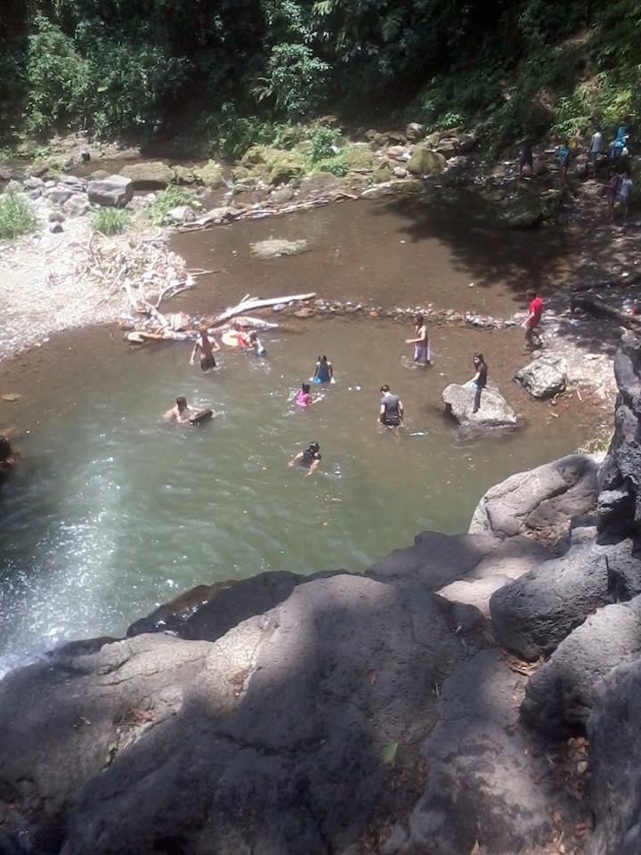
Matang Tubig
Waterfall · 7.9 km
Tourist attraction in Calamba, Laguna, Philippines




Museums and landmarks11

General Jose Ignacio Paua
Monument and historic site · 3.2 km
Aguinaldo Highway, Silang



Dasmariñas City Welcome Arch
Monument and historic site · 5.3 km
City of Dasmariñas;Home of the Paru-Paro Festival;Arch of Respect
Aguinaldo Highway, Dasmariñas
Gen. Vito Belarmino y Loyola
Monument and historic site
J. P. Rizal Street, Silang

Parks, trails and playgrounds35



Cordero's Compound
Park · 1.8 km
Residential
005 Silang-Banaybanay Road, Silang
Mo-Su 09:00-21:00
Washington Place Serenity Garden
Park · 7.0 km
60A-27 New Orleans, Dasmariñas
24/7
Washington Place Main Open Space
Park · 6.8 km
Common
Washington Avenue, Dasmariñas

23 more on the map.
Restaurants and cafes185


Ricardo's Coffee + Classic Cuisine
Cafe · 4.9 km
KM57+560 Crisanto M. De Los Reyes, Amadeo
Mo-Su 11:00-20:00
CaKe's Coffee and Tea
Cafe · Cake · 4.2 km
112 Crisanto M. Delos Reyes, Amadeo
Mo-Su 08:00-19:00
7MJ Arts and Drafts Biz Cafe
Cafe · 3.9 km
288 Ambid Street
Mo-Su 09:00-20:00
Haze Coffee House
Cafe · Coffee Shop · 2.7 km
J. P. Rizal Street, Silang
09:00-21:00
Hidden Charm
Restaurant · Regional · 6.9 km
M. Loyola Street, Silang
Mo-Sa 09:00-18:00

173 more on the map.
Where to stay35
Jesus Reigns Ministries - Amadeo
Campground · 5.6 km
Crisanto M. delos Reyes Avenue
Churches and places of worship55
WP Catholic Community
Church · Roman Catholic · 6.8 km
Washington Avenue, Dasmariñas
Cavite Mission of the Seventh-day Adventists Headquarters
Church · Seventh Day Adventist · 4.7 km
01 Crisanto M. delos Reyes Avenue, Amadeo
Hilltop Seventh-day Adventist Church
Church · Seventh Day Adventist · 5.8 km
Hilltop Street, Silang
Kingdom Hall of Jehovah's Witnesses
Church · Jehovahs Witness · 0.9 km
Emilio Aguinaldo Highway, Silang
Lumil Unida Evangelical Christian Church
Church · Evangelical · 5.6 km
Santa Rosa-Tagaytay Road, Silang
Shopping39
Gas and EV charging48
Schools, colleges and libraries121
Technological University of the Philippines-Cavite Campus
School · 14.5 km
Healthcare33
CCD's Generic Drugstore
Clinic and pharmacy · 6.8 km
Santa Rosa-Tagaytay Road, Silang
Kalymnos Generics Pharmacy and Medical Supplies
Clinic and pharmacy · 4.7 km
Aguinaldo Highway, Silang
South Prime Medical and Wellness Center
Hospital · 5.6 km
Crisanto M. delos Reyes Avenue, Amadeo
Map of Silang
250 places. The map loads OpenStreetMap tiles when you open it.
Getting there and nearby towns
Sangley Point Airport (SGL) is the nearest airport with scheduled flights listed in OpenStreetMap, 32 km away.
- Amadeo 7 km southwest, about 7 min by car
- Indang 10 km west, about 10 min by car
- Mendez-Nuñez 12 km southwest, about 12 min by car
- Dasmariñas 13 km north, about 13 min by car
- Tagaytay 14 km south, about 14 min by car
- Carmona 14 km northeast, about 14 min by car
- Talisay 15 km south, about 15 min by car
- Cabuyao 18 km east, about 18 min by car
- San Pedro 18 km northeast, about 18 min by car
- Biñan 18 km northeast, about 18 min by car
Drive times are estimates from straight-line distance, not routes.
Local news
Headlines from INDB.
Reviews, tips and questions
Loading what members have shared...
Sources and licences
- GeoNames (CC BY 4.0): population, coordinates, regions and time zone
- OpenStreetMap contributors (ODbL 1.0): places, airports, map data
- Wikidata (CC0 1.0): elevation, founding date, time zone, website, landmarks and historic places
- Wikimedia Commons (see each image): photos
- Wikipedia (CC BY-SA 4.0): overview and history text
Photo credits
- SilangCavitejf0087 06, Ramon FVelasquez, CC BY-SA 3.0
- Silang Public Market Extension, Cavite, Dec 2025, Ralff Nestor Nacor, CC BY-SA 4.0
- M. Belen St., Silang, Cavite, Dec 2025, Ralff Nestor Nacor, CC BY-SA 4.0
- Jose Rizal St., Silang, Cavite, Dec 2025 (1), Ralff Nestor Nacor, CC BY-SA 4.0
- Silang Public Market, Cavite, Dec 2025, Ralff Nestor Nacor, CC BY-SA 4.0
- Silang Public Market Parking Building, Cavite, Dec 2025, Ralff Nestor Nacor, CC BY-SA 4.0
- Patio Medina Marker, Silang, Cavite, Dec 2025, Ralff Nestor Nacor, CC BY-SA 4.0
- Silang Bayan, Cavite, Dec 2025, Ralff Nestor Nacor, CC BY-SA 4.0
- V. Toledo St., Silang, Cavite, Dec 2025, Ralff Nestor Nacor, CC BY-SA 4.0
- Silang Town Plaza, Cavite, Dec 2025 (1), Ralff Nestor Nacor, CC BY-SA 4.0
- Jose Rizal St., Silang, Cavite, Dec 2025 (3), Ralff Nestor Nacor, CC BY-SA 4.0
- Silang Municipal Hall, Cavite, Dec 2025 (2), Ralff Nestor Nacor, CC BY-SA 4.0
- Silang Municipal Hall, Cavite, Dec 2025 (1), Ralff Nestor Nacor, CC BY-SA 4.0
- Silang Town Plaza, Cavite, Dec 2025 (2), Ralff Nestor Nacor, CC BY-SA 4.0
- Simbahan ng Silang Historical Marker, Cavite, Ralff Nestor Nacor, CC BY-SA 4.0
- Jose Rizal Hauling Paalam Monument, Silang, Cavite, Dec 2025, Ralff Nestor Nacor, CC BY-SA 4.0
- Silang Church, Cavite, Dec 2025 (2), Ralff Nestor Nacor, CC BY-SA 4.0
- An ancestral house in Silang Bayan, Cavite, Dec 2025, Ralff Nestor Nacor, CC BY-SA 4.0
- Huling Paalam ni Jose Rizal, Silang, Cavite, Ralff Nestor Nacor, CC BY-SA 4.0
- Silang Church Interior, Cavite, Dec 2025 (1), Ralff Nestor Nacor, CC BY-SA 4.0
- Silang Church Interior, Cavite, Dec 2025 (2), Ralff Nestor Nacor, CC BY-SA 4.0
- Silang Church (Side view), Cavite, Dec 2025, Ralff Nestor Nacor, CC BY-SA 4.0
- M.H. Del Pilar St., Silang, Cavite, Dec 2025, Ralff Nestor Nacor, CC BY-SA 4.0
- Sacred Heart of Jesus in Silang Church, Cavite, Dec 2025, Ralff Nestor Nacor, CC BY-SA 4.0
- Silang Church Centenary Marker, Cavite, Ralff Nestor Nacor, CC BY-SA 4.0
- Silang Church, Cavite, Dec 2025 (3), Ralff Nestor Nacor, CC BY-SA 4.0
- Silang Church, Cavite, Dec 2025 (1), Ralff Nestor Nacor, CC BY-SA 4.0
- Silang Marker, Cavite, Dec 2025, Ralff Nestor Nacor, CC BY-SA 4.0
- Silang Patio Medina, Cavite, Dec 2025, Ralff Nestor Nacor, CC BY-SA 4.0
- Silang Church Jubilee Door 2020 Marker, Cavite, Ralff Nestor Nacor, CC BY-SA 4.0
- Silang Church Jubilee Door 2021 Marker, Cavite, Ralff Nestor Nacor, CC BY-SA 4.0
- Silang Church Porta Sancta, Cavite, Dec 2025, Ralff Nestor Nacor, CC BY-SA 4.0
- Silang Church as Pilgrim Church Marker, Cavite, Ralff Nestor Nacor, CC BY-SA 4.0
- Matang Tubig Down Falls, Ivan E Clarin, CC BY-SA 4.0
- Technological University of the Philippines, Unknown author, Public domain
- People's Park in the Sky, Noli Fernan "Dudut" Perez, CC BY 2.0
- Indang,CaviteChurchjf8400 03, Ramon FVelasquez, CC BY-SA 3.0
- Yankee Candle Coppergate Walk York, Malcolmxl5, CC BY-SA 4.0
- Heneral Jose Ignacio Paua NHCP Historical Marker, Kej Andrés (Ryomaandres), CC BY-SA 4.0
- Vito Belarmino NHCP historical marker - 1, Eugene Alvin Villar ( seav ), CC0
- Simbahan ng Silang NHCP Historical Marker, Kej Andrés (Ryomaandres), CC BY-SA 4.0
- Amadeo Church, Cavite, May 2025 (1), Ralff Nestor Nacor, CC BY-SA 4.0
- San Fernando City Hall, Pampanga, Nov 2025 (1), Ralff Nestor Nacor, CC BY-SA 4.0
- 167Dasmariñas City Landmarks Barangays 43, Judgefloro, CC0


Page built November 8, 2026. Spotted a mistake? Tell us or suggest a place.