


Sison, Philippines
Sison is a town of 9,256 people in Ilocos, Philippines, founded in December 14, 1862.
Why visit Sison
Townapedia lists 2 museums and landmarks, 1 park or trail, 70 places to eat, 8 places to stay and 3 attractions in and around town.
Weather in Sison
Forecast from MET Norway (CC BY 4.0). Full forecast
About Sison
Sison, officially the Municipality of Sison (Tagalog: [ˈsisɔn]; Pangasinan: Baley na Sison; Ilocano: Ili ti Sison; Tagalog: Bayan ng Sison), is a municipality in the province of Pangasinan, Philippines. According to the 2024 census, it has a population of 51,439 people.
From the Wikipedia article Sison, Pangasinan (this version), under CC BY-SA 4.0.
Travel tips from other travellers: Sison on Wikivoyage (CC BY-SA 4.0).
Things to do3


Museums and landmarks2

Rosario: Landas ng Pagkabansang Pilipino, 1899
Monument and historic site · 6.1 km
Parks, trails and playgrounds1

Restaurants and cafes70

KC Letchon House
Restaurant · Filipino · 6.1 km
Pugo - Rosario Road, Rosario
Mo-Sa 07:00-17:00
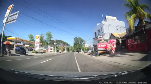
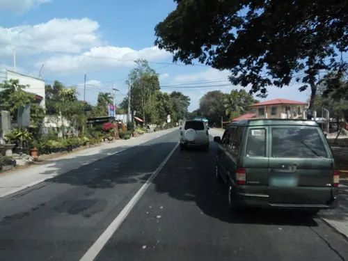
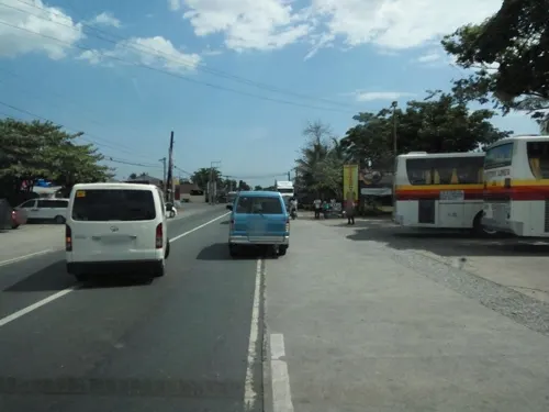
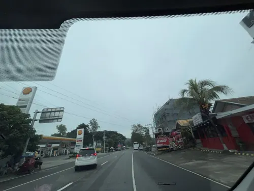



58 more on the map.
History
Sison was once part of San Fabian until petitioners from Barrio Bolaoen signed a manifesto on June 30, 1858, expressing their intention of creating a separate pueblo. It was petitioned to the gobernadorcillo of San Fabian and was later endorsed to the Alcalde Mayor of Lingayen on August 8, 1858.
After the definition of the jurisdiction of the proposed new pueblo, the administrative proceedings began with the mayor of San Fabian himself, Don Enrique Casaoay, as among those who appeared on behalf of the petitioners. On December 15, 1862, a royal decree was finally issued declaring the creation of a pueblo independent of San Fabian's civil jurisdiction. The pueblo was called Alava. Don Faustino Baclit served as its ad interim head until the pueblo's first elected president, Don Felix Genelazo, assumed his office on March 1, 1868.
On October 8, 1903, Alava was absorbed by the municipality of San Fabian by virtue of Philippine Commission Act No. 931. It was later separated as a re-established municipality on October 31, 1906.
In 1907, Esperanza - north-east of Alava - was formed into Pinmilapil, Agat, Sagunto, Cauringan, Bila and Colisao (now in San Fabian). Labayug was formed also into Inmalog, Calunetan, San Andres, Alibeng, Bacayao and Killo. Esperanza and Labayug were joined as Artacho, its poblacion, which become a regular municipality.
From the History section of Sison, Pangasinan on Wikipedia, under CC BY-SA 4.0.
Where to stay8
Churches and places of worship22
Shopping15
Gas and EV charging31
Schools, colleges and libraries76
Healthcare13
Map of Sison
241 places. The map loads OpenStreetMap tiles when you open it.
Getting there and nearby towns
Loakan Airport (BAG) is the nearest airport with scheduled flights listed in OpenStreetMap, 25 km away.
- Mangaldan 17 km southwest, about 17 min by car
- Urdaneta 23 km south, about 23 min by car
- Santa Barbara 23 km southwest, about 23 min by car
- Dagupan 24 km southwest, about 24 min by car
- Calasiao 25 km southwest, about 25 min by car
- Itogon 27 km northeast, about 27 min by car
- Baguio 28 km north, about 28 min by car
- Aringay 30 km northwest, about 30 min by car
- Villasis 31 km south, about 31 min by car
- La Trinidad 32 km north, about 32 min by car
Drive times are estimates from straight-line distance, not routes.
Local news
Headlines from INDB.
Reviews, tips and questions
Loading what members have shared...
Sources and licences
- GeoNames (CC BY 4.0): population, coordinates, regions and time zone
- Mapillary (see each image): photos
- OpenStreetMap contributors (ODbL 1.0): places, airports, map data
- Wikidata (CC0 1.0): elevation, founding date, time zone, website
- Wikimedia Commons (see each image): photos
- Wikipedia (CC BY-SA 4.0): overview and history text
Photo credits
- Sison Pangasinan, P199, CC BY-SA 3.0
- 6860Paldit, Sison, Pangasinan 33, Judgefloro, CC0
- 7278Paldit, Sison, Pangasinan 20, Judgefloro, CC0
- 7278Paldit, Sison, Pangasinan 05, Judgefloro, CC0
- 6933Paldit, Sison, Pangasinan 28, Judgefloro, CC0
- 6860Paldit, Sison, Pangasinan 30, Judgefloro, CC0
- 7278Paldit, Sison, Pangasinan 23, Judgefloro, CC0
- 6933Paldit, Sison, Pangasinan 46, Judgefloro, CC0
- 7278Paldit, Sison, Pangasinan 12, Judgefloro, CC0
- 6860Paldit, Sison, Pangasinan 09, Judgefloro, CC0
- 6933Paldit, Sison, Pangasinan 50, Judgefloro, CC0
- 6860Paldit, Sison, Pangasinan 04, Judgefloro, CC0
- 7278Paldit, Sison, Pangasinan 18, Judgefloro, CC0
- 6860Paldit, Sison, Pangasinan 40, Judgefloro, CC0
- 6933Paldit, Sison, Pangasinan 37, Judgefloro, CC0
- 6933Paldit, Sison, Pangasinan 43, Judgefloro, CC0
- 6933Paldit, Sison, Pangasinan 22, Judgefloro, CC0
- 6860Paldit, Sison, Pangasinan 47, Judgefloro, CC0
- 6860Paldit, Sison, Pangasinan 51, Judgefloro, CC0
- 7278Paldit, Sison, Pangasinan 07, Judgefloro, CC0
- 6933Paldit, Sison, Pangasinan 45, Judgefloro, CC0
- 6933Paldit, Sison, Pangasinan 19, Judgefloro, CC0
- 6933Paldit, Sison, Pangasinan 25, Judgefloro, CC0
- 6860Paldit, Sison, Pangasinan 25, Judgefloro, CC0
- 6860Paldit, Sison, Pangasinan 45, Judgefloro, CC0
- 6860Paldit, Sison, Pangasinan 20, Judgefloro, CC0
- 6860Paldit, Sison, Pangasinan 39, Judgefloro, CC0
- 6860Paldit, Sison, Pangasinan 06, Judgefloro, CC0
- 7278Paldit, Sison, Pangasinan 08, Judgefloro, CC0
- 6860Paldit, Sison, Pangasinan 24, Judgefloro, CC0
- 6933Paldit, Sison, Pangasinan 36, Judgefloro, CC0
- 7278Paldit, Sison, Pangasinan 17, Judgefloro, CC0
- 7278Paldit, Sison, Pangasinan 04, Judgefloro, CC0
- 7278Paldit, Sison, Pangasinan 22, Judgefloro, CC0
- 6933Paldit, Sison, Pangasinan 20, Judgefloro, CC0
- 6860Paldit, Sison, Pangasinan 37, Judgefloro, CC0
- 6933Paldit, Sison, Pangasinan 09, Judgefloro, CC0
- 6933Paldit, Sison, Pangasinan 29, Judgefloro, CC0
- 7278Paldit, Sison, Pangasinan 03, Judgefloro, CC0
- 6933Paldit, Sison, Pangasinan 02, Judgefloro, CC0
- Street-level photo, Kaart---RIGHT, CC BY-SA 4.0
- Street-level photo, Kaart---LEFT, CC BY-SA 4.0
- Street-level photo, Kaart---FRONT, CC BY-SA 4.0
- Street-level photo, asdfasdf0986, CC BY-SA 4.0
- Street-level photo, asdfasdf0986, CC BY-SA 4.0
- Street-level photo, asdfasdf0987, CC BY-SA 4.0
- Street-level photo, asdfasdf0986, CC BY-SA 4.0
- Street-level photo, asdfasdf0986, CC BY-SA 4.0
- Street-level photo, Yivan000, CC BY-SA 4.0
- Street-level photo, Prof_Pickell, CC BY-SA 4.0
- Street-level photo, Kaart---RIGHT, CC BY-SA 4.0
- Street-level photo, Yivan000, CC BY-SA 4.0
- Street-level photo, Kaart---RIGHT, CC BY-SA 4.0
- Street-level photo, Kaart---LEFT, CC BY-SA 4.0
- Street-level photo, asdfasdf0986, CC BY-SA 4.0
- Street-level photo, asdfasdf0986, CC BY-SA 4.0
- Street-level photo, asdfasdf0987, CC BY-SA 4.0
- Street-level photo, asdfasdf0987, CC BY-SA 4.0
- Street-level photo, asdfasdf0987, CC BY-SA 4.0
- Street-level photo, asdfasdf0987, CC BY-SA 4.0
- Street-level photo, asdfasdf0987, CC BY-SA 4.0
- Street-level photo, asdfasdf0987, CC BY-SA 4.0
- Street-level photo, asdfasdf0987, CC BY-SA 4.0
- Street-level photo, asdfasdf0986, CC BY-SA 4.0
- Street-level photo, Kaart---LEFT, CC BY-SA 4.0
- Street-level photo, Yivan000, CC BY-SA 4.0
- Street-level photo, Kaart---FRONT, CC BY-SA 4.0
- Street-level photo, Kaart---RIGHT, CC BY-SA 4.0


Page built November 7, 2026. Spotted a mistake? Tell us or suggest a place.