


Unisan, Philippines
Unisan is a town of 4,764 people in Calabarzon, Philippines, founded in February 18, 1876.
Why visit Unisan
Townapedia lists 1 museum or landmark, 3 parks and trails, 5 places to eat, 2 places to stay and 1 attraction in and around town.
Highlights include paradise park.
Weather in Unisan
Forecast from MET Norway (CC BY 4.0). Full forecast
About Unisan
Unisan, officially the Municipality of Unisan (Tagalog: Bayan ng Unisan), is a municipality in the province of Quezon, Philippines. According to the 2024 census, it has a population of 25,357 people.
From the Wikipedia article Unisan, Quezon (this version), under CC BY-SA 4.0.
Things to do1

Museums and landmarks1

Parks, trails and playgrounds3

Restaurants and cafes5
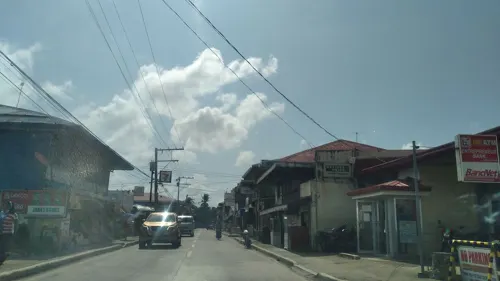
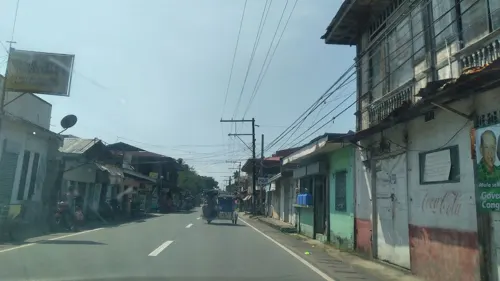


History
Unisan, originally called Kalilayan. During the latter part of the 19th century, legends said that the real founder of the town was a Malayan queen called of Ladya. Hence her title was "Queen of Kalilayan".
It is believed that the founding occurred in the Middle Ages when immigration of the Malayans to this country was still predominant. That was before the advent of Islam in the East Indies. This proven by the fact that no traces of Mohamed's Creed were found in that part of the Philippines when the Europeans arrived.
The name Kalilayan derived from the Tagalog root word lilay, refers to a kind of palm similar to buri with the smaller leaves in the size of anahaw leaves that once grew in abundance.
The town was designated as the first capital of the province of Kalilayan from the province's creation in 1591 to 1749, when the capital was transferred to the town of Tayabas. In February 1876, the town was separated from Pitogo and became an independent municipality. At the same time, it was renamed to Unisan which was derived from the Latin word uni-sancti, meaning "holy saint".
From the History section of Unisan, Quezon on Wikipedia, under CC BY-SA 4.0.
Where to stay2
Churches and places of worship11
Lokal ng Summit, Iglesia ni Cristo
Church · Iglesia Ni Cristo · 8.9 km
Atimonan-Unisan Road
Shopping1
Gas and EV charging6
Schools, colleges and libraries39
Polytechnic University of the Philippines, Unisan
School · 0.8 km
Padre Burgos - Pototanin Junction Road
Healthcare6
Map of Unisan
75 places. The map loads OpenStreetMap tiles when you open it.
Getting there and nearby towns
Marinduque Airport (MRQ) is the nearest airport with scheduled flights listed in OpenStreetMap, 56 km away.
- Gumaca 16 km northeast, about 16 min by car
- Atimonan 19 km north, about 19 min by car
- Lopez 31 km east, about 31 min by car
- Pagbilao 33 km northwest, about 33 min by car
- Calauag 36 km east, about 36 min by car
- Lucena 40 km west, about 40 min by car
- Tayabas 46 km northwest, about 46 min by car
- Catanauan 47 km southeast, about 47 min by car
- Sariaya 50 km west, about 50 min by car
- Lucban 54 km northwest, about 54 min by car
Drive times are estimates from straight-line distance, not routes.
Local news
Headlines from INDB.
Reviews, tips and questions
Loading what members have shared...
Sources and licences
- GeoNames (CC BY 4.0): population, coordinates, regions and time zone
- Mapillary (see each image): photos
- OpenStreetMap contributors (ODbL 1.0): places, airports, map data
- Wikidata (CC0 1.0): elevation, founding date, time zone, website, landmarks and historic places
- Wikimedia Commons (see each image): photos
- Wikipedia (CC BY-SA 4.0): overview and history text
Photo credits
- Burgos Street in Brgy.R.magsaysay, Unisan - panoramio, Adrian Alpay, CC BY 3.0
- Unisan, Quezon, Philippines - panoramio, Adrian Alpay, CC BY 3.0
- 7-11 Unisan Quezon Branch - panoramio, Adrian Alpay, CC BY 3.0
- Dominican Academy Unisan Quezon - panoramio, Adrian Alpay, CC BY 3.0
- PUP Unisan Covered Court - panoramio, Adrian Alpay, CC BY 3.0
- Polytechnic University of the Philippines Unisan Campus - panoramio, Adrian Alpay, CC BY 3.0
- Divinagracia Resort Unisan Quezon - panoramio, Adrian Alpay, CC BY 3.0
- Aredan Hotel and Resort Unisan Quezon Brgy Iba. Kalilayan - panoramio, Adrian Alpay, CC BY 3.0
- Birthing Station, Iba.Muliguin, Unisan Quezon - panoramio, Adrian Alpay, CC BY 3.0
- Rural Health Center 2 Unisan Quezon Brgy. Iba. Muliguin - panoramio, Adrian Alpay, CC BY 3.0
- Petron Unisan Quezon, Kalilayan - panoramio, Adrian Alpay, CC BY 3.0
- Bahay Bakasyonan - panoramio, Adrian Alpay, CC BY 3.0
- Cheri Water refiling Station - panoramio, Adrian Alpay, CC BY 3.0
- Garage House - panoramio, Adrian Alpay, CC BY 3.0
- Dominican Academy Covered Court - panoramio, Adrian Alpay, CC BY 3.0
- Castle ni Rhon ng Hilaga - panoramio, Adrian Alpay, CC BY 3.0
- Iba Muliguin Basketball Court - panoramio, Adrian Alpay, CC BY 3.0
- ISS006-E-44712 - View of the Philippines, Earth Science and Remote Sensing Unit , Lyndon B. Johnson Space Center, Public domain
- ISS038-E-33936 - View of Earth, Earth Science and Remote Sensing Unit , Lyndon B. Johnson Space Center, Public domain
- ISS038-E-853 - View of the Philippines, Earth Science and Remote Sensing Unit , Lyndon B. Johnson Space Center, Public domain
- ISS038-E-852 - View of the Philippines, Earth Science and Remote Sensing Unit , Lyndon B. Johnson Space Center, Public domain
- Street-level photo, nickrds09, CC BY-SA 4.0
- Street-level photo, nickrds09, CC BY-SA 4.0
- Street-level photo, nickrds09, CC BY-SA 4.0
- Street-level photo, nickrds09, CC BY-SA 4.0
- Street-level photo, nickrds09, CC BY-SA 4.0
- Street-level photo, nickrds09, CC BY-SA 4.0
- Street-level photo, nickrds09, CC BY-SA 4.0
- Street-level photo, nickrds09, CC BY-SA 4.0
- Street-level photo, nickrds09, CC BY-SA 4.0
- Street-level photo, nickrds09, CC BY-SA 4.0
- Street-level photo, nickrds09, CC BY-SA 4.0
- Street-level photo, nickrds09, CC BY-SA 4.0
- Street-level photo, nickrds09, CC BY-SA 4.0
- Street-level photo, nickrds09, CC BY-SA 4.0
- Street-level photo, nickrds09, CC BY-SA 4.0
- Street-level photo, nickrds09, CC BY-SA 4.0
- Street-level photo, nickrds09, CC BY-SA 4.0


Page built November 7, 2026. Spotted a mistake? Tell us or suggest a place.