
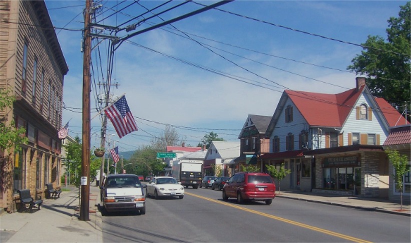


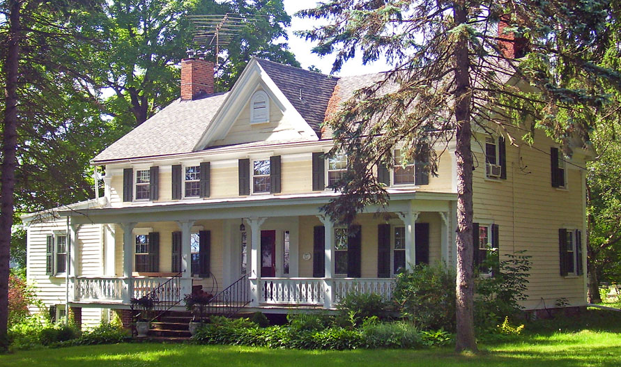

Pine Bush, New York
Pine Bush is a community of 1,868 people in Orange County, New York.
Why visit Pine Bush
Townapedia lists 12 museums and landmarks, 2 parks and trails, 3 places to eat and 2 places to stay in and around town.
Highlights include Abraham Dickerson Farmhouse and Benjamin Van Keuren House Ruin.
July is the warmest month, with average highs of 84°F; January lows average 17°F.
Weather in Pine Bush
Forecast from the National Weather Service. Full forecast
About Pine Bush
Pine Bush is a hamlet (and census-designated place) located in the town of Crawford and adjacent to Shawangunk, New York, within Orange and adjacent to Ulster counties in the United States. It is roughly coterminous with the 12566 ZIP code and 744 telephone exchange in the 845 area code. These both extend into adjacent regions of the town of Shawangunk in Ulster County. (The Pine Bush Central School District includes part of the town of Mamakating in Sullivan County as well).
From the Wikipedia article Pine Bush, New York (this version), under CC BY-SA 4.0.
Museums and landmarks12
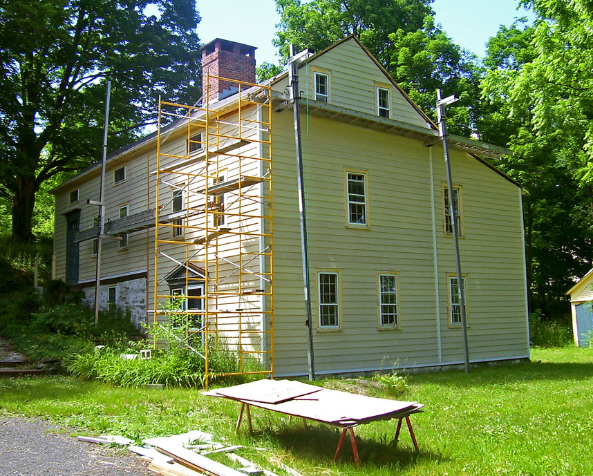
Abraham Dickerson Farmhouse
Monument and historic site · National Register of Historic Places · 3.4 mi
Historic house in Montgomery, New York

Benjamin Van Keuren House Ruin
Monument and historic site · National Register of Historic Places · 2.6 mi
Single-family detached home in New York, United States of America

Dill Farm
Monument and historic site · National Register of Historic Places · 3.0 mi
Historic farm in Shawangunk, New York, United States

John I Crawford Farm
Monument and historic site · National Register of Historic Places · 2.9 mi
Historic barn in New York

Miller's House at Red Mills
Monument and historic site · National Register of Historic Places · 1.7 mi
Historic house in New York, United States
Moses Mould House
Monument and historic site · National Register of Historic Places · 2.6 mi
Historic house in New York, United States

Pearl Street Schoolhouse
Monument and historic site · National Register of Historic Places · 3.4 mi
Building in New York, United States

Taylor-Corwin House
Monument and historic site · National Register of Historic Places
Historic house in New York, United States

Terwilliger House
Monument and historic site · National Register of Historic Places · 3.3 mi
Building in New York, United States

Thomas Jansen House
Monument and historic site · National Register of Historic Places · 3.0 mi
Building in New York, United States


William Decker House
Monument and historic site · National Register of Historic Places · 3.1 mi
Building in New York, United States

Parks, trails and playgrounds2

Restaurants and cafes3


Dunkin'
Fast food · Donut, Coffee Shop
2380 State Highway 52;State Route 52, Pine Bush
Mo-Su 05:00-23:00
Where to stay2

Pine Bush House Bed and Breakfast
Motel and hotel
5 room bed and breakfast
215 Maple Avenue, Pine Bush
History
The community was one of the four early nineteenth century settlements in the jurisdiction of the town. It has previously been known as "Shawangunk," "Crawford," and "Bloomfield." Another community named "Crawford" is located to the northwest in bordering Ulster County. This hamlet was an early terminus for a short line railroad, the Middletown & Crawford Railroad. This line was bought by the Erie Railroad, which served the town until the 1970s.
As a result of reported unusual sightings since the early 1960s, Pine Bush developed a reputation as the UFO capital of the East Coast. The town has held an annual UFO festival since 2011. Ellen Crystall's 1994 book, Silent Invasion: The Shocking Discoveries of a UFO Researcher describes UFO encounters in the town.
From the History section of Pine Bush, New York on Wikipedia, under CC BY-SA 4.0.
Churches and places of worship5
Hopewell Presbyterian Church
Church · National Register of Historic Places · 3.4 mi
Shopping1
Schools, colleges and libraries7
Healthcare1
Map of Pine Bush
33 places. The map loads OpenStreetMap tiles when you open it.
Climate by month
Monthly table
| Month | High | Low | Rain |
|---|---|---|---|
| Jan | 35°F | 17°F | 2.4 in |
| Feb | 38°F | 18°F | 2.4 in |
| Mar | 47°F | 27°F | 3.2 in |
| Apr | 60°F | 36°F | 3.5 in |
| May | 70°F | 47°F | 3.4 in |
| Jun | 79°F | 56°F | 4.3 in |
| Jul | 84°F | 61°F | 3.3 in |
| Aug | 82°F | 59°F | 4.4 in |
| Sep | 74°F | 51°F | 3.9 in |
| Oct | 62°F | 40°F | 3.7 in |
| Nov | 50°F | 31°F | 3.0 in |
| Dec | 39°F | 23°F | 3.4 in |
U.S. Climate Normals 1991-2020 for Montgomery Orange Ap (7 mi away), NOAA NCEI.
People and cost of living
American Community Survey 5-year estimates, 2020-2024, U.S. Census Bureau. Estimates have margins of error, larger for small towns.
Disaster history
Orange County has had 26 federal disaster declarations since 2000, most often for severe storms.
- 2024-11-15: Jennings Creek Fire (Fire)
- 2023-07-22: Severe Storms And Flooding (Severe Storm)
- 2021-09-05: Remnants Of Hurricane Ida (Hurricane)
- 2021-09-02: Remnants Of Hurricane Ida (Hurricane)
- 2021-08-22: Hurricane Henri (Hurricane)
- 2020-03-20: Covid-19 Pandemic (Biological)
OpenFEMA disaster declarations summaries.
Getting there and nearby towns
Orange County Airport (MGJ) is the nearest airport with scheduled flights listed in OpenStreetMap, 7 miles away.
- Gardiner 9 mi northeast, about 15 min by car
- Scotchtown 10 mi south, about 16 min by car
- Kerhonkson 12 mi north, about 19 min by car
- Middletown 13 mi southwest, about 21 min by car
- Clintondale 14 mi northeast, about 23 min by car
- Newburgh 16 mi southeast, about 26 min by car
- Otisville 16 mi southwest, about 25 min by car
- Beacon 19 mi southeast, about 30 min by car
- Kiryas Joel 20 mi south, about 32 min by car
- Poughkeepsie 20 mi east, about 33 min by car
Drive times are estimates from straight-line distance, not routes.
Local news
Headlines from INDB, the NEMICO news database.
Reviews, tips and questions
Loading what members have shared...
Sources and licences
- NCES EDGE (Public domain): public schools
- NOAA NCEI U.S. Climate Normals 1991-2020 (Public domain): climate by month
- OpenFEMA (Public domain): disaster declarations
- OpenStreetMap contributors (ODbL 1.0): places, airports, map data
- U.S. Census Bureau (Public domain): population, income, housing, education, commute
- Wikidata (CC0 1.0): elevation, founding date, time zone, website, landmarks and historic places
- Wikimedia Commons (see each image): photos
- Wikipedia (CC BY-SA 4.0): overview and history text
Photo credits
- Downtown Pine Bush NY, The original uploader was Daniel Case at English Wikipedia ., CC BY-SA 3.0
- Hopewell Presbyterian Church, The original uploader was Daniel Case at English Wikipedia ., CC BY-SA 3.0
- Pearl Street Schoolhouse, Daniel Case, CC BY-SA 3.0
- Thomas Jansen House, Daniel Case, CC BY-SA 3.0
- Moses Mould House, The original uploader was Daniel Case at English Wikipedia ., CC BY-SA 3.0
- William Decker House, Daniel Case, CC BY-SA 3.0
- Dill Farm, Shawangunk, NY, Daniel Case, CC BY-SA 3.0
- John I Crawford Farm, Daniel Case, CC BY-SA 3.0
- Benjamin Van Keuren House site, Daniel Case, CC BY-SA 3.0
- Taylor-Corwin House, Original uploader was Daniel Case at en.wikipedia, CC BY-SA 3.0
- Abraham Dickerson Farmhouse, The original uploader was Daniel Case at English Wikipedia ., CC BY-SA 3.0
- Terwilliger House, Shawangunk, NY, Daniel Case, CC BY-SA 3.0
Page built October 30, 2026. Spotted a mistake? Tell us or suggest a place.