


Charsadda, Pakistan
چارسدہ
Charsadda is a town of 120,170 people in Khyber Pakhtunkhwa, Pakistan.
Why visit Charsadda
Townapedia lists 3 museums and landmarks and 2 parks and trails in and around town.
Highlights include Pushkalavati and Shaikhan Dehri hoard.
Weather in Charsadda
Forecast from MET Norway (CC BY 4.0). Full forecast
About Charsadda
Charsadda (Pashto: چارسده; ; Urdu: چارسدہ; ) is a town and headquarters of Charsadda District, in the Khyber Pakhtunkhwa province of Pakistan. Located in the Valley of Peshawar, Charsadda lies about 29 kilometres (18 mi) from the provincial capital Peshawar at an altitude of 276 metres (906 ft).
From the Wikipedia article Charsadda (this version), under CC BY-SA 4.0.
Travel tips from other travellers: Charsadda on Wikivoyage (CC BY-SA 4.0).
Museums and landmarks3


Pushkalavati
Monument and historic site · 2.2 km
Archaeological site in Pakistan, former capital of the Gandhara kingdom
Shaikhan Dehri hoard
Monument and historic site · 2.2 km
Archaeological site
Parks, trails and playgrounds2


Churches and places of worship5

Shopping1

History
The earliest archaeological deposits recovered at Charsadda, in Bala Hisar, are dated to c. 1400 BCE, when a small community was established on a low natural mound of clay above the floodplain of the Kabul and Swat rivers, constructing structures of timber posts slotted into postholes, in association with ceramic sherds and ash. Subsequent periods indicate that more permanent structures were built at Charsadda, including stone-lined pits. Between the 14th century BCE and the 6th century BCE, when an Achaemenid presence is represented at the site (see below), the inhabitants of Charsadda developed an iron-working industry and used ceramics that were typical for this period in the Vale of Peshawar, Swat and Dir.
From the History section of Charsadda on Wikipedia, under CC BY-SA 4.0.
Gas and EV charging1
Schools, colleges and libraries2
Healthcare2
Map of Charsadda
16 places. The map loads OpenStreetMap tiles when you open it.
Getting there and nearby towns
Bacha Khan International Airport (PEW) is the nearest airport with scheduled flights listed in OpenStreetMap, 27 km away.
- Utmanzai 5 km northeast, about 5 min by car
- Pabbi 16 km south, about 16 min by car
- Shabqadar 19 km northwest, about 19 min by car
- Tangi 19 km northwest, about 19 min by car
- Peshawar 22 km southwest, about 22 min by car
- Amangarh 24 km southeast, about 24 min by car
- Nowshera Kalan 26 km southeast, about 26 min by car
- Risalpur Cantonment 25 km southeast, about 25 min by car
- Mardan 29 km east, about 29 min by car
- Nowshera Cantonment 29 km southeast, about 29 min by car
Drive times are estimates from straight-line distance, not routes.
Local news
Headlines from INDB.
Reviews, tips and questions
Loading what members have shared...
Sources and licences
- GeoNames (CC BY 4.0): population, coordinates, regions and time zone
- OpenStreetMap contributors (ODbL 1.0): places, airports, map data
- Wikidata (CC0 1.0): elevation, founding date, time zone, website, landmarks and historic places
- Wikimedia Commons (see each image): photos
- Wikipedia (CC BY-SA 4.0): overview and history text
Photo credits
- Bacha Khan Square In Charsadda, Zeeshan afand, CC BY-SA 4.0
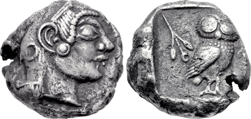
- Athens coin discovered in Pushkalavati, CNG Coins, CC BY-SA 3.0
- Bala Hisar - Charsadda - Northern Mound, Muhammad Zahir, CC BY-SA 3.0
Page built November 3, 2026. Spotted a mistake? Tell us or suggest a place.