


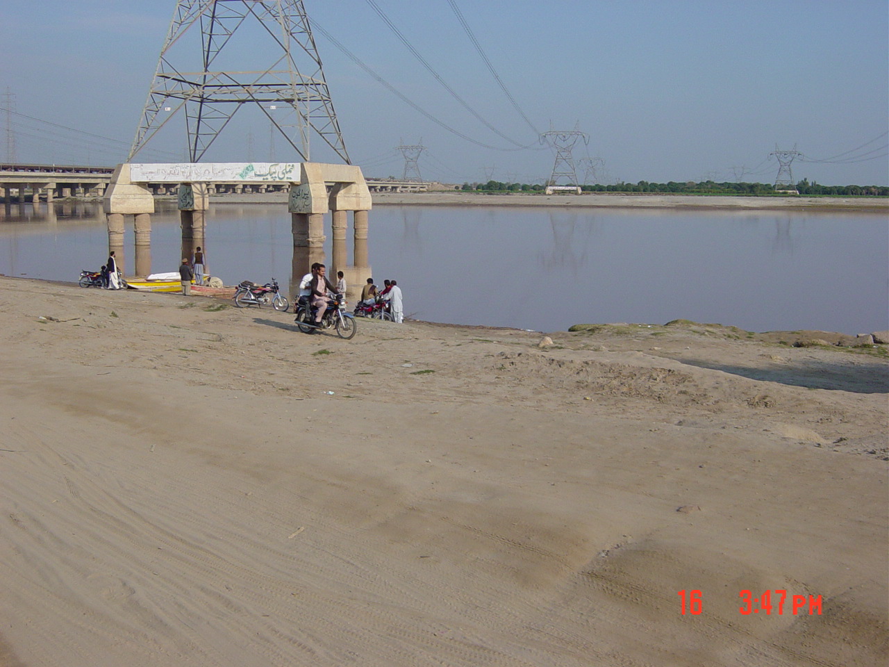
Muzaffargarh, Pakistan
مظفر گڑھ
Muzaffargarh is a town of 235,541 people in Punjab, Pakistan.
Why visit Muzaffargarh
Townapedia lists 7 parks and trails, 4 places to eat and 3 places to stay in and around town.
Highlights include Fayyaz Park and Nawab Muzaffar Khan Park.
Weather in Muzaffargarh
Forecast from MET Norway (CC BY 4.0). Full forecast
About Muzaffargarh
Muzaffargarh is a city in the province of Punjab, Pakistan. Located on the bank of the Chenab River, it is the capital of the eponymous district. It is the 41st most populous city of Pakistan.
From the Wikipedia article Muzaffargarh (this version), under CC BY-SA 4.0.
Travel tips from other travellers: Muzaffargarh on Wikivoyage (CC BY-SA 4.0).
Parks, trails and playgrounds7




Restaurants and cafes4

Where to stay3

Churches and places of worship4

History
The Muzaffargarh region was an agricultural and forested area during the Indus Valley civilization. Then came the Vedic period, which was characterized by the introduction of Indo-Aryan culture into the Punjab province. Over time, several other civilizations came to power in the ancient town and surrounding district: the Kambojas, the Daradas, the Kekayas, the Madras, the Pauravas, the Yaudheyas, the Malavas and the Kurus.
After the fall of the Achaemenid Empire in 331 BCE, Alexander the Great marched into the present-day Punjab province with an army of 50,000 men. The Muzaffargarh region was, during different time periods, also ruled by the Maurya Empire, the Indo-Greek kingdom, the Kushan Empire, the Gupta Empire, the White Huns, the Kushano-Hephthalites, and the Turk and Hindu Shahi kingdoms.
In 997 CE, Sultan Mahmud Ghaznavi took over the Ghaznavid Empire, and, in 1005, conquered the Shahis in Kabul, which granted him power over the Punjab region. The Delhi Sultanate and later the Mughal Empire also ruled the region. The location of the present-day town became predominantly Muslim during this time because of the arrival of missionary Sufis whose dargahs still persist in the area.
After the decline of the Mughal Empire, the Sikhs conquered the Muzaffargarh District. Later, in 1848, the British Raj assumed control of the area.
From the History section of Muzaffargarh on Wikipedia, under CC BY-SA 4.0.
Shopping11
Gas and EV charging10
Schools, colleges and libraries15
Healthcare5
Map of Muzaffargarh
59 places. The map loads OpenStreetMap tiles when you open it.
Getting there and nearby towns
Multan International Airport (MUX) is the nearest airport with scheduled flights listed in OpenStreetMap, 26 km away.
- Khangarh 18 km south, about 18 min by car
- Shujaabad 23 km southeast, about 23 min by car
- Multan 31 km northeast, about 31 min by car
- Kot Addu 49 km northwest, about 49 min by car
- Qadirpur Ran 52 km northeast, about 52 min by car
- Dera Ghazi Khan 53 km west, about 53 min by car
- Shahr Sultan 58 km south, about 58 min by car
- Jahanian 60 km east, about 1 h by car
- Dunyapur 61 km southeast, about 1 h by car
- Jalalpur Pirwala 63 km south, about 1 h by car
Drive times are estimates from straight-line distance, not routes.
Local news
Headlines from INDB.
Reviews, tips and questions
Loading what members have shared...
Sources and licences
- GeoNames (CC BY 4.0): population, coordinates, regions and time zone
- OpenStreetMap contributors (ODbL 1.0): places, airports, map data
- Wikidata (CC0 1.0): elevation, founding date, time zone, website, landmarks and historic places
- Wikimedia Commons (see each image): photos
- Wikipedia (CC BY-SA 4.0): overview and history text
Photo credits
- Muzaffargarh Railway Station Board 02, امین اکبر, CC BY-SA 4.0
- USAID Mission Director, CM Punjab Inaugurate Rehabilitated Muzaffargarh Power Station (23050422512), USAID Pakistan, Public domain
- Anar, Farzana Ahmad Awan, CC BY-SA 4.0
- ISS061-E-60066 - View of Earth, Earth Science and Remote Sensing Unit, NASA Johnson Space Center, Public domain
- ISS061-E-4197 - View of Earth, Earth Science and Remote Sensing Unit, NASA Johnson Space Center, Public domain
- Chanab - panoramio, iqbalbabbi, CC BY-SA 3.0
Page built November 3, 2026. Spotted a mistake? Tell us or suggest a place.