
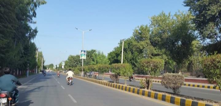


Rahim Yar Khan, Pakistan
رحیم یار خان
Rahim Yar Khan is a town of 517,000 people in Punjab, Pakistan.
Why visit Rahim Yar Khan
Townapedia lists 1 museum or landmark, 9 parks and trails, 9 places to eat, 4 places to stay and 2 attractions in and around town.
Highlights include Khwaja Fareed University of Engineering & Information Technology, Rahim Yar Khan, Bano Bazar Park and Children and Family Park, Main Raod, Gulshan e Usman.
Weather in Rahim Yar Khan
Forecast from MET Norway (CC BY 4.0). Full forecast
About Rahim Yar Khan
Rahim Yar Khan (Urdu: رحیم یار خان, romanized: Rahīm Yār Khān; Urdu pronunciation: [ɾəɦiːm jɑːɾ xɑːn]) is a city in the Punjab, Pakistan. It is the 21st most populous city in Pakistan and is the capital of the Rahim Yar Khan District. The city's administration is divided into nine union councils. Originally named Noshehra, it was renamed to Rahim Yar Khan in honour of the son of Sadeq Mohammad Khan IV.
From the Wikipedia article Rahim Yar Khan (this version), under CC BY-SA 4.0.
Travel tips from other travellers: Rahim Yar Khan on Wikivoyage (CC BY-SA 4.0).
Things to do2

Khwaja Fareed University of Engineering & Information Technology, Rahim Yar Khan
School · 8.2 km
University in Punjab, Pakistan

Museums and landmarks1

Parks, trails and playgrounds9

Children and Family Park, Main Raod, Gulshan e Usman
Park · 1.9 km
Main Raod, Gulshan e Usman, Rahim Yar Khan
Early Morning - Late Night
Chaudhry Bashir Warraich Park
Park · 1.8 km
Opposite Govt. Boys Secondary School Low Income Scheme No. 2, Rahim Yar Khan

Restaurants and cafes9

Angrezi Dhaba
Restaurant · Coffee Shop, Salad, Juice, Ice Cream, Burger, Fries · 1.5 km
Trust Colony Chowk, Rahim Yar Khan



History
People have lived near this area for a very long time. The ancient tower of Pattan Minara stands 8 km to the east of the city center, and is believed to be the remains of a 5,000-year-old monastery, with the minara built during the Hakrra valley civilization of the Mauryan period (250 BC).
Rahim Yar Khan was founded in 1751 as Noshehra. Its region was part of the Multan province of Mughal Empire. Railway administrators wanted to change the name of the town due to its similar name to Nowshera. In 1881, Sadeq Mohammad Khan IV renamed the area to Rahim Yar Khan in honour of his son.
Rahim Yar Khan was a part of the Bahawalpur State until 1943, when it became a separate district.
From the History section of Rahim Yar Khan on Wikipedia, under CC BY-SA 4.0.
Where to stay4
Golden Sand Hotel
Motel and hotel · 1.5 km
14-15 Businessman Colony, Rahim Yar Khan
Churches and places of worship13
Jamia Hussainia Rabbania Makki Masjid
Place of worship · Sunni · 0.9 km
Chowk Pathanistan, Rahim Yar Khan
Jamia Masjid Al Amin
Place of worship · Sunni · 1.6 km
Block V, Gulshan e Usman, Rahim Yar Khan
Jamia Masjid Gulzar e Madina
Place of worship · Sunni · 1.7 km
Basti Mad Darari, Rahim Yar Khan
Jamia Masjid Khizra
Place of worship · Sunni · 1.9 km
Bahadarpur Road (Shehbaz Pur Road), Rahim Yar Khan
Jamia Masjid Railway Road
Place of worship · Sunni
Railway Service Road, رحیم یار خان
Jamia Masjid Usmania
Place of worship · Sunni · 1.5 km
18/C Main St, Gulshan e Usman Rahim Yar Khan,, Rahim Yar Khan
Jamia Qadria Masjid o Madrassa
Place of worship · Sunni
Jamia Qadria Road, رحیم یار خان
Madina Jamia Masjid
Place of worship · Sunni · 1.8 km
Gulshan e Usman Rahim Yar Khan,, Rahim Yar Khan
Shopping1
Gas and EV charging9
Abdul Sattar Filling Station
Gas station · 0.9 km
Bahadarpur Road (Shehbaz Pur Road), Rahim Yar Khan
AL-MACCA CNG & PETROLEUM CENTER
Gas station · 1.0 km
Bahadarpur Road (Shehbaz Pur Road), Rahim Yar Khan
Schools, colleges and libraries7
Healthcare7
7 Pharmacy
Clinic and pharmacy · 1.0 km
Bahadarpur Road (Shehbaz Pur Road), Rahim Yar Khan
Map of Rahim Yar Khan
62 places. The map loads OpenStreetMap tiles when you open it.
Getting there and nearby towns
Shaikh Zaid Airport (RYK) is the nearest airport with scheduled flights listed in OpenStreetMap, 5 km away.
- Saddiqabad 21 km southwest, about 21 min by car
- Kot Samaba 22 km northeast, about 22 min by car
- Khanpur 43 km northeast, about 43 min by car
- Rojhan 45 km northwest, about 45 min by car
- Zahir Pir 49 km northeast, about 49 min by car
- Ubauro 63 km southwest, about 1 h by car
- Daharki 72 km southwest, about 1 h 15 min by car
- Khairpur 71 km southwest, about 1 h 15 min by car
- Kashmor 70 km west, about 1 h 15 min by car
- Rajanpur 76 km north, about 1 h 15 min by car
Drive times are estimates from straight-line distance, not routes.
Local news
Headlines from INDB.
Reviews, tips and questions
Loading what members have shared...
Sources and licences
- GeoNames (CC BY 4.0): population, coordinates, regions and time zone
- OpenStreetMap contributors (ODbL 1.0): places, airports, map data
- Wikidata (CC0 1.0): elevation, founding date, time zone, website, landmarks and historic places
- Wikimedia Commons (see each image): photos
- Wikipedia (CC BY-SA 4.0): overview and history text
Photo credits
- Road in Rahim Yar Khan, Clever Boiiii at English Wikipedia, CC BY-SA 4.0
- Rahim yar khan railway station - panoramio, khadim-un-nabi Rao, CC BY-SA 3.0
- Royal Castle Gust House Rahim Yar Khan, Irfa9mahmood, CC BY-SA 4.0
- شیخ حمیدالدین حاکم, محمد منصور اللّٰہ فضل, CC BY-SA 4.0
- Satellite Town - panoramio, Hamzah, CC BY 3.0
- ISS067-E-295652 - View of Earth, Earth Science and Remote Sensing Unit , Lyndon B. Johnson Space Center, Public domain
- ISS047-E-42612 - View of Earth, Earth Science and Remote Sensing Unit , Lyndon B. Johnson Space Center, Public domain
- Bierton Particular Baptists 1, Christchurch Bierton Particular Baptists Pakistan, CC BY-SA 4.0
- Bierton Particular Baptists, Anilanwar, CC BY-SA 4.0


Page built November 3, 2026. Spotted a mistake? Tell us or suggest a place.