


Rawalpindi, Pakistan
راولپنڈی
Rawalpindi is a town of 3,357,612 people in Punjab, Pakistan.
Why visit Rawalpindi
Townapedia lists 28 museums and landmarks, 49 parks and trails, 97 places to eat, 34 places to stay and 26 attractions in and around town.
Highlights include Fatima Jinnah Women University, Air University, Lok Virsa Museum and National Art Gallery, Pakistan.
Weather in Rawalpindi
Forecast from MET Norway (CC BY 4.0). Full forecast
About Rawalpindi
Rawalpindi, colloquially known as Pindi, is the third-largest city in the Pakistani province of Punjab and the fourth-most populous city in Pakistan. Located along the Soan River in north-western Punjab, Rawalpindi lies adjacent to Pakistan's capital, Islamabad, and the two are jointly known as the "twin cities".
From the Wikipedia article Rawalpindi (this version), under CC BY-SA 4.0.
Travel tips from other travellers: Rawalpindi on Wikivoyage (CC BY-SA 4.0).
Things to do26

Fatima Jinnah Women University
School · 2.0 km
Public university in Rawalpindi, Pakistan
Air University
School · 13.1 km
Public university in Islamabad, Pakistan

Allama Iqbal Open University
School · 9.5 km
Public university in Islamabad, Pakistan

Arid Agriculture University
School · 6.4 km
Public university in Rawalpindi, Pakistan
Army Public College of Management Sciences
School · 2.3 km
Rawalpindi, Pakistan

COMSATS University Islamabad
School · 11.7 km
Public university in Islamabad, Pakistan

Daman-e-Koh
Monument and historic site · 15.9 km
Viewing point and hill top garden north of Islamabad, Pakistan
Government College Asghar Mall Rawalpindi
School · 3.7 km
College in Rawalpindi, Pakistan
Institute of Space Technology
School · 14.8 km
Public university in Islamabad, Pakistan
International Islamic University Islamabad
School · 6.9 km
Public university in Islamabad, Pakistan
14 more on the map.
Museums and landmarks28

Lok Virsa Museum
Museum · 9.7 km
Cultural institute, museum, ethnology museum in ICT, Pakistan.


Pakistan Monument
Monument and historic site · 10.8 km
Monument in Islamabad
Riwat
Monument and historic site · 17.8 km
Paleolithic site in Punjab, northern Pakistan
Riwat Site 55
Monument and historic site · 17.8 km
Upper Paleolithic archaeological site

shrine of Meher Ali Shah
Monument and historic site · 12.5 km
Dargah in Golra Sharif, Pakistan
Darbar Hazrat Khawaja Syed Hussain Ali Shah Bukhari
Monument and historic site · 2.8 km
Murree Road, راولپنڈی
Noor Ashraf and Sons, Al Makkah Market, Jinnah Road
Monument and historic site · 1.2 km
13 City Saddar Road
16 more on the map.
Parks, trails and playgrounds49

Allama Iqbal Park, Rawalpindi
Park · 4.3 km
Public park in Rawalpindi, Pakistan
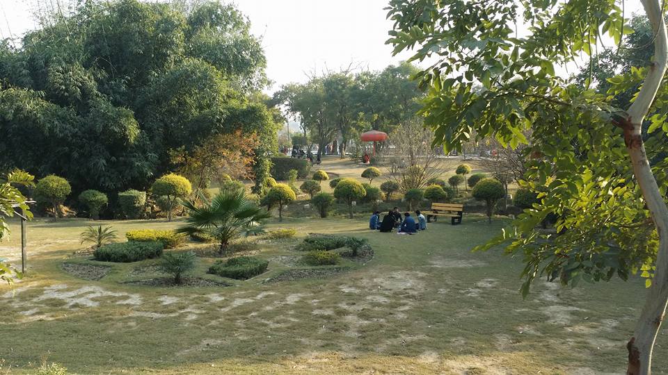
Ayub National Park
Park · 4.2 km
Leisure park in Rawalpindi, Pakistan

Fatima Jinnah Park
Park · 11.8 km
Public recreational park in Islamabad, Pakistan


Jungle World
Park · 4.9 km
Zoo and animal theme park in Rawalpindi, Pakistan


37 more on the map.
Restaurants and cafes97

Tehzeeb bakers
Cafe · Sandwich, Kebab, Donut · 3.9 km
Chib Plaza COMMERCIAL MARKET SCHEME 3, Chaklala Scheme 3, Rawalpindi
Mo-Su 10:00-22:00
crumble cookies
Cafe · Coffee Shop, Ice Cream, Tea · 3.9 km
Khudadad Plaza COMMERCIAL MARKET SCHEME 3, Chaklala Scheme 3, Rawalpindi
Mo-Su 10:00-22:00

Sattar Tikka House
Restaurant · Barbecue, Pakistani · 2.0 km
D.A.V. college road, راولپنڈی
Mo-Su 19:00-01:00
85 more on the map.
Where to stay34
Churches and places of worship129
Jamia Masjid Hanfia Muslim Abad PAF
Place of worship · Sunni · 3.2 km
Chaklala Road
Shopping41
M Umair Rice Traders
Shopping center · 2.2 km
Shop V-110 Dalgiran Bazar, Rawalpindi
Rauf Rasheed Traders
Shopping center · 2.2 km
Shop-V109 Dalgiran Bazar, Rawalpindi
Gas and EV charging33
Schools, colleges and libraries92
FIT Computer institute _ Graphic design course , IT short courses , Web development course in Rawalpindi, Pakistan
School · 4.5 km
2nd Floor, FIT Computer institute, Al-Mustafa Plaza, near Chandni Chowk Flyover, راولپنڈی
Nasir Foundation College of Commerce & Sciences
School · 4.4 km
Service Lane گرینڈ ٹرنک روڈ, Chour Harpal -Allah Abad
Healthcare59
Haji Muhammad Bashir مطب ہڈی جوڑ
Clinic and pharmacy · 4.0 km
256 Asghar Mall Road
Major General (Retired) Dr. Mohammad Naeem Khan Neuro-Physician
Clinic and pharmacy · 2.9 km
604-A Peshawer Road
Mega Medical Complex
Hospital
Mega Medical Complex, Saddar, Rawalpindi,, راولپنڈی
Nelson Pharmacy
Clinic and pharmacy · 2.2 km
Farid Family Hospital Range Road, راولپنڈی
Map of Rawalpindi
250 places. The map loads OpenStreetMap tiles when you open it.
Getting there and nearby towns
Islamabad International Airport (ISB) is the nearest airport with scheduled flights listed in OpenStreetMap, 21 km away.
- Alipur 13 km northeast, about 13 min by car
- Islamabad 14 km north, about 14 min by car
- Saidpur 16 km north, about 16 min by car
- Kuri Dulal 31 km southeast, about 31 min by car
- Bhata 31 km southeast, about 31 min by car
- Kahuta 31 km east, about 31 min by car
- Sharifabad 34 km southeast, about 34 min by car
- Fatehjang 38 km west, about 38 min by car
- Gujar Khan 45 km southeast, about 45 min by car
- Haripur 46 km north, about 46 min by car
Drive times are estimates from straight-line distance, not routes.
Local news
Headlines from INDB.
Reviews, tips and questions
Loading what members have shared...
Sources and licences
- GeoNames (CC BY 4.0): population, coordinates, regions and time zone
- OpenStreetMap contributors (ODbL 1.0): places, airports, map data
- Wikidata (CC0 1.0): elevation, founding date, time zone, website, landmarks and historic places
- Wikimedia Commons (see each image): photos
- Wikipedia (CC BY-SA 4.0): overview and history text
Photo credits
- Rawalpindi railway station 4, Miiqbal, CC BY-SA 3.0
- Allama Iqbal Open University, Islamabad, Khalid Mahmood, CC BY-SA 3.0
- Islamic university faculty of basic and applied sciences 3, Saadkhan12345, CC BY-SA 4.0
- A Pakistani Gate, Khalid Mahmood, CC BY-SA 3.0
- National Art Gallery, Islamabad, Pakistan, Khalid Mahmood, CC BY-SA 3.0
- Blue Hour at Pakistan Monument, Muhammad Ashar, CC BY-SA 4.0
- Mausoleum of Meher Ali Shah by Balochlens, Balochlens, CC BY-SA 4.0
- Ayub national park garden, Saadkhan12345, CC BY-SA 4.0
- Islamabad F9 Park (3875031085), Ahmed Sajjad Zaidi from Pakistan, CC BY-SA 2.0
- Zebra in Islamabad, Bhurban Pakistan, Farhan from Karachi, Pakistan, CC BY 2.0
- Jinnah Park-1, Inlandmamba, CC BY-SA 3.0
- Ayub park Jungle world, Drsaeed90, CC BY 3.0
- Lake View Park Islamabad Entrance 2, Syed Fahad Wasti, CC BY-SA 4.0
- Faisal Masjid seen from Margalla Hills, Obaid747, CC BY-SA 3.0
- Rose and jasmine garden, Pakistan, Bakhtawar.hasan, CC BY-SA 4.0
- Crescent and Star Monument, Ahmed Sajjad Zaidi from Islamabad, Pakistan, CC BY-SA 3.0
- ARID Agriculture university Rawalpindi 1, Fahads1982, CC BY-SA 4.0
- Rawalpindi institute of cardiology, Fahads1982, CC BY-SA 4.0

Page built November 3, 2026. Spotted a mistake? Tell us or suggest a place.