


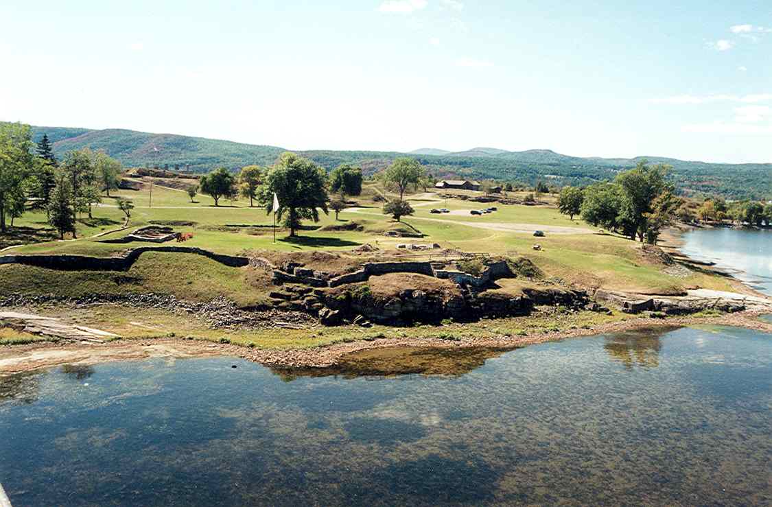

Port Henry, New York
Port Henry is a community of 1,410 people in Essex County, New York, founded in 1785.
Why visit Port Henry
Townapedia lists 11 museums and landmarks, 9 parks and trails, 11 places to eat, 3 places to stay and 3 attractions in and around town.
Highlights include Lake Champlain Bridge, Crown Point Light, Sherman Free Library and Chimney Point Tavern.
July is the warmest month, with average highs of 83°F; January lows average 10°F, and about 64 inches of snow fall in a normal year.
Weather in Port Henry
Forecast from the National Weather Service. Full forecast
About Port Henry
Port Henry is a hamlet (and census-designated place) in Essex County, New York, United States. The population was 1,194 at the 2010 census.
From the Wikipedia article Port Henry, New York (this version), under CC BY-SA 4.0.
Things to do3
Lake Champlain Bridge
Bridge · National Register of Historic Places · 2.1 mi
Former bridge across Lake Champlain from New York to Vermont, United States

Crown Point Light
Lighthouse · 2.2 mi
Lighthouse in New York, United States

Museums and landmarks11

Sherman Free Library
Monument and historic site · National Register of Historic Places
Public library in Port Henry, New York, United States
4 Church Street, Port Henry

Chimney Point Tavern
Monument and historic site · National Register of Historic Places · 2.1 mi
Historic building in Addison, Vermont, United States

Fort Crown Point
Monument and historic site · National Register of Historic Places · 1.9 mi
Fort in New York state
Fort Saint-Frédéric
Monument and historic site · National Register of Historic Places · 1.9 mi
Fort in New York

John Strong Mansion Museum
Monument and historic site · National Register of Historic Places · 2.5 mi
House in Addison, Vermont
Moriah Town Office Building
Monument and historic site · National Register of Historic Places
Rathaus in New York, United States of America
Port Henry Fire Department Building
Monument and historic site · National Register of Historic Places
Fire station in New York, United States of America

Port Henry station
Monument and historic site · National Register of Historic Places
Railway station in Port Henry, New York


Van Ornam & Murdock Block
Monument and historic site · National Register of Historic Places
Historic commercial building in New York, United States

Parks, trails and playgrounds9




Restaurants and cafes11

Golden Palace
Restaurant · Chinese
3266 Broad Street, Port Henry
We-Fr 11:00-20:30; Sa-Su 12:00-20:00; Mo-Tu closed

Boyea's Lakeside
Restaurant · Burger · 0.6 mi
15 Dock Lane, Port Henry



History
Port Henry is in a tract of land set aside by the British Crown for veterans of the Seven Years' War (also known as the French and Indian War). Although a mill was built in 1765, no other European-American settlers arrived until 1785, after the American Revolutionary War.
The Iroquoian-speaking Mohawk and Oswegatchie, members of the Seven Nations of Canada, were still living in the town until after 1800.
Most of the Iroquois from the territory of New York had been resettled in Canada, forced out of New York and the United States due to their alliance with the British during the war. In the early years, timber harvesting was a major industry and 20 mills were located in the area. The first dock was built on Lake Champlain by 1820 for shipping lumber to other ports.
Early settlers discovered iron ore a few miles inland. Its extraction and processing became an important industry in the township for about one hundred and fifty years. A blast furnace constructed in 1822 in Port Henry was one of the first in the United States, and Republic Steel established major operations in the county. The village residents used Lake Champlain and the Hudson River to transport its ore and products to major markets such as Albany and New York City. Later a railroad connected the village to markets.
From the History section of Port Henry, New York on Wikipedia, under CC BY-SA 4.0.
Where to stay3
Churches and places of worship3
Mount Moriah Presbyterian Church
Church · Presbyterian · National Register of Historic Places
19 Church Street, Port Henry
Shopping4
Gas and EV charging3
Schools, colleges and libraries3
Healthcare2
Map of Port Henry
52 places. The map loads OpenStreetMap tiles when you open it.
Climate by month
Monthly table
| Month | High | Low | Rain | Snow |
|---|---|---|---|---|
| Jan | 29°F | 10°F | 2.4 in | 13.1 in |
| Feb | 32°F | 10°F | 2.3 in | 17.2 in |
| Mar | 40°F | 20°F | 2.8 in | 13.9 in |
| Apr | 55°F | 34°F | 3.1 in | 3.1 in |
| May | 68°F | 45°F | 3.3 in | 0.1 in |
| Jun | 77°F | 56°F | 4.1 in | 0.0 in |
| Jul | 83°F | 61°F | 3.6 in | 0.0 in |
| Aug | 81°F | 59°F | 3.6 in | 0.0 in |
| Sep | 73°F | 51°F | 3.2 in | 0.0 in |
| Oct | 59°F | 40°F | 3.7 in | 0.3 in |
| Nov | 47°F | 29°F | 3.0 in | 3.8 in |
| Dec | 36°F | 18°F | 2.8 in | 12.2 in |
U.S. Climate Normals 1991-2020 for Vergennes (14 mi away), rain and snow from Elizabethtown, NOAA NCEI.
People and cost of living
American Community Survey 5-year estimates, 2020-2024, U.S. Census Bureau. Estimates have margins of error, larger for small towns.
Disaster history
Essex County has had 19 federal disaster declarations since 2000, most often for severe storms.
- 2024-09-24: Remnants Of Tropical Storm Debby (Tropical Storm)
- 2024-08-29: Severe Storm, Tornadoes, And Flooding (Flood)
- 2023-07-22: Severe Storms And Flooding (Severe Storm)
- 2020-03-20: Covid-19 Pandemic (Biological)
- 2020-03-13: Covid-19 (Biological)
- 2019-12-19: Severe Storms, Straight-Line Winds, And Flooding (Severe Storm)
OpenFEMA disaster declarations summaries.
Getting there and nearby towns
Lake Placid Airport (LKP) is the nearest airport with scheduled flights listed in OpenStreetMap, 29 miles away.
- Mineville 5 mi northwest, about 7 min by car
- South Burlington 30 mi northeast, about 49 min by car
- Burlington 33 mi north, about 53 min by car
- Essex Junction 35 mi northeast, about 57 min by car
- Peru 37 mi north, about 1 h by car
- Rutland 39 mi southeast, about 1 h by car
- Plattsburgh West 44 mi north, about 1 h 15 min by car
- Plattsburgh 45 mi north, about 1 h 15 min by car
- Morrisonville 45 mi north, about 1 h 15 min by car
- Glens Falls 52 mi south, about 1 h 30 min by car
Drive times are estimates from straight-line distance, not routes.
Local news
Headlines from INDB, the NEMICO news database.
Reviews, tips and questions
Loading what members have shared...
Sources and licences
- NCES EDGE (Public domain): public schools
- NOAA NCEI U.S. Climate Normals 1991-2020 (Public domain): climate by month
- OpenFEMA (Public domain): disaster declarations
- OpenStreetMap contributors (ODbL 1.0): places, airports, map data
- U.S. Census Bureau (Public domain): population, income, housing, education, commute
- Wikidata (CC0 1.0): elevation, founding date, time zone, website, landmarks and historic places
- Wikimedia Commons (see each image): photos
- Wikipedia (CC BY-SA 4.0): overview and history text
Photo credits
- Sherman Free Library Nov 10, Doug Kerr from Albany, NY, United States, CC BY-SA 2.0
- Mount Moriah Presbyterian Church, Port Henry, New York, Doug Kerr from Albany, NY, United States, CC BY-SA 2.0
- Moriah Town Hall, Port Henry, New York, Enesse Bhé, CC BY-SA 2.0
- Original Port Henry Fire Department Building, Alex Scrodin, CC0
- Crown Pt NY foreground French Fort St Frederic, petersent, Public domain
- Champlain bridge, Saucemaster, CC BY-SA 3.0
- JOHN STRONG HOUSE, JERRYE & ROY KLOTZ MD, CC BY-SA 3.0
- Van Orman and Murdoch Block, Alex Scrodin, CC0
- Fort Crown Point New York, Daniel M. Horowitz, CC BY-SA 4.0
- Port Henry, NY, train station, Daniel Case, CC BY-SA 3.0
- Chimney point historic building, Zeph77, CC BY-SA 4.0
- Champlain Memorial Lighthouse Nov 10, Doug Kerr from Upstate New York, CC BY-SA 2.0
Page built October 30, 2026. Spotted a mistake? Tell us or suggest a place.