
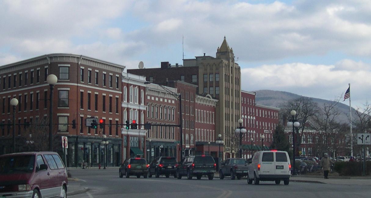


Why visit Rutland
Townapedia lists 19 museums and landmarks, 16 parks and trails, 30 places to eat, 12 places to stay and 5 attractions in and around town.
Highlights include Brown Covered Bridge, Paramount Theatre, Rutland Courthouse Historic District and Arthur Perkins House.
July is the warmest month, with average highs of 80°F; January lows average 8°F, and about 75 inches of snow fall in a normal year.
Weather in Rutland
Forecast from the National Weather Service. Full forecast
About Rutland
Rutland is the only city in and the seat of Rutland County, Vermont, United States. As of the 2020 census, the city had a total population of 15,807. It is located approximately 65 miles (105 km) north of the Massachusetts state line, 35 miles (56 km) west of New Hampshire state line, and 20 miles (32 km) east of the New York state line. Rutland is the third largest city in the state of Vermont after Burlington and South Burlington.
From the Wikipedia article Rutland (city), Vermont (this version), under CC BY-SA 4.0.
Things to do5

Brown Covered Bridge
Bridge · National Register of Historic Places · 4.2 mi
Wooden covered bridge in Shrewsbury, Vermont

Paramount Theatre
Cinema and theater
Theater in Rutland, Vermont, United States

Museums and landmarks19

Rutland Courthouse Historic District
Monument and historic site · National Register of Historic Places
Historic district in Vermont, United States
Arthur Perkins House
Monument and historic site · National Register of Historic Places · 1.3 mi
Historic house at 242 South Main Street in Rutland, Vermont

Chaffee-Moloney Houses
Monument and historic site · National Register of Historic Places · 0.7 mi
Historic houses in Vermont, United States
Clementwood
Monument and historic site · National Register of Historic Places · 1.6 mi
Historic estate in Rutland, Vermont
Cold River Bridge
Monument and historic site · National Register of Historic Places · 2.8 mi
Historic bridge in Vermont, United States
Immaculate Heart of Mary School
Monument and historic site · National Register of Historic Places
Historic school building at 10 Lincoln Avenue in Rutland, Vermont
Kazon Building
Monument and historic site · National Register of Historic Places · 3.7 mi
Historic industrial building in West Rutland, Vermont
Linden Terrace
Monument and historic site · National Register of Historic Places · 0.7 mi
Historic house in Vermont, United States
Longfellow School
Monument and historic site · National Register of Historic Places
School building in Rutland, United States of America
Marble Street Historic District
Monument and historic site · National Register of Historic Places · 3.7 mi
Historic district in Vermont, United States
Proctor-Clement House
Monument and historic site · National Register of Historic Places · 1.3 mi
Historic house in Vermont, United States
7 more on the map.
Parks, trails and playgrounds16

Pine Hill Park
Park · 1.4 mi
Trail system for hiking and mountain biking for summer and winter. Groomed trails for winter mountain biking.
2 Oak Street Extension, Rutland
Mo-Su 06:00-18:00
Main Street Park
Park
Contains an arboretum, gazebo, and benches. Is home to summer music performances and events.
5 Main Street
Baxter Street Park
Park · 0.5 mi
An outdoor park with playground structures, swings, and covered picnic benches. Part of a Rutland revitalization effort, this park...
65 Baxter Street, Rutland
Justin Thomas Memorial Park
Park · 0.5 mi
Justin Thomas Memorial Park is an enclosed park has a Play Structure, Gazebo, Picnic Tables and a portion of the park is designed with...
32 Madison Street, Rutland

Center Street Marketplace Park
Park
Opened in 2018 after the revitalization of an alley, the park hosts an open green space, outdoor seating, and outdoor family events.
Depot Park
Park
In the summer, this park is home to the Vermont Farmers Market. In winter, this is the location of the annual tree lighting.

4 more on the map.
Restaurants and cafes30


Little Haveli (Indian)
Restaurant · Indian
44 North Main Street, Rutland
The Maple Angus
Restaurant · Burger, Hot Dog, Ice Cream · 2.1 mi
Tu-Th 11:00-19:00; Fr-Sa 11:00-20:00; Su 12:00-19:00


18 more on the map.
History
The town of Rutland was chartered in 1761 and named after John Manners, 3rd Duke of Rutland. It was settled in 1770 and served as one of the capitals of the Vermont Republic. In the early 19th century, small high-quality marble deposits were discovered in Rutland, and in the 1830s a large deposit of nearly solid marble was found in what is now West Rutland. By the 1840s, small firms had begun excavations, but marble quarries proved profitable only after the railroad arrived in 1851. Rutland eventually became one of the world's leading marble producers. A large number of Italians with experience in the industry immigrated and brought their families to Rutland.
This fueled enough growth and investment that in 1886 the center of town incorporated as Rutland village. Most of the town was split off as West Rutland and Proctor, which contained the bulk of the marble quarries. Rutland City was incorporated as Vermont's third city on November 18, 1892. The new city's first mayor was John A. Mead.
The closing of the marble quarries in the area in the 1980s and 1990s led to a loss of jobs in the area.
From the History section of Rutland (city), Vermont on Wikipedia, under CC BY-SA 4.0.
Where to stay12
Churches and places of worship20
Rutland Jewish Center
Place of worship · National Register of Historic Places
96 Grove Street, Rutland
St. Peter's Church and Mount St. Joseph Convent Complex
Church · National Register of Historic Places · 0.6 mi
Immaculate Heart of Mary Roman Catholic Church
Church · Roman Catholic
18 Lincoln Avenue, Rutland
Church of Christ the King Roman Catholic Church
Church · Catholic · 0.5 mi
68 South Main Street, Rutland
Shopping18
Gas and EV charging16
Schools, colleges and libraries31
Healthcare2
Map of Rutland
169 places. The map loads OpenStreetMap tiles when you open it.
Climate by month
Monthly table
| Month | High | Low | Rain | Snow |
|---|---|---|---|---|
| Jan | 29°F | 8°F | 2.7 in | 18.3 in |
| Feb | 32°F | 9°F | 2.2 in | 16.0 in |
| Mar | 41°F | 18°F | 2.7 in | 13.8 in |
| Apr | 55°F | 31°F | 3.1 in | 3.2 in |
| May | 68°F | 42°F | 3.6 in | 0.0 in |
| Jun | 76°F | 52°F | 4.3 in | 0.0 in |
| Jul | 80°F | 56°F | 4.6 in | 0.0 in |
| Aug | 78°F | 54°F | 4.0 in | 0.0 in |
| Sep | 71°F | 46°F | 3.4 in | 0.0 in |
| Oct | 58°F | 35°F | 4.0 in | 0.3 in |
| Nov | 46°F | 26°F | 2.8 in | 4.7 in |
| Dec | 35°F | 16°F | 3.0 in | 18.3 in |
U.S. Climate Normals 1991-2020 for Rutland (1 mi away), NOAA NCEI.
People and cost of living
American Community Survey 5-year estimates, 2020-2024, U.S. Census Bureau. Estimates have margins of error, larger for small towns.
Disaster history
Rutland County has had 17 federal disaster declarations since 2000, most often for severe storms.
- 2024-08-08: Tropical Depression Debby (Tropical Storm)
- 2024-03-02: Severe Storm And Flooding (Severe Storm)
- 2023-07-14: Severe Storms, Flooding, Landslides, And Mudslides (Flood)
- 2023-07-10: Flooding (Flood)
- 2021-08-22: Tropical Storm Henri (Hurricane)
- 2020-04-08: Covid-19 Pandemic (Biological)
OpenFEMA disaster declarations summaries.
Getting there and nearby towns
Rutland-Southern Vermont Regional Airport (RUT) is the nearest airport with scheduled flights listed in OpenStreetMap, 6 miles away.
- West Rutland 3 mi west, about 5 min by car
- Proctor 6 mi northwest, about 9 min by car
- Pittsford 7 mi north, about 12 min by car
- Wallingford 9 mi south, about 15 min by car
- Castleton 10 mi west, about 17 min by car
- Claremont 36 mi southeast, about 58 min by car
- Lebanon 36 mi east, about 58 min by car
- Glens Falls 39 mi southwest, about 1 h by car
- West Glens Falls 42 mi southwest, about 1 h by car
- Saratoga Springs 55 mi southwest, about 1 h 30 min by car
Drive times are estimates from straight-line distance, not routes.
Local news
Headlines from INDB, the NEMICO news database.
Reviews, tips and questions
Loading what members have shared...
Sources and licences
- NCES EDGE (Public domain): public schools
- NOAA NCEI U.S. Climate Normals 1991-2020 (Public domain): climate by month
- OpenFEMA (Public domain): disaster declarations
- OpenStreetMap contributors (ODbL 1.0): places, airports, map data
- U.S. Census Bureau (Public domain): population, income, housing, education, commute
- Wikidata (CC0 1.0): elevation, founding date, time zone, website, landmarks and historic places
- Wikimedia Commons (see each image): photos
- Wikipedia (CC BY-SA 4.0): overview and history text
Photo credits
- Downtown Rutland, Vermont, Unknown author, CC BY-SA 3.0
- Live music Trinity Episcopal Church Rutland VT April 2023 01, Artaxerxes, CC BY-SA 4.0
- Live music Trinity Episcopal Church Rutland VT April 2023 02, Artaxerxes, CC BY-SA 4.0
- Old espresso machine Speakeasy Cafe 31 Center Street downtown Rutland VT August 2023, Artaxerxes, CC BY-SA 4.0
- Old typewriters Speakeasy Cafe 31 Center Street downtown Rutland VT August 2023, Artaxerxes, CC BY-SA 4.0
- Harley-Davidson motorcycle Center Street downtown Rutland VT August 2025, Artaxerxes, CC BY 4.0
- Unisex bathroom Yellow Deli Rutland VT August 2016, Artaxerxes, CC BY-SA 3.0
- Rutland, Vermont, Doug Kerr from Albany, NY, United States, CC BY-SA 2.0
- The Leash by Patrick Villiers Farrow Depot Park Rutland Plaza 15 Evelyn Street downtown Rutland VT August 2023 02, Artaxerxes, CC BY-SA 4.0
- The Leash by Patrick Villiers Farrow Depot Park Rutland Plaza 15 Evelyn Street downtown Rutland VT August 2023 01, Artaxerxes, CC BY-SA 4.0
- RutlandVT GraceCongregationalChurch, Magicpiano, CC BY-SA 3.0
- RutlandVT FreeLibrary, Magicpiano, CC BY-SA 3.0
- RutlandVT CourthouseAndBaptistChurch, Magicpiano, CC BY-SA 3.0
- RutlandVT HouseOppositeCourthouse, Magicpiano, CC BY-SA 3.0
- RutlandVT JewishCommunityCenter, Magicpiano, CC BY-SA 3.0
- Ford Falcon Ranchero Rutland Plaza 1 Rutland Street downtown Rutland VT August 2023 left, Artaxerxes, CC BY-SA 4.0
- Ford Falcon Ranchero Rutland Plaza 1 Rutland Street downtown Rutland VT August 2023 right, Artaxerxes, CC BY-SA 4.0
- Lake Bomaseen, near Rutland Vermont (2381094093), Boston Public Library, CC BY 2.0
- Catholic Church of Christ the King, made of Vermont Marble. Rutland Vermont 15 (2381928936), Boston Public Library, CC BY 2.0
- Vermont Mountain Village near Rutland Vermont (2381092713), Boston Public Library, CC BY 2.0
- Valley Mountain and Farm View, Rutland, Vt. (2381089645), Boston Public Library, CC BY 2.0
- Residential Area, Rutland, Vermont 7 (2381092209), Boston Public Library, CC BY 2.0
- Upper end of Lake Bomoseen, near Rutland, Vermont (2381927650), Boston Public Library, CC BY 2.0
- Lake Dunmore near Rutland Vt. (2381088271), Boston Public Library, CC BY 2.0
- Green Mountain Boy Monument, Rutland Vt. (2381087889), Boston Public Library, CC BY 2.0
- Covered bridge near Rutland, Vermont (2381926458), Boston Public Library, CC BY 2.0
- Marble quarry near Rutland, Vt. (2381920544), Boston Public Library, CC BY 2.0
- Marble bridge on Proctor Road, near Rutland, Vermont (2381926886), Boston Public Library, CC BY 2.0
- Depot Park showing service building on merchant row, Rutland, Vt. 2 (2381090035), Boston Public Library, CC BY 2.0
- Bardwell Hotel Rutland, Vt. (2381923590), Boston Public Library, CC BY 2.0
- Center Rutland Fall, Otter Creek, Rutland, Vermont (2381924998), Boston Public Library, CC BY 2.0
- Merchants Row looking north, Rutland, Vermont (2381090853), Boston Public Library, CC BY 2.0
- Lake Bomoseen waterfront, near Rutland Vermont (2381928534), Boston Public Library, CC BY 2.0
- Lake Bomoseen waterfront, near Rutland Vermont (2381928076), Boston Public Library, CC BY 2.0
- Center Street, Rutland, Vermont (2381924484), Boston Public Library, CC BY 2.0
- Service Building Rutland VT 2025, MrFib, CC BY 4.0
- Greetings from Rutland, Vermont - Large Letter Postcard (9377169412), Steve Shook from Moscow, Idaho, USA, CC BY 2.0
- Rutland station building, March 2013, Pi.1415926535, CC BY-SA 4.0
- Amtrak Station Rutland VT, Robert Mortell, CC BY-SA 3.0
- Walmart (Rutland, Vermont) 1, NNECAPA Photo Library, CC BY 2.0


Page built October 30, 2026. Spotted a mistake? Tell us or suggest a place.