


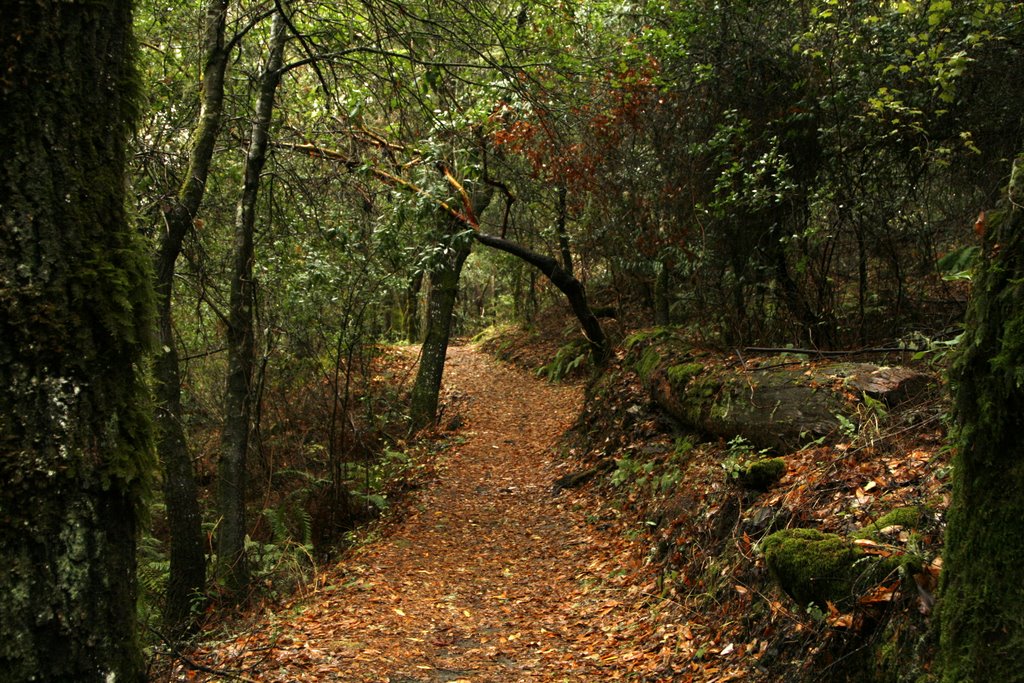

Portola Valley, California
Portola Valley is a town of 4,305 people in San Mateo County, California.
Why visit Portola Valley
Townapedia lists 7 museums and landmarks, 18 parks and trails, 7 places to eat and 10 attractions in and around town.
Highlights include Palo Alto University, Windy Hill, Casa De Tableta and Folger Estate Stable Historic District.
August is the warmest month, with average highs of 81°F; December lows average 40°F.
Weather in Portola Valley
Forecast from the National Weather Service. Full forecast
About Portola Valley
Portola Valley is a town in San Mateo County, California, United States. As of the 2020 census, the town had a population of 4,456. Located on the San Francisco Peninsula in the Bay Area, the community is nestled on the eastern slopes of the Santa Cruz Mountains.
From the Wikipedia article Portola Valley, California (this version), under CC BY-SA 4.0.
Things to do10

Palo Alto University
School · 2.7 mi
Private university located in Palo Alto, California, United States
1791 Arastradero Road, Palo Alto


Museums and landmarks7

Casa De Tableta
Monument and historic site · National Register of Historic Places · 2.4 mi
Historical building in San Mateo County, California, United States of America

Folger Estate Stable Historic District
Monument and historic site · National Register of Historic Places · 3.3 mi
Historical buildings and property in Woodside, California

Portola Valley School
Monument and historic site · National Register of Historic Places · 1.2 mi

Parks, trails and playgrounds18

Foothills Nature Preserve
Hiking and trails · 2.8 mi
Nature preserve in Palo Alto, California, United States
3300 Page Mill Road, Los Altos Hills
Mo-Su 08:00-sunset

Thornewood Open Space Preserve
Hiking and trails · 2.2 mi
Park in the Santa Cruz Mountains of San Mateo County, California, United States
sunrise-sunset

Foothills Open Space Preserve
Park · 4.0 mi
Open space preserve in Palo Alto, California, United States
La Honda Creek Open Space Preserve
Park · 1.9 mi
Open space preserve in San Mateo County, California, United States
Los Trancos Open Space Preserve
Park · 4.0 mi
Open space preserve in San Mateo and Santa Clara counties, California, United States

Russian Ridge Open Space Preserve
Park · 3.3 mi
Open space preserve in San Mateo County, California, United States


Sam McDonald County Park
Park · 4.7 mi
Park in San Mateo County, California
Thornewood Open Space Preserve (closed area)
Hiking and trails · 1.9 mi
6 more on the map.
Restaurants and cafes7

Rossotti's Alpine Inn
Restaurant · Burger, American · 2.4 mi
3915 Alpine Road, Portola Valley
Tu-Th 11:30-21:00; Fr 11:00-21:30; Sa 10:30-21:30; Su 10:30-21:00

Skywood Trading Post & Deli
Cafe · Sandwich · 2.3 mi
17287 Skyline Boulevard, Woodside
07:30-19:00


History
Portola Valley was named for Spanish explorer Gaspar de Portolá, who led the first party of Europeans to explore the San Francisco Peninsula in 1769.
The Native Americans already present were Ohlone and specifically the group (or groups) known as Olpen or Guemelento but these were later moved to Mission Dolores and Mission Santa Clara de Asís which claimed the land and peoples.
The area's written history dates back to 1833, when a square league of land was given to Domingo Peralta and Máximo Martínez by Governor José Figueroa to form the Rancho Cañada del Corte de Madera. In those days it was used for lumbering and cattle grazing.
By the 1880s Andrew S. Hallidie, a wire rope manufacturer, had built his country home of Eagle Home Farm in what is now Portola Valley. He built a 7,341 foot long aerial tramway from his house to the top of Skyline in 1894 though it was removed after his death in 1900.
In 1886 the name Portola-Crespi Valley was bestowed on the area from the then community of Crystal Springs (now under Crystal Springs Reservoir to the then community of Searsville (in the area of the present day Jasper Ridge Biological Preserve); Crespi is for Juan Crespí, a Franciscan friar with the Portolà expedition.
The town was incorporated in 1964. Bill Lane, known as the publisher of Sunset magazine, was its first mayor.
From the History section of Portola Valley, California on Wikipedia, under CC BY-SA 4.0.
Churches and places of worship5
Our Lady of the Wayside Church
Church · National Register of Historic Places · 1.3 mi
Shopping2
Gas and EV charging2
Schools, colleges and libraries19
Map of Portola Valley
70 places. The map loads OpenStreetMap tiles when you open it.
Climate by month
Monthly table
| Month | High | Low | Rain |
|---|---|---|---|
| Jan | 55°F | 41°F | 7.8 in |
| Feb | 55°F | 40°F | 8.0 in |
| Mar | 58°F | 41°F | 6.3 in |
| Apr | 62°F | 43°F | 3.4 in |
| May | 67°F | 47°F | 1.3 in |
| Jun | 75°F | 52°F | 0.4 in |
| Jul | 81°F | 58°F | 0.0 in |
| Aug | 81°F | 58°F | 0.1 in |
| Sep | 79°F | 57°F | 0.2 in |
| Oct | 71°F | 52°F | 1.7 in |
| Nov | 60°F | 44°F | 4.6 in |
| Dec | 54°F | 40°F | 8.4 in |
U.S. Climate Normals 1991-2020 for Skyline Ridge Preserve (4 mi away), NOAA NCEI.
People and cost of living
American Community Survey 5-year estimates, 2020-2024, U.S. Census Bureau. Estimates have margins of error, larger for small towns.
Disaster history
San Mateo County has had 14 federal disaster declarations since 2000, most often for floods.
- 2023-04-03: Severe Winter Storms, Straight-Line Winds, Flooding, Landslides, And Mudslides (Severe Storm)
- 2023-03-10: Severe Winter Storms, Flooding, Landslides, And Mudslides (Flood)
- 2023-01-14: Severe Winter Storms, Flooding, Landslides, And Mudslides (Flood)
- 2023-01-09: Severe Winter Storms, Flooding, And Mudslides (Flood)
- 2020-08-22: Wildfires (Fire)
- 2020-08-20: Czu Lightning Fire Complex (Fire)
OpenFEMA disaster declarations summaries.
Getting there and nearby towns
Palo Alto Airport (PAO) is the nearest airport with scheduled flights listed in OpenStreetMap, 9 miles away.
- Ladera 3 mi northeast, about 5 min by car
- La Honda 4 mi southwest, about 6 min by car
- Palo Alto 5 mi northeast, about 9 min by car
- Los Altos Hills 5 mi east, about 8 min by car
- West Menlo Park 5 mi north, about 8 min by car
- Stanford 6 mi northeast, about 9 min by car
- Atherton 7 mi north, about 10 min by car
- Los Altos 7 mi east, about 12 min by car
- Emerald Lake Hills 7 mi north, about 12 min by car
- North Fair Oaks 8 mi north, about 13 min by car
Drive times are estimates from straight-line distance, not routes.
Local news
Headlines from INDB, the NEMICO news database.
Reviews, tips and questions
Loading what members have shared...
Sources and licences
- NCES EDGE (Public domain): public schools
- NOAA NCEI U.S. Climate Normals 1991-2020 (Public domain): climate by month
- OpenFEMA (Public domain): disaster declarations
- OpenStreetMap contributors (ODbL 1.0): places, airports, map data
- U.S. Census Bureau (Public domain): population, income, housing, education, commute
- Wikidata (CC0 1.0): elevation, founding date, time zone, website, landmarks and historic places
- Wikimedia Commons (see each image): photos
- Wikipedia (CC BY-SA 4.0): overview and history text
Photo credits
- Thornewood Open Space Preserve mountains and trail, Runner1928, CC BY-SA 3.0
- Casa de Tableta, Portola Valley, California, W Nowicki, CC BY 3.0
- Folger Estate Stable Historic District, 4040 Woodside Rd., Woodside, CA 9-18-2011 4-24-36 PM, Sanfranman59, CC BY-SA 3.0
- Portola Valley School, W Nowicki, CC BY 3.0
- Los Trancos openspace, Grey3k, CC BY 3.0
- Russian Ridge-Wildflowers, Steve Jurvetson, CC BY 2.0
- Sam McDonald County Park (16121518351), C N from San Francisco, CA, CC BY-SA 2.0
Page built October 30, 2026. Spotted a mistake? Tell us or suggest a place.