


Princeton, Kentucky
Princeton is a city of 6,241 people in Caldwell County, Kentucky, founded in December 6, 1820.
Why visit Princeton
Townapedia lists 11 museums and landmarks, 11 parks and trails, 28 places to eat and 2 places to stay in and around town.
Highlights include Adsmore Museum and Adsmore.
July is the warmest month, with average highs of 89°F; January lows average 27°F.
Weather in Princeton
Forecast from the National Weather Service. Full forecast
About Princeton
Princeton is a home rule-class city in Caldwell County, Kentucky, in the United States. It is the seat of its county. As of the 2020 census, Princeton had a population of 6,270. Princeton is home to several notable attractions such as Adsmore Museum, Champion-Shepherdson House (home of the Princeton Art Guild), University of Kentucky Research and Education Center Botanical Garden, and the Annual Black Patch Festival.
From the Wikipedia article Princeton, Kentucky (this version), under CC BY-SA 4.0.
Museums and landmarks11


Adsmore
Monument and historic site · National Register of Historic Places · 0.4 mi
House in Princeton, Kentucky
304 North Jefferson Street, Princeton
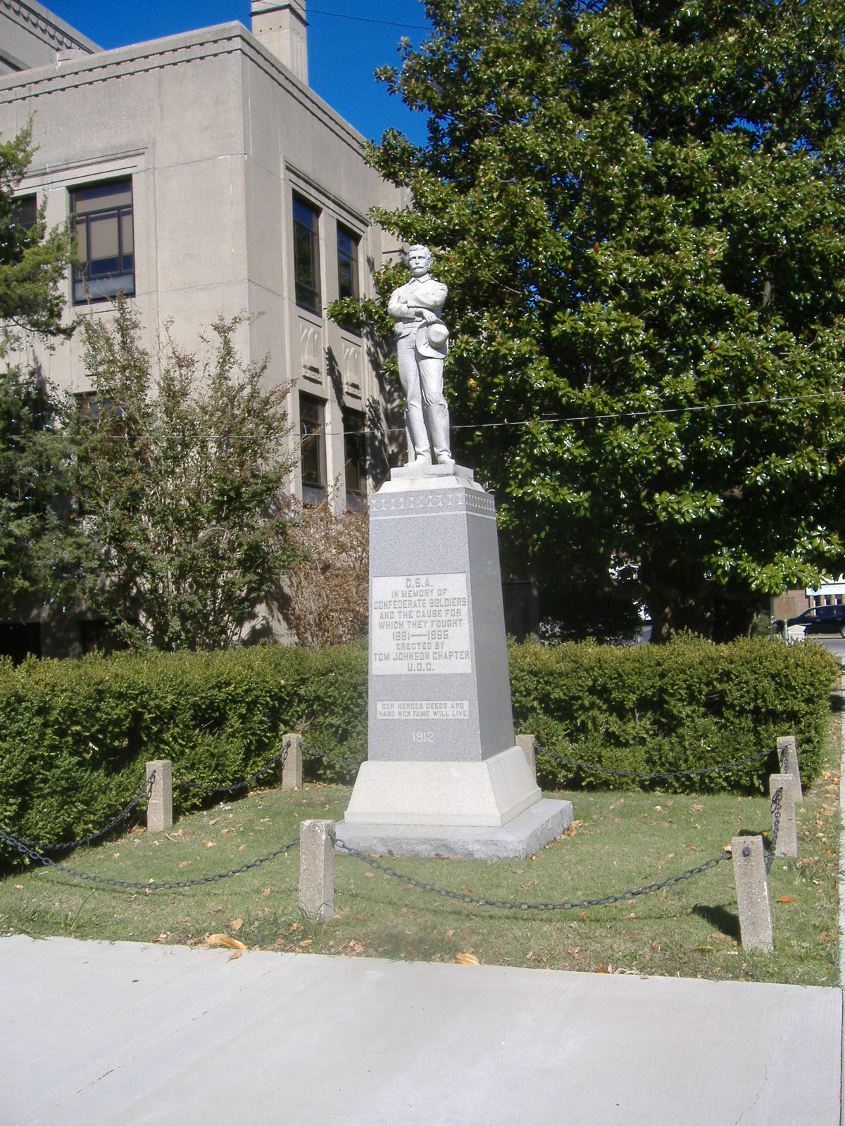
Confederate Soldier Monument in Caldwell
Monument and historic site · National Register of Historic Places
Sculpture in Kentucky, United States of America
L.B. Overby House
Monument and historic site · National Register of Historic Places
Historic house in Kentucky, United States


Princeton Downtown Commercial District
Monument and historic site · National Register of Historic Places
Historic district in Princeton, Kentucky, USA
Parks, trails and playgrounds11

Big Springs Park - Historic Cherokee Trail of Tears
Park
East Washington Street, Princeton

Restaurants and cafes28

Adams Breezy Hill Farm Restaurant
Restaurant · American, Chicken, Pasta, Steak House, Fish, Salad · 1.6 mi
1222 Cadiz Road, Princeton
Mo off; Tu-We 10:30-14:30; Th-Sa 10:30-14:30,16:30-20:30; Su off
Ms Piggy Pigs BBQ
Restaurant · Barbecue · 0.6 mi
509 Madisonville Street, Princeton
Mo,Su off; Tu-Sa 10:00-18:00
Pagliai's Pizza of Princeton
Restaurant · Italian · 1.1 mi
100 Micbeth Drive, Princeton
Su-Th 11:00-21:30; Fr,Sa 11:00-22:00
The Biscuit Barn
Restaurant · Breakfast, Ice Cream, American, Donut
116 Edwards Avenue, Princeton
06:00-16:00, Su,We closed

Crooked Tail Distilery
Brewery and winery
106 East Washington Street, Princeton
Mo-Th 10:00-22:00; Fr,Sa 10:00-24:00; Su off
Kay's Kitchen
Restaurant · 0.5 mi
501 North Jefferson Street, Princeton
Mo-Fr 05:30-14:00; Sa 05:30-11:00
Great Wall Chinese Restaurant
Restaurant · Chinese · 1.1 mi
338 US HWY 62 W, Princeton
Mo-Su 11:00-21:00
La Potosina Mexican Restaurant
Restaurant · Mexican · 1.1 mi
302 Marion Road, Princeton
Mo-Su 11:00-21:00

16 more on the map.
Where to stay2

History
The community at the head of Eddy Creek was first called Eddy Grove for the creek's source at a large whirling spring. 1,700 acres (690 ha) of surrounding land was granted to the Virginian William Prince for his service during the American Revolution. He settled there in what was then Livingston County in 1799 and erected Shandy Hall, a brick home and tavern. Prince's heirs and another local landowner named Thomas Frazier granted 40 acres (16 ha) around Eddy Grove and Prince's Place towards the establishment of a new town in 1817, provided the courthouse of the newly formed Caldwell County was relocated there from Eddyville. The county court accepted the proposal in July and named the new community Princetown, which shortened to Princeton by the time of the Eddy Grove.
Construction of Princeton College began in 1860 but was delayed by the commencement of the Civil War. Confederate troops camped on its campus in 1861, using one of the buildings as a hospital when the area came under Confederate control. Following the Confederate retreat in early 1862, Union soldiers occupied the town for the remainder of the war. In December 1864, Confederate-allied Kentuckian cavalry under Gen. Hylan B. Lyon raided the town and razed the courthouse, which was serving as a Union garrison.
From the History section of Princeton, Kentucky on Wikipedia, under CC BY-SA 4.0.
Churches and places of worship13
The Church of Jesus Christ of Latter-day Saints
Church · Mormon · 0.8 mi
865 Hopkinsville Street, Princeton
First Christian Church
Church · Disciples Of Christ · 0.4 mi
510 Hopkinsville Street, Princeton
Shopping8
Gas and EV charging10
Schools, colleges and libraries13
Caldwell County Schools - Board of Education - Butler Building
School
612 West Main Street, Princeton
Caldwell County Area Technology Center
School · 2.1 mi
130 Vocational School Rd, Princeton
Healthcare10
Caldwell Medical Associates - Family Practice Clinic
Clinic and pharmacy · 1.2 mi
302 Micbeth Drive, Princeton
Fresenius Kidney Care Jefferson - Princeton
Clinic and pharmacy
401 South Jefferson Street, Princeton
Caldwell Medical Associates - Internal Medicine & Pediatrics
Clinic and pharmacy · 1.1 mi
320 Micbeth Drive, Princeton
Map of Princeton
106 places. The map loads OpenStreetMap tiles when you open it.
Climate by month
Monthly table
| Month | High | Low | Rain | Snow |
|---|---|---|---|---|
| Jan | 46°F | 27°F | 3.7 in | 2.6 in |
| Feb | 51°F | 30°F | 4.0 in | 2.7 in |
| Mar | 61°F | 38°F | 4.8 in | 1.4 in |
| Apr | 72°F | 47°F | 5.1 in | 0.0 in |
| May | 79°F | 56°F | 4.8 in | 0.0 in |
| Jun | 86°F | 64°F | 4.5 in | 0.0 in |
| Jul | 89°F | 68°F | 4.5 in | 0.0 in |
| Aug | 89°F | 66°F | 3.5 in | 0.0 in |
| Sep | 83°F | 59°F | 3.3 in | 0.0 in |
| Oct | 73°F | 47°F | 4.1 in | 0.1 in |
| Nov | 60°F | 37°F | 4.1 in | 0.1 in |
| Dec | 49°F | 30°F | 4.5 in | 1.6 in |
U.S. Climate Normals 1991-2020 for Princeton 1 Se (2 mi away), NOAA NCEI.
People and cost of living
American Community Survey 5-year estimates, 2020-2024, U.S. Census Bureau. Estimates have margins of error, larger for small towns.
Disaster history
Caldwell County has had 24 federal disaster declarations since 2000, most often for severe storms.
- 2026-01-24: Severe Winter Storm (Winter Storm)
- 2025-05-23: Severe Storms, Straight-Line Winds, And Tornadoes (Severe Storm)
- 2025-04-24: Severe Storms, Straight-Line Winds, Tornadoes, Flooding, Landslides, And Mudslides (Severe Storm)
- 2025-04-03: Severe Storms, Straight-Line Winds, Tornadoes, And Flooding (Severe Storm)
- 2025-02-24: Severe Storms, Straight-Line Winds, Flooding, Landslides, And Mudslides (Severe Storm)
- 2025-02-16: Severe Storms, Straight-Line Winds, Flooding, And Landslides (Severe Storm)
OpenFEMA disaster declarations summaries.
Getting there and nearby towns
Campbell Army Airfield (HOP) is the nearest airport with scheduled flights listed in OpenStreetMap, 37 miles away.
- Eddyville 11 mi west, about 17 min by car
- Dawson Springs 12 mi northeast, about 19 min by car
- Cadiz 17 mi south, about 28 min by car
- Marion 19 mi northwest, about 30 min by car
- Earlington 24 mi northeast, about 38 min by car
- Madisonville 26 mi northeast, about 43 min by car
- Calvert City 28 mi west, about 46 min by car
- Hopkinsville 29 mi southeast, about 47 min by car
- Dixon 30 mi north, about 48 min by car
- Benton 32 mi southwest, about 51 min by car
Drive times are estimates from straight-line distance, not routes.
Local news
Headlines from INDB, the NEMICO news database.
Reviews, tips and questions
Loading what members have shared...
Sources and licences
- NCES EDGE (Public domain): public schools
- NOAA NCEI U.S. Climate Normals 1991-2020 (Public domain): climate by month
- OpenFEMA (Public domain): disaster declarations
- OpenStreetMap contributors (ODbL 1.0): places, airports, map data
- U.S. Census Bureau (Public domain): population, income, housing, education, commute
- Wikidata (CC0 1.0): elevation, founding date, time zone, website, landmarks and historic places
- Wikimedia Commons (see each image): photos
- Wikipedia (CC BY-SA 4.0): overview and history text
Photo credits
- Caldwell County Kentucky Courthouse, Dlove4000, CC BY-SA 3.0
- L.B. Overby House, Princeton, Nyttend, Public domain
- Downtown Princeton, Dlove4000, CC BY-SA 4.0
- Downtown Princeton Kentucky, Dlove4000, CC BY-SA 3.0
- Princeton downtown, Dlove4000, CC BY-SA 3.0
- PRINCETONKYTORNADO, Dlove4000, CC BY-SA 4.0
- Halleck's School near Princeton, Nyttend, Public domain
- 114-116 East Main; Princeton, KY, Sjbodell at English Wikipedia, Public domain
- Confederate Soldier Monument in Caldwell 2, The original uploader was Bedford at English Wikipedia ., Attribution
- Big Springs Cave, Dlove4000, CC BY-SA 3.0
- Capitol Cinemas, Dlove4000, CC BY-SA 3.0
- Big Springs, Dlove4000, CC BY-SA 3.0
- William S. Powell House, Nyttend, Public domain
- Nancy Newsom's Hams, Dlove4000, CC BY-SA 3.0
- Adsmore museum, Dlove4000, CC BY-SA 3.0
- Sarah Knott House, Nyttend, Public domain
- ISS066-E-2241 - View of Earth, Earth Science and Remote Sensing Unit , Lyndon B. Johnson Space Center, Public domain
- ISS023-E-44087 - View of Earth, Earth Science and Remote Sensing Unit , Lyndon B. Johnson Space Center, Public domain
- ISS030-E-18970 - View of Earth, Earth Science and Remote Sensing Unit , Lyndon B. Johnson Space Center, Public domain
- ISS066-E-2242 - View of Earth, Earth Science and Remote Sensing Unit , Lyndon B. Johnson Space Center, Public domain
- ISS048-E-5179 - View of Earth, Earth Science and Remote Sensing Unit , Lyndon B. Johnson Space Center, Public domain
- Agriculture station, Dlove4000, CC BY-SA 3.0


Page built October 30, 2026. Spotted a mistake? Tell us or suggest a place.