


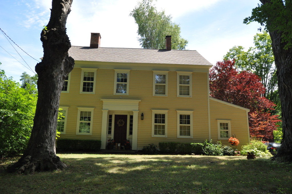

Putnam Lake, New York
Putnam Lake is a community of 3,664 people in Putnam County, New York.
Why visit Putnam Lake
Townapedia lists 2 museums and landmarks, 3 parks and trails, 2 places to eat, 1 place to stay and 4 attractions in and around town.
Highlights include Thunder Ridge Ski Area, Brimstone Mountain, Cosier-Murphy House and Williams House.
July is the warmest month, with average highs of 78°F; January lows average 16°F.
Weather in Putnam Lake
Forecast from the National Weather Service. Full forecast
About Putnam Lake
Putnam Lake is a hamlet and census-designated place in the eastern part of the town of Patterson in Putnam County, New York, United States. As of the 2020 census, Putnam Lake had a population of 3,776. Putnam Lake is adjacent to the Connecticut border, which is crossed by a number of local streets. The community surrounds a lake, which is also called Putnam Lake.
From the Wikipedia article Putnam Lake, New York (this version), under CC BY-SA 4.0.
Things to do4

Thunder Ridge Ski Area
Ski area · 2.8 mi
Ski area in New York, United States

Museums and landmarks2
Cosier-Murphy House
Monument and historic site · National Register of Historic Places · 4.0 mi
New Fairfield, Connecticut, listed on the NRHP in Fairfield County
Williams House
Monument and historic site · National Register of Historic Places · 3.3 mi
Historic single-family residence located at 5 Williams Road in New Fairfield, Connecticut
Parks, trails and playgrounds3

Ball Pond Town Park
Hiking and trails · 1.7 mi
Municipal, Open To Public Without Fee
Weldon Picnic Area
Hiking and trails · 1.7 mi
Private, Open To Public Without Fee
Restaurants and cafes2

Putnam Diner & Restaurant
Diner · American · 1.5 mi
2600 NY-22, Patterson
Mo-Th, Su 07:00-22:00; Fr-Sa 07:00-23:00

History
Up until the end of World War I, Putnam Lake was a small rural hamlet called Valleyville, consisting mainly of dairy farms. In the years leading into the Great Depression, failing farms were bought by developers McGolrick Realty Co. in association with Warren and Arthur Smadbeck, to create a recreational community for New York City citizens.
In 1930, the State Line Golf and Country Club in association with the Smadbecks' New York Daily Mirror Holding Co. bought five farms, totaling 1,111 acres (4.50 km2) of land in Patterson, encroaching New Fairfield, Connecticut. Morlock Brook was dammed, flooding the area of Valleyville, creating the 200-acre (0.81 km2) lake.
The area around Putnam Lake was divided into 11,000 plots, each 20 by 100 feet (6.1 by 30.5 m), which were to be occupied by summer cottages, general stores, restaurants, gas stations, dance pavilions, and taverns. The New York Daily Mirror first published advertisements for the community in 1931, and 75 percent of the lots were sold in the first year. Some 2000 homes were built by 1932, which made Putnam Lake the most densely populated community in Patterson, if only for the summer. Some families made Putnam Lake their year-round residence, and a school house was constructed where the Veterans of Foreign Wars building now stands on Fairfield Drive.
From the History section of Putnam Lake, New York on Wikipedia, under CC BY-SA 4.0.
Where to stay1
Churches and places of worship3
Old Southeast Church
Church · National Register of Historic Places · 3.2 mi
Gas and EV charging2
Schools, colleges and libraries15
Map of Putnam Lake
32 places. The map loads OpenStreetMap tiles when you open it.
Climate by month
Monthly table
| Month | High | Low | Rain |
|---|---|---|---|
| Jan | 33°F | 16°F | 3.9 in |
| Feb | 36°F | 19°F | 3.0 in |
| Mar | 44°F | 26°F | 4.2 in |
| Apr | 57°F | 37°F | 3.5 in |
| May | 66°F | 47°F | 4.1 in |
| Jun | 74°F | 56°F | 4.6 in |
| Jul | 78°F | 61°F | 4.2 in |
| Aug | 76°F | 60°F | 4.9 in |
| Sep | 70°F | 53°F | 4.9 in |
| Oct | 60°F | 41°F | 4.2 in |
| Nov | 49°F | 32°F | 3.9 in |
| Dec | 39°F | 23°F | 5.0 in |
U.S. Climate Normals 1991-2020 for Carmel 4N (5 mi away), NOAA NCEI.
People and cost of living
American Community Survey 5-year estimates, 2020-2024, U.S. Census Bureau. Estimates have margins of error, larger for small towns.
Disaster history
Putnam County has had 20 federal disaster declarations since 2000, most often for hurricanes.
- 2023-07-22: Severe Storms And Flooding (Severe Storm)
- 2021-09-05: Remnants Of Hurricane Ida (Hurricane)
- 2021-09-02: Remnants Of Hurricane Ida (Hurricane)
- 2021-08-22: Hurricane Henri (Hurricane)
- 2020-10-02: Tropical Storm Isaias (Hurricane)
- 2020-03-20: Covid-19 Pandemic (Biological)
OpenFEMA disaster declarations summaries.
Getting there and nearby towns
Danbury Municipal Airport (DXR) is the nearest airport with scheduled flights listed in OpenStreetMap, 8 miles away.
- Ball Pond 1 mi southeast, about 2 min by car
- Brewster Hill 5 mi southwest, about 8 min by car
- Inglenook 5 mi northeast, about 8 min by car
- Danbury 6 mi southeast, about 10 min by car
- Lake Carmel 6 mi west, about 10 min by car
- Brewster 6 mi southwest, about 10 min by car
- Brewster Heights 6 mi southwest, about 10 min by car
- Pawling 7 mi north, about 11 min by car
- Peach Lake 7 mi south, about 12 min by car
- Carmel 9 mi southwest, about 14 min by car
Drive times are estimates from straight-line distance, not routes.
Local news
Headlines from INDB, the NEMICO news database.
Reviews, tips and questions
Loading what members have shared...
Sources and licences
- NCES EDGE (Public domain): public schools
- NOAA NCEI U.S. Climate Normals 1991-2020 (Public domain): climate by month
- OpenFEMA (Public domain): disaster declarations
- OpenStreetMap contributors (ODbL 1.0): places, airports, map data
- U.S. Census Bureau (Public domain): population, income, housing, education, commute
- Wikidata (CC0 1.0): elevation, founding date, time zone, website, landmarks and historic places
- Wikimedia Commons (see each image): photos
- Wikipedia (CC BY-SA 4.0): overview and history text
Photo credits
- Old Southeast Church, Southeast, NY, Daniel Case, CC BY-SA 3.0
- NewFairfieldCT CosierMurphyHouse, Magicpiano, CC BY-SA 3.0
- NewFairfieldCT WilliamsHouse, Magicpiano, CC BY-SA 3.0
Page built October 30, 2026. Spotted a mistake? Tell us or suggest a place.