


Loading the weather...
Population3,542
GeoNames
Local nameАршан
RegionKalmykiya Republic
Elevation94 m
308 ft
Time zoneEurope/Moscow
Land area9.9 km²
Nearest airportElista Airport (ESL)
14 km
Why visit Arshan’
Townapedia lists 2 museums and landmarks and 2 places to eat in and around town.
Weather in Arshan’
Forecast from MET Norway (CC BY 4.0). Full forecast
Museums and landmarks2

Restaurants and cafes2


Churches and places of worship3
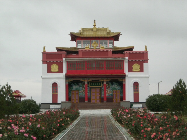
Святая обитель теории и практики школы Гелуг
Place of worship · Gelug · 1.7 km

Advertisement
Gas and EV charging1

Schools, colleges and libraries2
Map of Arshan’
10 places. The map loads OpenStreetMap tiles when you open it.
Getting there and nearby towns
Elista Airport (ESL) is the nearest airport with scheduled flights listed in OpenStreetMap, 14 km away.
- Elista 5 km northeast, about 5 min by car
- Troitskoye 16 km north, about 16 min by car
- Remontnoye 54 km northwest, about 54 min by car
- Priyutnoye 58 km west, about 58 min by car
- Iki Burul 60 km southeast, about 1 h by car
- Divnoye 78 km southwest, about 1 h 15 min by car
- Yashkul’ 87 km east, about 1 h 30 min by car
Drive times are estimates from straight-line distance, not routes.
Local news
Headlines from INDB.
Reviews, tips and questions
Loading what members have shared...
Sources and licences
- GeoNames (CC BY 4.0): population, coordinates, regions and time zone
- OpenStreetMap contributors (ODbL 1.0): places, airports, map data
- Wikidata (CC0 1.0): elevation, founding date, time zone, website
- Wikimedia Commons (see each image): photos
Photo credits
- Geden Sheddup Choikorling, Buzava at English Wikipedia, Public domain
- GShCh, Alexandr Demidenko, CC BY-SA 4.0
- Syakyusn syume Temple Elista Kalmykia, Author=Author= JialiangGao www.peace-on-earth.org, CC BY-SA 3.0
- Elista Syakusn Syume, Ymblanter, CC BY-SA 4.0
- Elista banner, Ymblanter, CC BY-SA 4.0
- Tselinny District, Kalmykia, Russia - panoramio (1), Владимир К, CC BY 3.0
Page built November 4, 2026. Spotted a mistake? Tell us or suggest a place.