
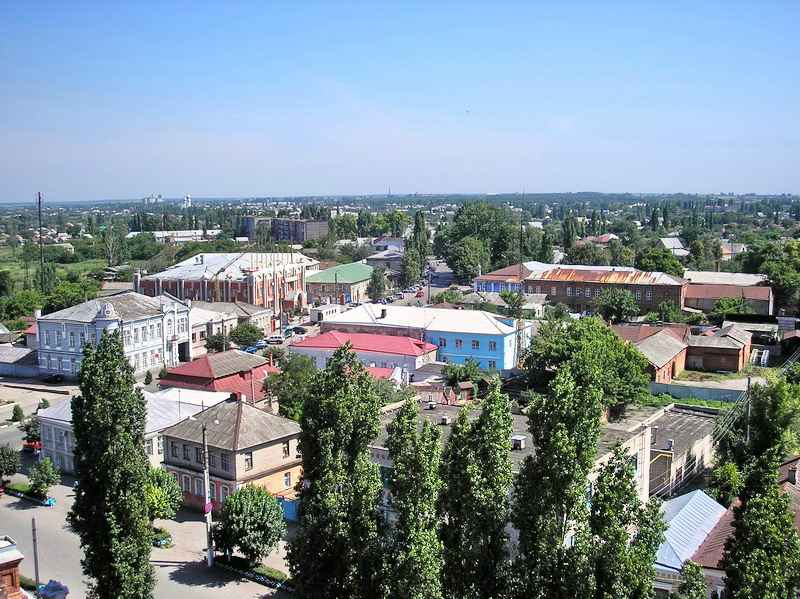


Buturlinovka, Russia
Бутурлиновка
Buturlinovka is a town of 28,581 people in Voronezh Oblast, Russia, founded in 1740.
Why visit Buturlinovka
Townapedia lists 9 museums and landmarks, 5 parks and trails, 3 places to eat and 1 attraction in and around town.
Weather in Buturlinovka
Forecast from MET Norway (CC BY 4.0). Full forecast
About Buturlinovka
Buturlinovka (Russian: Бутурли́новка) is a town in Voronezh Oblast, Russia, on the Ossered River, a tributary of the Don. It serves as the administrative center of Buturlinovsky District. Its population as of 2021 was 24,397.
From the Wikipedia article Buturlinovka (this version), under CC BY-SA 4.0.
Things to do1

Museums and landmarks9

Parks, trails and playgrounds5

Restaurants and cafes3





History
It was founded in 1740 as a sloboda inhabited by settlers from Left-bank Ukraine. After the settlement was transferred into the ownership of count Buturlin, in 1766 local residents staged a rebellion against enserfment. Under the Tsarist rule Buturlinovka was the biggest village of Voronezh Governorate, and local population engaged in handicrafts. Town status was granted to Buturlinovka in 1917.
The settlement represented the northeasternmost part of Ukrainian ethnic territory, with 85% of its population of 28,000 identifying as Ukrainians (according to the 1926 Soviet census). Its population has shrunk throughout the past 30 years, as per the Russian census: 24,397 (2021 census); 27,208 (2010 census); 28,627 (2002 census); 29,258 (1989 Soviet census)..
From the History section of Buturlinovka on Wikipedia, under CC BY-SA 4.0.
Churches and places of worship4
Собор Спаса Преображения
Church · Russian Orthodox · 1.3 km
36 площадь Воли, Бутурлиновка
Церковь Покрова Пресвятой Богородицы
Church · Russian Orthodox · 0.9 km
252 улица Ленина
Shopping4
Gas and EV charging6
Schools, colleges and libraries8
МКОУ Зелёнопоселковая ООШ Бутурлиновского района
School · 1.5 km
4 улица Ленина, Бутурлиновка
Healthcare6
Map of Buturlinovka
46 places. The map loads OpenStreetMap tiles when you open it.
Getting there and nearby towns
- Kozlovka 11 km west, about 11 min by car
- Vorontsovka 29 km southwest, about 29 min by car
- Nizhniy Kislyay 30 km west, about 30 min by car
- Talovaya 34 km north, about 34 min by car
- Muzhich’ye 34 km east, about 34 min by car
- Khrenovoye 39 km northwest, about 39 min by car
- Losevo 42 km southwest, about 42 min by car
- Pavlovsk 53 km southwest, about 53 min by car
- Kalach 53 km southeast, about 53 min by car
- Liski 79 km west, about 1 h 15 min by car
Drive times are estimates from straight-line distance, not routes.
Local news
Headlines from INDB.
Reviews, tips and questions
Loading what members have shared...
Sources and licences
- GeoNames (CC BY 4.0): population, coordinates, regions and time zone
- OpenStreetMap contributors (ODbL 1.0): places, airports, map data
- Wikidata (CC0 1.0): elevation, founding date, time zone, website
- Wikimedia Commons (see each image): photos
- Wikipedia (CC BY-SA 4.0): overview and history text
Photo credits
- Бутурлиновка,центр города, Фотография сделана мной, CC BY-SA 3.0
- Buturlinovka, Voronezh Oblast, Russia - panoramio (9), Анатолий Таранцов, CC BY 3.0
- Buturlinovka, Voronezh Oblast, Russia - panoramio (5), Анатолий Таранцов, CC BY 3.0
- Buturlinovka, Voronezh Oblast, Russia - panoramio (4), Анатолий Таранцов, CC BY 3.0
- Buturlinovka, Voronezh Oblast, Russia - panoramio, Анатолий Таранцов, CC BY 3.0
- Buturlinovka, Voronezh Oblast, Russia - panoramio (7), Анатолий Таранцов, CC BY 3.0
- Buturlinovka, Voronezh Oblast, Russia - panoramio (3), Анатолий Таранцов, CC BY 3.0
- Buturlinovka, Voronezh Oblast, Russia - panoramio (6), Анатолий Таранцов, CC BY 3.0
- Buturlinovka, Voronezh Oblast, Russia - panoramio (2), Анатолий Таранцов, CC BY 3.0
- Buturlinovka, Voronezh Oblast, Russia - panoramio (1), Анатолий Таранцов, CC BY 3.0
- Buturlinovka, Voronezh Oblast, Russia - panoramio (8), Анатолий Таранцов, CC BY 3.0
- Спасо-Преображенский собор - panoramio (3), daserna, CC BY 3.0
- Спасо-Преображенский собор - panoramio (1), daserna, CC BY 3.0
- Спасо-Преображенский собор - panoramio, daserna, CC BY 3.0
- Спасо-Преображенский собор - panoramio (2), daserna, CC BY 3.0
- Памятник павшим воинам - panoramio (1), daserna, CC BY 3.0
- Памятник павшим воинам - panoramio (2), daserna, CC BY 3.0
- Памятник павшим воинам - panoramio, daserna, CC BY 3.0
- Река Осередь - panoramio (1), daserna, CC BY 3.0
- Река Осередь - panoramio, daserna, CC BY 3.0
- Мост через реку Осередь - panoramio, daserna, CC BY 3.0
- ISS052-E-43519 - View of Earth, Earth Science and Remote Sensing Unit , Lyndon B. Johnson Space Center, Public domain


Page built November 4, 2026. Spotted a mistake? Tell us or suggest a place.