


Why visit Khankala
Townapedia lists 5 museums and landmarks, 1 park or trail, 2 places to eat, 1 place to stay and 3 attractions in and around town.
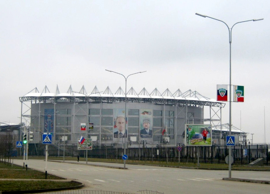
Highlights include Grozny State Oil Technical University, Grozny synagogue, Memorial to the Victims of the Deportation of 1944 and Akhmat Arena.
Weather in Khankala
Forecast from MET Norway (CC BY 4.0). Full forecast
About Khankala
Khankala (Russian: Ханкала, Chechen: Хан-ГӀала, romanized: Ẋan-Ġala) is a settlement in Groznensky District of the Chechen Republic, Russia, located to the east of Grozny, the republic's capital. Population: 7,908 (2002 census).
From the Wikipedia article Khankala (this version), under CC BY-SA 4.0.
Things to do3

Grozny State Oil Technical University
School · 5.3 km
Education organization in Grozny, Russia

Grozny synagogue
Monument and historic site · 5.2 km
Synagogue in Grozny, Chechen Republic

Kadyrov Chechen State University
School · 4.4 km
University located in Grozny, Chechnya, Russia
Museums and landmarks5

Memorial to the Victims of the Deportation of 1944
Monument and historic site · 4.9 km
Monument in Grozny, Russia

Карьер в который похоронили остатки города Грозный
Monument and historic site · 2.4 km
Parks, trails and playgrounds1


Restaurants and cafes2


Where to stay1
Churches and places of worship2
Shopping2
Gas and EV charging1
Schools, colleges and libraries4
Healthcare7
Map of Khankala
28 places. The map loads OpenStreetMap tiles when you open it.
Getting there and nearby towns
Grozny Airport (GRV) is the nearest airport with scheduled flights listed in OpenStreetMap, 11 km away.
- Staraya Sunzha 4 km north, about 4 min by car
- Grozny 6 km west, about 6 min by car
- Prigorodnoye 5 km south, about 5 min by car
- Shali 21 km southeast, about 21 min by car
- Vedeno 46 km southeast, about 46 min by car
- Dyshne-Vedeno 48 km southeast, about 48 min by car
- Sunzha 57 km west, about 57 min by car
- Khasavyurt 67 km east, about 1 h by car
- Karabulak 69 km west, about 1 h 15 min by car
- Nazran 80 km west, about 1 h 15 min by car
Drive times are estimates from straight-line distance, not routes.
Local news
Headlines from INDB.
Reviews, tips and questions
Loading what members have shared...
Sources and licences
- GeoNames (CC BY 4.0): population, coordinates, regions and time zone
- OpenStreetMap contributors (ODbL 1.0): places, airports, map data
- Wikidata (CC0 1.0): elevation, founding date, time zone, website, landmarks and historic places
- Wikimedia Commons (see each image): photos
- Wikipedia (CC BY-SA 4.0): overview and history text
Photo credits
- Ханкала, падение МИ-26, Lesless, CC BY-SA 4.0
- Grozny Oil University, Simba16, CC BY-SA 4.0
- Grozny, Synagogue (01), Unknown author Unknown author, Public domain
- Chechen university 1946, Simba16, CC BY-SA 4.0
- Mémorial (recto), Deniev Dagun, CC BY 4.0
- Hram-mihail-arhangel(Grozniy), Краснов Сергей, CC BY-SA 3.0
- Ahmat-arena2, Станислав Гайдук, CC0
- Ahmat-arena1, Станислав Гайдук, CC0
- Восточная объездная перед путепроводом 20220710 180543, Lesless, CC BY-SA 4.0
- Groznensky District, Chechnya, Russia - panoramio (3), Dalibor Z. Chvatal, CC BY 3.0
- Путепровод через ж д линию Ханкала — Грозный Восточной объездной дороги 20220710 180608, Lesless, CC BY-SA 4.0
- Grozny, Chechnya, Russia - panoramio, Dalibor Z. Chvatal, CC BY 3.0
- Groznensky District, Chechnya, Russia - panoramio (2), Dalibor Z. Chvatal, CC BY 3.0


Page built November 4, 2026. Spotted a mistake? Tell us or suggest a place.