
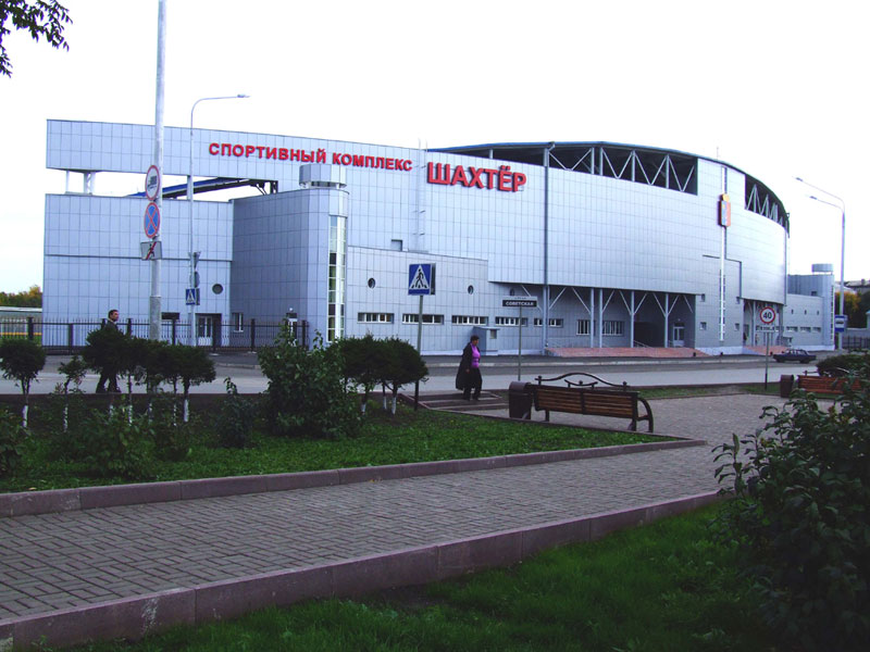


Kiselëvsk, Russia
Киселёвск
Kiselëvsk is a town of 104,000 people in Kuzbass, Russia, founded in 1917.
Why visit Kiselëvsk
Townapedia lists 9 museums and landmarks, 4 parks and trails, 6 places to eat and 6 attractions in and around town.
Highlights include Россия and киноцентр Дружба.
Weather in Kiselëvsk
Forecast from MET Norway (CC BY 4.0). Full forecast
About Kiselëvsk
Kiselyovsk (Russian: Киселёвск) is a town in Kemerovo Oblast, Russia, located in the foothill belt of the Salair Ridge, at the source of the Aba River, 193 kilometers (120 mi) south of Kemerovo. Population: 98,365 (2010 census); 106,341 (2002 census); 128,083 (1989 Soviet census).
From the Wikipedia article Kiselyovsk (this version), under CC BY-SA 4.0.
Things to do6

киноцентр Дружба
Cinema and theater · 2.4 km
5 улица 50 лет Октября, Киселёвск
пн-вс с 10.00 до 22.00

Museums and landmarks9


Памятник воинам Великой Отечественной войны 1941-1945 гг.
Monument and historic site · 3.3 km
Parks, trails and playgrounds4


Restaurants and cafes6


History
Residents of the town and Russian rights groups have campaigned for several years for the Russia government to move the city away from the immediate outskirts of the mine due to the extreme levels of pollution. In September 2019, a number of the town's residents lobbied the Canadian government to grant them status as environmental refugees.
From the History section of Kiselyovsk on Wikipedia, under CC BY-SA 4.0.
Churches and places of worship2
Shopping27
Gas and EV charging11
Schools, colleges and libraries28
Средняя общеобразовательная школа №11
School · 3.4 km
2 Студенческая улица, Киселёвск
Healthcare16
Поликлиника №3, Городская больница №2, г. Киселёвск
Clinic and pharmacy · 3.3 km
3 Студенческая улица, Киселевск
Родильный дом, Киселёвская городская больница №2
Hospital · 3.2 km
23 улица Чумова
Map of Kiselëvsk
109 places. The map loads OpenStreetMap tiles when you open it.
Getting there and nearby towns
Novokuznetsk (Spichenkovo) Airport (NOZ) is the nearest airport with scheduled flights listed in OpenStreetMap, 24 km away.
- Kisilevsk 1 km northwest, about 1 min by car
- Prokop’yevsk 9 km southeast, about 9 min by car
- Karagayla 21 km north, about 21 min by car
- Krasnobrodskiy 23 km northwest, about 23 min by car
- Trudarmeyskiy 23 km northwest, about 23 min by car
- Artyshta 28 km northwest, about 28 min by car
- Novokuznetsk 40 km southeast, about 40 min by car
- Listvyagi 40 km southeast, about 40 min by car
- Starobachaty 41 km northwest, about 41 min by car
- Novyy Gorodok 43 km northwest, about 43 min by car
Drive times are estimates from straight-line distance, not routes.
Local news
Headlines from INDB.
Reviews, tips and questions
Loading what members have shared...
Sources and licences
- GeoNames (CC BY 4.0): population, coordinates, regions and time zone
- OpenStreetMap contributors (ODbL 1.0): places, airports, map data
- Wikidata (CC0 1.0): elevation, founding date, time zone, website
- Wikimedia Commons (see each image): photos
- Wikipedia (CC BY-SA 4.0): overview and history text
Photo credits
- Ksl, http://www.shahter.ru/, CC BY-SA 3.0
- Ул Ленина - panoramio (1), @@@@@@@@@@@@, CC BY-SA 3.0
- Что то сгорело - panoramio, @@@@@@@@@@@@, CC BY-SA 3.0
- Железные игрушки детства - panoramio, @@@@@@@@@@@@, CC BY-SA 3.0
- Рынок - panoramio (64), @@@@@@@@@@@@, CC BY-SA 3.0
- Гастроном (был) - panoramio, @@@@@@@@@@@@, CC BY-SA 3.0
- Ленин и дети - panoramio, @@@@@@@@@@@@, CC BY-SA 3.0
- Центр Детского творчества - panoramio, @@@@@@@@@@@@, CC BY-SA 3.0
- Школа иЛенин - panoramio, @@@@@@@@@@@@, CC BY-SA 3.0
- Памятник - panoramio (99), @@@@@@@@@@@@, CC BY-SA 3.0
- Школа - panoramio (144), @@@@@@@@@@@@, CC BY-SA 3.0
- Универмаг (был) - panoramio, @@@@@@@@@@@@, CC BY-SA 3.0
- Школа.... - panoramio, @@@@@@@@@@@@, CC BY-SA 3.0
- Шахта - panoramio, Pavel Nikolaev, CC BY 3.0
- М-Ж - panoramio, @@@@@@@@@@@@, CC BY-SA 3.0
- Бродвей(был) - panoramio, @@@@@@@@@@@@, CC BY-SA 3.0
- Kiselevsk ambulance-depot, Tom Verlinden, CC BY-SA 3.0
- Воздушный город - panoramio, @@@@@@@@@@@@, CC BY-SA 3.0
- Мфц - panoramio, @@@@@@@@@@@@, CC BY-SA 3.0
- Именные лавочки - panoramio, @@@@@@@@@@@@, CC BY-SA 3.0
- Россия - panoramio, @@@@@@@@@@@@, CC BY-SA 3.0
- Погибшим в горячих точках - panoramio, @@@@@@@@@@@@, CC BY-SA 3.0
- Аллея - panoramio (81), @@@@@@@@@@@@, CC BY-SA 3.0
- Улица Ленина - panoramio (13), @@@@@@@@@@@@, CC BY-SA 3.0
- Память - panoramio (8), @@@@@@@@@@@@, CC BY-SA 3.0
- Белый дом - panoramio (3), @@@@@@@@@@@@, CC BY-SA 3.0
- Памятник шахтёрам - panoramio, @@@@@@@@@@@@, CC BY-SA 3.0
- Аллея - panoramio (72), @@@@@@@@@@@@, CC BY-SA 3.0
- Сельский двор - panoramio, @@@@@@@@@@@@, CC BY-SA 3.0
- Памятник революционерам - panoramio, @@@@@@@@@@@@, CC BY-SA 3.0
- С К - Шахтёр - panoramio, @@@@@@@@@@@@, CC BY-SA 3.0
- Корзина - panoramio, @@@@@@@@@@@@, CC BY-SA 3.0
- Киселёвск-Жд вокзал - panoramio, @@@@@@@@@@@@, CC BY-SA 3.0
- Детский городок - panoramio (3), @@@@@@@@@@@@, CC BY-SA 3.0
- Фонтан - panoramio (81), @@@@@@@@@@@@, CC BY-SA 3.0
- Остановка Трест (была) - panoramio, @@@@@@@@@@@@, CC BY-SA 3.0
- Стадион шахтёр - panoramio, @@@@@@@@@@@@, CC BY-SA 3.0
- Автовокзал - panoramio (34), @@@@@@@@@@@@, CC BY-SA 3.0
- Жд- вокзал - panoramio, @@@@@@@@@@@@, CC BY-SA 3.0
- Жд вокзал - panoramio (15), @@@@@@@@@@@@, CC BY-SA 3.0


Page built November 4, 2026. Spotted a mistake? Tell us or suggest a place.