


Korolev, Russia
Королёв
Korolev is a town of 139,798 people in Moscow Oblast, Russia, founded in December 26, 1938.
Why visit Korolev
Townapedia lists 33 museums and landmarks, 17 parks and trails, 142 places to eat, 11 places to stay and 5 attractions in and around town.
Highlights include State University of Education, Russian State University of Tourism and Services Studies, Мемориальный дом-музей С.Н. Дурылина and Музей наукограда Королёв. Новейшая история города.
Weather in Korolev
Forecast from MET Norway (CC BY 4.0). Full forecast
About Korolev
Korolyov or Korolev (Russian: Королёв, IPA: [kərɐˈlʲɵf]) is an industrial city in Moscow Oblast, Russia, well known as the cradle of Soviet and Russian space exploration. As of the 2010 Census, its population was 183,402, the largest as a science city. As of 2018, the population was more than 222,000 people.
From the Wikipedia article Korolyov, Moscow Oblast (this version), under CC BY-SA 4.0.
Travel tips from other travellers: Korolev on Wikivoyage (CC BY-SA 4.0).
Things to do5

Russian State University of Tourism and Services Studies
School · 6.6 km


Museums and landmarks33


21 more on the map.
Parks, trails and playgrounds17



Техас
Park · 2.9 km
Парк создан под ЛЭП. Летом практикуется активный отдых в виде прогулок, приготовлением еды на мангале, различные виды спорта. Зимой -...


5 more on the map.
Restaurants and cafes142

Tanuki
Restaurant · Japanese · 1.1 km
6А проспект Королёва, Королев
Fr-Sa 12:00-01:00;Mo-Th,Su 12:00-23:00
Вишневый сад
Restaurant · Regional, Italian · 2.6 km
17А улица Тихонравова, Юбилейный
Su-Th 12:00-24:00; Fr-Sa 12:00-02:00
Дюшес
Restaurant · Regional · 0.7 km
33А Пионерская улица, Королёв
Su-Th 10:00-01:00; Fr-Sa 10:00-04:00

Tesla food&bar
Restaurant · 2.3 km
34В улица Сакко и Ванцетти
Mo-Th 12:00-24:00; Fr-Sa 12:00-03:00; Su 12:00-24:00
130 more on the map.
History
In the 12th century, a Slavic settlement was located on the site of modern Korolyov. The settlement stood on a junction of trade routes between the Moscow and Vladimir-Suzdal principalities. After the Mongol conquests in the 13th century, the region was in decline.
The village of Podlipki had formed on the site by the 18th century, when one of the first textile factories in Russia was established there.
From the late 19 century, Podlipki was also known as a dacha village frequented by many literali, as can be witnessed by the name of Podlipki-Dachnye railway station. They later moved their dachas to Peredelkino in Moscow's southwestern suburb, when Podlipki became a closed city of the Russian SFSR.
In 1924, the first OGPU working commune in the Soviet Union was established at Podlipki. In 1938, the Kalininsky settlement near an artillery plant (which had previously been relocated from Leningrad to better protect it in case of any future war) was granted town status and named Kaliningrad (meaning Kalinin City, after Bolshevik leader Mikhail Kalinin; not to be confused with the Baltic port city also renamed Kaliningrad after Mikhail Kalinin in 1946). Over the next three decades the town expanded greatly as a home of rocket manufacturing for both military missiles and the Soviet space program. As such it was a closed city to foreigners, who could not travel there.
From the History section of Korolyov, Moscow Oblast on Wikipedia, under CC BY-SA 4.0.
Where to stay11
Churches and places of worship12
Церковь Троицы Живоначальной
Church · Russian Orthodox · 3.4 km
77 улица Горького
Церковь Пантелеимона Целителя
Church · Russian Orthodox · 3.3 km
24Б улица Коминтерна
Церковь Рождества Пресвятой Богородицы
Church · Russian Orthodox · 1.7 km
1 Калининградская улица
Церковь Новомучеников и Исповедников Российских
Church · Russian Orthodox · 2.0 km
Shopping142
Gas and EV charging17
Schools, colleges and libraries59
Healthcare93
Map of Korolev
250 places. The map loads OpenStreetMap tiles when you open it.
Getting there and nearby towns
Chkalovsky Air Base (CKL) is the nearest airport with scheduled flights listed in OpenStreetMap, 15 km away.
- Mytishchi 6 km west, about 6 min by car
- Pushkino 9 km north, about 9 min by car
- Shchyolkovo 9 km east, about 9 min by car
- Moscow 22 km southwest, about 22 min by car
- Zheleznodorozhnyy 22 km southeast, about 22 min by car
- Khimki 25 km west, about 25 min by car
- Lyubertsy 27 km south, about 27 min by car
- Cherëmushki 32 km southwest, about 32 min by car
- Noginsk 39 km east, about 39 min by car
- Zelenograd 41 km west, about 41 min by car
Drive times are estimates from straight-line distance, not routes.
Local news
Headlines from INDB.
Reviews, tips and questions
Loading what members have shared...
Sources and licences
- GeoNames (CC BY 4.0): population, coordinates, regions and time zone
- OpenStreetMap contributors (ODbL 1.0): places, airports, map data
- Openverse (see each image): photos
- Wikidata (CC0 1.0): elevation, founding date, time zone, website, landmarks and historic places
- Wikimedia Commons (see each image): photos
- Wikipedia (CC BY-SA 4.0): overview and history text
Photo credits
- Вид на Подлипки, Grishinia, CC BY-SA 4.0
- Plant composition - Korolev, Russia - panoramio, Sergey Ashmarin, CC BY-SA 3.0
- Moscow, Radio Street 10, NVO, CC BY 3.0
- Mgus-rgutis, Амир-Хан, Public domain
- Losiny Ostrov 2009-09-22, Nikiforovvb, CC BY-SA 4.0
- Tsiolkovsky Street 9 (Korolyov) 001, P.Fisxo, CC BY-SA 4.0
- Lesteh 2011, Qweasdqwe, CC0
- Pionerskaya street 49A (Korolyov) 002, P.Fisxo, CC BY-SA 4.0
- Pionerskaya street Lane 51G (Korolyov) 001, P.Fisxo, CC BY-SA 4.0
- Pionerskaya street 51A (Korolyov) 001, P.Fisxo, CC BY-SA 4.0
- Pionerskaya street 10k3 (Korolyov) 001, P.Fisxo, CC BY-SA 4.0
- Pionerskaya street 10k3 (Korolyov) 002, P.Fisxo, CC BY-SA 4.0
- Pionerskaya street 49A (Korolyov) 001, P.Fisxo, CC BY-SA 4.0
- Vympel Stadium (Korolyov) 001 (4), P.Fisxo, CC BY-SA 4.0
- Общий вид футбольного поля, Товболатов, CC BY-SA 4.0
- Главная трибуна ст. Вымпел, Товболатов, CC BY-SA 4.0
- Vympel Stadium (Korolyov) 001 (8), P.Fisxo, CC BY-SA 4.0
- Стадион Вымпел г. Королёв, Товболатов, CC BY-SA 4.0
- Справа здание ледового дворца, Товболатов, CC BY-SA 4.0
- Теннисные корты Вымпел, Товболатов, CC BY-SA 4.0
- Теннисные корты ст. Вымпел, Товболатов, CC BY-SA 4.0
- RomaVorontsov1, Роман Воронцов, CC BY-SA 4.0
- Трибуна для зрителей, Товболатов, CC BY-SA 4.0
- Серпокрылка берёзовая, Горбунова М.С., CC BY-SA 4.0
- Vympel Stadium (Korolyov) 001 (1), P.Fisxo, CC BY-SA 4.0
- Главный вход ст. Вымпел, Товболатов, CC BY-SA 4.0
- Vympel Stadium (Korolyov) 001 (6), P.Fisxo, CC BY-SA 4.0
- Здание бассейна Вымпел, Товболатов, CC BY-SA 4.0
- Vympel Stadium (Korolyov) 001 (5), P.Fisxo, CC BY-SA 4.0
- COVID 19 Korolyov 062020 03, P.Fisxo, CC BY-SA 4.0
- Vympel Stadium (Korolyov) 001 (2), P.Fisxo, CC BY-SA 4.0
- Vympel Stadium (Korolyov) 001 (3), P.Fisxo, CC BY-SA 4.0
- Church of Saint Hieromartyr Vladimir in Korolyov Moscow Oblast 1, Dmitry Ivanov ., CC BY-SA 4.0
- Church of Saint Hieromartyr Vladimir in Korolyov Moscow Oblast 2, Dmitry Ivanov ., CC BY-SA 4.0
- Vympel Stadium (Korolyov) 001 (7), P.Fisxo, CC BY-SA 4.0
- ФГБОУ ВО «Технологический университет» в Королёве, лицевая сторона, 2025 год, U51N433, CC BY-SA 4.0
- Ледовая арена им. А. В. Касатонова, Товболатов, CC BY-SA 4.0
- ФГБОУ ВО «Технологический университет» в Королёве, вид с улицы Гагарина, 2025 год, U51N433, CC BY-SA 4.0
- Цветущая жимолость, Горбунова М.С., CC BY-SA 4.0
- Covid 19 in Korolyov 0001, P.Fisxo, CC BY-SA 4.0
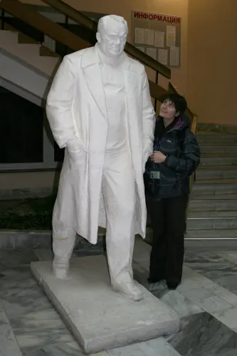
- Statue of Sergei Korolev in Star City., AstroSamantha, CC BY 2.0


Page built November 4, 2026. Spotted a mistake? Tell us or suggest a place.