
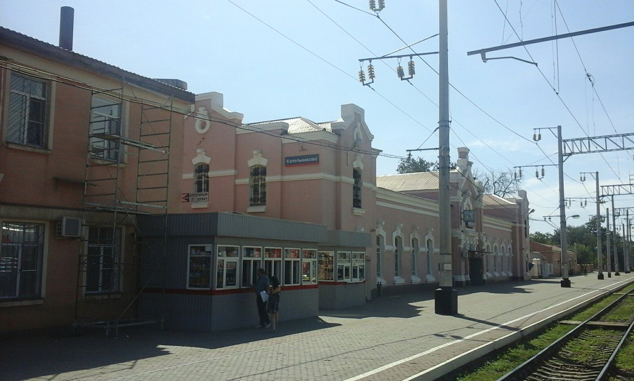


Kotel’nikovo, Russia
Котельниково
Kotel’nikovo is a town of 19,622 people in Volgograd Oblast, Russia, founded in 1897.
Why visit Kotel’nikovo
Townapedia lists 2 museums and landmarks, 1 park or trail, 4 places to eat and 7 places to stay in and around town.
Weather in Kotel’nikovo
Forecast from MET Norway (CC BY 4.0). Full forecast
About Kotel’nikovo
Kotelnikovo (Russian: Коте́льниково) is a town and the administrative center of Kotelnikovsky District in Volgograd Oblast, Russia, located on the Kurmoyarsky Aksay River (which flows into the Tsimlyansk Reservoir), 190 kilometers (120 mi) southwest of Volgograd, the administrative center of the oblast. Population: 20,428 (2010 census); 19,656 (2002 census); 20,328 (1989 Soviet census).
From the Wikipedia article Kotelnikovo, Volgograd Oblast (this version), under CC BY-SA 4.0.
Museums and landmarks2

Parks, trails and playgrounds1

Restaurants and cafes4



Where to stay7

History
It was founded in 1897 as a settlement servicing the construction of a railway station of the same name (opened 1899). During World War II, it served as a base for the German troops of Field Marshal Erich von Manstein during the Battle of Stalingrad. A Soviet counteroffensive liberated Kotelnikovo on December 29, 1942. It was granted town status in 1955.
Kotelnikovo (air base), a Russian Air Force airbase is located nearby.
From the History section of Kotelnikovo, Volgograd Oblast on Wikipedia, under CC BY-SA 4.0.
Churches and places of worship1
Shopping5
Gas and EV charging3
Schools, colleges and libraries3
Healthcare1
Map of Kotel’nikovo
27 places. The map loads OpenStreetMap tiles when you open it.
Getting there and nearby towns
Volgodonsk Airport (VLK) is the nearest airport with scheduled flights listed in OpenStreetMap, 80 km away.
- Dubovskoye 37 km southwest, about 37 min by car
- Zimovniki 74 km southwest, about 1 h 15 min by car
- Krasnoyarskaya 73 km west, about 1 h 15 min by car
- Volgodonsk 75 km west, about 1 h 15 min by car
- Tsimlyansk 79 km west, about 1 h 15 min by car
- Zavetnoye 80 km southeast, about 1 h 15 min by car
- Nizhniy Chir 81 km north, about 1 h 15 min by car
- Krasnoyarskaya 82 km west, about 1 h 15 min by car
- Romanovskaya 85 km west, about 1 h 30 min by car
Drive times are estimates from straight-line distance, not routes.
Local news
Headlines from INDB.
Reviews, tips and questions
Loading what members have shared...
Sources and licences
- GeoNames (CC BY 4.0): population, coordinates, regions and time zone
- OpenStreetMap contributors (ODbL 1.0): places, airports, map data
- Wikidata (CC0 1.0): elevation, founding date, time zone, website
- Wikimedia Commons (see each image): photos
- Wikipedia (CC BY-SA 4.0): overview and history text
Photo credits
- Станция Котельниково, Илья Драконов, CC BY-SA 4.0
- Железная дорога. Фото Виктора Белоусова. - panoramio, Victor Belousov, CC BY 3.0
- Дом моего деда - panoramio, Андрей Хабаров, CC BY 3.0
- Аэродром. Фото Виктора Белоусова. - panoramio (2), Victor Belousov, CC BY 3.0
- Посадка. Фото Виктора Белоусова. - panoramio, Victor Belousov, CC BY 3.0
- Речка Аксай Курмоярский. Котельниково. Фото Виктора Белоусова, Victor Belousov, CC BY 3.0
- NASA FIRMS 2024-10-13 Kotelnikovo, Imagery from LANCE FIRMS operated by NASA's Earth Science Data and Information System (ESDIS) with funding provided by NASA Headquarters., Public domain
- ISS053-E-110217 - View of Earth, Earth Science and Remote Sensing Unit , Lyndon B. Johnson Space Center, Public domain
- ISS053-E-107355 - View of Earth, Earth Science and Remote Sensing Unit , Lyndon B. Johnson Space Center, Public domain
- ISS053-E-289805 - View of Earth, Earth Science and Remote Sensing Unit , Lyndon B. Johnson Space Center, Public domain
- ISS053-E-289804 - View of Earth, Earth Science and Remote Sensing Unit , Lyndon B. Johnson Space Center, Public domain


Page built November 4, 2026. Spotted a mistake? Tell us or suggest a place.