


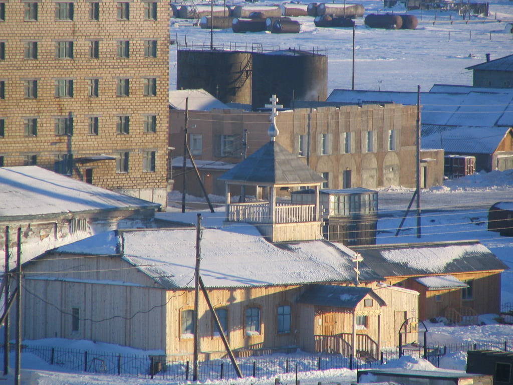


Lavrentiya, Russia
Лаврентия
Lavrentiya is a town of 1,242 people in Chukotka, Russia, founded in 1928.
Why visit Lavrentiya
Townapedia lists 3 museums and landmarks, 5 parks and trails, 1 place to eat and 1 attraction in and around town.
Weather in Lavrentiya
Forecast from MET Norway (CC BY 4.0). Full forecast
About Lavrentiya
Lavrentiya (Russian: Лавре́нтия, Yupik: Ӄышы; Chukchi: Ӄытрын, Ḳytryn; Naukan: Qerre; Inupiaq: Kesrreq or Kisrriq) is a rural locality (a selo) and the administrative center of Chukotsky District of Chukotka Autonomous Okrug, Russia, located on Lavrentiya Bay, close to the Bering Strait. Population: 1,459 (2010 census); 1,333 (2002 census); 3,012 (1989 Soviet census). Lavrentiya is the only district administrative center in the whole autonomous okrug that does not have urban status; it accounts for 30.2% of the district's total population.
From the Wikipedia article Lavrentiya (this version), under CC BY-SA 4.0.
Things to do1

Museums and landmarks3


Parks, trails and playgrounds5

Restaurants and cafes1

History
It is situated on Lavrentiya Bay, named by Captain James Cook who arrived in the bay on the feast day of Saint Lawrence in 1778. The village itself was founded in 1928 (although some sources suggest 1927). By 1928 a Kultbaza (a semi-permanent cultural base established by the Soviet Union in rural areas to ensure the ideological education of local indigenous inhabitants) had been established in the area and by 1930 the settlement was sufficient that it was appointed as the administrative centre of Chukotsky District. This appointment was later transferred to Uelen but administrative responsibilities returned to Lavrentiya in 1942.,
From the History section of Lavrentiya on Wikipedia, under CC BY-SA 4.0.
Churches and places of worship1
Schools, colleges and libraries1
Healthcare3
Map of Lavrentiya
15 places. The map loads OpenStreetMap tiles when you open it.
Getting there and nearby towns
- Lorino 34 km west, about 34 min by car
- Uelen 84 km northeast, about 1 h 30 min by car
Drive times are estimates from straight-line distance, not routes.
Local news
Headlines from INDB.
Reviews, tips and questions
Loading what members have shared...
Sources and licences
- GeoNames (CC BY 4.0): population, coordinates, regions and time zone
- OpenStreetMap contributors (ODbL 1.0): places, airports, map data
- Wikidata (CC0 1.0): elevation, founding date, time zone, website
- Wikimedia Commons (see each image): photos
- Wikipedia (CC BY-SA 4.0): overview and history text
Photo credits
- Lavrentiya 02-2005 - panoramio (4), Tarık krimn, CC BY 3.0
- Lavrentiya 02-2005 - panoramio, Tarık krimn, CC BY 3.0
- Lavrentiya 02-2005 - panoramio (3), Tarık krimn, CC BY 3.0
- Lavrentiya 02-2005 - panoramio (2), Tarık krimn, CC BY 3.0
- Мемориальная доска писателю Тихону Сёмушкину в с. Лаврентия, Abrikoss, CC BY-SA 4.0
- Мемориальная доска Виктору Галышеву на Чукотке, в с. Лаврентия, Abrikoss, CC BY-SA 4.0
- С. Лаврентия, Abrikoss, CC BY-SA 4.0
- Библиотека им. Т. З. Семушкина в с. Лаврентия, Abrikoss, CC BY-SA 4.0


Page built November 4, 2026. Spotted a mistake? Tell us or suggest a place.