
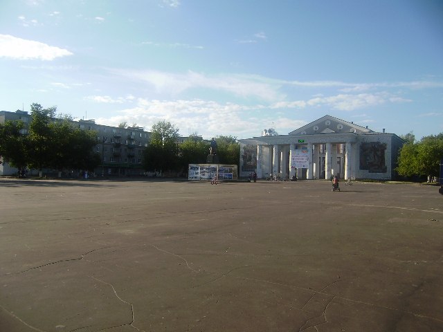


Navashino, Russia
Навашино
Navashino is a town of 14,830 people in Nizhny Novgorod Oblast, Russia, founded in 1957.
Why visit Navashino
Townapedia lists 5 museums and landmarks, 1 park or trail, 7 places to eat and 1 place to stay in and around town.
Weather in Navashino
Forecast from MET Norway (CC BY 4.0). Full forecast
About Navashino
Navashino (Russian: Нава́шино) is a town in Nizhny Novgorod Oblast, Russia, located on a branch of the Oka River, 10 km east of Murom and 158 kilometers (98 mi) southwest of Nizhny Novgorod. As of the 2010 Census, its population was 16,416.
From the Wikipedia article Navashino (this version), under CC BY-SA 4.0.
Museums and landmarks5

Три штыка
Monument and historic site · 1.3 km
Памятник участникам Великой Отечественной войны
Parks, trails and playgrounds1

Restaurants and cafes7


Where to stay1

History
The town of Navashino was founded in 1957 by merging two neighboring settlements of Mordovshchikovo and Lipnya and named after the nearby railway station of Navashino. A railway was built in the area in 1912.
From the History section of Navashino on Wikipedia, under CC BY-SA 4.0.
Churches and places of worship3
Shopping19
Gas and EV charging2
Schools, colleges and libraries9
ГАПОУ "Выксунский металлургический колледж им. А.А. Козерадского" ОСП №3
School
2 улица Калинина
Healthcare6
Map of Navashino
53 places. The map loads OpenStreetMap tiles when you open it.
Getting there and nearby towns
- Murom 11 km west, about 11 min by car
- Savasleyka 12 km southeast, about 12 min by car
- Doschatoye 18 km south, about 18 min by car
- Blizhne-Pesochnoye 23 km south, about 23 min by car
- Vyksa 25 km south, about 25 min by car
- Kulebaki 26 km southeast, about 26 min by car
- Shimorskoye 26 km southwest, about 26 min by car
- Velet’ma 27 km southeast, about 27 min by car
- Vilya 33 km south, about 33 min by car
- Melenki 42 km southwest, about 42 min by car
Drive times are estimates from straight-line distance, not routes.
Local news
Headlines from INDB.
Reviews, tips and questions
Loading what members have shared...
Sources and licences
- GeoNames (CC BY 4.0): population, coordinates, regions and time zone
- OpenStreetMap contributors (ODbL 1.0): places, airports, map data
- Wikidata (CC0 1.0): elevation, founding date, time zone, website
- Wikimedia Commons (see each image): photos
- Wikipedia (CC BY-SA 4.0): overview and history text
Photo credits
- Площадь им. В.И.Ленина, Gabriel-87m, CC BY-SA 3.0
- Г.Навашино советская постройка. 2008г - panoramio, Marik Zhavoronkov, CC BY 3.0
- Памятник Ульянову у дома культуры в Навашино 2008г. - panoramio, Marik Zhavoronkov, CC BY 3.0
- 2008г. Навашинская улица, на окраине города. - panoramio, Marik Zhavoronkov, CC BY 3.0
- Bridge - panoramio - ecom, ecom, CC BY-SA 3.0
- Водка и продукты... А нужно ли что-нибудь еще - panoramio, Anton Nikiforov, CC BY 3.0
Page built November 4, 2026. Spotted a mistake? Tell us or suggest a place.