
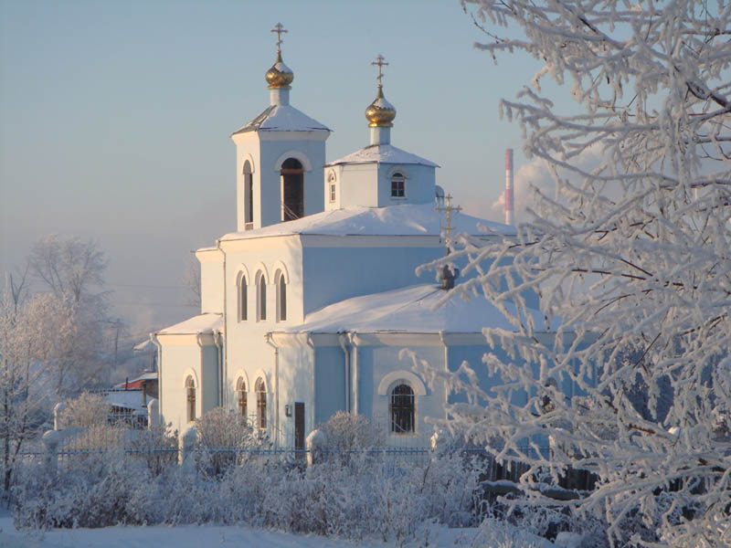


Nazarovo, Russia
Назарово
Nazarovo is a town of 55,252 people in Krasnoyarsk Krai, Russia, founded in 1760.
Why visit Nazarovo
Townapedia lists 2 museums and landmarks, 2 parks and trails, 6 places to eat, 1 place to stay and 1 attraction in and around town.
Weather in Nazarovo
Forecast from MET Norway (CC BY 4.0). Full forecast
About Nazarovo
Nazarovo (Russian: Наза́рово) is a town in Krasnoyarsk Krai, Russia, located on the left bank of the Chulym River (an Ob River tributary), 239 kilometers (149 mi) west of Krasnoyarsk. Population: 52,817 (2010 census); 56,539 (2002 census); 64,350 (1989 Soviet census).
From the Wikipedia article Nazarovo, Krasnoyarsk Krai (this version), under CC BY-SA 4.0.
Things to do1

Museums and landmarks2


Parks, trails and playgrounds2


Restaurants and cafes6





History
The selo of Nazarovo was founded in 1700 by Nazary Patyukov, a Cossack, and was named after him. In 1888, deposits of brown coal were discovered in the vicinity of the village, and in 1925 a railroad was built through it. The selo was granted urban-type settlement status in 1946 and town status in 1961.
From the History section of Nazarovo, Krasnoyarsk Krai on Wikipedia, under CC BY-SA 4.0.
Where to stay1
Shopping13
Gas and EV charging5
Schools, colleges and libraries7
Healthcare10
Map of Nazarovo
47 places. The map loads OpenStreetMap tiles when you open it.
Getting there and nearby towns
Achinsk Airport (ACS) is the nearest airport with scheduled flights listed in OpenStreetMap, 30 km away.
- Bor 7 km northwest, about 7 min by car
- Achinsk 29 km north, about 29 min by car
- Novochernorechenskiy 51 km northeast, about 51 min by car
- Bogotol 59 km west, about 59 min by car
- Kozul’ka 63 km east, about 1 h by car
- Kedrovyy 76 km northeast, about 1 h 15 min by car
- Uzhur 85 km southwest, about 1 h 30 min by car
- Tyukhtet 90 km northwest, about 1 h 30 min by car
Drive times are estimates from straight-line distance, not routes.
Local news
Headlines from INDB.
Reviews, tips and questions
Loading what members have shared...
Sources and licences
- GeoNames (CC BY 4.0): population, coordinates, regions and time zone
- OpenStreetMap contributors (ODbL 1.0): places, airports, map data
- Wikidata (CC0 1.0): elevation, founding date, time zone, website
- Wikimedia Commons (see each image): photos
- Wikipedia (CC BY-SA 4.0): overview and history text
Photo credits
- Khram nazarowo, Rovirey, CC BY-SA 3.0
- Nazarovo Central Square, Лумпиду, CC BY-SA 4.0
- Производственные цеха бывшего Назаровского завода "Сельмаш", WWR24, CC BY-SA 4.0
- Бывший Назаровский завод "КПД", WWR24, CC BY-SA 4.0
Page built November 4, 2026. Spotted a mistake? Tell us or suggest a place.